The smallest and greenest of the three U.S. Virgin Islands: about 20 square miles, around 60 percent of it Virgin Islands National Park, no airport and no cruise pier. Everyone arrives by boat into Cruz Bay — then it is white-sand bays, reef trails and switchback roads.
Virgin Islands National ParkMain roadsBeach sandTownDock & pierSightHikeFood & drink
St. John drawn from the U.S. Census shoreline, with Virgin Islands National Park (green) from the National Park Service's own boundary, the roads the taxis drive, and the sand of the main beaches. Tap a pin for its page.
St. John has no airport. Fly into Cyril E. King Airport (STT) on St. Thomas, take a taxi to a ferry terminal, and cross by boat: almost everyone lands at the Cruz Bay dock, a short walk from everything in town.
The quick way is the Red Hook ferry on St. Thomas's east end — about 20 minutes, roughly hourly from early morning to late evening. The downtown boat from Charlotte Amalie takes about 45 minutes and runs a few times a day in season (it pauses for part of the off-season — the table shows whether it is running now), which can suit you if you are staying in town.
From the airport: a taxi from Airport (STT) to Red Hook is $23 for one rider, $17 each for two or more, about 30–40 minutes — see the fare.
The Cruz Bay ferry terminal, where the boats from St. Thomas land Photo: Fred Hsu, CC BY-SA 3.0
Varlack Ventures, Transportation Services of St. John
Fastest: Red Hook, St. Thomas ↔ Cruz Bay, 20 min. Children and bag fees vary by route — each timetable page has the full fare table and booking links.
Bringing a car: the car barge
Two barge lines cross between Red Hook on St. Thomas and Enighed Pond, about half a mile south of Cruz Bay, in about 30 minutes: 26 sailings a day from St. John, the first at 6:00am and the last at 6:30pm; the other way 6:30am–7:30pm. Tickets are bought on board.
Vehicle — non-resident: $65 one way · $80 round trip
Vehicle — USVI resident: $50 one way · $65 round trip
Buy ferry tickets at the terminal or online at stjohnticketing.com; no reservation is needed on the Red Hook boat.
Allow two hours from landing at STT to the Cruz Bay dock on a normal day — longer when several ships are in Charlotte Amalie and the airport road is busy.
Renting a car on St. Thomas? It crosses on the car barge from Red Hook to Enighed Pond, about half a mile south of Cruz Bay. Check your rental agreement allows it.
Going on to the BVI? The international ferries from Cruz Bay go to Jost Van Dyke, Virgin Gorda and Anegada — bring your passport.
There is no bus to the beaches and no ride-hailing. You either rent a jeep in Cruz Bay or ride the open-air safari taxis, which wait at the ferry dock and charge an official fixed fare per person — the table below has the fare from Cruz Bay to every main beach and to Coral Bay, straight from the VI Taxicab Commission schedule.
Driving is on the left, the roads are steep, narrow and full of switchbacks, and parking at the north-shore beaches fills by mid-morning in season. Book a rental early in winter: the island's fleet is small.
Cruz Bay harbor from the hill above town, boats on their moorings Photo: Fred Hsu, CC BY-SA 3.0
Most of St. John's beaches are national park: public, protected, unbuilt and free — Trunk Bay, with its day-use fee, is the one exception. Numbers match the map. For which one is calm and uncrowded today, open the beach report.
On Salomon Bay below Lind Point: a 15–30 minute walk on the Lind Point Trail from the visitor center, or the shore walk from the old Caneel Bay road. Gentle water and loungers and kayaks to rent.
Taxi from Cruz Bay (fare to Caneel Bay, then the shore walk): $9 for one rider, $8 each for two or more
The first national-park beach on the North Shore Road, a few minutes from Cruz Bay. A narrow strip of sand with reef right off it and fewer people than Trunk.
Taxi from Cruz Bay: $9 for one rider, $8 each for two or more
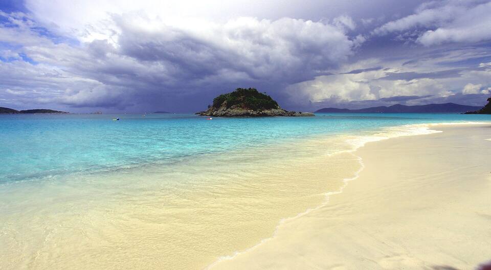
The postcard beach — and the one with the National Park Service's marked underwater snorkel trail round Trunk Cay. The only St. John beach that charges a day-use fee; it has lifeguards, showers and a snack bar, and it is busiest when ships are in Charlotte Amalie.
Taxi from Cruz Bay: $12 for one rider, $9 each for two or more
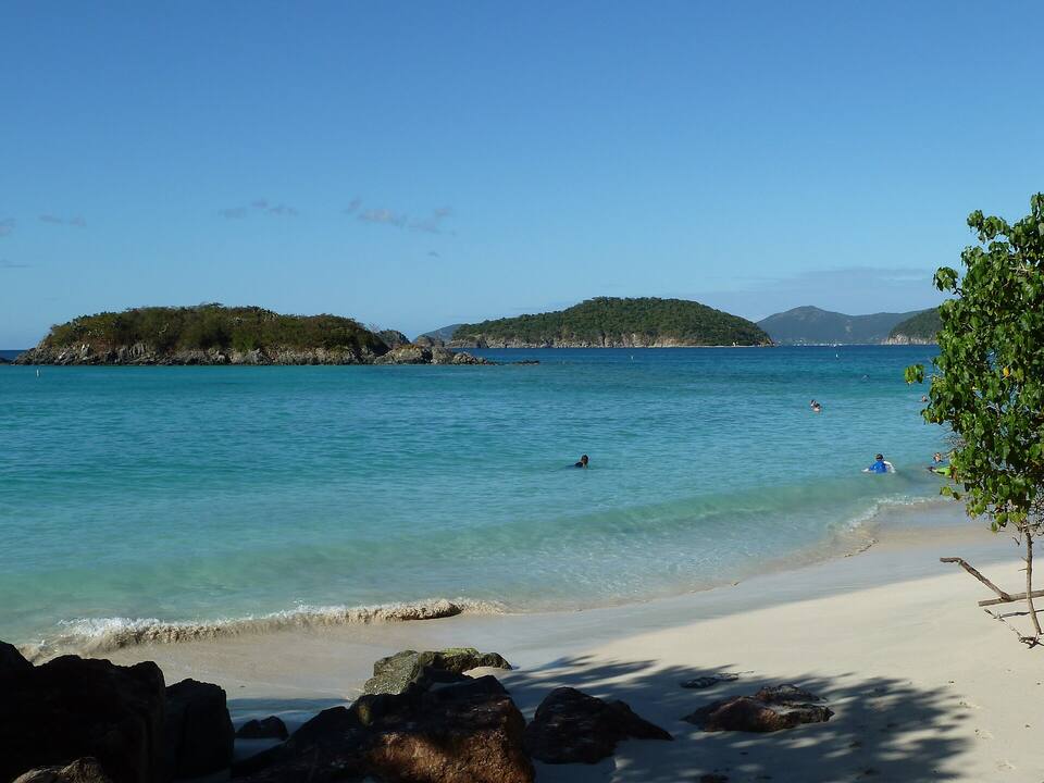
The island's longest north-shore beach, with water-sport rentals, the campground and sugar-mill ruins behind it. Snorkel out to Cinnamon Cay on a calm morning.
Taxi from Cruz Bay: $14 for one rider, $11 each for two or more
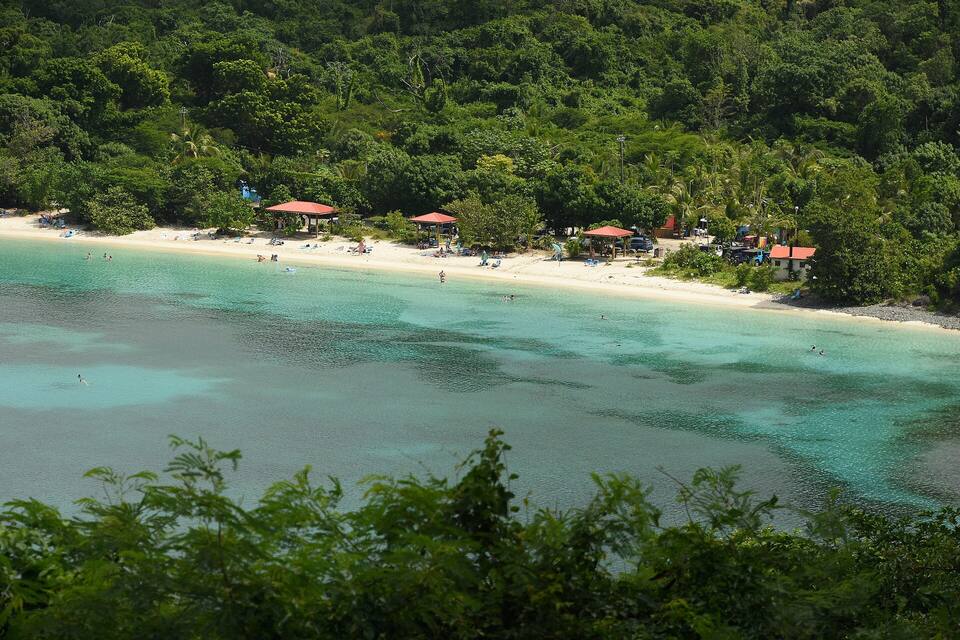
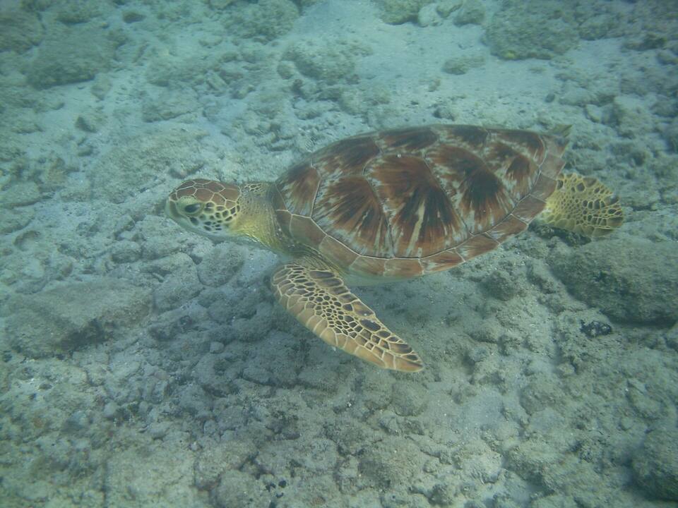
Shallow, sheltered and right beside the road: the turtle beach. Green sea turtles graze the seagrass a few yards out, which makes it the easiest turtle swim in the territory.
Taxi from Cruz Bay: $17 for one rider, $12 each for two or more
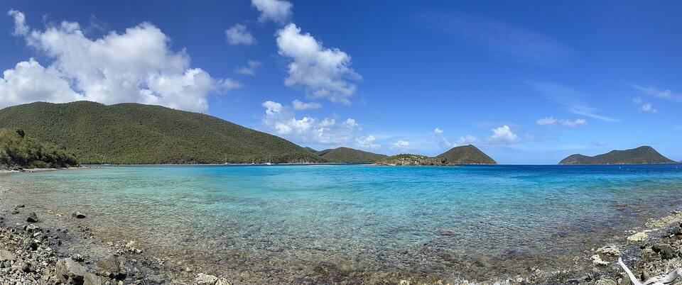
Park at Annaberg and walk the flat shoreline trail to Waterlemon Cay — widely called the best snorkeling on St. John: turtles, rays, starfish and a reef ringing the cay. Water shoes help on the rocky entry.
Taxi from Cruz Bay: $20 for one rider, $14 each for two or more
A short trail down from the road near the island's south-east tip. Good snorkeling at both points, and the start of the Ram Head hike. Sheltered when the north swell is running.
Taxi from Cruz Bay: $30 for one rider, $21 each for two or more
A flat walk of under a mile from the Annaberg parking area along Leinster Bay, then a swim out to the cay. Turtles in the seagrass on the way, a reef all round the cay. Best on a calm morning; the current round the cay's far side can be strong.
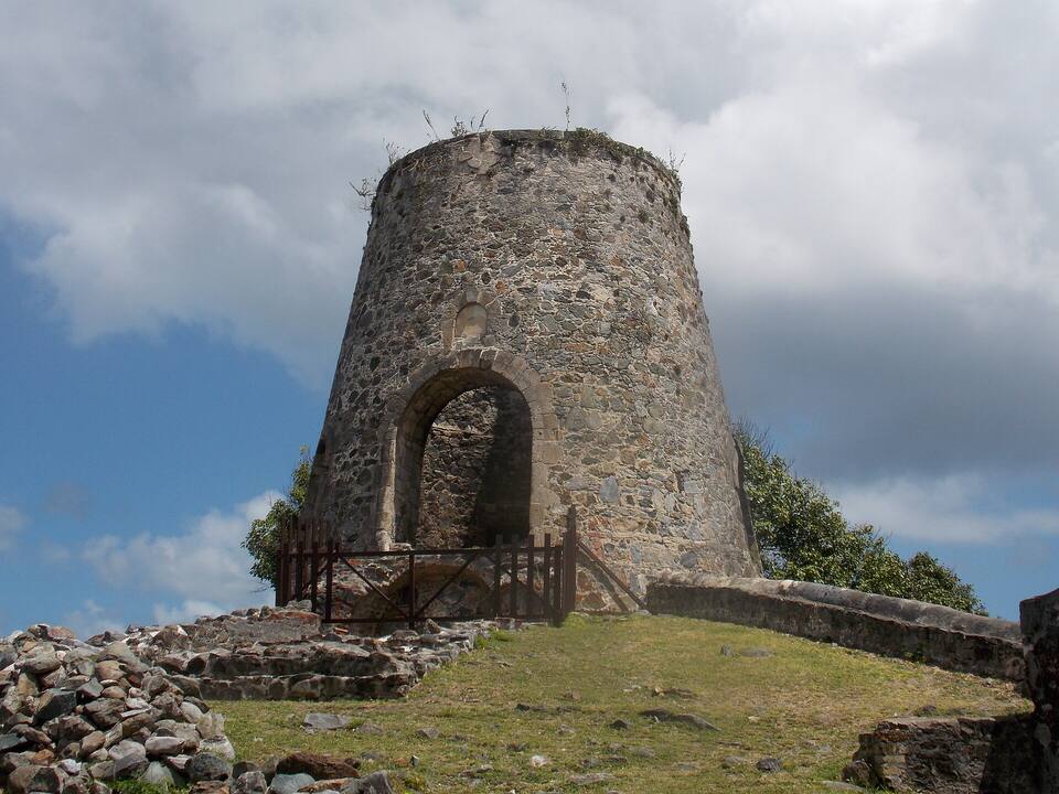
The best-preserved sugar works in the Virgin Islands: the windmill tower, the horse mill, the boiling house and the slave quarters, on a hill over Leinster Bay with the BVI across the Narrows. Free, in the national park, and the start of the Leinster Bay Trail.
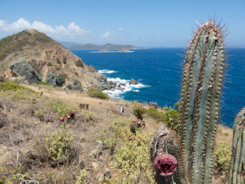
From Salt Pond Bay, about a mile each way over a cobble beach and up a dry, cactus-covered ridge to the cliffs at the island's south-east tip. No shade: go early and carry water.
The park's signature hike: 2.2 miles one way, steeply downhill from Centerline Road through the forest to Taíno petroglyphs by a freshwater pool and the ruins of a sugar factory at Reef Bay. The walk back is all uphill — plan for it.
A hilltop bar above Cruz Bay looking west over Pillsbury Sound to St. Thomas, built round an old windmill. Taxis run up from town; the bar's live camera is on our webcams page if you want to check the sky first.
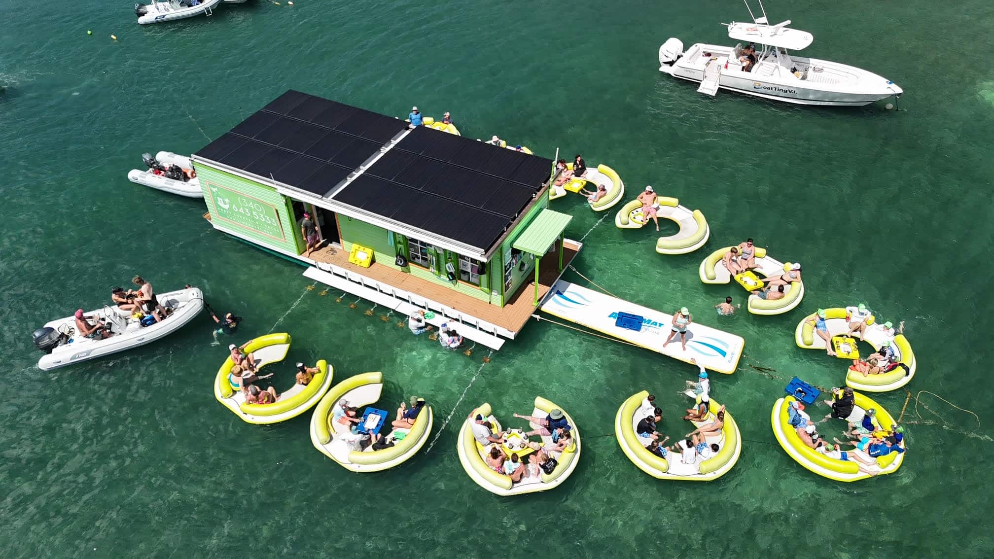
A taco bar on a barge in Coral Harbor that you can only reach by boat — kayak, shuttle, or your own charter. Closed for part of the off-season; the Lime Out page has every ride, the menu and whether it is open today.
Jost Van Dyke's White Bay and the Soggy Dollar are a short hop from Cruz Bay by ferry or a day charter; Norman Island and The Baths make a long, spectacular day. Passport required, plus BVI entry fees.
Cruz Bay is where most of the island eats and drinks: the waterfront at Wharfside Village, the courtyards round Mongoose Junction, and a few blocks of open-air bars between. Coral Bay, a 25-minute drive east, is quieter and more local. Many places close for some or all of August to October — the list below says who, from our seasonal-closures tracker.
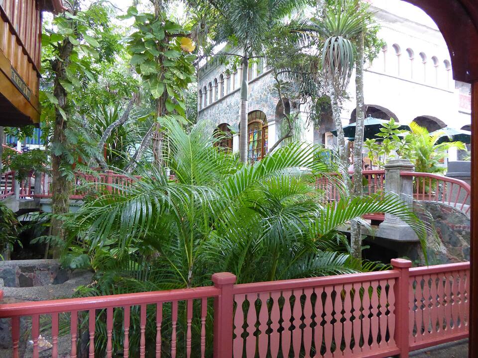
Mongoose Junction, the stone-and-wood shopping village in Cruz Bay Photo: Mattes, CC BY 2.0 de
Cruz Bay
Woody's Seafood SaloonLong-running Cruz Bay happy hour institution. Open-front bar a block from the ferry. $1 oysters, cold beer.
The LongboardSurf-themed Cruz Bay bar and kitchen. Great tacos, fresh poke bowls, and a mezzanine with Cruz Bay views.
Joe's Rum HutWaterfront rum bar at Wharfside Village. 100+ rums, legendary Painkiller, best sunset seats in Cruz Bay.
High Tide Bar & Seafood GrillWaterfront casual spot at Wharfside Village. Pool tables, sports on TV, fish tacos and ice-cold Painkillers.
Driftwood Dave'sLaid-back rooftop bar and restaurant in Cruz Bay. Good pizza, excellent happy hour, open-air second-floor views.
Lime InnClosed for the season · back Oct 11Local favorite for lobster, steak and seafood in a lush Cruz Bay garden courtyard. All-you-can-eat shrimp Wednesdays.
Extra Virgin BistroClosed for the season · back Oct 27Mongoose Junction bistro with rustic-Italian small plates, wood-fired flatbreads and an extensive wine list.
Morgan's MangoClosed for the season · back Oct 8Open-air Caribbean-fusion dinner spot across from the NPS visitor center. Tropical drinks, fresh fish, festive vibe.
Rhumb LinesClosed for the season · back OctPan-Caribbean / Pacific Rim fusion tucked in a Cruz Bay courtyard. Pad thai, jerk chicken, tropical cocktails.
Sun Dog CaféCasual upstairs café in Mongoose Junction. Famous pizza, killer black bean quesadilla, outdoor terrace.
Coral Bay & the south shore
Skinny Legs Bar & GrillClosed for the season · back Oct 31Coral Bay's quintessential beach bum hangout. Cheeseburgers, cold beer, sailor cruiser clientele, live music.
Shipwreck LandingCoral Bay roadside favorite. Conch fritters, fresh fish sandwiches, rum punches, live music on the deck.
Miss Lucy'sClosed for the season · back TBDFriis Bay waterfront institution. West Indian menu, Sunday brunch with a live full-moon-party vibe when tides align.
Closed for the season right now
Skinny Legs Bar & Grill — back Oct 31
Lime Out — back Oct 11
Kekoa Sailing Expeditions — back Oct 15
Banana Deck — back Nov 1
Café Roma — back ~Nov 2
Cinnamon Bay Restaurant (Rain Tree Café) — back Nov 1
Shopping: Mongoose Junction — Stone-and-wood open-air shopping village. Local artists, Bajo el Sol gallery, Pink Papaya, Bamboula Caribbean. Wharfside Village — Waterfront Cruz Bay plaza with boutiques, beach bars and restaurants right next to the ferry dock.
Weather & sea
St. John weather and the best time to go
Warm all year: highs in the mid-80s °F, a steady easterly trade wind, and short tropical showers rather than all-day rain. December to April is the dry, busy season. June to November is hurricane season, with the peak from mid-August to mid-October — when many restaurants close and the ferries run an off-season timetable.
Daily-mean sea-surface temperature, averaged 2021–2024 (Open-Meteo marine reanalysis): warmest in Sep (86.3°F), coolest in Feb (79.7°F). Hurricane history map
Cruise ships
Cruise ships and St. John
No cruise pier was ever built on St. John: ships anchor off Cruz Bay and tender passengers to the dock beside the ferry terminal. Calls are small — expedition ships, sailing yachts and small luxury vessels — so a ship day here is a few hundred people, not a few thousand. The crowds St. John feels come from the big ships in Charlotte Amalie, whose excursions ferry over to Trunk Bay.
2 calls at the Cruz Bay anchorage in the next 30 days. Next:
Wed, Oct 28 — MSC Explora 3 (1,473 guests), 8:00am–5:00pm
Thu, Oct 29 — Star Pride (312 guests), 8:00am–6:00pm
Seventeen Spanish ships anchor at Salt River, St. Croix. A landing party fights the Kalinago there — the first recorded battle between Europeans and Native Americans. Columbus names the chain Las Once Mil Vírgenes and claims it all for Spain; Spain never settles any of it.
Nov 1595
Drake's fleet sails the channel
Sir Francis Drake leads 27 English ships through the passage between Tortola and St. John on his way to attack Spanish San Juan. The channel has carried his name ever since.
Mar 25, 1718
Denmark takes St. John
Planters from St. Thomas raise the Dannebrog at Coral Bay and lay out the first estates. Britain, which also claimed the island, protests and lets it go.
Nov 23, 1733
The St. John slave rebellion
Enslaved Akwamu people seize the fort at Coral Bay and hold St. John for six months — one of the earliest and longest slave revolts in the Americas. French troops from Martinique end it in May 1734.
May 1734
French troops return St. John to Denmark
Two hundred soldiers from Martinique retake the island for the Danes.
Mar 28, 1801
Britain occupies the Danish islands
With Denmark drawn into Napoleon's wars, a British fleet takes St. Thomas, St. John and St. Croix without a shot. They are handed back the following February.
Feb 1802
Denmark gets them back
The Peace of Amiens returns the three islands to Denmark.
Dec 22, 1807
Britain takes them again — for seven years
Denmark sides with France after the bombardment of Copenhagen, and the Royal Navy returns. The Union Jack flies over the Danish islands until April 1815.
Apr 15, 1815
The Dannebrog returns
After Napoleon's fall the islands go back to Denmark, which keeps them for another century.
Oct 1867
The first sale to the U.S. falls through
Denmark agrees to sell St. Thomas and St. John for $7.5 million. Within weeks an earthquake, a tsunami and a hurricane hit the islands, and the U.S. Senate never ratifies the treaty.
Mar 31, 1917
Transfer Day: the U.S. buys the Danish West Indies
$25 million in gold — the most the United States has ever paid for territory. At 4 p.m. in Charlotte Amalie the Dannebrog comes down and the Stars and Stripes go up, with the USS Hancock in the harbour and a U-boat war on in the Atlantic.
Today
Two flags, one archipelago
St. Thomas, St. John, St. Croix and Water Island are the U.S. Virgin Islands. Tortola, Virgin Gorda, Jost Van Dyke and Anegada are the British Virgin Islands. Cruise ships and ferries cross the line every day.
The U.S. Virgin Islands ban sunscreens with oxybenzone, octinoxate or octocrylene. Bring a mineral (zinc or titanium) one, or buy it in Cruz Bay.
Drive on the left
Keep left — especially on blind switchbacks, and when pulling out of a beach lot. Hoot before a blind corner the way the locals do.
Leave nothing in the car
Beach lots on the North Shore are busy and remote; take valuables with you or leave them at home.
Cash for the small stuff
Taxis and some beach bars prefer cash. Cruz Bay has ATMs; Coral Bay has fewer options.
Mind the donkeys
Feral donkeys wander the roads and beach lots. Do not feed them, and secure your lunch.
Check the swell
In winter, big north swells can close the north-shore beaches to swimming for a day or two; the south shore stays calm. Our beach report and finder read it daily.
Fly into Cyril E. King Airport (STT) on St. Thomas, take a taxi to the Red Hook ferry terminal (about 30–40 minutes), and take the passenger ferry to Cruz Bay — about 20 minutes, roughly every hour. A slower ferry runs from downtown Charlotte Amalie (about 45 minutes), and vehicles cross on the car barge from Red Hook to Enighed Pond. St. John has no airport.
Do you need a passport to go to St. John?
Not if you are a U.S. citizen: St. John is in the U.S. Virgin Islands, a U.S. territory, so it is a domestic trip. You do need a passport to take a ferry from Cruz Bay to the British Virgin Islands, and non-U.S. visitors need the same documents as for the mainland United States.
How much of St. John is national park?
About 60 percent of the land is Virgin Islands National Park, created in 1956 after Laurance Rockefeller gave some 5,000 acres to the United States. The park also covers the waters and reefs around much of the island, and the Virgin Islands Coral Reef National Monument protects more of the sea beyond it.
What are the best beaches on St. John?
Trunk Bay for its marked underwater snorkel trail and the classic view; Maho Bay for sea turtles in calm, shallow water; Cinnamon Bay for a long beach with water sports; Leinster Bay and Waterlemon Cay for the island's best snorkeling; Honeymoon for an easy walk-in from Cruz Bay; and Salt Pond Bay on the south shore when north swells are running.
Do you need a car on St. John?
Not necessarily. Open-air safari taxis meet every ferry and charge fixed per-person fares to the beaches — Cruz Bay to Trunk Bay is $12 for one rider, $9 each for two or more. A rental jeep makes it easier to reach several beaches in a day and to get to Coral Bay and the south shore. Remember to drive on the left.
Is there a fee for Trunk Bay?
Yes. Trunk Bay is the one St. John beach where the National Park Service charges a day-use amenity fee, which pays for its lifeguards, showers and facilities. The other park beaches are free.
Can cruise ships dock at St. John?
No. St. John has no cruise pier. Only small ships — expedition ships, sailing yachts and small luxury vessels — anchor off Cruz Bay and tender passengers to the dock beside the ferry terminal. Big ships call at Charlotte Amalie on St. Thomas, and many of their passengers come over on excursions to Trunk Bay.
When is the best time to visit St. John?
December to April is the dry season with the most reliable weather and the biggest crowds. May, June and November are quieter and still warm. August to October is the peak of hurricane season, when the island is quietest and many restaurants close for a few weeks.
Photo & map credits
Trunk Bay, St. John, seen from the North Shore Road overlook — white sand, turquoise water and Trunk Cay — Navin75, CC BY-SA 2.0, via Wikimedia Commons (resized).
The beach at Trunk Bay with Trunk Cay offshore — Prayitno, CC BY 2.0, via Wikimedia Commons (resized).
Cinnamon Bay with Cinnamon Cay and Whistling Cay offshore — Gruepig, CC BY-SA 4.0, via Wikimedia Commons (resized).
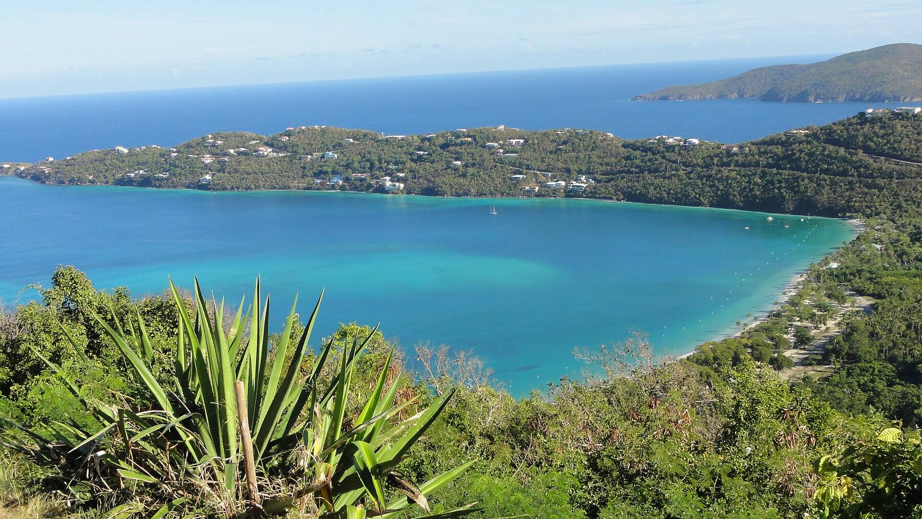
Maho Bay from the hillside: a long curve of sand under the forest — Amaury Laporte, CC BY 2.0, via Wikimedia Commons (resized).
Honeymoon Beach on Salomon Bay, St. John — Bradley Furlow, CC BY-SA 4.0, via Wikimedia Commons (resized).
Leinster Bay and Waterlemon Cay from the Leinster Bay Trail — Eoghanacht, CC0, via Wikimedia Commons (resized).
The windmill tower at the Annaberg sugar plantation ruins — Farragutful, CC BY-SA 4.0, via Wikimedia Commons (resized).
Ram Head on St. John's south-east tip, with turk's cap cactus on the trail — Scott Long, CC BY 3.0, via Wikimedia Commons (resized).
A green sea turtle over the seagrass near Waterlemon Cay — Gruepig, CC BY-SA 3.0, via Wikimedia Commons (resized).
Cruz Bay harbor from the hill above town, boats on their moorings — Fred Hsu, CC BY-SA 3.0, via Wikimedia Commons (resized).
The Cruz Bay ferry terminal, where the boats from St. Thomas land — Fred Hsu, CC BY-SA 3.0, via Wikimedia Commons (resized).
Mongoose Junction, the stone-and-wood shopping village in Cruz Bay — Mattes, CC BY 2.0 de, via Wikimedia Commons (resized).
Map: shoreline from U.S. Census Bureau TIGER/Line 2023; park boundary from the National Park Service; roads from our taxi-route data.
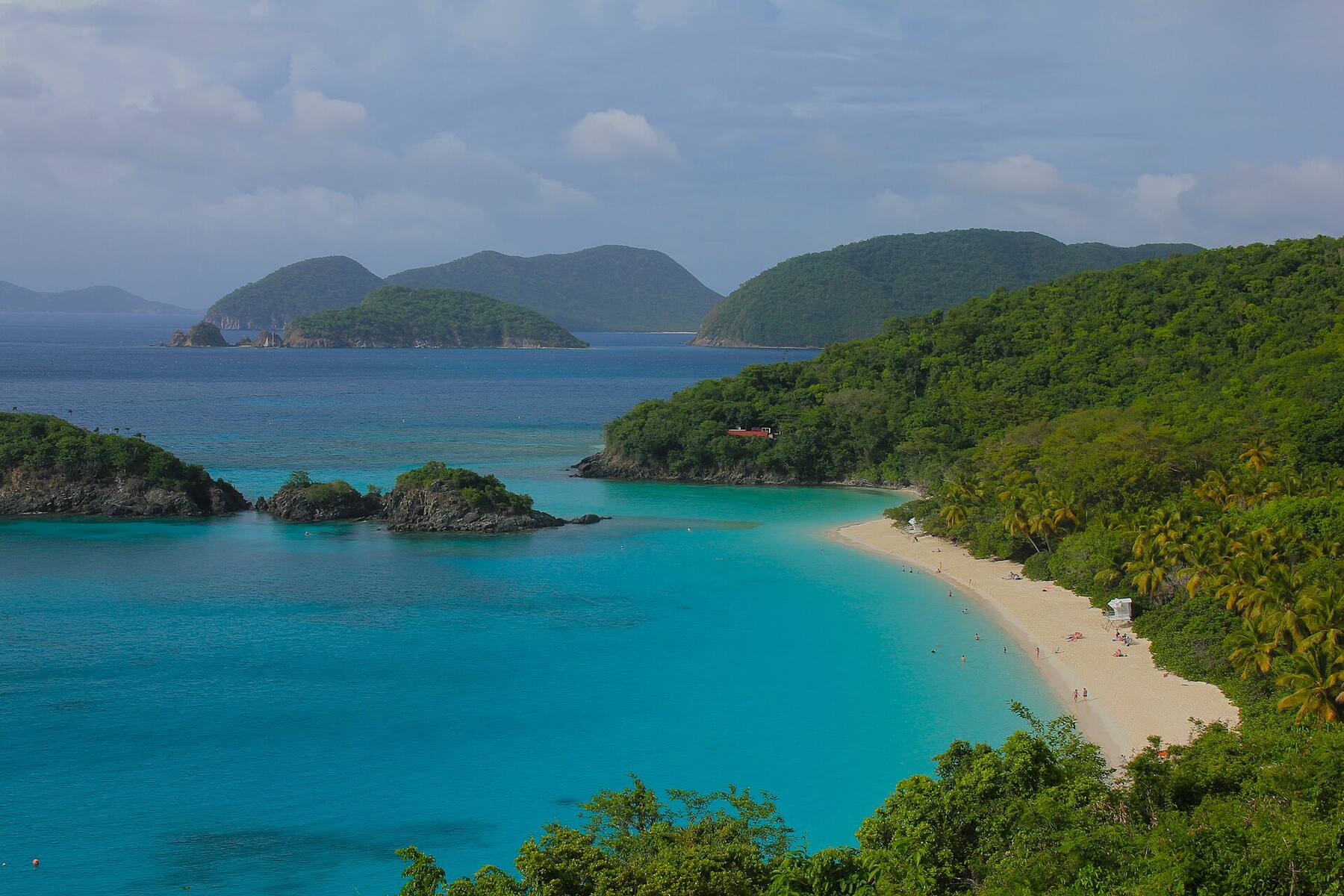
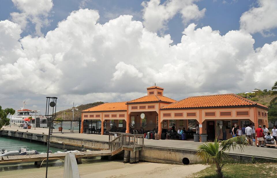
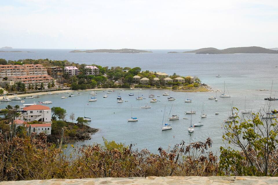
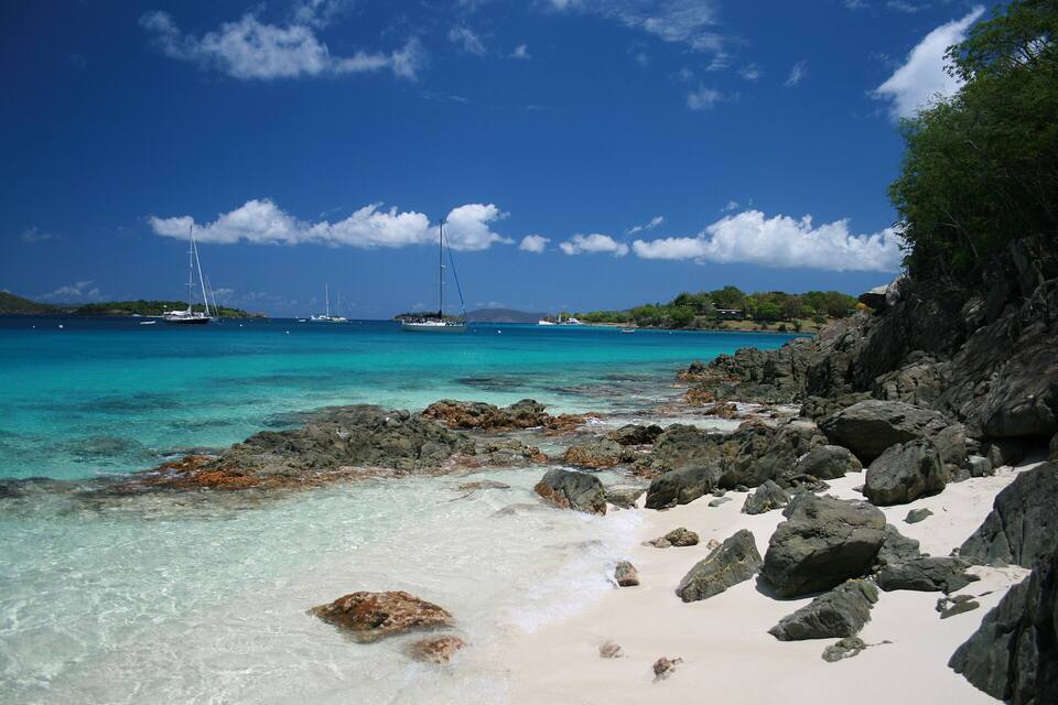 Photo: Bradley Furlow, CC BY-SA 4.0