The largest of the British Virgin Islands and home to most of its people: about 21 square miles of steep green ridges, with Road Town — the capital, the ferry terminal and the cruise pier — on the south shore and the beaches on the north. It is where the BVI's charter fleets set sail, and where most visitors arrive, by ferry from St. Thomas or by air to Beef Island.
Tortola and Beef Island drawn from the OpenStreetMap shoreline, with the roads the taxis drive and the sand of the main beaches. Tap a pin for its page.
Most visitors come by sea from St. Thomas. Ferries run from downtown Charlotte Amalie to Road Town, and from Red Hook on St. Thomas's east end to West End (Soper's Hole), the shorter crossing. Both are international: you clear BVI immigration and customs at the dock and pay the BVI entry fees.
Tortola's airport, Terrance B. Lettsome International (EIS), is on Beef Island at the east end, across a short bridge. American Eagle flies nonstop from Miami; otherwise you connect through San Juan or another Caribbean hub on Cape Air, interCaribbean and others. From Tortola, ferries go on to Virgin Gorda from Road Town and Trellis Bay, to Jost Van Dyke from West End, and to Anegada from Road Town on set days.
From the airport: a taxi from Beef Island Airport to Road Town is $27 for one rider, $14 each for two, $12 each for three or more, about 20–30 minutes — see the fare.
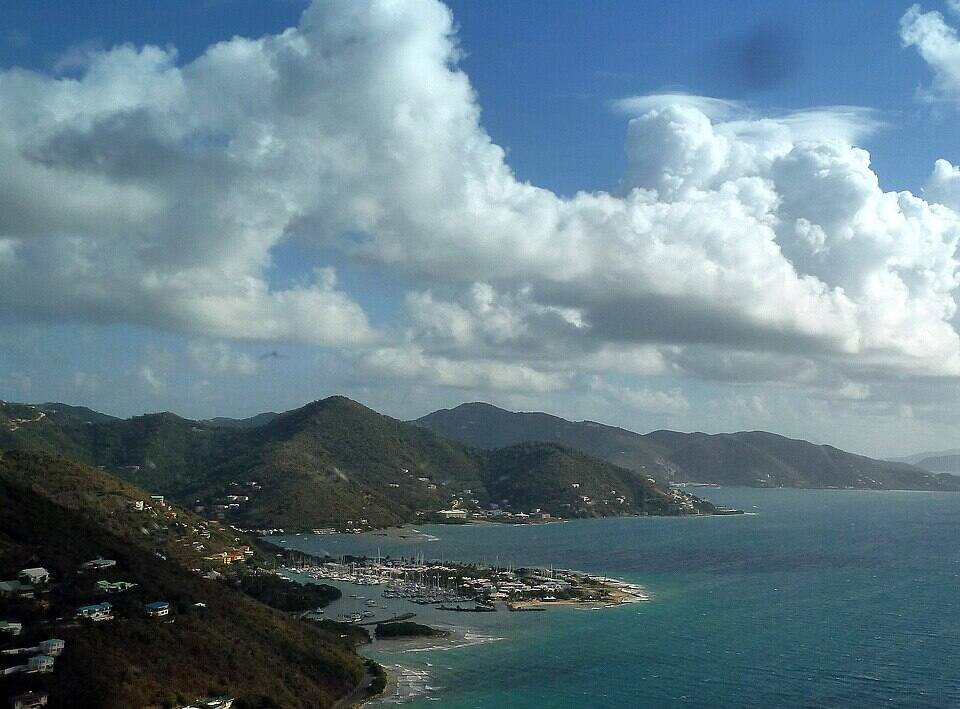
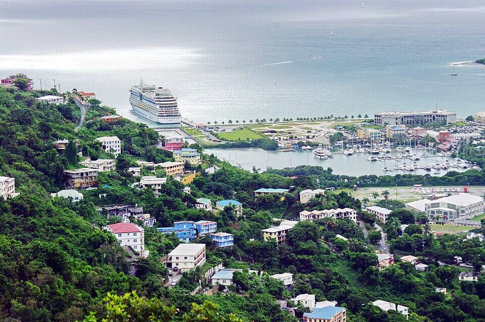
Road Town and Road Harbour from the hills, a cruise ship in the harbour and the Sir Francis Drake Channel beyond Photo: Bgabel, CC BY-SA 3.0
Fastest: Great Harbour, Jost Van Dyke ↔ West End, 10–15 min. Children and bag fees vary by route — each timetable page has the full fare table and booking links.
To and from the U.S. Virgin Islands
These crossings are international: bring a passport — U.S. citizens too — clear BVI immigration and customs when you land and pay the entry fees, and clear U.S. customs on the way back.
Landing at St. Thomas (STT)? The Charlotte Amalie ferry dock is a short taxi ride from the airport; Red Hook, for the West End boat, is 30–40 minutes across the island.
Pick your landing by where you are staying: West End for the West End, Long Bay, Apple Bay and Jost Van Dyke; Road Town for town, the charter bases and the Virgin Gorda ferries.
Give yourself time at the dock on the way out: international boats board only after immigration, and there is a BVI departure tax.
Sailing in on your own boat? Clear in at a port of entry — Road Town or Soper's Hole on Tortola — before you pick up a mooring anywhere else.
Taxis are the easy way round. Open-air safari taxis and vans wait at the ferry terminals, the cruise pier and the airport, and fares are set by the BVI's passenger-fare regulations: per person, and cheaper each as the group grows. The table below has the official fare from Road Town to the beaches, West End and the airport.
To explore on your own, rent a car or jeep in Road Town, at West End or at the airport. You drive on the left, the roads over the island's spine are very steep and winding — low gear on the way down — and the rental desk issues the temporary BVI licence you need.
Open-air safari taxis waiting in Road Town Photo: Bgabel, CC BY-SA 3.0
Tortola's best beaches are on the north shore, over the ridge from Road Town, with the quietest at the West End and on Beef Island. Numbers match the map. For which one is calm and uncrowded today, open the beach report.
Tortola's best-known beach: a long curve of sand under steep green hills, lined with beach bars, chairs and water-sport rentals, with the Callwood distillery just behind. Flat most of the year; a winter north swell can bring real surf. Busy on ship days, when the tours come over the hill from Road Town.
Taxi from Road Town: $18 for one rider, $10 each for three or more
The next bay north-east of Cane Garden Bay, down a steep, winding road: a quiet beach with reef to snorkel along its edges and a beach bar or two. Leave it alone in a big north swell.
Taxi from Road Town: $18 for one rider, $10 each for three or more
At the far west end, down a rough road past Long Bay: a small, sheltered cove with reef close to shore — one of the calmest swims on the island. Little in the way of facilities: bring water and shade.
Taxi from Road Town: $32 for one rider, $16 each for two, $14 each for three or more
The highest point in all the Virgin Islands, 1,716 ft, and the BVI's first national park: a patch of moist forest with mahogany, tree ferns and big boulders on marked trails from a car park off Ridge Road. On a clear morning the view runs from Jost Van Dyke to Virgin Gorda; cloud often settles on the top by afternoon.
Behind Cane Garden Bay, the Callwood family still makes rum in an old stone distillery, from cane juice in a pot still, much as it has been done there for well over a century. Look round, taste, and buy a bottle of their Arundel rum — bring cash.
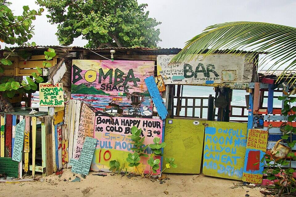
A beach shack on the north shore at Apple Bay built from driftwood, signs and whatever visitors leave behind, famous for its full-moon parties. Apple Bay in front is Tortola's surf break when the winter swell arrives.
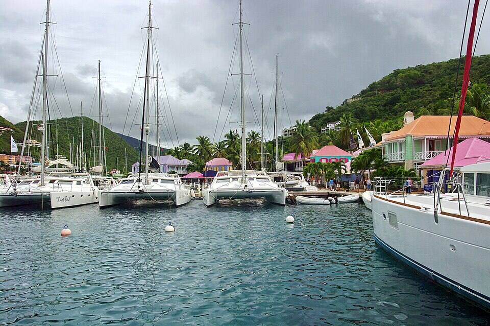
Where the St. Thomas and Jost Van Dyke ferries land: a sheltered harbour full of moored yachts, with painted wharf-side shops and Pusser's Landing on Frenchman's Cay. Worth an hour before or after a boat.
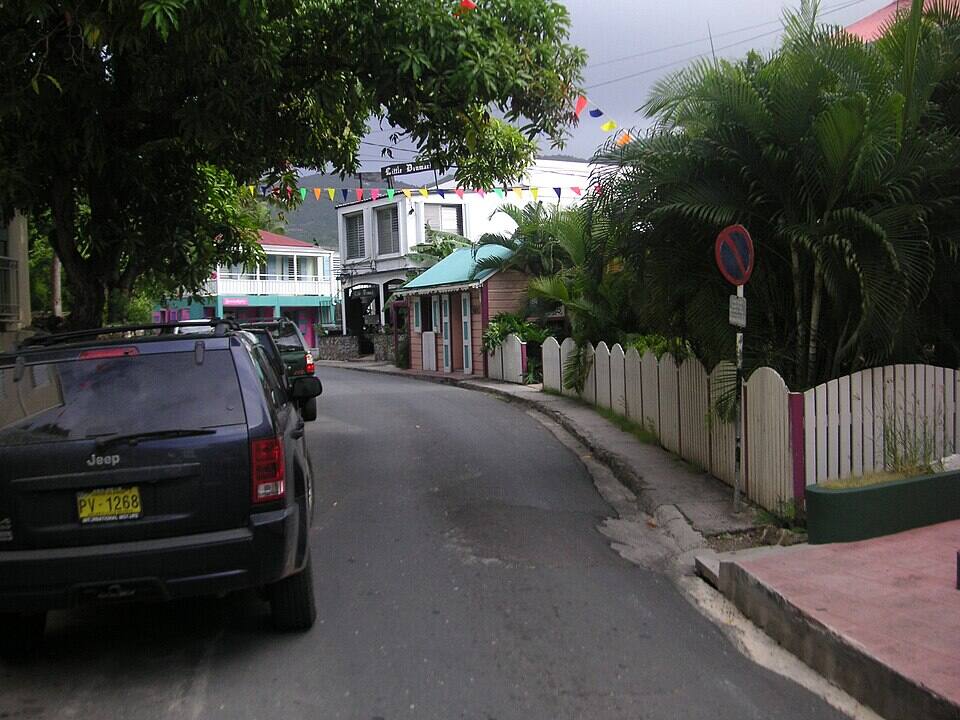
Main Street, a block back from the waterfront, keeps the old wooden and stone buildings — the Dove, Pusser's, the former prison wall — and the market square. Old Government House, now a museum, is on the hill above the ferry dock, and the J.R. O'Neal Botanic Gardens are a short walk north.
Tortola is the base of the BVI charter fleets: bareboats and crewed yachts sail from Road Town, Nanny Cay and the West End for a week round Norman Island, Cooper, Virgin Gorda's North Sound, Anegada and Jost Van Dyke. Mooring balls are first-come or booked through BoatyBall.
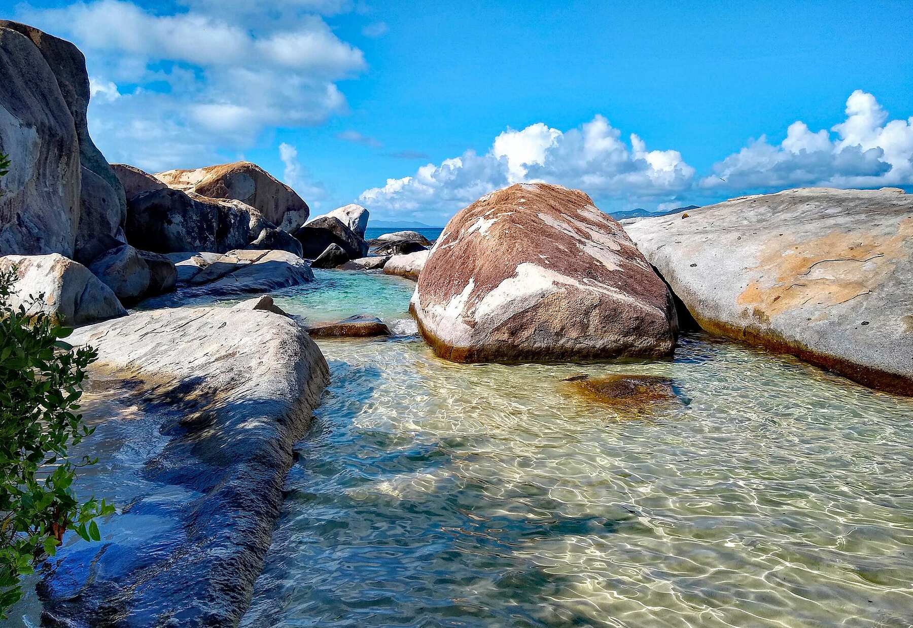
The ferry from Road Town or Trellis Bay to Spanish Town, then a short taxi, puts you among Virgin Gorda's giant granite boulders and pools by mid-morning. Go on a day with no cruise ship in Road Town if you can.
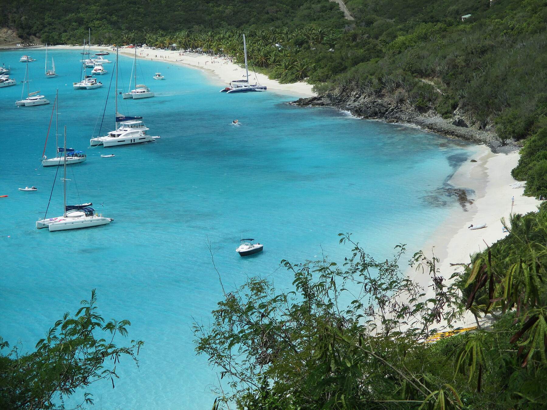
From West End the ferry to Great Harbour is a short hop; White Bay and the Soggy Dollar, home of the Painkiller, are a taxi ride or a walk over the hill from there.
Road Town has the most choice — waterfront places round Village Cay and the old restaurants of Main Street a block back. The north shore does beach bars, with Cane Garden Bay's strip the liveliest; the West End has Soper's Hole. Many places close for part of August to October — the list below says who, from our seasonal-closures tracker.
Road Town from above: the Wickhams Cay marinas, the waterfront and a cruise ship at the pier Photo: Bgabel, CC BY-SA 3.0
Road Town
Village Cay Restaurant & BarRoad Town's most reliable waterfront dining. Breakfast, lunch and dinner with fresh fish, sandwiches and a solid rum list.
The Dove RestaurantIntimate Road Town fine-dining restaurant in a colonial building. Caribbean-European fusion, excellent wine cellar, romantic atmosphere.
Capriccio di MareCasual Road Town Italian café and bar with excellent homemade pasta, espresso and gelato. Lunch and early dinner.
Brandywine Bay RestaurantHillside Florentine restaurant east of Road Town. Upscale Tuscan-Caribbean cuisine with panoramic views of the Sir Francis Drake Channel.
The north shore
Myetts Garden Grille & BarCane Garden Bay beach institution. Frozen drinks, barbecue, live music most nights. Hammocks under the trees.
Quito'sClosed for the season · back Mid-OctCane Garden Bay beach bar owned by local musician Quito Rhymer. Live reggae performances several nights a week — Quito himself often plays.
Bomba's Surfside ShackApple Bay institution plastered in graffiti and bras. Bomba's Full Moon Party is a legendary BVI beach rave held monthly.
West End
Pusser's LandingWaterfront Pusser's Rum bar at Soper's Hole. Great spot to nurse a Painkiller after clearing customs. Outdoor deck overlooks the marina.
Shopping: Road Town Market Square — Outdoor market in the heart of Road Town. Local produce, spices, handmade crafts, hot sauce and souvenir t-shirts. Soper's Hole Wharf & Market — Colourful marina-side market with boutique shops, art galleries, dive operators and the Pusser's chandlery. Great place to stock a charter boat.
Weather & sea
Tortola weather and the best time to go
Warm all year: highs in the mid-80s °F, a steady easterly trade wind that the sailors count on, and short tropical showers rather than all-day rain — often a cap of cloud on Sage Mountain while the coast stays sunny. December to April is the dry, busy season. June to November is hurricane season, peaking from mid-August to mid-October, when many restaurants and some resorts close for a few weeks.
Daily-mean sea-surface temperature, averaged 2021–2024 (Open-Meteo marine reanalysis): warmest in Sep (86.3°F), coolest in Feb (79.3°F). Hurricane history map
Cruise ships
Cruise ships and Tortola
Cruise ships berth at the Tortola Pier Park in Road Town, a short walk from Main Street, the ferry terminal and the charter docks; a few small ships call at Soper's Hole instead. On a big-ship day the taxis and tour buses carry thousands of passengers over the hill to Cane Garden Bay, and the ferries to Virgin Gorda for The Baths fill up — check the ships before you plan a beach.
22 calls at Road Town and Soper's Hole in the next 30 days. Next:
Wed, Oct 7 — Norwegian Luna (4,224 guests), 6:45am–2:00pm
Thu, Oct 8 — Norwegian Prima (3,950 guests), 6:00am–12:30pm
Sun, Oct 11 — Rhapsody of the Seas (2,050 guests), 8:00am–5:00pm
Tue, Oct 13 — Disney Treasure (2,476 guests), 7:30am–5:30pm
Seventeen Spanish ships anchor at Salt River, St. Croix. A landing party fights the Kalinago there — the first recorded battle between Europeans and Native Americans. Columbus names the chain Las Once Mil Vírgenes and claims it all for Spain; Spain never settles any of it.
Nov 1595
Drake's fleet sails the channel
Sir Francis Drake leads 27 English ships through the passage between Tortola and St. John on his way to attack Spanish San Juan. The channel has carried his name ever since.
1648
The Dutch fortify Tortola
Dutch West India Company settlers build a fort above Road Harbour. Jost Van Dyke already carries the name of a Dutch privateer who used its harbour a generation earlier.
1672
England seizes Tortola from the Dutch
In the Third Anglo-Dutch War, Colonel William Stapleton's force from the Leeward Islands takes Tortola. Virgin Gorda and Anegada follow by 1680 — the British Virgin Islands begin here.
Aug 1, 1834
Emancipation in the British Virgin Islands
Slavery ends across the British Empire. Tortola's plantations were already failing; most estates are abandoned within a generation and the land passes to the people who worked it.
Nov 15, 1960
The British Virgin Islands stand alone
Separated from the Leeward Islands, the BVI becomes its own colony, and on November 15, 1960 raises the flag it flies today — the Blue Ensign with the badge of St. Ursula and her lamps. A 1967 constitution brings elected government; today it is a British Overseas Territory.
Today
Two flags, one archipelago
St. Thomas, St. John, St. Croix and Water Island are the U.S. Virgin Islands. Tortola, Virgin Gorda, Jost Van Dyke and Anegada are the British Virgin Islands. Cruise ships and ferries cross the line every day.
The BVI is British, not American: U.S. citizens need a passport too, for the ferry from St. Thomas as much as for a flight. Keep it handy for the trip back, when you clear U.S. customs.
Drive on the left
Keep left — on blind hairpins most of all. The hills between Road Town and the north shore are steep enough to need low gear going down.
Agree the taxi fare
Fares are set per person by regulation, cheaper each for two and for three or more. Ask the total for your group before you set off.
Check for ships
When a big ship is at the pier, Road Town's streets, Cane Garden Bay and the Virgin Gorda ferries are at their busiest. The cruise page shows which days.
Cash for the small stuff
The U.S. dollar is the currency. Road Town has banks and ATMs; beach bars, taxis and the distillery like cash.
Watch the north swell
In winter a big north swell can make the north-shore beaches rough for a day or two; Smuggler's Cove and the south side stay calmer. Our beach report reads it daily.
Most visitors fly into St. Thomas (STT) and take a ferry — from Charlotte Amalie to Road Town, or from Red Hook to West End — with a passport, since the crossing is international. You can also fly to Terrance B. Lettsome International Airport (EIS) on Beef Island, joined to Tortola by a bridge: American Eagle flies nonstop from Miami, and regional airlines connect through San Juan and other islands.
Do you need a passport to go to Tortola?
Yes. Tortola is in the British Virgin Islands, a British Overseas Territory, so everyone needs a passport — U.S. citizens included, even on a day trip by ferry from St. Thomas or St. John. You clear BVI immigration and customs and pay entry fees on arrival, and clear U.S. customs on the way back.
How do you get from Beef Island airport to Road Town?
By taxi: they wait outside arrivals, and the drive over the bridge and along the south shore takes about 20–30 minutes. The official fare is $27 for one rider, $14 each for two, $12 each for three or more. Car rental desks are at the airport too.
What are the best beaches on Tortola?
Cane Garden Bay for a long beach with bars and water sports; Brewers Bay for a quieter swim and snorkeling; Smuggler's Cove at the far west end for calm, clear water and reef close in; Long Bay on the West End for a long walk; Apple Bay for surf in winter; and Long Bay on Beef Island for a last swim near the airport.
Do you need a car on Tortola?
Not necessarily. Taxis meet the ferries, the cruise pier and the airport and charge government-set fares per person — Road Town to Cane Garden Bay is $18 for one rider, $10 each for three or more. A rental makes it easier to reach several beaches and the West End in a day; you drive on the left, on steep roads, and need a temporary BVI licence from the rental desk.
What is the highest point in the Virgin Islands?
Mount Sage on Tortola, at 1,716 feet (523 m). Its summit forest is Sage Mountain National Park, the first national park in the British Virgin Islands, with marked trails from a car park off Ridge Road.
Do cruise ships dock at Tortola?
Yes. Cruise ships berth at the Tortola Pier Park in Road Town, a short walk from Main Street and the ferry terminal; a few small ships call at Soper's Hole on the West End. On a big-ship day expect Cane Garden Bay and the ferries to Virgin Gorda to be busy.
How do you get from Tortola to Virgin Gorda or Jost Van Dyke?
By ferry. Boats run from Road Town and from Trellis Bay on Beef Island to Spanish Town on Virgin Gorda, and from West End to Great Harbour on Jost Van Dyke. These are BVI-to-BVI crossings, so there is no customs; the timetables are on our ferry pages.
Photo & map credits
Cane Garden Bay from the hillside above it: the curve of sand, yachts at anchor and the green north-shore hills — Balou46, CC BY-SA 4.0, via Wikimedia Commons (resized).
The sand at Cane Garden Bay under the palms, looking out to sea — Jean-Marc Astesana, CC BY-SA 2.0, via Wikimedia Commons (resized).
Road Town and Road Harbour from the hills, a cruise ship in the harbour and the Sir Francis Drake Channel beyond — Bgabel, CC BY-SA 3.0, via Wikimedia Commons (resized).
Road Town from above: the Wickhams Cay marinas, the waterfront and a cruise ship at the pier — Bgabel, CC BY-SA 3.0, via Wikimedia Commons (resized).
Open-air safari taxis waiting in Road Town — Bgabel, CC BY-SA 3.0, via Wikimedia Commons (resized).
Bomba's Surfside Shack, its walls of hand-painted signs, on the north shore — Bgabel, CC BY-SA 3.0, via Wikimedia Commons (resized).
Soper's Hole at the West End: yachts on the moorings and the painted wharf-side buildings — Bgabel, CC BY-SA 3.0, via Wikimedia Commons (resized).
Main Street, Road Town: the narrow old street a block back from the waterfront — Colin Riegels, Public domain, via Wikimedia Commons (resized).
Nanny Cay's marina, one of Tortola's charter bases, on the south coast below the hills — giggel, CC BY 3.0, via Wikimedia Commons (resized).
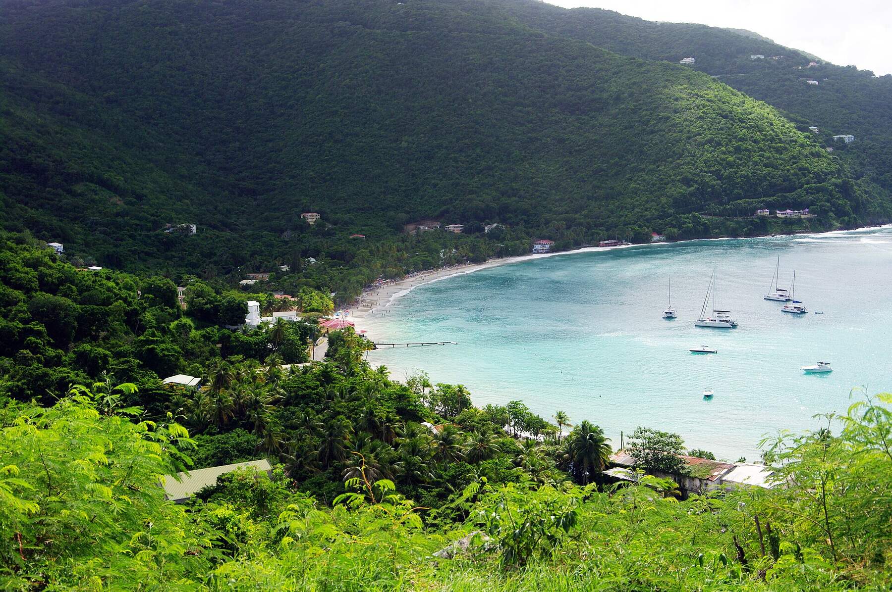
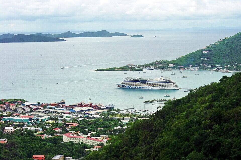
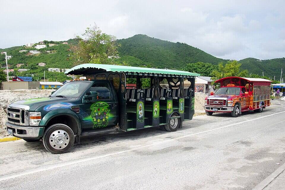
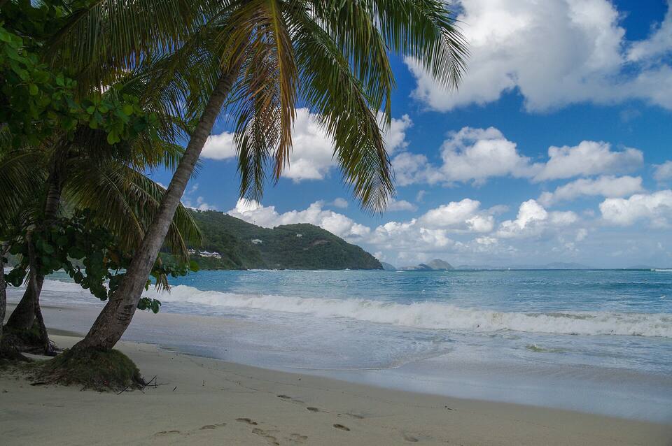 Photo: Jean-Marc Astesana, CC BY-SA 2.0