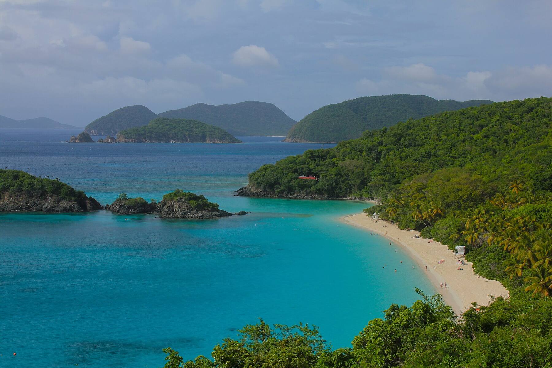
A third of a mile of white sand on St. John's north shore, inside Virgin Islands National Park, with Trunk Cay a short swim off the beach and the park's underwater snorkel trail along its side. The park calls it its most famous beach. It is the one beach on St. John with a fee, a short taxi ride from the Cruz Bay ferry dock.
The north shore of St. John, U.S. Virgin Islands — on the North Shore Road (Route 20), east of Cruz Bay
The beach
About a third of a mile (0.5 km) of white sand, with Trunk Cay just offshore
Run by
The National Park Service: Trunk Bay is part of Virgin Islands National Park
Fee
$5 a person aged 16 and up, sunrise to sunset — card or phone only since October 1, 2026
Facilities
8 am to 4 pm: restrooms, showers, a snack bar and bar, a gift shop, snorkel and chair rentals
Lifeguards
None on duty, the park says
Snorkeling
The park's underwater trail: signs on the seabed along the west side of Trunk Cay
Crowds
One of three places in the park where tour groups may go by land; busiest when ships are in St. Thomas
Access
Accessible paths and beach ramps, an accessible restroom and wheelchairs, the park lists
History
Sold to the National Park Service in 1957 by the Boulon family, who had run a guest house at the bay
Today
Is Trunk Bay good today?
Skip today Rough — 3.3 ft WNW swell, shore break · Thunderstorms in the forecast. If you go, the least bad stretch left is 10 am–1 pm.
Day
The call
Why
Best time
Cruise guests here
Sea at the beach
Rain
Today
Skip today
Rough — 3.3 ft WNW swell, shore break · Thunderstorms in the forecast
10 am–1 pm
None
Rough · 2.9 ft
Thunder
Tomorrow
Skip today
Rough — 3.5 ft WNW swell, shore break · Thunderstorms in the forecast
12 pm–3 pm
None
Rough · 3 ft
Thunder
Sun, Nov 8
Skip today
Rough — 3.5 ft NW swell, shore break
3 pm–6 pm
~250
Rough · 3 ft
59%
Mon, Nov 9
Think twice
Choppy — NNE swell into the bay
8 am–11 am
~100
Some chop · 2.3 ft
35%
Tue, Nov 10
Think twice
Choppy — NNE swell into the bay
10 am–1 pm
~150
Some chop · 2.2 ft
31%
The call is the same one our beach report makes, refreshed every half hour: the swell reaching the bay (Open-Meteo's marine forecast north of the islands), the cruise passengers our crowd model puts on the sand, NOAA's sargassum satellite and the rain forecast. It is a model, not a ranger's report — Trunk Bay has no lifeguards on duty, so the posted warnings and the park staff have the last word. The bars under each call are the hours from 8 am to 5 pm. Today's beach report
Taxi fares from the ferry dock, the boats over from St. Thomas, the ships that fill the beach, today's beach and weather reads and the island around it — each one opens the full page.
RoadsTrailsBeach sandSightSnorkel & diveFood & drinkGate & feesParkingBathhouseLifeguard stand
Trunk Bay from OpenStreetMap: the sand, Trunk Cay, the North Shore Road and the beach's parking lot, and each facility where OpenStreetMap's mappers put it. The small red dots are the lifeguard stands — no lifeguards are on duty, the park says. Tap a pin for its section.
Getting there
How to get to Trunk Bay
Trunk Bay is on the North Shore Road (Route 20), east of Cruz Bay, where the ferries from St. Thomas land. The road climbs out of town past Caneel Bay and Hawksnest, passes the overlook above Trunk Bay — the view on the postcards — and comes down to the beach's parking lot. There is no bus to the north-shore beaches and no ride-hailing: you come by safari taxi, in a rental jeep or on a tour.
The open-air safari taxis wait at the Cruz Bay ferry dock and charge the official per-person fare in the table. Driving, keep left; the lot fills on busy days, and there is nowhere else to park — the park's service road beyond the lot is closed to the public.
Per person, one way: fares set by the VI Taxicab Commission (rates revised October 24, 2022); night, luggage and waiting surcharges apply. Drive times are Google's for an ordinary day. Fare calculator for any two stops
Agree the fare before you set off — it is per person, one way — and agree a pick-up time with the driver for the ride back.
From a ship in St. Thomas, allow for a taxi to the ferry, the crossing and a taxi each way, and keep the all-aboard time in mind.
Download the Recreation.gov app before you leave Cruz Bay: the fee is card or phone only, and Recreation.gov warns that cell service can be limited.
In a rental jeep, leave nothing in the car at the beach lot.
Trunk Bay is the one beach on St. John where the National Park Service charges a fee — an expanded amenity fee, which pays for its water, restrooms and showers, the park says. The rest of Virgin Islands National Park has no entrance fee. Since October 1, 2026 the fee booth takes cards and phone payments only; you can also buy the day pass ahead on Recreation.gov, or scan the QR code at the beach with its app.
The amenity fee
Day pass, age 16 and up
$5
Under 16
Free
Interagency Senior or Access Pass holder
$2.50
On national park fee-free days
Still charged
Arriving by dinghy
Same fee
Driving into the park
No charge
In September 2024 the park proposed raising the day pass to $10, adding a $60 annual pass and charging from age 10; the fees page, last updated September 29, 2026, still lists $5. That page says Trunk Bay is cashless since October 1, 2026 — and, further down, that cash is accepted there for passes. Bring a card.
Hours
The park
Open 24 hours
Fee charged
Sunrise – sunset
Restrooms, showers, rentals
8:00 am – 4:00 pm
Snack Shack and bar
10:00 am – 4:00 pm
Lifeguards
None on duty
Every day. The park's hours page and Recreation.gov agree on 8 to 4 for the facilities and that no lifeguards are on duty; older guides still list lifeguards. The park's rules waive the fee while the fee booth is closed. The Cruz Bay visitor center, for passes and questions, is open Monday to Thursday 8:15 am to 4 pm and Friday 8:15 am to 1:30 pm.
Park rules
✓Your own food and drink — the park lists picnic tables and grills
✓Alcohol — the bar sells it; the park bans it only in visitor centers and on ranger programs
✕Glass bottles and containers — on every park beach
✕Pets — on park beaches
✕Smoking and vaping — on the beach, or within 50 ft of picnic tables, pavilions and restrooms
✕Drones — unless the superintendent has approved it in writing
✕Landing on Trunk Cay — it is closed to foot traffic
✕Kayaks and paddleboards near the trail — keep 200 ft off Trunk Cay's west side
✕Fishing or scuba in the swim area — the buoyed area where boats are banned
✕Fires on the ground — only in the park's grills or a portable grill
Everything sits between the parking lot and the sand, a few steps apart: the fee booth, the restrooms and showers, the snack bar and the gift shop. What the park lists and when it is open, as of October 2026; the park does not publish rental or menu prices, so neither do we.
The fee
The fee booth
By the parking lot, on the way to the sand. Pay $5 a person aged 16 and up by card or phone — no cash since October 1, 2026 — or show a day pass bought ahead on Recreation.gov. Interagency passes can be bought here too. Arriving by boat? The fee applies to everyone who lands.
Facilities
Restrooms, showers and a foot rinse
Restrooms for men and women, outdoor showers and a foot rinse behind the beach, open 8 am to 4 pm. The park lists an accessible restroom, a family restroom, drinking water and a bottle-filling station.
Food & drink
The Snack Shack, the bar and the gift shop
The park lists snacks, coffee, ice cream and drinks including alcohol, from 10 am to 4 pm, and the gift shop next door — the beach shop on Recreation.gov's list. Nothing else to eat at the beach: bring a picnic if you are staying the day.
The park lists snorkel and chair rentals at Trunk Bay, open 8 am to 4 pm, and life jackets for rent. It publishes no prices. If you mean to snorkel the trail early or late, bring your own mask and fins.
Snorkeling
The underwater trail
The park's self-guided snorkel trail starts from the beach and follows the west side of Trunk Cay, with signs on the seabed about the reef's animals and how to protect them; allow 30 to 60 minutes, the park says. How long it is depends on which park page you read: about 300 feet out before it turns back (the snorkeling page), about 400 feet (the trail's own page) or 225 yards (Places to Go and Recreation.gov). Kayaks and paddleboards must keep 200 feet off the cay's west side, and scuba is not allowed in the swim area.
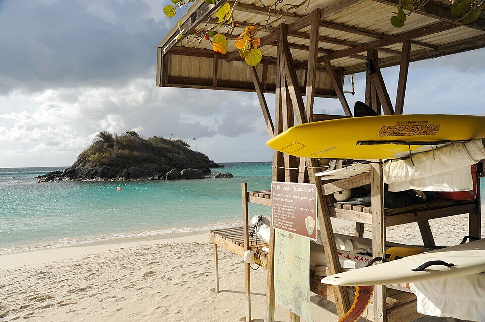
The park's hours page and Recreation.gov both say no lifeguards are on duty at Trunk Bay; the station in this 2009 photo, and older guides, are out of date. Swim inside the buoys that keep boats out, read the posted warnings, and in winter treat a north swell with care — the park warns that cold fronts can send large waves onto the north-shore beaches.
Access
Wheelchair access
The park lists accessible paths and beach ramps, an accessible restroom and wheelchairs available at Trunk Bay. Ask the park staff at the beach.
Trees along the back of the beach give shade, and the park lists picnic tables, a picnic shelter and grills. Food, drinks and coolers are fine; glass is not. Fires only in the park's grills or a portable grill — never on the ground.
Getting back
Parking and taxis
The parking lot is behind the beach, by the fee booth. The park charges nothing for cars — the fee is per person — but the lot fills on busy days, and the service road beyond it is closed to the public. If you came by taxi, agree a pick-up time with the driver; the fare back is the same official per-person fare.
Swim out from the beach to Trunk Cay and follow the trail's signs along its west side, then back. The park calls it a good place for beginners. The reef carries on to the cay's northern tip, but the farther out you go the rougher the water tends to be. Stand only on sand, and wear a rash guard or reef-safe sunscreen.
The swim area is the water inside the buoys that keep boats out. There are no lifeguards, so swim with someone, and in winter check the swell first: a north swell can break on the beach for a day or two at a time.
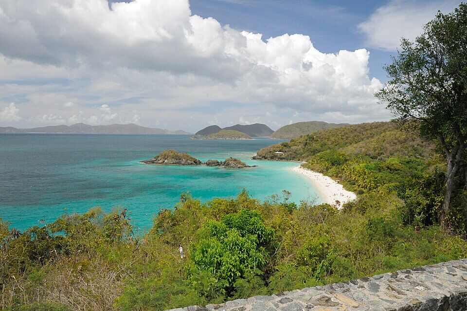
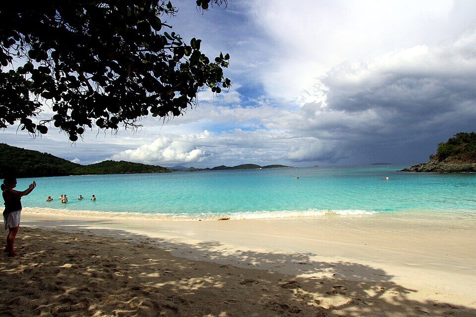
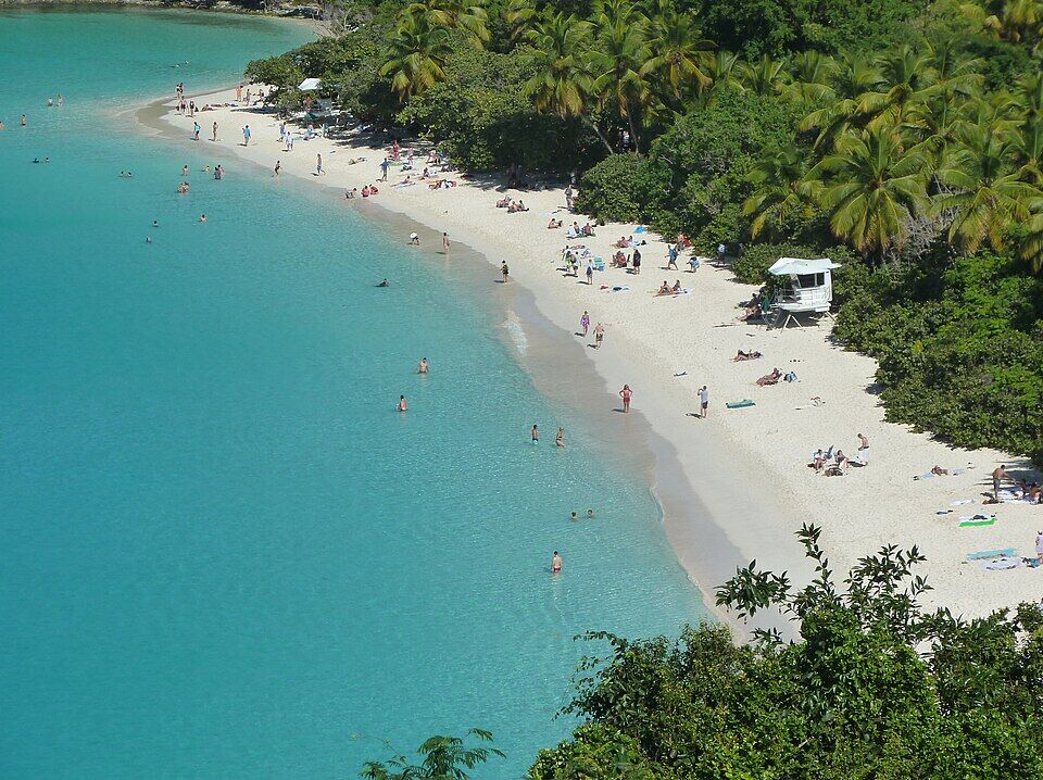
Just west of the beach, the North Shore Road passes the Trunk Bay overlook: the bay, the cay and the sand from above, the view in several of the photos on this page. Ask your taxi to stop on the way out or back.
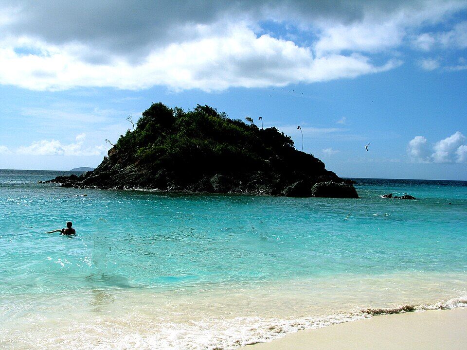
Swim round it, but do not climb onto it: the park closes Trunk Cay to foot traffic, because climbing onto the rocky cays damages the reef and birds nest and rest on them at certain times of year.
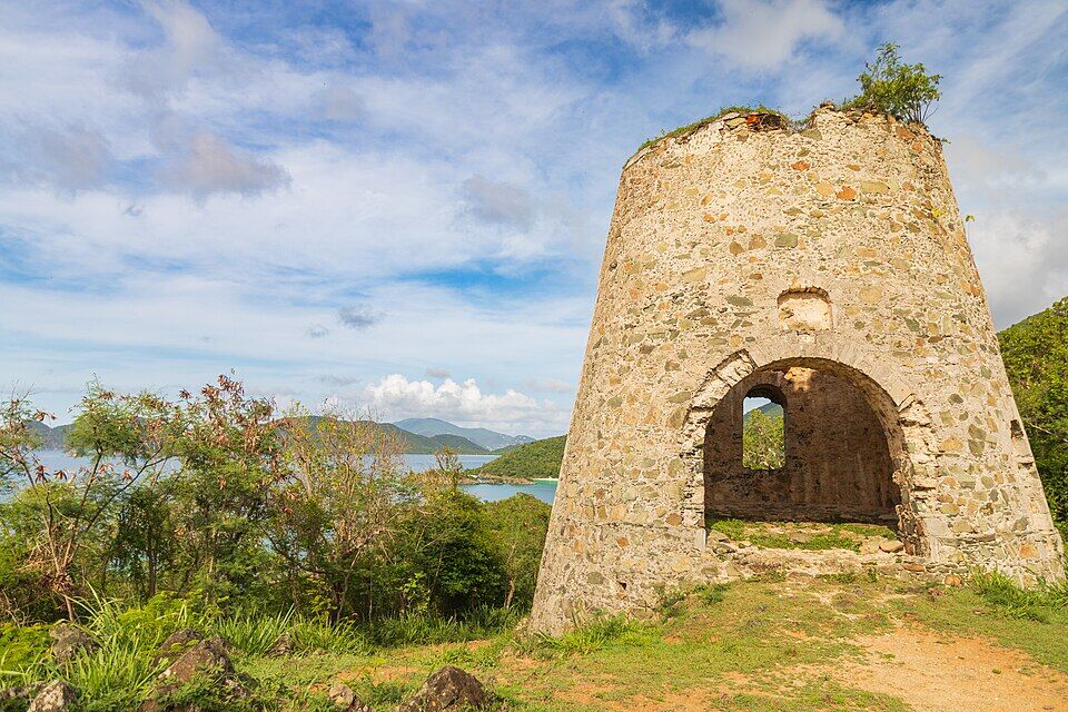
On the North Shore Road between Hawksnest and Trunk Bay, a short path climbs from a small parking area to the stone tower of a windmill from the Denis Bay plantation, with views over the north-shore bays. The plaque at the top says Julius Wadsworth raised a statue there, the Christ of the Caribbean, in 1953, and gave the hill to the national park in 1975.
The next beach east is the longest on St. John, the park says, with Cinnamon Bay Beach & Campground behind it: camping, the Rain Tree Cafe for breakfast and dinner, a lunchtime food truck and water-sport rentals, its operator says. It also has St. John's only beach webcam.
The Snack Shack and bar behind the beach is the only food at Trunk Bay: snacks, coffee, ice cream and drinks including alcohol, from 10 am to 4 pm, the park says. Bring your own lunch by all means — the park lists picnic tables and grills — but leave glass at home.
For a meal, Cruz Bay's restaurants are back along the North Shore Road. Cinnamon Bay, the next beach east, has the Rain Tree Cafe at its campground for breakfast and dinner, and a food truck at lunch.
The Snack Shack and barSnacks, coffee, ice cream, drinks including alcohol; 10 am–4 pm daily, the park says.
Bring your ownPicnics and coolers are welcome; glass is not. The park lists picnic tables and grills.
Along the North Shore Road
Cinnamon Bay Beach & CampgroundThe next beach east: the Rain Tree Cafe for breakfast and dinner, a food truck at lunch.
Cruz BayThe island's restaurants and bars, back by the ferry dock.
Weather & sea
Trunk Bay weather and the best time to go
Warm all year, with a steady easterly trade wind and short tropical showers rather than all-day rain. December to April is the dry season — and the busy one. Summer brings more rain and lighter winds, and, more often than storms, clouds of African dust, the park says.
Trunk Bay is on the north shore, so the sea that matters is the winter north swell. The park warns that cold fronts coming off the mainland can send large waves onto the north-shore beaches, and asks swimmers to take extreme care and heed the posted warnings and the park staff. With no lifeguards on duty, check before you swim: the call at the top of this page reads the swell every half hour.
The next 7 days on St. John
Day
Sky
High / low
Rain
Wind
Seas offshore
Today
Thunderstorms
85° / 78°F
90%
SW 20 mph, gusts 28
3 ft
Tomorrow
Thunderstorms
83° / 80°F
92%
WSW 19 mph, gusts 28
3.4 ft
Sun, Nov 8
Drizzle
84° / 81°F
57%
WSW 13 mph
3 ft
Mon, Nov 9
Drizzle
83° / 82°F
18%
NNW 5 mph
2.2 ft
Tue, Nov 10
Drizzle
83° / 80°F
25%
NE 11 mph
2 ft
Wed, Nov 11
Overcast
84° / 82°F
20%
ENE 11 mph, gusts 17
2.2 ft
Thu, Nov 12
Drizzle
84° / 82°F
27%
ESE 12 mph
2.1 ft
Open-Meteo forecast for St. John, refreshed every half hour. The seas are offshore; how much of it reaches the sand is the call above. NWS alerts & marine forecast · North swell season
Sea temperature by month
80°Jan
80°Feb
80°Mar
81°Apr
83°May
85°Jun
85°Jul
85°Aug
86°Sep
86°Oct
84°Nov
82°Dec
Daily-mean sea-surface temperature off St. John, averaged 2021–2024 (Open-Meteo marine reanalysis): warmest in Sep (86.3°F), coolest in Feb (79.7°F).
Cruise crowds
Cruise ships and the crowd at Trunk Bay
No cruise ship docks at St. John. The big ships call at Charlotte Amalie on St. Thomas, and their passengers come over to Trunk Bay on excursions, by ferry and taxi; a few small ships anchor off Cruz Bay and send theirs ashore by tender. Under the park's rules Trunk Bay is one of only three places in the national park where tour groups of 12 or more may go by land, so a heavy ship day in St. Thomas shows on the sand.
26 of the next 31 days have a ship in Charlotte Amalie or off Cruz Bay. The busiest at Trunk Bay, by our model:
Wed, Nov 11 — 4 ships, 14,943 guests in port. Some crowd: ~750 expected here, 10 am–4 pm
Thu, Nov 12 — 4 ships, 17,041 guests in port. Busy: ~900 expected here, 9 am–4 pm
Tue, Nov 17 — 4 ships, 15,246 guests in port. Some crowd: ~700 expected here, 9 am–4 pm
Wed, Nov 25 — 5 ships, 19,304 guests in port. Busy: ~1,200 expected here, 9 am–4 pm
Mon, Nov 30 — 4 ships, 10,048 guests in port. Some crowd: ~650 expected here, 10 am–4 pm
Wed, Dec 2 — 5 ships, 19,835 guests in port. Some crowd: ~800 expected here, 10 am–5 pm
Our crowd model, not a head count: it puts about 5% of each big ship's passengers in Charlotte Amalie on Trunk Bay, and a much larger share of a small ship anchored off Cruz Bay, starting about 75 minutes after the ship is in and gone 90 minutes before it sails; past 1,500 on the sand we call it packed. The same model makes the call at the top of the page and on our beach report.
No — there is no public live webcam at Trunk Bay that we can embed, and we would rather say so than show a still photo dressed up as live. The nearest live camera is at Cinnamon Bay, the next beach east along the North Shore Road, and it is a good read on the north-shore sea.
Adrian Runnels, a Dutchman from St. Eustatius who had moved from St. Thomas to St. John in 1691, adds Trunk Bay to his plantation, Estate Adrian, uphill from the bay, to give it a seaport.
1823–1845
The sugar factory falls
An 1823 inventory lists Trunk Bay's sugar factory as intact; one taken in 1845 lists it in ruins. The ruin stands by the North Shore Road at the beach.
1927
The Boulons' bay
The Boulon family buys 100 acres including Trunk Bay for $5,000, and later runs a small guest house of 8 to 10 rooms there; Tortola sloops sail in to the beach with produce and passengers.
August 2 and December 1, 1956
A national park
Congress authorizes Virgin Islands National Park; on December 1 Laurance Rockefeller hands the deeds to 5,086 acres of St. John to the Secretary of the Interior in Cruz Bay. The Boulons sell him about 59 acres of their land back from the beach.
1957
The beach goes to the park
The Boulons sell the Trunk Bay beachfront to the National Park Service, keeping about three acres at Windswept beside the bay.
1962
Beach facilities
The park's brochure lists new beach facilities at Trunk Bay, built under the Mission 66 program, and a day-use concession that 'provides luncheon'.
2009
The ruin shored up
Eight restoration masons from San Juan National Historic Site stabilize the sugar factory ruin by the road.
2015
The last fee rise
The last time the park raised its amenity fees before the 2024 proposal, by the park's own account.
November 20, 2017
Reopened after Irma and Maria
Trunk Bay reopens after the two hurricanes: the park stabilizes structures, removes fallen trees and more than 480 cubic yards of debris, and divers clear the swimming areas.
June 6, 2020
Reopened after the pandemic closures
The restrooms and showers reopen with the amenity fee waived for the time being; food service stays closed.
Fall 2021
New trail signs
The park schedules ten new signs for the underwater trail.
September 2024
A higher fee proposed
The park proposes a $10 day pass and a $60 annual pass; the fee was still $5 in October 2026.
2024
Top of a list
The World's 50 Best Beaches puts Trunk Bay first in its 2024 list.
October 1, 2026
No more cash
The fee booth goes cashless: cards and phone payments only.
The fee booth stopped taking cash on October 1, 2026. Pay by card or phone, or buy the day pass on Recreation.gov before you go — cell service at the beach can be limited.
Reef-safe sunscreen is the law
The U.S. Virgin Islands ban sunscreens with oxybenzone, octinoxate or octocrylene, and the park asks snorkelers on the trail for a rash guard or reef-safe sunscreen. Bring a mineral (zinc or titanium) one.
Stand only on sand
The park's rule on the trail: stand only on sand, never on coral — and be confident of your swimming before you set out. Life jackets are for rent at the beach.
Come early or late on a ship day
When big ships are in St. Thomas the excursion groups arrive from late morning. Come before or after them; the call at the top of the page shows today's ships and when their passengers are on the sand.
The facilities close at 4
The restrooms, showers, rentals and the snack bar close at 4 pm, but the beach stays open — the park never closes.
Nothing on the cay
Swim round Trunk Cay, but do not land on it: it is closed to foot traffic. Keep off the reef, and take everything you bring home with you.
The National Park Service charges an amenity fee of $5 a person aged 16 and up, from sunrise to sunset; under-16s are free, and holders of an Interagency Senior or Access Pass pay $2.50. Since October 1, 2026 the fee booth takes cards and phone payments only, or you can buy the day pass on Recreation.gov. Trunk Bay is the only beach on St. John with a fee.
What are the hours at Trunk Bay?
The beach is in Virgin Islands National Park, which is open 24 hours. The fee is charged from sunrise to sunset; the restrooms, showers and rentals are open from 8 am to 4 pm, and the snack shack and bar from 10 am to 4 pm, the park says.
Are there lifeguards at Trunk Bay?
No. The National Park Service and Recreation.gov both say no lifeguards are on duty at Trunk Bay, though older guides still mention them. Swim inside the buoys that keep boats out, read the posted warnings, and take care in a winter north swell.
How long is the Trunk Bay underwater snorkel trail?
Short. The park's snorkeling page says it follows the west side of Trunk Cay for about 300 feet before turning back to the beach; its other pages say about 400 feet or 225 yards. The park allows 30 to 60 minutes for it, and signs on the seabed name the reef's animals.
Can you rent snorkel gear at Trunk Bay?
Yes. The park lists snorkel and chair rentals at Trunk Bay, open from 8 am to 4 pm, and life jackets for rent; it does not publish prices. Bring your own mask and fins if you want to be sure, or to snorkel before 8 or after 4.
How do you get to Trunk Bay from Cruz Bay?
By safari taxi or rental jeep along the North Shore Road: about 11 minutes (5.5 km) by road from the Cruz Bay ferry dock. The official taxi fare is $12 for one rider, $9 each for two or more. There is no bus to the north-shore beaches.
How much is a taxi to Trunk Bay?
Taxis charge fixed per-person fares set by the VI Taxicab Commission. From the Cruz Bay ferry dock it is $12 for one rider, $9 each for two or more; from the Westin $15 for one rider, $12 each for two or more; from Coral Bay $14 for one rider, $11 each for two or more. Night, luggage and waiting surcharges apply.
Can I visit Trunk Bay from a cruise ship in St. Thomas?
Yes, on a ship's excursion or on your own: a taxi to the Red Hook ferry (or the downtown boat, when it runs), the crossing to Cruz Bay, then a safari taxi along the North Shore Road. Allow for the ferry both ways and keep the all-aboard time in mind; our ferry pages have today's boats.
Is Trunk Bay crowded?
It can be. Trunk Bay is the park's most famous beach and one of only three places in the park where tour groups may go by land, so it is busiest when big ships are in St. Thomas, from late morning. Early mornings, late afternoons and days with no ships are quieter. The call at the top of this page reads each day's ships.
Is there parking at Trunk Bay?
Yes, a lot behind the beach by the fee booth. The park charges nothing for cars — the fee is per person — but the lot fills on busy days and there is nowhere else to park: the service road beyond it is closed to the public.
Can you bring food and alcohol to Trunk Bay?
Yes. Picnics are welcome — the park lists picnic tables and grills — and the park's rules ban alcohol only in visitor centers and on ranger programs; the beach bar sells it. Glass bottles and containers are banned on every park beach, and so are pets and smoking.
Are dogs allowed at Trunk Bay?
No. Pets are not allowed on any Virgin Islands National Park beach, under the superintendent's rules for the park.
Can you walk out to Trunk Cay?
No. Swim or snorkel round it, but the park closes Trunk Cay to foot traffic: climbing onto the rocky cays damages the reef, and birds nest and rest on them at certain times of year.
Is there a Trunk Bay webcam?
No public live stream we can embed. The nearest live camera is at Cinnamon Bay, the next beach east along the North Shore Road, and it is a good read on the north-shore sea.
Why is it called Trunk Bay?
The usual explanation is the leatherback sea turtle, called a 'trunk' in the Virgin Islands — the reason the guidebooks and The World's 50 Best Beaches give. We have not found the National Park Service's own word on it.
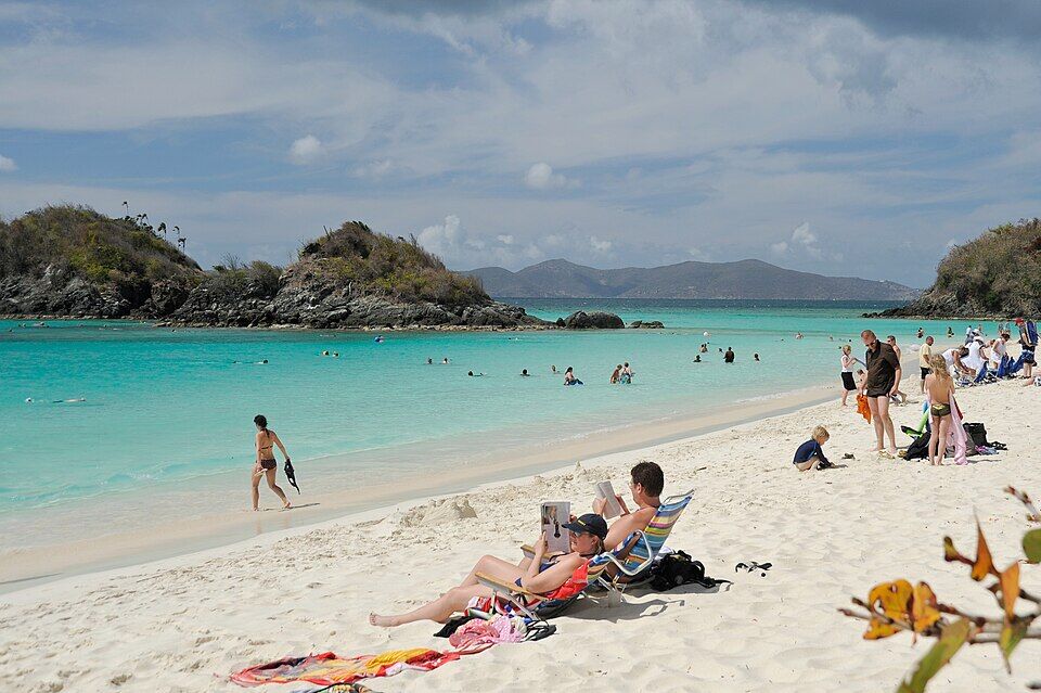
The lifeguard station at Trunk Bay in May 2009, with rescue boards, a National Park rules sign and the underwater trail map; Trunk Cay behind. The park says no lifeguards are on duty now — Fred Hsu (Wikipedia:User:Fred Hsu on en.wikipedia), CC BY-SA 3.0, via Wikimedia Commons (resized).
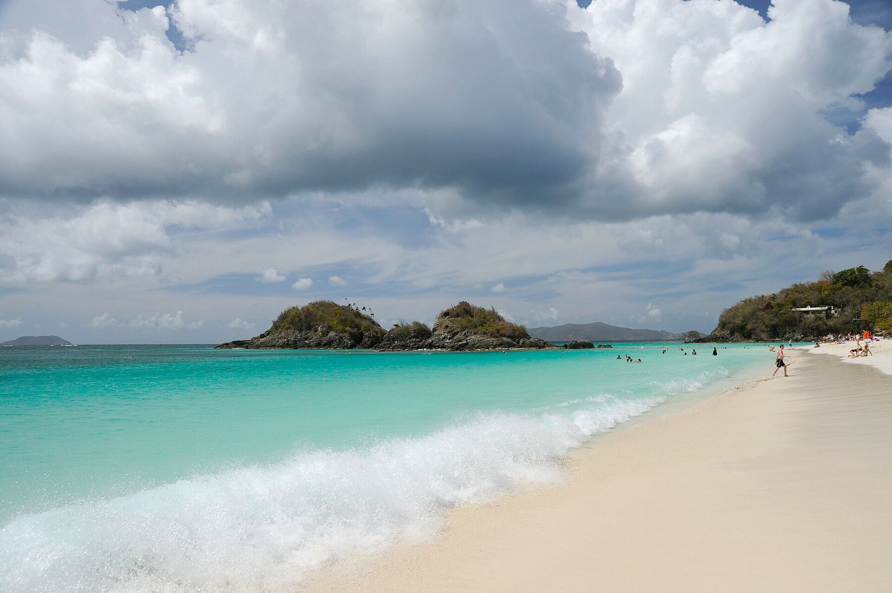
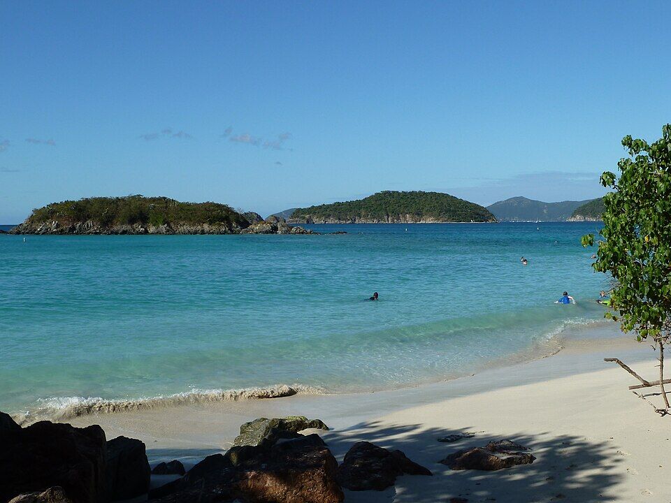
Trunk Cay from the water's edge, a swimmer heading out toward it (July 2008) — Rennett Stowe from USA, CC BY 2.0, via Wikimedia Commons (resized).
Looking down on Trunk Bay from the overlook in December 2013: beachgoers along the sand and a lifeguard hut among the palms — Gruepig, CC BY-SA 4.0, via Wikimedia Commons (resized).
The stone windmill tower on Peace Hill, in the Denis Bay Historic District, with the north-shore bays behind (August 2023) — Madlabscientist, CC BY-SA 4.0, via Wikimedia Commons (resized).
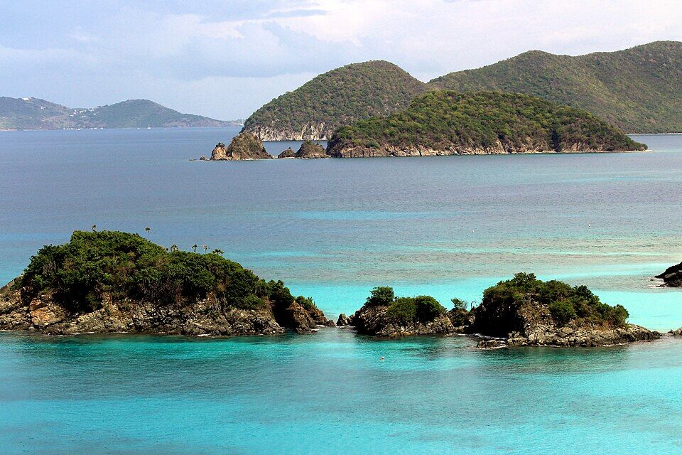
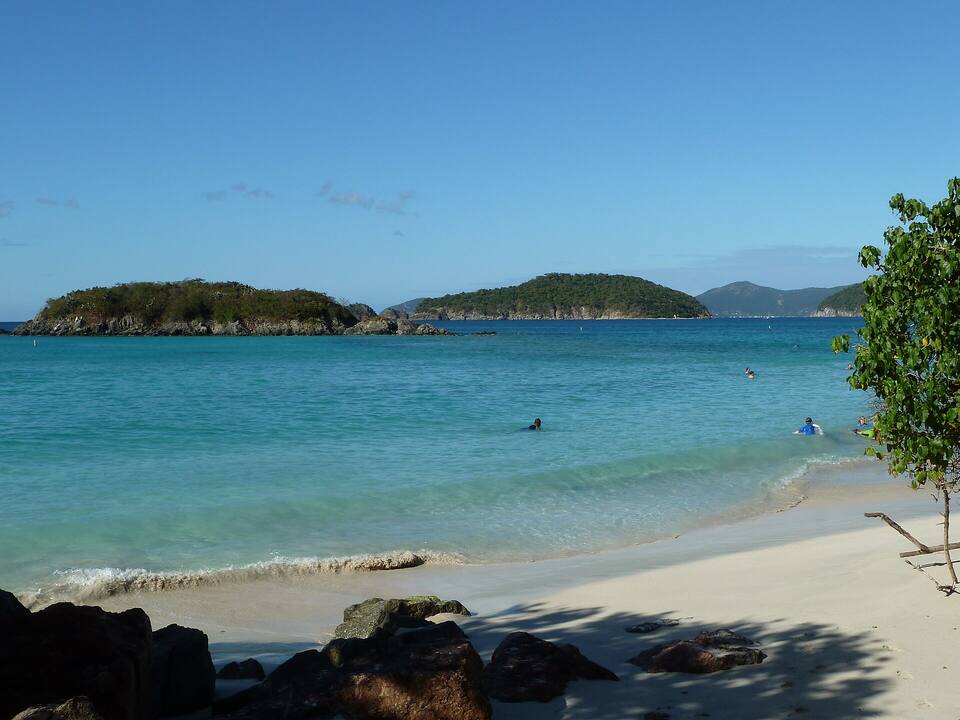
Cinnamon Bay, the next beach east, with Cinnamon Cay and Whistling Cay offshore (2011) — Gruepig, CC BY-SA 4.0, via Wikimedia Commons (resized).
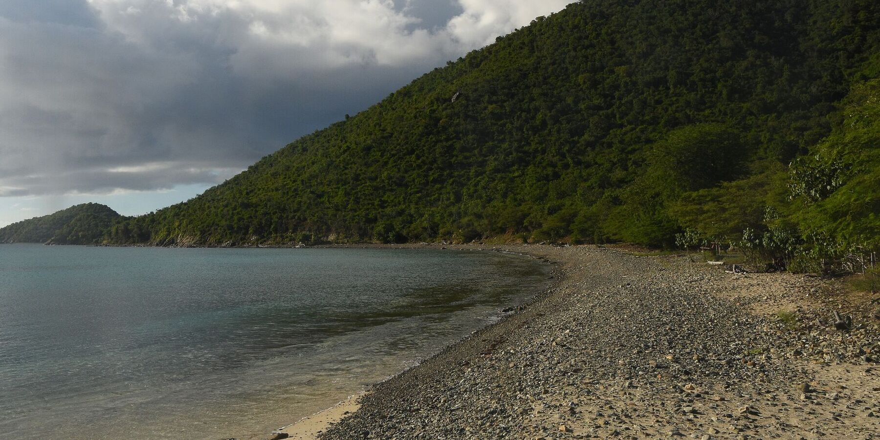
Little Lameshur Bay on St. John's south shore: sand and pebbles under the forest (October 2022) — Amaury Laporte, CC BY 2.0, via Wikimedia Commons (resized).
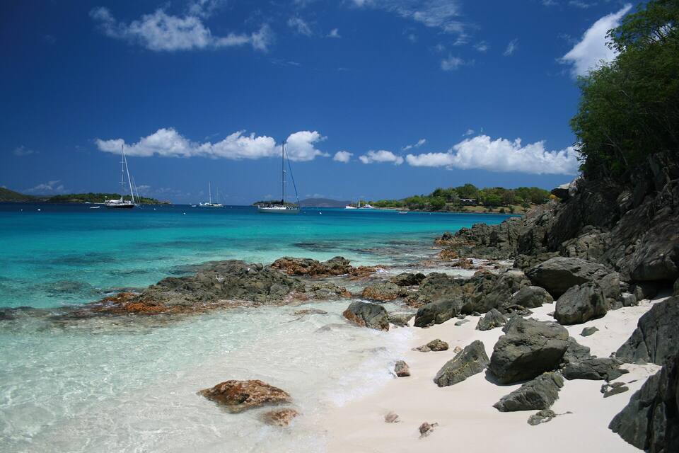
Honeymoon Beach on Salomon Bay, St. John — Bradley Furlow, CC BY-SA 4.0, via Wikimedia Commons (resized).
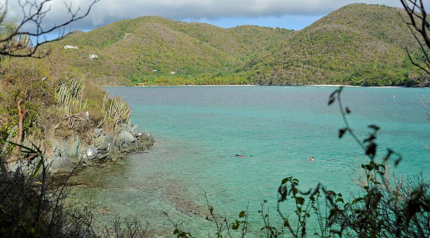
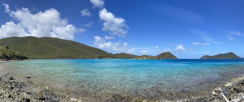
Hawksnest Bay from the rocks on its west shore in May 2009, looking across to the sand at the head of the bay, where Hawksnest Beach is; two snorkelers over the reef in the foreground — Fred Hsu (Wikipedia:User:Fred Hsu on en.wikipedia), CC BY-SA 3.0, via Wikimedia Commons (cropped and resized).
Cinnamon Bay with Cinnamon Cay and Whistling Cay offshore — Gruepig, CC BY-SA 4.0, via Wikimedia Commons (resized).
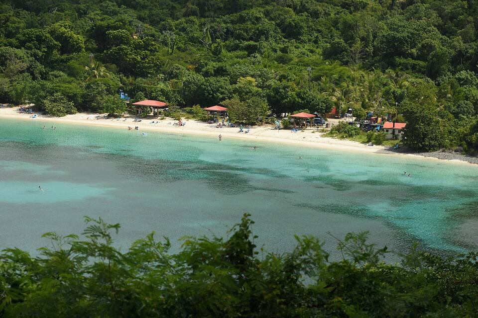
Maho Bay from the hillside: a long curve of sand under the forest — Amaury Laporte, CC BY 2.0, via Wikimedia Commons (resized).
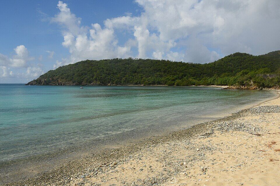
Francis Bay beach in October 2022, looking north along the shore to the wooded slopes of Mary Point — Amaury Laporte, CC BY 2.0, via Wikimedia Commons (cropped and resized).
Leinster Bay and Waterlemon Cay from the Leinster Bay Trail — Eoghanacht, CC0, via Wikimedia Commons (resized).
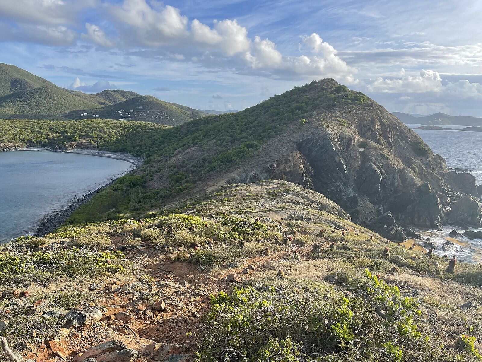
Salt Pond Bay from the Ram Head Trail in April 2022: the bay on the left, with the beach at its head and the cobbles of Blue Cobblestone Beach nearer, the ridge of the Ram Head peninsula, and houses on the hill above — Eoghanacht, CC0, via Wikimedia Commons (resized).
 Skip today today
 Skip today today
 Skip today today
 Skip today today
 Skip today today
 Skip today today
 Think twice today
 Skip today today