10 of 16 sites good today
Scuba & snorkel · USVI & BVI

Virgin Islands dive sites

Every top dive from the RMS Rhone to the Cane Bay Wall, called for the day from the swell and wind at each site.

Today--:--:-- --ASTIsland Time

10 of 16 sites look good today

Islandthe map flies there
Daysites good · 8 AM–3 PM
Siteor tap a pin

RMS Rhone

Good

Wreck · Salt Island, BVI · Rhone Marine Park

20–80feet
1.6 ftswell ENE
14mph wind
85°Fwater
Good to dive todayIt is in the lee of the 1.6 ft ENE swell, and the 14 mph ESE wind is mostly blocked. Visibility should be around 65 ft.
How deep0 to 130 ft, the recreational limit
surface20–80 ft130 ft

What you see. The two halves of a 310 ft Royal Mail steamer off Black Rock Point. The stern lies at about 30 ft with its propeller and shaft; the coral-covered bow is at about 80 ft. You can see the boilers, the engine and a famous porthole, with schools of fish swarming the hull.

The story. The hurricane of 29 October 1867 drove her onto Black Rock Point. She broke in two and her boilers exploded; more than 120 people died. Scenes for the 1977 film The Deep were shot on the wreck.

Level. All levels on the stern; the bow at 80 ft is a deeper, advanced dive. Moor only on the National Parks Trust balls; a marine park permit is required.

Shops that run it

The call compares the Open-Meteo marine forecast at the site (8 AM–3 PM) with the directions the site is open to. The dive shop always makes the final call on the morning.

Every dive site, today

Swell 1.6 ft from the ENE at 4 s, wind 14 mph ESE. 10 of 16 sites look good: the lee sides first.

British Virgin Islands
St. Thomas & St. John
St. Croix

Scuba diving in the Virgin Islands

The U.S. and British Virgin Islands give you two kinds of diving in one trip. St. Thomas, St. John and the BVI share one shallow bank, mostly less than 150 ft deep, so their dives are reefs, rock pinnacles and wrecks in clear, sheltered water, the RMS Rhone above all. St. Croix sits on its own across a trough more than two miles deep, so its north shore is a wall: at Cane Bay you swim off the beach and the reef drops away beneath you. This guide covers 16 sites, from the Buck Island snorkel trail to the Chikuzen in open water north of Tortola, and today 10 of them look good on the forecast.

Shore dives: Coki Point, Frederiksted Pier, Cane Bay Wall. Every other site is a boat dive, and most BVI sites are tied to National Parks Trust moorings.

Every dive site, by island

British Virgin Islands

RMS Rhone

Wreck · 20–80 ft · Salt Island, BVI · Rhone Marine Park

The two halves of a 310 ft Royal Mail steamer off Black Rock Point. The stern lies at about 30 ft with its propeller and shaft; the coral-covered bow is at about 80 ft. You can see the boilers, the engine and a famous porthole, with schools of fish swarming the hull.

The hurricane of 29 October 1867 drove her onto Black Rock Point. She broke in two and her boilers exploded; more than 120 people died. Scenes for the 1977 film The Deep were shot on the wreck.

Level: All levels on the stern; the bow at 80 ft is a deeper, advanced dive. Moor only on the National Parks Trust balls; a marine park permit is required.

Run by Blue Water Divers (Nanny Cay, Tortola), Sail Caribbean Divers (Hodges Creek, Tortola).

Painted Walls

Reef · 10–48 ft · Dead Chest Island, BVI · Rhone Marine Park

Four long gullies cut into the point of Dead Chest, their walls painted with sponges, corals and algae, plus a narrow cave. Look for hawksbill turtles, lobsters, nurse sharks, silversides and tarpon.

Level: Intermediate. Dive it only in settled conditions.

Run by Blue Water Divers (Nanny Cay, Tortola), Sail Caribbean Divers (Hodges Creek, Tortola).

Blonde Rock

Pinnacle · 15–65 ft · between Dead Chest and Salt Island, BVI · Rhone Marine Park

Twin pinnacles topped with fire coral rise from a sea-fan plateau at 35–40 ft to within 15 ft of the surface, ringed with ledges, tunnels and caves. Lobsters and crabs inside; turtles, jacks, cobia and barracuda passing.

A Royal Navy sketch from 1824 already marks it as a danger in the passage to Tortola.

Level: Advanced: current runs through the passage.

Run by Blue Water Divers (Nanny Cay, Tortola), Sail Caribbean Divers (Hodges Creek, Tortola).

Wreck Alley

Wreck · 60–90 ft · Cooper Island, BVI

Four ships lie in a line on sand beside a reef slope: the Marie L and the Pat side by side, the tug Beata, and the Island Seal upside down. All are coral-covered and draw schooling fish, rays and turtles.

All sunk on purpose as artificial reefs: the 90 ft Marie L in 1991, the Pat in 1995, the Beata in 2000, and in 2009 the Island Seal, a container ship that had run aground near Salt Island.

Level: Intermediate to advanced.

Run by Blue Water Divers (Nanny Cay, Tortola), Sail Caribbean Divers (Hodges Creek, Tortola).

The Indians

Reef · 0–50 ft · off Pelican Island, by Norman Island, BVI

Four rock pinnacles rise from about 50 ft to above the surface between Norman and Pelican islands, covered in hard and soft corals, sponges and sea fans, with swim-throughs and ledges full of reef fish.

Level: All levels, and a good snorkel. National Parks Trust moorings only.

Run by Blue Water Divers (Nanny Cay, Tortola), Sail Caribbean Divers (Hodges Creek, Tortola).

Chikuzen

Wreck · 45–75 ft · open water north of Tortola

A 246 ft refrigerated ship on her side on sand in open water, about 8 miles off Tortola, with three open holds. Far from any reef, she pulls in open-water life: big schools of barracuda and jacks, rays and sharks.

Built in Japan as a long-liner, later used for cold storage in St. Maarten. With a hurricane coming in 1981 she was set on fire and cast adrift, and sank here.

Level: Advanced: an open-water boat dive with current. Fully exposed. Often not diveable.

Run by Blue Water Divers (Nanny Cay, Tortola).

Kodiak Queen

Wreck · 20–60 ft · north-west of Virgin Gorda, BVI

A Navy fuel barge sits upright, wrapped in the steel mesh of an 80 ft kraken sculpture. Irma damaged the kraken in 2017; the mesh now carries coral, sponges and reef fish.

Built in 1940 as the US Navy fuel barge YO-44, she survived the attack on Pearl Harbor and later worked as an Alaskan crab boat. She was sunk in 2017 as the BVI Art Reef.

Level: Beginner to intermediate; also a snorkel.

Run by Dive BVI (Leverick Bay, Virgin Gorda), Sunchaser Scuba (Bitter End, Virgin Gorda).
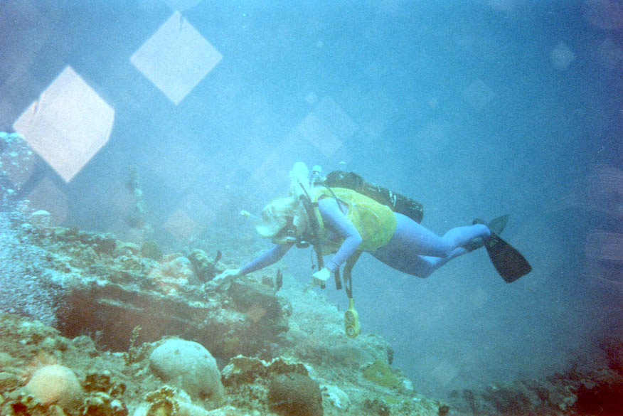
St. Thomas & St. John

Carval Rock

Pinnacle · 15–80 ft · just east of Congo Cay, north of St. John · Virgin Islands National Park

An isolated pinnacle by Congo Cay with steep walls and swim-throughs, including The Cut. Schooling tarpon, octopus and passing open-water fish.

Level: Advanced: strong currents; mornings are calmest.

Run by Low Key Watersports (Cruz Bay).

Cow and Calf

Reef · 15–50 ft · off the south-east of St. Thomas

Two rocks break the surface off the East End. The Cow hides a maze of tunnels and arches, the Champagne Cork among them, with elkhorn coral, ledges, nurse sharks, turtles and schooling snapper and grunts.

Level: Beginner to intermediate.

Run by Coki Dive Center (Coki Point).

Cartanser Senior

Wreck · 15–50 ft · Buck Island, south of St. Thomas

A 190 ft freighter lying in three sections in Shipwreck Cove, heavily grown over and home to resident schools of fish.

Abandoned by her crew in St. Thomas in the late 1970s, she sank near Charlotte Amalie, was refloated and sunk here as a reef in 1979. Hurricane Hugo broke her in three in 1989.

Level: Beginner to intermediate.

Run by Coki Dive Center (Coki Point).

Coki Point

Shore dive · 5–60 ft · by Coral World, St. Thomas

Two reefs start a few feet from the beach in a sheltered cove beside Coral World. Dense reef fish, eels, stingrays and octopus. Night dives here are popular.

Level: Beginners: the island's classic shore dive.

Run by Coki Dive Center (Coki Point).

St. Croix

Frederiksted Pier

Pier dive · 10–40 ft · Frederiksted, St. Croix

The pilings of the 1,526 ft cruise pier are covered in sponges: a world-class small-creature dive for seahorses, frogfish, batfish and octopus, best at night.

Level: All levels. Not while a cruise ship is alongside.

Run by N2 the Blue (Frederiksted).

Cane Bay Wall

Wall (from the beach) · 35–100 ft · Cane Bay, north shore of St. Croix

About 150 yards of sand and reef from the beach, the bottom falls away at 35–40 ft and the wall drops into the deep water north of St. Croix. Sponges and coral line it, with turtles, reef sharks, rays and barracuda.

Level: Intermediate; the wall goes far below recreational limits.

Run by Cane Bay Dive Shop (Cane Bay).

Salt River Canyon

Wall · 40–100 ft · mouth of Salt River Bay, St. Croix · Salt River Bay National Historical Park

An undersea canyon with two walls about a quarter-mile apart: the West Wall with swim-throughs, ledges and sand chutes, the East Wall known for big fish.

Level: Advanced.

Run by Anchor Dive Center (Salt River Marina).

Butler Bay wrecks

Wreck · 20–100 ft · west coast of St. Croix

Several wrecks share a calm bay: the trawler Suffolk Maid, the tug Northwind, the oil barge Virgin Islander and, deepest, the freighter Rosaomaira at up to about 117 ft. Seahorses, spadefish and southern stingrays are common.

The Suffolk Maid was driven onto the Frederiksted pier in a 1984 hurricane and scuttled here; the Rosaomaira capsized while unloading in 1986 and was towed out and sunk.

Level: Intermediate to advanced, by wreck.

Run by N2 the Blue (Frederiksted), Cane Bay Dive Shop (Cane Bay).

Buck Island Reef

Snorkel trail · 0–12 ft · off the north-east of St. Croix · Buck Island Reef National Monument

A marked trail with underwater plaques crosses shallow elkhorn coral and runs through a coral grotto to the outside of the barrier reef. Parrotfish, tangs, jacks and turtles.

Level: Snorkellers, by tour boat from Christiansted.

Run by Big Beard's Adventure Tours (Christiansted), NPS-authorised boats (Christiansted).

Virgin Islands wrecks at a glance

WreckWhereDepthLevel
RMS RhoneSalt Island, BVI20–80 ftAll levels on the stern; the bow at 80 ft is a deeper, advanced dive
Wreck AlleyCooper Island, BVI60–90 ftIntermediate to advanced
Chikuzenopen water north of Tortola45–75 ftAdvanced: an open-water boat dive with current
Kodiak Queennorth-west of Virgin Gorda, BVI20–60 ftBeginner to intermediate; also a snorkel
Cartanser SeniorBuck Island, south of St. Thomas15–50 ftBeginner to intermediate
Butler Bay wreckswest coast of St. Croix20–100 ftIntermediate to advanced, by wreck

When and where to dive

The trade winds blow from the east most of the year, and swell runs in from the north-east in winter and the east and south-east in summer. Sites in the lee of an island, such as the Rhone, Wreck Alley, the Frederiksted Pier and the Butler Bay wrecks, stay calm when the north shores are rough. North-facing sites such as Coki Point, Cane Bay, Salt River and the Chikuzen are the first to close in a winter swell. Water runs from about 79°F in February to 84–86°F from August to October. Rain washes silt off the hills and cuts visibility close to shore for a day or two.

Questions

What is the best dive in the Virgin Islands?

The RMS Rhone off Salt Island in the BVI is the best known: a 310 ft Royal Mail steamer wrecked in the hurricane of 29 October 1867, with the stern at about 30 ft and the bow at about 80 ft, inside the Rhone Marine Park. For a wall, it is Cane Bay on St. Croix, a shore dive where the reef drops away at 35–40 ft into the deep water north of the island.

Why does St. Croix have wall dives and St. Thomas does not?

St. Thomas, St. John and the BVI sit together on one shallow bank, mostly less than 150 ft deep. St. Croix is on its own, across a trough more than two miles deep, so its north shore falls straight off: off Cane Bay the seafloor is past 1,900 ft deep about a kilometre from the beach.

Can you dive the Virgin Islands from the shore?

Yes. Coki Point on St. Thomas, and Cane Bay and the Frederiksted Pier on St. Croix are all shore dives. Most BVI sites are boat dives tied to National Parks Trust moorings.

When is diving best in the Virgin Islands?

The water is warmest from August to October, around 84–86°F, which is also hurricane season. Winter north swells close the north-facing sites such as Coki Point, Cane Bay and the Chikuzen on some days, while the south and west sides usually stay calm. Check the call for each site on this page.

Do I need a permit to dive the RMS Rhone?

Yes. The Rhone, Blonde Rock and Painted Walls are inside the Rhone Marine Park. Dive shops include the permit; private boats buy one from the BVI National Parks Trust and must use the park moorings.

What is the Kodiak Queen?

A Second World War US Navy fuel barge, built in 1940, that survived the attack on Pearl Harbor and later worked as an Alaskan crab boat. She was sunk off north-west Virgin Gorda in 2017 as the BVI Art Reef, wrapped in an 80 ft steel kraken, at about 20–60 ft.

Where is the best night dive in the Virgin Islands?

The Frederiksted Pier on St. Croix. Its sponge-covered pilings at 10–40 ft are known for seahorses, frogfish, batfish and octopus after dark. It is not dived while a cruise ship is alongside.

How the daily call works

Each site has the arc of compass bearings its water is open to, our reading of where it sits. The page compares that with the Open-Meteo marine forecast at the site from 8 AM to 3 PM: swell height, direction and period, wind waves and wind. Swell from inside the arc reaches the site, swell from its edge wraps in, and swell from outside it is blocked. Long-period swell counts for more. Visibility is a rough estimate: the site’s usual visibility, less some for surge and for rain in the last 48 hours. Site positions come from wannadive.net, Wikipedia and Atlas Obscura, and photos from Wikimedia Commons, credited on each. The dive shop always makes the final call on the morning.

Share this page

Also on VIslandGuide