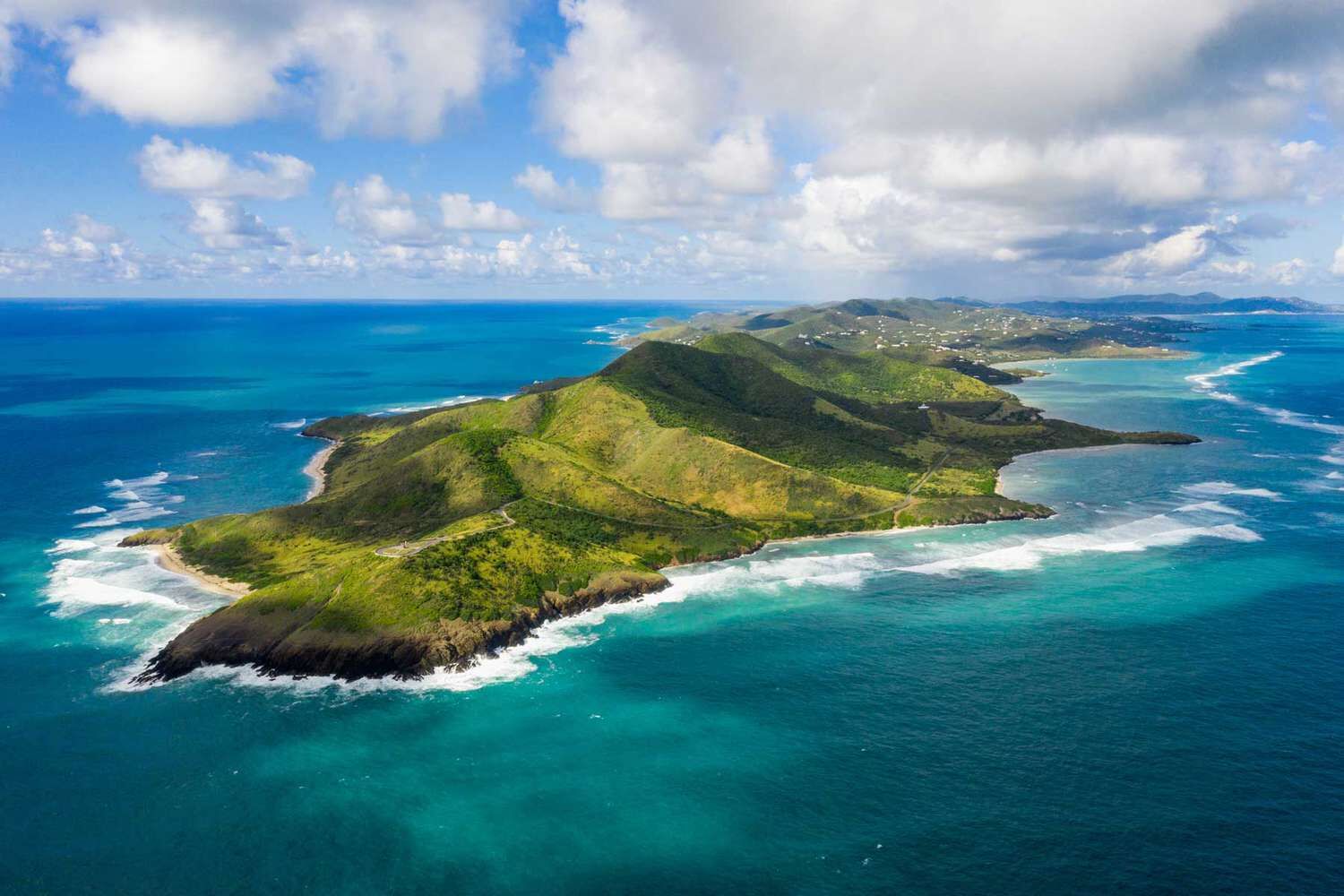
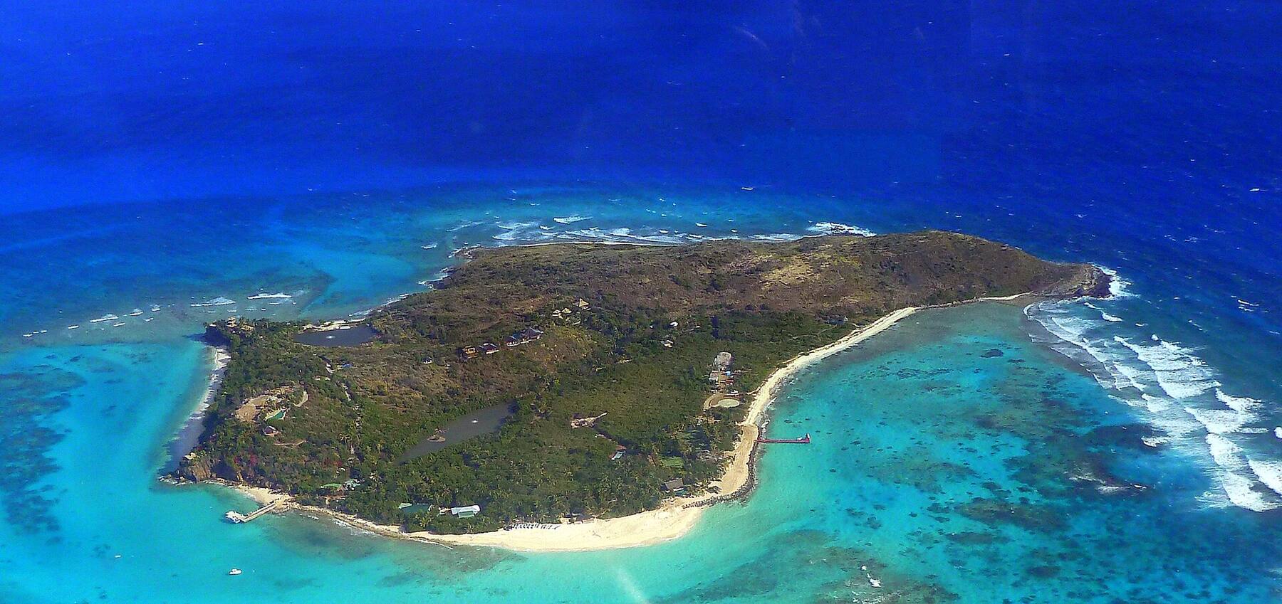
The largest of the U.S. Virgin Islands: about 84 square miles, some 40 miles south of St. Thomas across open sea. Two old Danish towns — Christiansted on the north shore, Frederiksted on the west end — its own airport and cruise pier, Buck Island's reef off the north-east and the Cane Bay Wall a swim from the beach.
At a glance
St. Croix in ten facts
Territory
U.S. Virgin Islands — an unincorporated U.S. territory; St. Croix is the largest of its islands
Size
About 84 sq mi (218 km²): roughly 28 miles long and 7 wide
People
41,004 residents (2020 Census)
Highest point
Mount Eagle, about 1,165 ft (355 m), in the north-west hills
Towns
Christiansted on the north shore, once the capital of the Danish West Indies; Frederiksted on the west end, with the cruise pier
Airport
Henry E. Rohlsen Airport (STX) on the south shore, with nonstop flights to the U.S. mainland
National parks
Buck Island Reef National Monument, Christiansted National Historic Site and Salt River Bay National Historical Park
Driving
On the LEFT, in left-hand-drive American cars
Clock
Atlantic Standard Time (UTC−4) all year — no daylight saving
Money & ID
U.S. dollar. No passport needed for U.S. citizens; you do need one for the BVI
Plan with VIslandGuide
Every St. Croix tool on VIslandGuide
Live schedules, official fares, today's beach and weather reads, cameras and maps — each one opens the full page.
National Park Service landMain roadsBeach sandTownDock & pierSight
St. Croix drawn from the U.S. Census shoreline, with the National Park Service's own boundaries (green) for Buck Island Reef National Monument, Christiansted National Historic Site and Salt River Bay, the roads the taxis drive, and the sand of the main beaches. Tap a pin for its page.
You can fly straight to St. Croix: Henry E. Rohlsen Airport (STX), on the south shore, has nonstop flights from the U.S. mainland — Miami, Charlotte and Atlanta, with more routes in winter — plus small commuter planes to St. Thomas and San Juan. From the airport it is a taxi ride to Christiansted or Frederiksted.
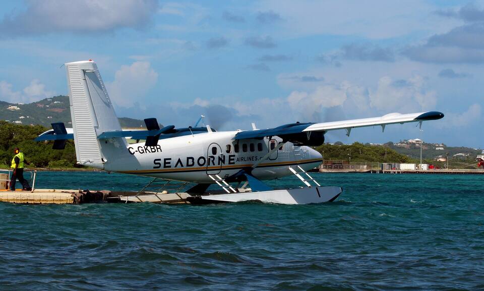
From St. Thomas, about 40 miles north across open sea, you can fly airport to airport or go town to town. The Seaborne seaplane flies from the seaplane terminal on the Charlotte Amalie waterfront to Christiansted harbour in about 25 minutes — downtown to downtown, with no airport transfer. The passenger ferry leaves the Blyden Marine Terminal in Charlotte Amalie for Gallows Bay, on the east side of Christiansted, and takes about two hours. It does not sail every day: the table below has the days, today's times and the fares.
From the airport: a taxi from Airport (STX) to Christiansted is $24 for one or two, $14 each for three or more, about 20–30 minutes — see the fare.
A Seaborne Airlines Twin Otter seaplane at the Christiansted harbour seaplane base Photo: Prayitno, CC BY 2.0
Two ways across: the ~25-minute Seaborne seaplane ($120–250 each way), or the sea ferry (2 hr 10 min, $85 pp). Tap a line on the map — or a chip above — to compare.
Fastest: Charlotte Amalie, St. Thomas ↔ Gallows Bay, 2 hr 10 min. Children and bag fees vary by route — each timetable page has the full fare table and booking links.
The ferry crosses about 40 miles of open water and can be rough when the trade winds are up. Confirm your sailing the day before — weather can cancel it — and take something for seasickness if you need to.
Both seaplane terminals are downtown: in Charlotte Amalie beside the Blyden ferry terminal, in Christiansted on the harbour west of the fort. The planes are small, so book ahead in winter.
Flying between the airports instead? Commuter flights link STT and STX several times a day; the airport pages have the day's departures and the security line.
There is no regular car ferry from St. Thomas, so rent your car on St. Croix.
Going on to the BVI? There is no ferry from St. Croix to the British Virgin Islands — connect through St. Thomas, and bring your passport.
St. Croix is about 28 miles long and its sights are spread from Frederiksted to Point Udall, so most visitors rent a car. Taxis do not cruise for fares: they wait at the airport, the Frederiksted cruise pier and in Christiansted, or come when called, and charge the official fixed fares in the table below — one price for one or two riders, then a per-person fare for three or more.
Driving is on the left. Centerline Road (the Queen Mary Highway) runs down the middle of the island from Christiansted toward Frederiksted, the Melvin H. Evans Highway along the south side past the airport, and the North Shore Road past Cane Bay. The roads into the north-west hills are steep, narrow and winding.
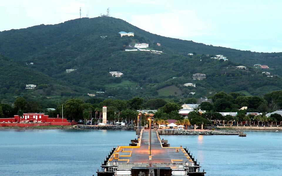
Frederiksted at dusk from the cruise pier: Fort Frederik and the waterfront under the west-end hills Photo: Prayitno, CC BY 2.0
St. Croix's beaches are public to the waterline, from the little cay in Christiansted harbour and the beach beside Frederiksted to the wild turtle beach at Sandy Point. Numbers match the map. For which one is calm and uncrowded today, open the beach report.
1
Buck Island
Underwater trailDay tripNational monument
An uninhabited island off the north-east coast, protected as Buck Island Reef National Monument: a white beach at Turtle Bay and a marked underwater snorkel trail through the reef. You get there on a licensed tour boat from Christiansted or Green Cay Marina — a half or full day.
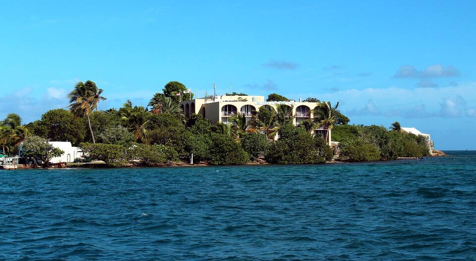
A tiny cay in Christiansted harbour, a minute or two by the little ferry from the boardwalk. A small, sheltered beach with a bar and chairs from the hotel on the cay — the easiest swim from town.
The north-shore beach famous for the Wall: the reef drops away into very deep water a short swim off the beach, so divers walk in from the sand. A dive shop and beach bars are right there. Calm on most days; north swells in winter can make it rough.
Taxi from Christiansted: $36 for one or two, $17 each for three or more
The west end's social beach, just north of Frederiksted: calm water, a beach bar, water-sport rentals and the sunset over the sea. Busiest at weekends and on cruise-ship days.
The long beach running north from Frederiksted's waterfront: a short walk from the pier and the town, sheltered from the trade winds, and facing the sunset.
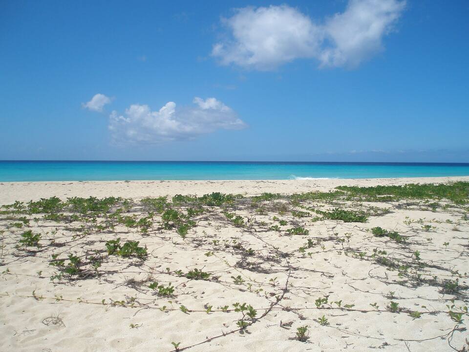
Miles of undeveloped sand on the island's south-west tip, protected as Sandy Point National Wildlife Refuge because leatherback, green and hawksbill turtles nest here. It opens only on certain days and closes for parts of the nesting season — check the U.S. Fish & Wildlife Service's current opening days before you drive out.
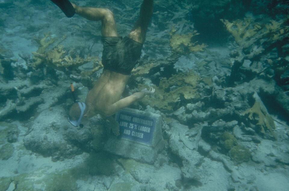
The reason many people come: a National Park Service snorkel trail with underwater markers through elkhorn coral off the east end of Buck Island, then lunch on the beach at Turtle Bay. Licensed tour boats leave Christiansted and Green Cay Marina in the morning; book a day ahead in winter.
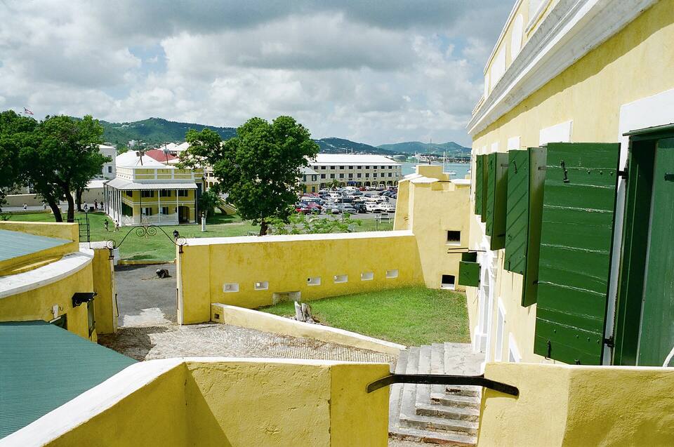
Fort Christiansvaern, the yellow Danish fort on the harbour, anchors the Christiansted National Historic Site: the fort, the Steeple Building, the old customs house and scale house round the waterfront, run by the National Park Service. Then walk the arcaded streets behind it and the boardwalk along the harbour.
One of the Caribbean's best-known shore dives: swim out from the beach over the reef and the bottom falls away into the deep. Snorkellers see the top of the reef on a calm day; divers book with the shop at the beach.
Frederiksted is the quieter of the two towns until a ship is in. Divers know its pier for the night dive among the pilings; everyone else comes for the waterfront, Fort Frederik, the old Danish fort beside the pier, and a sunset over open sea from Rainbow or Frederiksted beach.
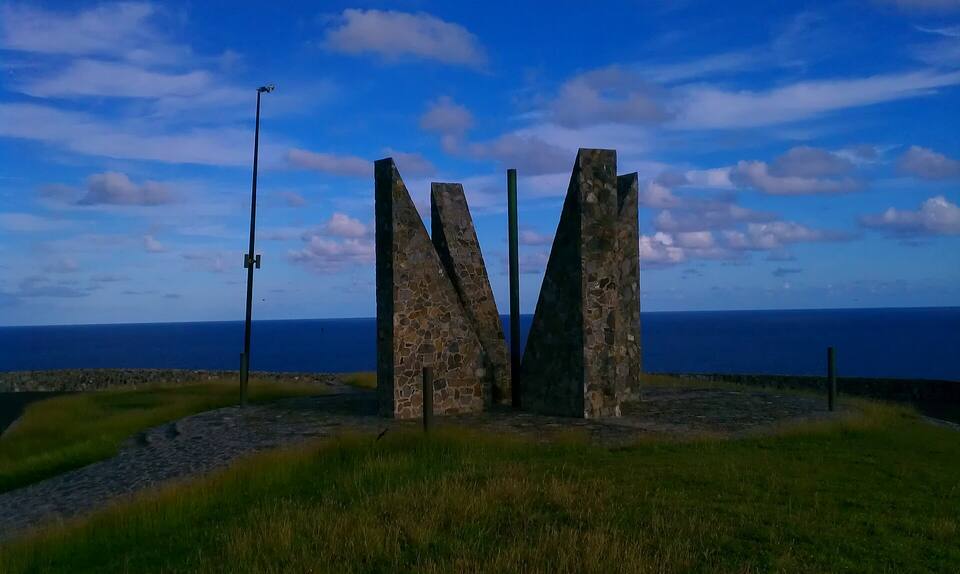
St. Croix's eastern tip, often called the easternmost point of the United States. A road climbs to the cliff-top lookout and its millennium sundial monument, with the open sea below. Go for sunrise — the today card at the top of this page has the time.
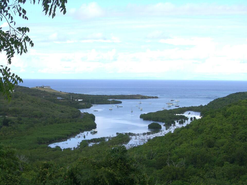
Where Columbus's second voyage anchored in November 1493 and his men fought the Kalinago — the first recorded battle between Europeans and Native Americans. Today it is a national historical park and ecological preserve of mangroves and seagrass; kayak tours paddle the bay, at night for its glowing bioluminescence.
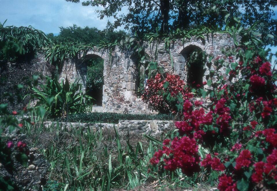
Gardens of native and tropical plants laid out among the stone ruins of an old sugar estate, just east of Frederiksted off Centerline Road. Shady, quiet and a good stop on the way to or from the west end.
Christiansted is where most of the island eats out: the boardwalk along the harbour and the old Danish streets behind it, with everything from a craft brewery to candle-lit courtyards. Frederiksted's waterfront is smaller and busiest on ship days and at weekends, and Rainbow Beach just north of town has the west end's beach bar.
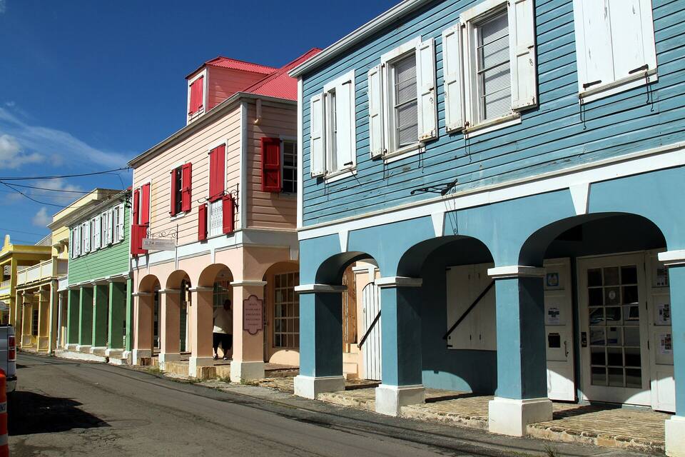
Arcaded Danish-era shopfronts on a Christiansted street Photo: Prayitno, CC BY 2.0
Christiansted
Savant RestaurantUpscale eclectic-fusion dining in a restored Danish townhouse garden. Mexican, Thai and Caribbean flavours share the menu. Consistently ranked the island's best restaurant.
Tutto BeneChristiansted's beloved Italian restaurant in the historic Pan Am Pavilion. Handmade pasta, wood-fired pizza, and an extensive Caribbean-Italian wine list.
Rum RunnersChristiansted harbourfront restaurant with views of the cay. Casual all-day dining, good lobster bisque, and a serious rum collection.
Stiix Bar & RestaurantChristiansted waterfront sports bar right on the boardwalk. Cold beer, bar food, TVs for game day, and prime people-watching over the harbor.
Brew STXSt. Croix's craft brewery in Christiansted. Rotating taps of lagers, IPAs and seasonal ales brewed on-island. Best beer selection in the USVI.
Frederiksted & the west end
Polly's at the PierWaterfront Frederiksted café and restaurant at the cruise pier. Breakfast all day, fresh fish sandwiches and local specials. Great for a post-dive lunch.
Rhythms at Rainbow BeachBeachfront bar at Rainbow Beach. Live reggae on weekends, frozen drinks, food trucks and a crowd-pleasing Caribbean party vibe on the west end.
Shopping: Christiansted Boardwalk (Pan Am Pavilion) — Waterfront shopping arcade in a restored Danish warehouse. Local art, jewelry, rum tastings, handmade soaps and Caribbean clothing boutiques. Gallows Bay Shopping District — Up-and-coming neighbourhood east of Christiansted with independent galleries, book shops, local food purveyors and the excellent Zion Modern Kitchen.
Weather & sea
St. Croix weather and the best time to go
Warm all year: highs in the mid-80s °F and a steady easterly trade wind. The east end is dry, cactus country; the hills of the north-west catch the most rain and are the greenest part of the island. December to April is the dry, busy season. June to November is hurricane season, with the peak from mid-August to mid-October. Before a crossing in those months, check the ferry is sailing.
Daily-mean sea-surface temperature, averaged 2021–2024 (Open-Meteo marine reanalysis): warmest in Oct (86.5°F), coolest in Feb (80.2°F). Hurricane history map
Cruise ships
Cruise ships and St. Croix
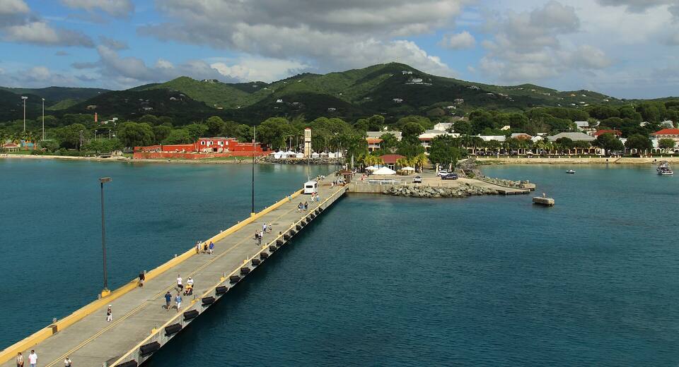
Cruise ships tie up at the Frederiksted Pier on the west end — Christiansted's reef-sheltered harbour is too shallow for them. St. Croix sees far fewer ships than St. Thomas, mostly in the winter season, so a ship day here means a busier Frederiksted waterfront and Rainbow Beach rather than an island-wide crowd.
10 calls at the Frederiksted Pier in the next 30 days. Next:
Mon, Oct 19 — Adventure of the Seas (3,114 guests), 8:00am–6:00pm
Mon, Oct 26 — Carnival Dream (3,646 guests), 7:00am–4:00pm
Wed, Oct 28 — Valiant Lady (2,770 guests), 9:00am–6:00pm
Thu, Oct 29 — Rhapsody of the Seas (2,050 guests), 8:00am–5:00pm
Seventeen Spanish ships anchor at Salt River, St. Croix. A landing party fights the Kalinago there — the first recorded battle between Europeans and Native Americans. Columbus names the chain Las Once Mil Vírgenes and claims it all for Spain; Spain never settles any of it.
1625
English and Dutch planters settle St. Croix
The first European colony in the Virgin Islands: English and Dutch settlers arrive together on St. Croix and grow tobacco side by side, until a quarrel in 1645 leaves the Dutch governor dead and the Dutch gone.
Aug 1650
Spain drives the English off St. Croix
A force from Puerto Rico lands and expels the English colony. Within months the French governor of St. Kitts sends his own men, and the Spanish garrison is gone by the end of the year.
late 1650
France takes St. Croix
Philippe de Poincy's expedition from St. Kitts seizes the island for France.
1651
The Knights of Malta buy St. Croix
De Poincy, himself a Knight of St. John, sells the island to his order. For fourteen years St. Croix is ruled from Malta — the one Caribbean island the crusader knights ever owned.
1665
France's West India Company takes over
The Knights sell St. Croix to the French West India Company; in 1674 it passes to the French crown.
1695
France abandons St. Croix
The French crown ships the remaining colonists to Saint-Domingue and leaves the island empty. For 38 years St. Croix flies no flag at all.
Jun 15, 1733
Denmark buys St. Croix from France
For 750,000 livres the empty island changes hands, and the three Danish islands are complete. Within a decade St. Croix is the sugar capital of the Danish West Indies.
Mar 28, 1801
Britain occupies the Danish islands
With Denmark drawn into Napoleon's wars, a British fleet takes St. Thomas, St. John and St. Croix without a shot. They are handed back the following February.
Feb 1802
Denmark gets them back
The Peace of Amiens returns the three islands to Denmark.
Dec 22, 1807
Britain takes them again — for seven years
Denmark sides with France after the bombardment of Copenhagen, and the Royal Navy returns. The Union Jack flies over the Danish islands until April 1815.
Apr 15, 1815
The Dannebrog returns
After Napoleon's fall the islands go back to Denmark, which keeps them for another century.
Jul 3, 1848
Emancipation in the Danish West Indies
Eight thousand enslaved people march on Frederiksted, St. Croix, and Governor-General Peter von Scholten declares every unfree person in the Danish West Indies free from that day.
Mar 31, 1917
Transfer Day: the U.S. buys the Danish West Indies
$25 million in gold — the most the United States has ever paid for territory. At 4 p.m. in Charlotte Amalie the Dannebrog comes down and the Stars and Stripes go up, with the USS Hancock in the harbour and a U-boat war on in the Atlantic.
Today
Two flags, one archipelago
St. Thomas, St. John, St. Croix and Water Island are the U.S. Virgin Islands. Tortola, Virgin Gorda, Jost Van Dyke and Anegada are the British Virgin Islands. Cruise ships and ferries cross the line every day.
The U.S. Virgin Islands ban sunscreens with oxybenzone, octinoxate or octocrylene. Bring a mineral (zinc or titanium) one — it matters at Buck Island and Cane Bay.
Drive on the left
Keep left — especially on the narrow north-west roads and when pulling out of a beach lot or a side road.
Check Sandy Point before you go
The wildlife refuge opens only on certain days and closes for parts of the turtle nesting season. Check the U.S. Fish & Wildlife Service's current opening days first.
Book Buck Island early
The tour boats are the only easy way to the reef and they fill up in winter. Book a day or two ahead, and go on a calm day.
Leave nothing in the car
At beach pull-offs and remote lots take valuables with you or leave them at the hotel.
Check the swell
In winter, north swells can make Cane Bay and the north shore rough; the west end round Frederiksted usually stays calm. Our beach report reads it daily.
Three ways. The Seaborne seaplane flies downtown to downtown — from the seaplane terminal on the Charlotte Amalie waterfront to Christiansted harbour — in about 25 minutes. The passenger ferry runs from the Blyden Marine Terminal in Charlotte Amalie to Gallows Bay in Christiansted in about two hours, but not every day. And commuter flights link St. Thomas's Cyril E. King Airport (STT) with Henry E. Rohlsen Airport (STX). The ferry table on this page has the sailing days, today's times and the fares.
Is there a ferry from St. Thomas to St. Croix?
Yes. A passenger ferry crosses between the Blyden Marine Terminal in Charlotte Amalie, St. Thomas, and Gallows Bay in Christiansted, St. Croix. The crossing is about 40 miles of open water and takes about two hours. It does not sail every day, and weather can cancel it, so check the timetable — the ferry section on this page and our St. Thomas ↔ St. Croix ferry page have the days, departure times and fares.
How long is the flight from St. Thomas to St. Croix?
About 25 minutes on the Seaborne seaplane, which flies from downtown Charlotte Amalie to downtown Christiansted with no airport transfer. Commuter flights between Cyril E. King (STT) and Henry E. Rohlsen (STX) airports are similarly short in the air.
Can you fly directly to St. Croix?
Yes. Henry E. Rohlsen Airport (STX) on St. Croix's south shore has nonstop flights from the U.S. mainland — Miami, Charlotte and Atlanta, with more routes in winter — so you do not have to go through St. Thomas. From the airport, Christiansted is about 20–30 minutes by taxi and Frederiksted about 15.
Do you need a passport to go to St. Croix?
Not if you are a U.S. citizen flying from the mainland or coming from St. Thomas: St. Croix is in the U.S. Virgin Islands, a U.S. territory, so it is a domestic trip — carry a government photo ID, which the ferry also asks for. Non-U.S. visitors need the same documents as for the mainland United States, and everyone needs a passport for the British Virgin Islands.
How do you get to Buck Island?
By boat: licensed tour operators run half-day and full-day trips from Christiansted and Green Cay Marina to Buck Island Reef National Monument, with the underwater snorkel trail and time on the beach at Turtle Bay. The island is about 1.5 miles off St. Croix's north-east coast.
What are the best beaches on St. Croix?
Buck Island for the reef and its underwater trail; Cane Bay for shore diving on the Wall; Rainbow Beach for a beach bar, calm water and the sunset; Protestant Cay for an easy swim in Christiansted harbour; Frederiksted beach a walk from town; and Sandy Point, the wild turtle-nesting refuge on the south-west tip, on the days it is open.
Do you need a car on St. Croix?
Most visitors rent one: St. Croix is about 28 miles long and the beaches and sights are spread out. Taxis charge official fixed fares — the airport to Christiansted is $24 for one or two, $14 each for three or more — but they wait at the airport, the cruise pier and in town rather than cruising for fares. Remember to drive on the left.
Photo & map credits
A Seaborne Airlines Twin Otter seaplane at the Christiansted harbour seaplane base — Prayitno, CC BY 2.0, via Wikimedia Commons (resized).
Frederiksted at dusk from the cruise pier: Fort Frederik and the waterfront under the west-end hills — Prayitno, CC BY 2.0, via Wikimedia Commons (resized).
The Frederiksted Pier from a ship's deck, running in to the town and the red walls of Fort Frederik — Prayitno, CC BY 2.0, via Wikimedia Commons (resized).
Protestant Cay in Christiansted harbour, with the hotel among the palms — Prayitno, CC BY 2.0, via Wikimedia Commons (resized).
Arcaded Danish-era shopfronts on a Christiansted street — Prayitno, CC BY 2.0, via Wikimedia Commons (resized).
Inside Fort Christiansvaern, looking over its yellow walls to Christiansted and the harbour — Gillfoto, CC BY-SA 4.0, via Wikimedia Commons (resized).
A snorkeller reading one of the underwater trail's signs among the elkhorn coral at Buck Island — NPS staff, Public domain, via Wikimedia Commons (resized).
Stone arches of the old Estate St. George sugar works among the plantings of St. George Village Botanical Garden — Jerrye & Roy Klotz, MD, CC BY-SA 3.0, via Wikimedia Commons (resized).
The stone millennium monument at Point Udall, St. Croix's eastern tip, above the open sea — Aaron Cortina, CC BY 3.0, via Wikimedia Commons (resized).
Salt River Bay from the hills: mangroves, moored boats and the bay's mouth to the sea — Kborer, Public domain, via Wikimedia Commons (resized).
The empty beach at Sandy Point National Wildlife Refuge, beach morning glory on the sand — Turn685, CC BY-SA 3.0, via Wikimedia Commons (resized).
Map: shoreline from U.S. Census Bureau TIGER/Line 2023; park boundary from the National Park Service; roads from our taxi-route data.