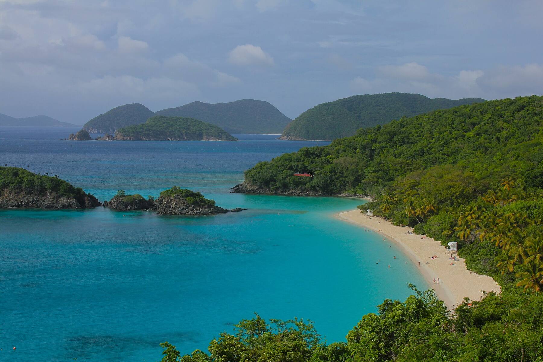
The longest beach in Virgin Islands National Park: about half a mile of sand on St. John's north shore, with Cinnamon Cay a short swim out. Behind it are the park's only campground, a watersports stand and the ruins of a sugar plantation founded in 1717. Free to visit, and about four miles from the ferry in Cruz Bay.
The north shore of St. John, U.S. Virgin Islands, on the North Shore Road (Route 20), about 4.3 miles from the park visitor center in Cruz Bay
The beach
The longest in Virgin Islands National Park: about half a mile (0.75 km) of sand by OpenStreetMap's outline, opening north-west
Run by
The National Park Service; the campground, café, store and rentals by its concessioner, CinnOpCo
Entry
Free: the park charges no entrance fee here (Trunk Bay is the St. John beach that charges)
Hours
No gate: the park is open 24 hours. The campground closes for September and October
Offshore
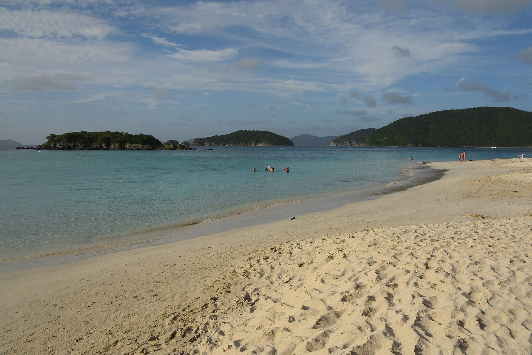
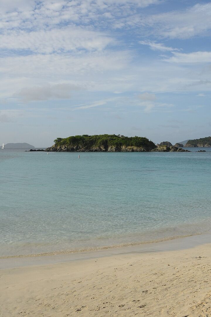
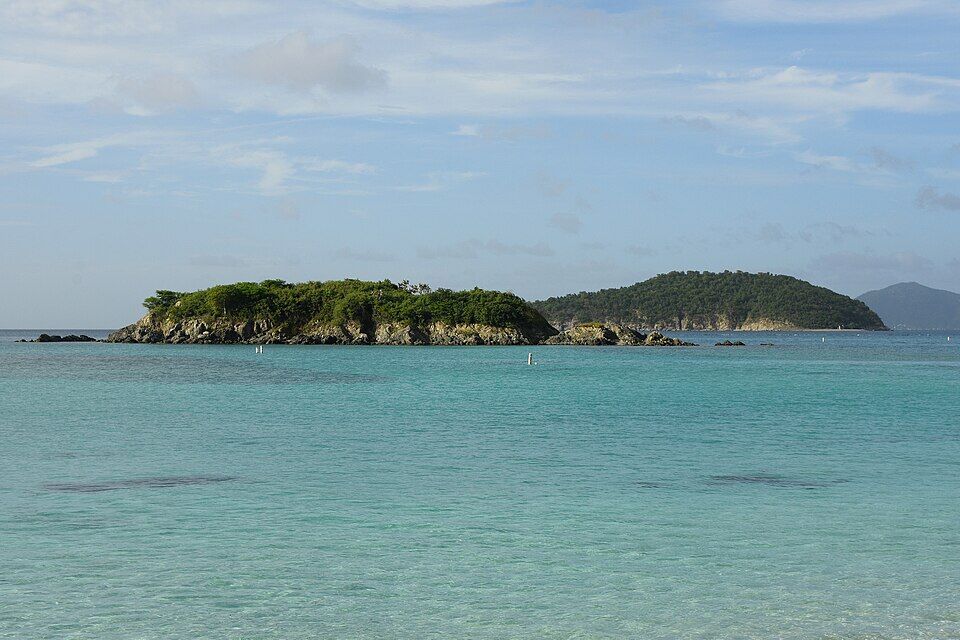
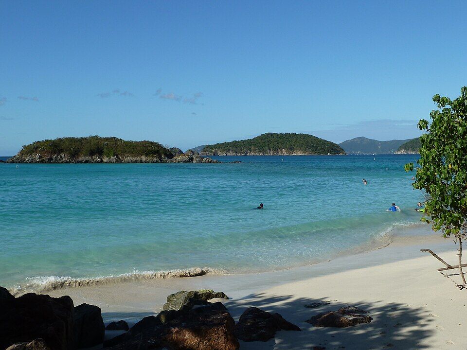
Cinnamon Cay, a small rocky cay about 200 yards off the sand, with Whistling Cay beyond
On the sand
Kayak, paddleboard, snorkel and chair rentals, a food truck and restrooms
Camping
The only camping allowed in the park: bare sites, eco-tents and cottages behind the beach
Ruins
A sugar plantation founded in 1717, on the National Register since 1978, with a half-mile nature loop through it
Archaeology
A Taíno ceremonial site, excavated by the park from 1998
Today
Is Cinnamon Bay good today?
Skip today Rough — 3.3 ft WNW swell, shore break · Thunderstorms in the forecast. If you go, the least bad stretch left is 10 am–1 pm.
Day
The call
Why
Best time
Cruise guests here
Sea at the beach
Rain
Today
Skip today
Rough — 3.3 ft WNW swell, shore break · Thunderstorms in the forecast
10 am–1 pm
None
Rough · 3.1 ft
Thunder
Tomorrow
Skip today
Rough — 3.6 ft WNW swell, shore break · Thunderstorms in the forecast
11 am–2 pm
None
Rough · 3.4 ft
Thunder
Sun, Nov 8
Skip today
Rough — 3.5 ft NW swell, shore break · No cruise crowd today
10 am–1 pm
None
Rough · 3.3 ft
59%
Mon, Nov 9
Think twice
Choppy — NNE swell into the bay · No cruise crowd today
10 am–1 pm
None
Some chop · 2.5 ft
35%
Tue, Nov 10
Think twice
Choppy — NNE swell into the bay · No cruise crowd today
2 pm–5 pm
None
Some chop · 2.3 ft
31%
The call is the same one our beach report makes, refreshed every half hour: the swell reaching the bay (Open-Meteo's marine forecast, read through our model of how open this shore is), the cruise passengers our crowd model puts on the sand, NOAA's sargassum satellite and the rain forecast. It is a model, not a lifeguard's report — and there are no lifeguards listed here, so look at the water yourself before you swim. The bars under each call are the hours from 8 am to 5 pm. Today's beach report
Taxi fares from the ferry and the hotels, the trail behind the beach, today's beach and weather reads, the camera above the bay and the island around it — each one opens the full page.
Cinnamon Bay from OpenStreetMap: the sand, Cinnamon Cay, the campground's buildings and drives, the North Shore Road behind them, and the trails into the hills, with each facility where OpenStreetMap's mappers put it. The small blue squares are the park's restrooms by the road and the campground's bathhouses. Tap a pin for its section.
Getting there
How to get to Cinnamon Bay
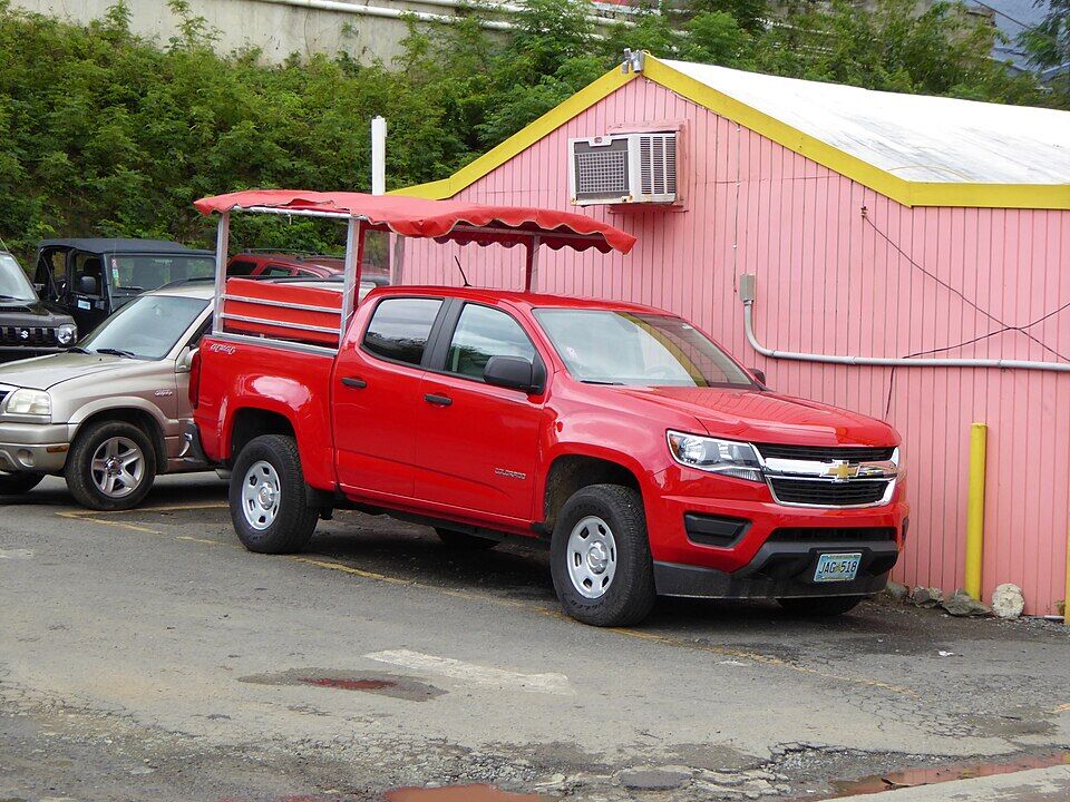
Cinnamon Bay is on the North Shore Road (Route 20), about 4.3 miles from the park visitor center in Cruz Bay, the National Park Service says — past Hawksnest and Trunk Bay, before Maho. St. John has no airport: you arrive by ferry in Cruz Bay, then ride one of the open-air safari taxis that wait at the dock, or drive.
Taxis charge the official per-person fare in the table, from the ferry dock, the hotels and Coral Bay, and drop you at the campground entrance, where the front space is kept for taxis loading and unloading. Driving, the road is steep and winding and you keep left. The road down through the campground is closed to public traffic: park in the lot by the North Shore Road and walk down to the sand.
A St. John safari taxi in Cruz Bay: a pickup with bench seats and a canopy on the back Photo: User:Mattes, CC BY 2.0 de
Per person, one way: fares set by the VI Taxicab Commission (rates revised October 24, 2022); night, luggage and waiting surcharges apply. Drive times are Google's for an ordinary day. Fare calculator for any two stops
Agree the fare before you set off — it is per person, one way — and agree a pick-up time for the ride back.
Parking is limited at every park beach, the park says: arrive early and park only in marked spaces.
The campground's own FAQ allows about 30 minutes by taxi from the ferry dock; the drive times in the table are Google's for an ordinary day.
Phone signal on the north shore is patchy, and phones can pick up BVI towers and roaming charges, the park warns. The campground's front desk has free wifi.
Cinnamon Bay is national park land, open to everyone and free: there is no gate and no entrance fee. The campground, café, store and watersports stand behind the sand are run for the park by its concessioner, CinnOpCo, and keep their own hours; the park's rules apply on the beach and in the water.
What it costs
Beach and park entry
Free
Bare campsite, a night
$50
Eco-tent for two
$190–$215
Family eco-tent for four
$210–$245
Cottage for up to four
$230–$315
Campground rates a night, as the National Park Service lists them in October 2026 (the higher prices are by the sea); book through the campground. Camping is allowed only at Cinnamon Bay's marked sites, for at most 14 days from December 1 to April 15. Trunk Bay, two bays west, is the St. John beach that charges: $5 a person aged 16 and up.
Hours
The beach
Every day, no gate
Watersports rentals
9 am – 4 pm
Food truck
11 am – 4 pm
General Store
10 am – 6 pm
Café breakfast
7:30 – 9:30 am
Café dinner
5:30 – 8 pm
Front desk
8 am – 8 pm
The park's hours page says it is open 24 hours; its older Cinnamon Bay beach page gives 7 am to 9 pm and closes the campground to anyone not staying after 9 pm. The campground closes for September and October, the park's listing says; our seasonal-closures tracker has the café shut from September 1 to November 1 this year, with the food truck staying open.
Park rules on the beach
✓Alcohol, in cans or plastic — the park bans it only in visitor centers and on ranger-led programs
✕Glass bottles and containers — on every park beach
✕Pets on the beach — leashed dogs may use the park's trails; the campground takes no pets
✕Smoking or vaping — on the beach, or within 50 ft of picnic tables, pavilions and restrooms; the campground is smoke-free
✕Drones — unless the superintendent has approved it in writing
✕Fires outside a grill — park grills or portable grills only
✕Boats, sailing, windsurfing, surfing or fishing inside the white NO BOATS buoys
✕Taking shells, coral, plants or artifacts — federal park rules (36 CFR 2.1)
✕Driving down the campground road — it is closed to public traffic; walk down from the lot
Cinnamon Cay from the sand, with two of the white buoys that mark the swimming area Photo: Amaury Laporte, CC BY 2.0
The beach runs about half a mile from the rocks at its west end to the foot of America Hill in the east, with Cinnamon Cay off its western half. Everything the concessioner runs is in the middle, where the campground meets the sand. Prices are the campground's own, as listed in October 2026.
On the water
Watersports rentals
The stand on the beach rents snorkel gear at $10 a day ($50 a week), beach chairs at $10 a day, kayaks at $30 an hour or $75 a day, and paddleboards and clear-bottomed kayaks at $35 an hour or $75 a day; a paddleboard lesson is $60 an hour. Open 9 am to 4 pm every day, the campground says — prices subject to change.
Cinnamon Bay Resort & Campground, behind the beach, is the only place you may camp in the national park: bare sites with a platform, eco-tents with a bed and power, and concrete cottages for four. Its main building has the front desk (8 am–8 pm), the Rain Tree Café (breakfast and dinner, open to day visitors too) and the General Store (10 am–6 pm: snacks, ice, sun products, local beer). The National Park Service established the campground in 1964; it reopened in January 2022, four and a half years after Hurricane Irma.
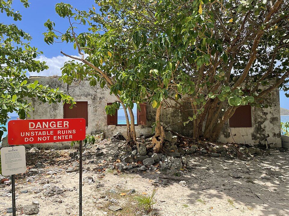
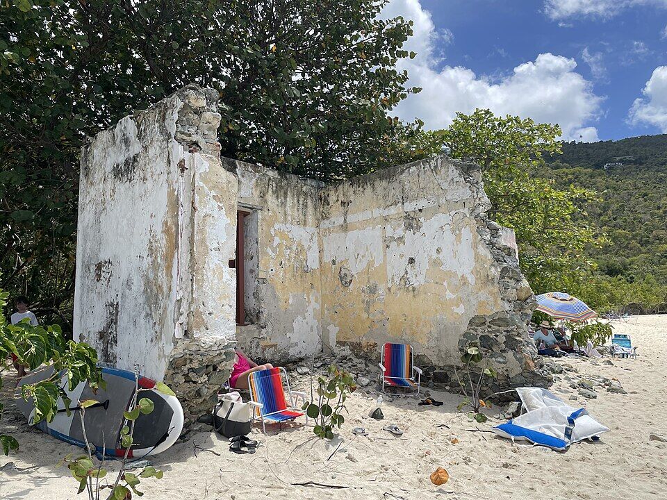
The whitewashed stone building in the middle of the beach is the plantation's old warehouse, probably mid-1800s, where produce was gathered to be shipped off the beach. It later held the park's archaeology lab and museum, until Hurricane Irma destroyed it on September 6, 2017. It is a fenced ruin now, signed Danger — unstable ruins, do not enter.
There are no umbrellas or cabanas for hire: the shade is the sea grapes and trees along the back of the beach. Beach chairs rent from the watersports stand at $10 for the day.
Facilities
Restrooms
The park's restrooms are up by the road, near the parking and the taxi stop. The campground's bathhouses — sinks, toilets and cold showers — serve its guests; the campground asks everyone to go easy on the water.
Getting back
Taxis
Taxis drop off and pick up at the campground entrance, where the front parking space is kept for them. The fare back to Cruz Bay is the same official per-person fare as the way out; agree a pick-up time with your driver before you go to the sand.
The park lists the campground's restaurant, front desk, store, beach and many of its campsites as wheelchair accessible, with beach wheelchairs among the amenities and accessible eco-tents and cottages to book. Across the road, the first stretch of the nature loop through the ruins is a boardwalk four feet wide with very little slope.
The park lists no lifeguards at Cinnamon Bay — not even at Trunk Bay, its busiest beach. The water shelves gently over sand, and white NO BOATS buoys keep boats out of the swimming area. Round the rocks and the cay, stand only on sand: damaging coral is illegal in the park. Winter north swells can close the north-shore beaches to swimming for a day or two; the call at the top of the page reads the swell every half hour.
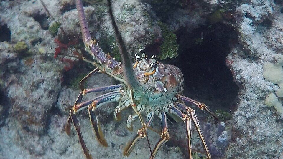
The small rocky cay about 200 yards off the western half of the beach is the snorkel here. The park describes snappers in the nooks of its steep sides, deeper water to the east, north and west, a few pillar coral colonies at the north-west corner and, on the south side, shallow sand to rest on before the swim back — and perhaps a lobster or two. Turtles and fish of all sizes are seen in the bay, the park says. Go on a calm morning, and keep out of the boat traffic beyond the buoys.
A kayak or paddleboard from the stand on the beach takes you round Cinnamon Cay and along the shore toward Maho Bay. The clear-bottomed kayaks show you what is underneath. Stay outside the white swim buoys, and on a day with a north swell keep close in or stay on the sand.
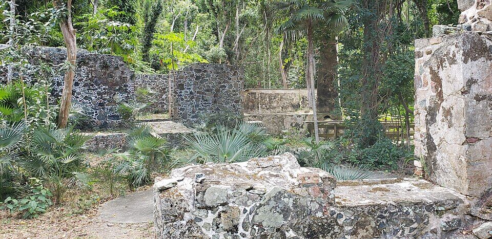
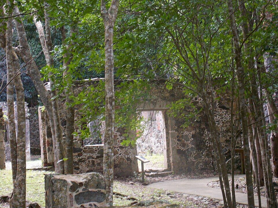
Across the road from the campground entrance, a half-mile nature loop winds through the ruins of the Cinnamon Bay sugar works: the horse mill where the cane was crushed, the boiling room, the estate house and the raised tombs of a plantation owner's wife. Signs name the bay rum, tyre palms and other native trees. Allow 30 minutes to an hour; the first part is boardwalk.
The Cinnamon Bay Trail starts east of the ruins and climbs about a mile through shady forest to Centerline Road — the park rates it strenuous. A 0.38-mile spur leads to the ruins of the great house on America Hill. Go up in the morning cool, and come down to a swim.
Round America Hill to the east, Maho Bay is shallow and sheltered, right beside the road, with green turtles grazing the seagrass a few yards out. It is a short drive or taxi ride along the North Shore Road, not a walk along the shore.
Everything to eat is the campground's, and the café and food truck serve day visitors as well as campers. The food truck by the beach does lunch, cold drinks, ice cream, beer and cocktails from 11 am to 4 pm; the Rain Tree Café in the main building does breakfast and a themed dinner each night; the General Store sells snacks, drinks and ice.
You are welcome to bring your own food and a cooler — just no glass on the beach. For a wider choice, Cruz Bay's restaurants are a taxi ride back along the North Shore Road. The café closes for part of the autumn: check our seasonal-closures tracker before a September or October visit.
Cinnamon Cay (left) and Whistling Cay from a shady corner of the beach, swimmers in the shallows (December 2011) Photo: Gruepig, CC BY-SA 4.0
At the beach
The food truckLunch — hot dogs, nachos, pulled pork — at $10–$15, cold drinks, ice cream, beer and cocktails ($6–$16); 11 am–4 pm.
General StoreSnacks, drinks, ice, sun products, local beer and basic groceries; 10 am–6 pm daily.
Bring your ownFood, drinks and coolers are fine on the beach; glass is not.
In the campground
Rain Tree CaféBreakfast 7:30–9:30 am, dinner 5:30–8 pm, open to campers and visitors: a different theme each night, from pasta Monday to prime rib Friday.
Cinnamon Bay ChatsEvening talks at the café, 6–7 pm on weeknights in season — sea turtles, music, birds, reefs — hosted by the Friends of Virgin Islands National Park, the campground lists.
Weather & sea
Cinnamon Bay weather and the best time to go
Warm all year: highs in the mid-80s °F, a steady easterly trade wind, and short tropical showers rather than all-day rain. December to April is the dry, busy season. June to November is hurricane season, with the peak from mid-August to mid-October — when the campground closes for two months.
Cinnamon Bay opens to the north-west, with Jost Van Dyke across the water to the north, so the easterly trade-wind swell mostly passes it by, and on most days the water is flat enough to float. Winter is the exception: swells from storms far out in the North Atlantic reach the north shore, and on those days the bay can close to swimming and the snorkel to the cay is off. The call at the top of the page reads the swell every half hour.
The next 7 days on St. John
Day
Sky
High / low
Rain
Wind
Seas offshore
Today
Thunderstorms
85° / 78°F
90%
SW 20 mph, gusts 28
3 ft
Tomorrow
Thunderstorms
83° / 80°F
92%
WSW 19 mph, gusts 28
3.4 ft
Sun, Nov 8
Drizzle
84° / 81°F
57%
WSW 13 mph
3 ft
Mon, Nov 9
Drizzle
83° / 82°F
18%
NNW 5 mph
2.2 ft
Tue, Nov 10
Drizzle
83° / 80°F
25%
NE 11 mph
2 ft
Wed, Nov 11
Overcast
84° / 82°F
20%
ENE 11 mph, gusts 17
2.2 ft
Thu, Nov 12
Drizzle
84° / 82°F
27%
ESE 12 mph
2.1 ft
Open-Meteo forecast for St. John, refreshed every half hour. The seas are offshore; how much of it reaches the sand is the call above. NWS alerts & marine forecast · North swell season
Sea temperature by month
80°Jan
80°Feb
80°Mar
81°Apr
83°May
85°Jun
85°Jul
85°Aug
86°Sep
86°Oct
84°Nov
82°Dec
Daily-mean sea-surface temperature off St. John, averaged 2021–2024 (Open-Meteo marine reanalysis): warmest in Sep (86.3°F), coolest in Feb (79.7°F).
Cruise crowds
Cruise ships and the crowd at Cinnamon Bay
St. John has no cruise pier: small ships — expedition ships, sailing yachts and small luxury vessels — anchor off Cruz Bay and tender their guests ashore, so a ship day here is a few hundred people, not a few thousand. Our crowd model counts those guests; the excursions that ferry over from the big ships in Charlotte Amalie are counted at Trunk Bay, not here. The park also keeps land-based commercial tour groups to Cinnamon Bay's restaurant area unless they hold a permit: the beach and the campground are closed to them.
7 of the next 31 days have a ship in Cruz Bay. The busiest at Cinnamon Bay, by our model:
Wed, Nov 11 — 1 ship, 388 guests in port. Quiet: ~70 expected here
Mon, Nov 16 — 1 ship, 312 guests in port. Quiet: ~60 expected here
Sun, Nov 22 — 1 ship, 388 guests in port. Quiet: ~70 expected here
Wed, Nov 25 — 1 ship, 1,473 guests in port. Some crowd: ~300 expected here, 11 am–3 pm
Mon, Nov 30 — 1 ship, 312 guests in port. Quiet: ~60 expected here
Fri, Dec 4 — 1 ship, 388 guests in port. Quiet: ~70 expected here
Our crowd model, not a head count: it puts about 18% of the guests of each small ship anchored off Cruz Bay on Cinnamon Bay, starting about 75 minutes after the ship arrives and gone 90 minutes before it sails; past 1,200 on the sand we call it packed. The same model makes the call at the top of the page and on our beach report.
Yes. The Friends of Virgin Islands National Park camera at Windswept Point streams live on YouTube, looking across Cinnamon, Maho and Francis Bays on the north shore. It can be off at times; it is on our St. John webcams page with the island's other live views.
Taíno people live and worship at the back of the beach. The park's excavation found offerings, carved zemís, beads and pottery — evidence, archaeologist Ken Wild argued, of a temple of a Taíno chief, in use from about AD 1000 until around 1500.
1717
The plantation
The Cinnamon Bay estate is established, the park says, as one of the earliest and most prosperous sugar plantations on St. John; its factory, horse mill and curing house probably date from before the last quarter of the 1700s.
November 23, 1733
The revolt
Enslaved people rise against the Danes, starting at the fort in Coral Bay and attacking the north-shore plantations. Cinnamon Bay is one of its settings, and its owner, Daniel Jansen, plays an important part, the National Register records; the revolt lasts six months, until French troops from Martinique help end it in May 1734.
1836
A tomb in Danish
Anna Margaretha Hjardemaal, born on St. Croix in 1785, dies on November 27, 1836. Her raised tomb, with its Danish inscription, is in the estate's cemetery south of the factory.
Mid-1800s
The warehouse on the beach
The stone warehouse behind the sand is built, probably in the mid-19th century: the collection point for produce shipped over the beach, and for supplies landed there.
1903
Bay rum
The Danish West India Plantation Company buys Cinnamon Bay and grows bay rum trees for bay leaf oil, used in St. John Bay Rum colognes; the old rum still is turned to distilling it.
August 2, 1956
The national park
Congress creates Virgin Islands National Park, on land given by Laurance Rockefeller; it opens on December 1, 1956.
1964
The campground
The National Park Service establishes Cinnamon Bay Campground, to be run by a concessioner.
July 11, 1978
On the National Register
The Cinnamon Bay Plantation — factory, horse mill, still, estate house, cemeteries, warehouse and the archaeological site — is listed on the National Register of Historic Places.
1998–2001
The dig
Park archaeologist Ken Wild leads the first major scientific excavation in the U.S. Virgin Islands of the Taíno, at Cinnamon Bay, with an early plantation village and a cemetery of enslaved people; about 50,000 objects are catalogued.
September 6, 2017
Hurricane Irma
Irma destroys the campground and the Danish warehouse, which held the park's archaeology museum; the collection had been moved to safety before the storm season.
January 22, 2022
The campground reopens
After four and a half years, under a new concessioner, CinnOpCo. Work on the cottages had been held up when a survey before construction found Taíno artifacts.
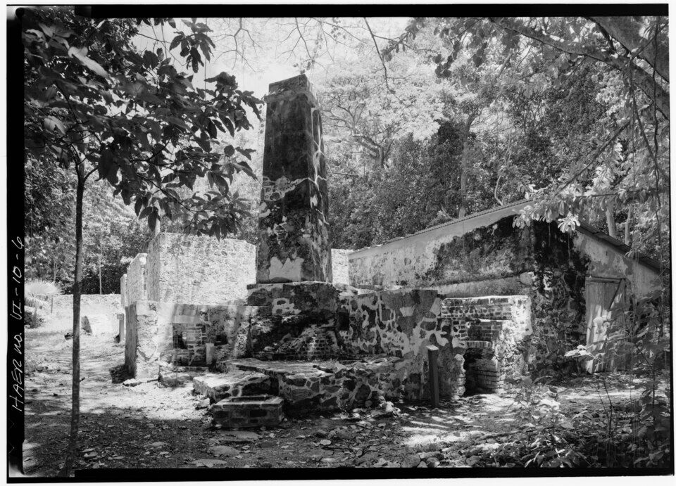
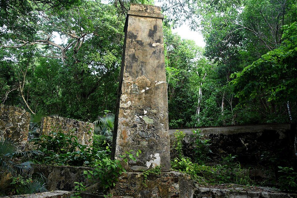
The rum still and its chimney in 1985, with the roofed storehouse beside it; the still was later used to distil bay oil Photo: Jet Lowe, Historic American Engineering Record, Public domainThe factory chimney at the Cinnamon Bay sugar works ruins, in the forest across the road from the beach (October 2022) Photo: Amaury Laporte, CC BY 2.0
None is listed at Cinnamon Bay. Swim inside the white buoys, stand only on sand, and leave the cay for a calm day.
Reef-safe sunscreen is the law
The U.S. Virgin Islands ban sunscreens with oxybenzone, octinoxate or octocrylene. Bring a mineral (zinc or titanium) one; the General Store sells sun products.
No glass, no dogs on the sand
Bring a cooler and lunch by all means, but no glass bottles on the beach; pets are not allowed on park beaches, though leashed dogs may use the trails.
Park early
The lots at every north-shore beach are small and fill in season. Park only in marked spaces, and leave nothing in the car.
Mind the autumn closure
The campground closes for September and October, and its café with it. The beach stays open, and our tracker has the food truck staying open too — but bring water and lunch in case.
Phones and wifi
Cell signal on the north shore is patchy and may roam onto BVI towers. The front desk has free wifi; the café's wifi is for overnight guests.
No. Virgin Islands National Park charges no entrance fee, and Cinnamon Bay has no gate. Trunk Bay, two bays west, is the St. John beach that charges, $5 a person aged 16 and up. You pay only for what you rent or buy, or to camp.
How do you get to Cinnamon Bay?
Take the ferry to Cruz Bay, then a safari taxi or a rental car east along the North Shore Road (Route 20) — about 15 minutes (7.3 km) by road, past Hawksnest and Trunk Bay. The official taxi fare from Cruz Bay is $14 for one rider, $11 each for two or more. The road down through the campground is closed to public traffic, so park in the lot by the road.
How much is a taxi to Cinnamon Bay?
Taxis charge fixed per-person fares set by the VI Taxicab Commission. From the Cruz Bay ferry dock it is $14 for one rider, $11 each for two or more; from the Westin $17 for one rider, $14 each for two or more; from Coral Bay $13 for one rider, $10 each for two or more. Night, luggage and waiting surcharges apply.
Is Cinnamon Bay good for snorkeling?
Yes, for a confident swimmer on a calm day: the snorkel is Cinnamon Cay, the small rocky cay about 200 yards off the western half of the beach, where the park describes snappers in the nooks of its sides and a few pillar coral colonies at its north-west corner. Turtles and fish of all sizes are seen in the bay. There are no lifeguards.
Can you rent kayaks and snorkel gear at Cinnamon Bay?
Yes. The watersports stand on the beach, run by the campground, rents snorkel gear ($10 a day), beach chairs ($10 a day), kayaks ($30 an hour, $75 a day) and paddleboards and clear kayaks ($35 an hour, $75 a day), 9 am to 4 pm every day, as listed in October 2026.
Is there food at Cinnamon Bay?
Yes, all from the campground and open to day visitors: a food truck by the beach (lunch, drinks, beer and cocktails, 11 am to 4 pm), the Rain Tree Café for breakfast and dinner, and the General Store for snacks and ice. You may also bring your own food and a cooler, but no glass.
Can you camp at Cinnamon Bay?
Yes — it is the only place camping is allowed in Virgin Islands National Park. Cinnamon Bay Resort & Campground has bare sites (from $50 a night), eco-tents ($190–$245) and cottages ($230–$315), as the park lists them, booked through the campground. It closes for September and October, and from December 1 to April 15 a stay is limited to 14 days.
Is Cinnamon Bay open in September and October?
The beach is: it is national park land with no gate, and the park is open 24 hours. The campground closes for September and October, the park's listing says, and the café with it; our seasonal-closures tracker has the café closed from September 1 to November 1 this year.
Are there lifeguards at Cinnamon Bay?
No lifeguards are listed at Cinnamon Bay, and the park lists none even at Trunk Bay. The water shelves gently over sand and white buoys keep boats out of the swimming area, but winter north swells can close the north-shore beaches to swimming. Swim with someone, and stand only on sand.
Are dogs allowed at Cinnamon Bay?
Not on the beach: pets are prohibited on Virgin Islands National Park beaches, and the campground takes no pets. Leashed dogs may use the park's trails, including the Cinnamon Bay Trail. Service animals are allowed.
What are the ruins at Cinnamon Bay?
On the beach, the roofless stone warehouse of the old plantation, probably mid-1800s, which held the park's archaeology museum until Hurricane Irma in 2017 — it is fenced off. Across the road, a half-mile nature loop runs through the sugar works of the Cinnamon Bay Plantation, established in 1717: the horse mill, the boiling room, the rum still and the estate house. The Cinnamon Bay Trail climbs from there to the great house ruins on America Hill.
Is there a Cinnamon Bay webcam?
Yes. The Friends of Virgin Islands National Park camera at Windswept Point streams live on YouTube, looking across Cinnamon, Maho and Francis Bays. It is on our St. John webcams page; it can be off at times.
Photo & map credits
Cinnamon Bay beach in October 2022: the curve of the sand, with Cinnamon Cay (left) and Whistling Cay offshore — Amaury Laporte, CC BY 2.0, via Wikimedia Commons (resized).
Cinnamon Cay (left) and Whistling Cay from a shady corner of the beach, swimmers in the shallows (December 2011) — Gruepig, CC BY-SA 4.0, via Wikimedia Commons (resized).
Cinnamon Cay from the beach, with Whistling Cay behind it and white buoys in the water — Amaury Laporte, CC BY 2.0, via Wikimedia Commons (resized).
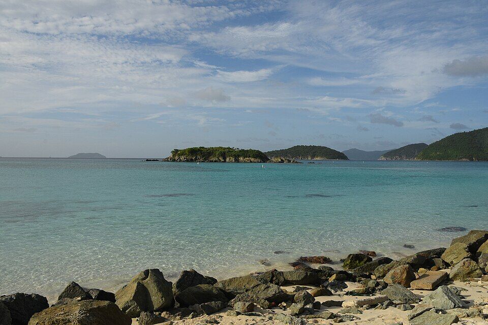
Clear, shallow water over sand between the rocks on the shore and Cinnamon Cay — Amaury Laporte, CC BY 2.0, via Wikimedia Commons (resized).
Cinnamon Cay from the sand, with two of the white buoys that mark the swimming area — Amaury Laporte, CC BY 2.0, via Wikimedia Commons (resized).
The Danish warehouse behind the beach in April 2022: roofless since Hurricane Irma, behind a sign that reads Danger, unstable ruins, do not enter — Eoghanacht, CC0, via Wikimedia Commons (resized).
Beach chairs and a paddleboard in the shade beside the warehouse ruin, with the forest of the north shore behind — Eoghanacht, CC0, via Wikimedia Commons (resized).
The paved path of the nature loop through the Cinnamon Bay sugar factory ruins, with a park sign by a doorway — Farragutful, CC BY-SA 4.0, via Wikimedia Commons (resized).
Walls of the sugar works among tyre palms, with the railing of the boardwalk on the right (March 2019) — Pi3.124, CC BY-SA 4.0, via Wikimedia Commons (resized).
The factory chimney at the Cinnamon Bay sugar works ruins, in the forest across the road from the beach (October 2022) — Amaury Laporte, CC BY 2.0, via Wikimedia Commons (resized).
A St. John safari taxi in Cruz Bay: a pickup with bench seats and a canopy on the back — User:Mattes, CC BY 2.0 de, via Wikimedia Commons (resized).
A Caribbean spiny lobster in a hole in the rock, photographed snorkelling at Cinnamon Bay (April 2022) — Tayton Alvis (iNaturalist), CC BY 4.0, via Wikimedia Commons (resized).
The rum still and its chimney in 1985, with the roofed storehouse beside it; the still was later used to distil bay oil — Jet Lowe, Historic American Engineering Record, Public domain, via Wikimedia Commons (resized).
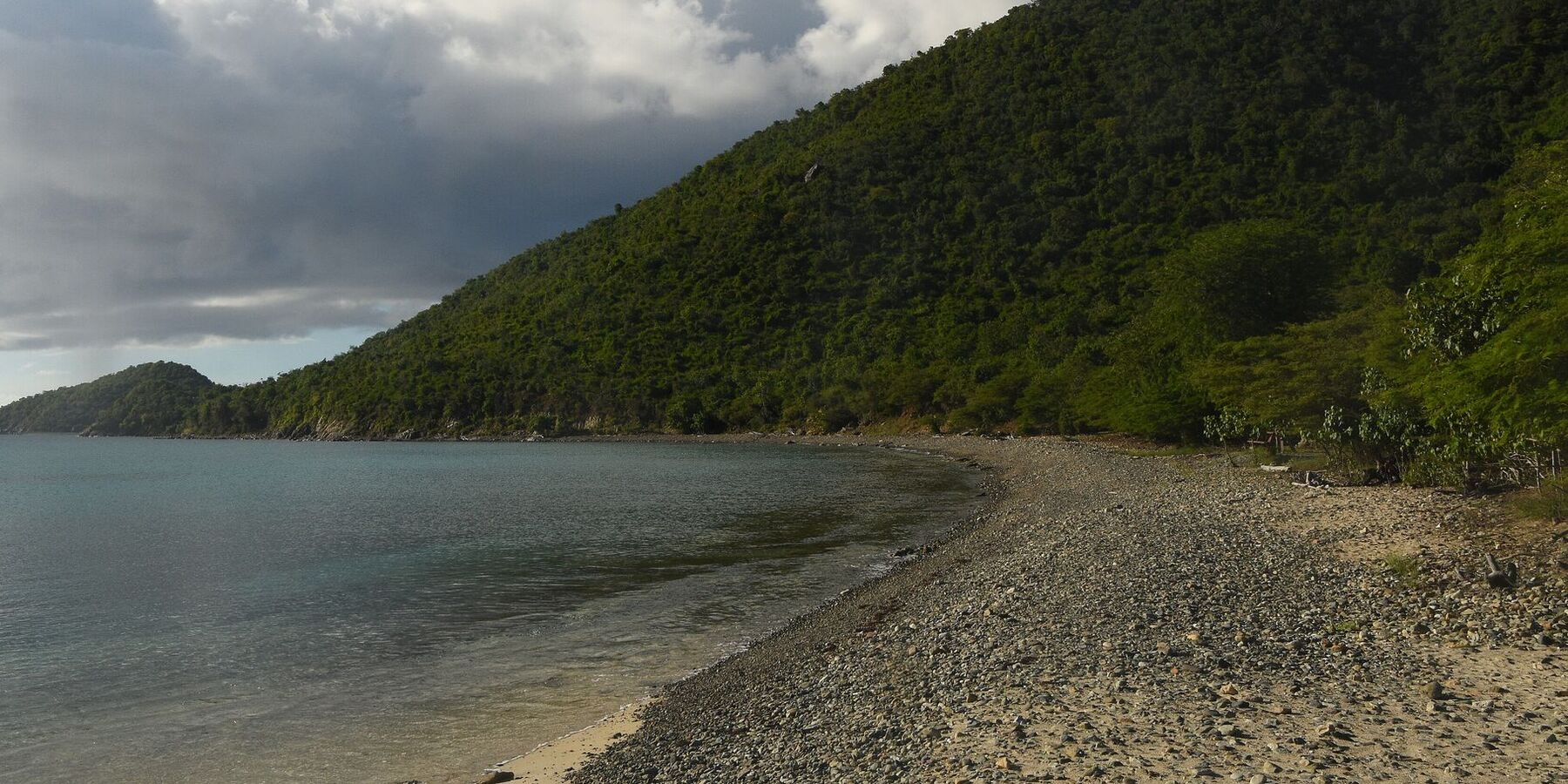
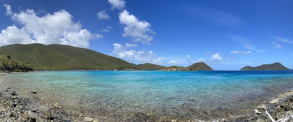
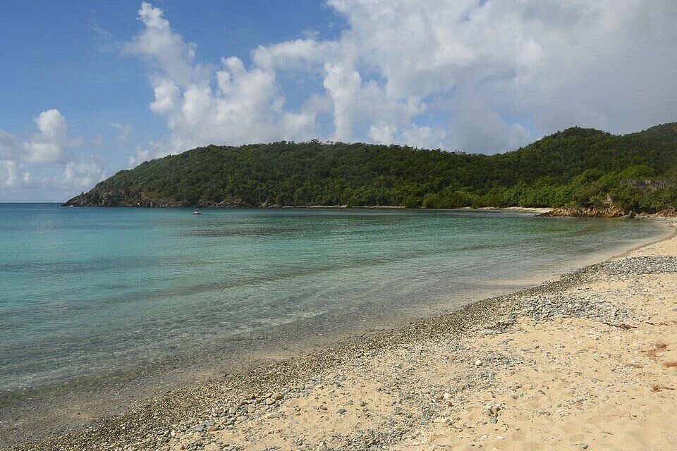
Little Lameshur Bay on St. John's south shore: sand and pebbles, with the forested point beyond (October 2022) — Amaury Laporte, CC BY 2.0, via Wikimedia Commons (resized).
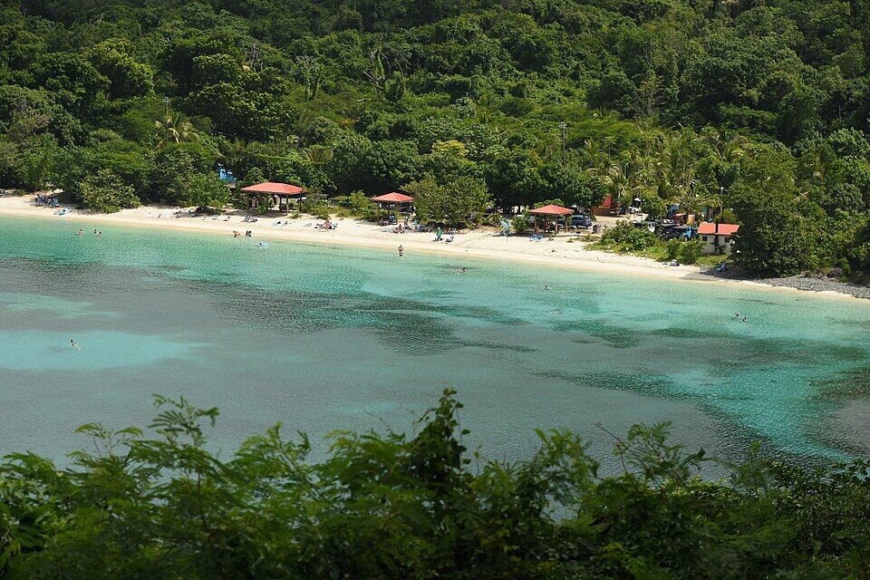
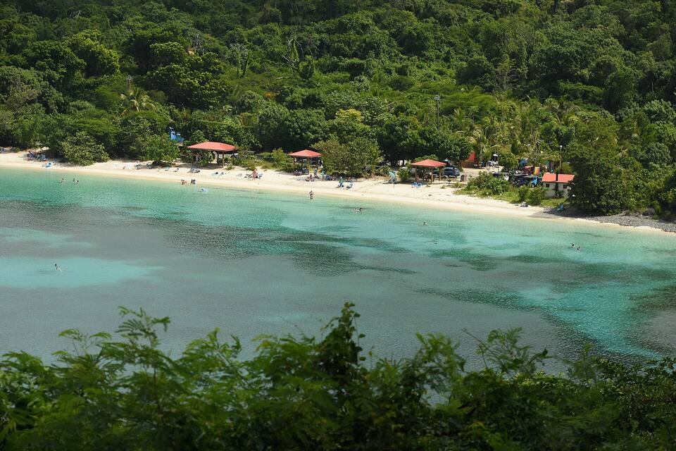
Maho Bay, the next bay east, from the hillside: the beach under the forest and swimmers in the shallows — Amaury Laporte, CC BY 2.0, via Wikimedia Commons (resized).
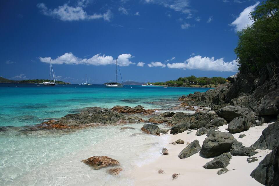
Honeymoon Beach on Salomon Bay, St. John — Bradley Furlow, CC BY-SA 4.0, via Wikimedia Commons (resized).
Hawksnest Bay from the rocks on its west shore in May 2009, looking across to the sand at the head of the bay, where Hawksnest Beach is; two snorkelers over the reef in the foreground — Fred Hsu (Wikipedia:User:Fred Hsu on en.wikipedia), CC BY-SA 3.0, via Wikimedia Commons (cropped and resized).
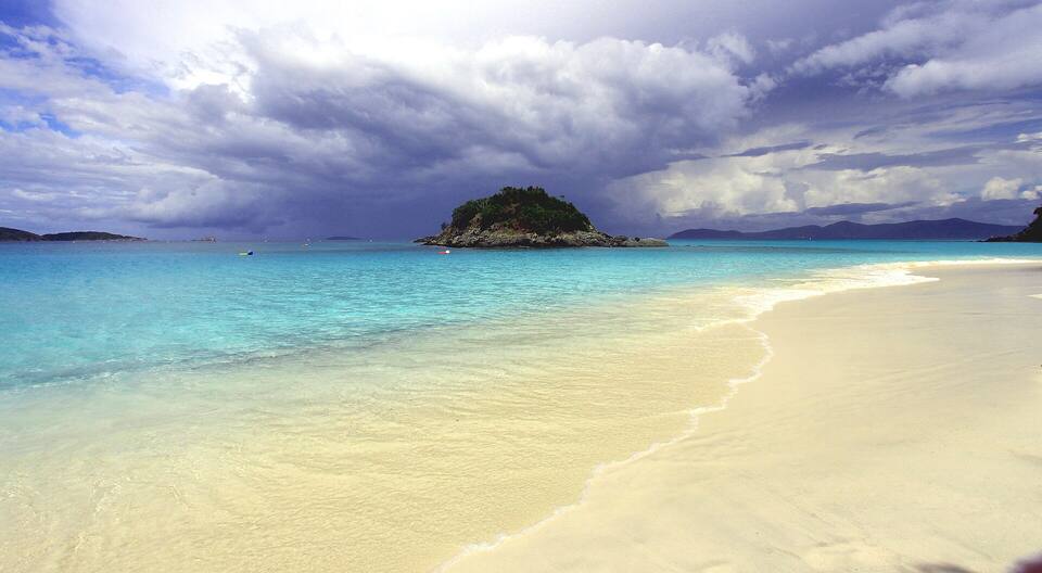
The beach at Trunk Bay with Trunk Cay offshore — Prayitno, CC BY 2.0, via Wikimedia Commons (resized).
Maho Bay from the hillside: a long curve of sand under the forest — Amaury Laporte, CC BY 2.0, via Wikimedia Commons (resized).
Francis Bay beach in October 2022, looking north along the shore to the wooded slopes of Mary Point — Amaury Laporte, CC BY 2.0, via Wikimedia Commons (cropped and resized).
Leinster Bay and Waterlemon Cay from the Leinster Bay Trail — Eoghanacht, CC0, via Wikimedia Commons (resized).
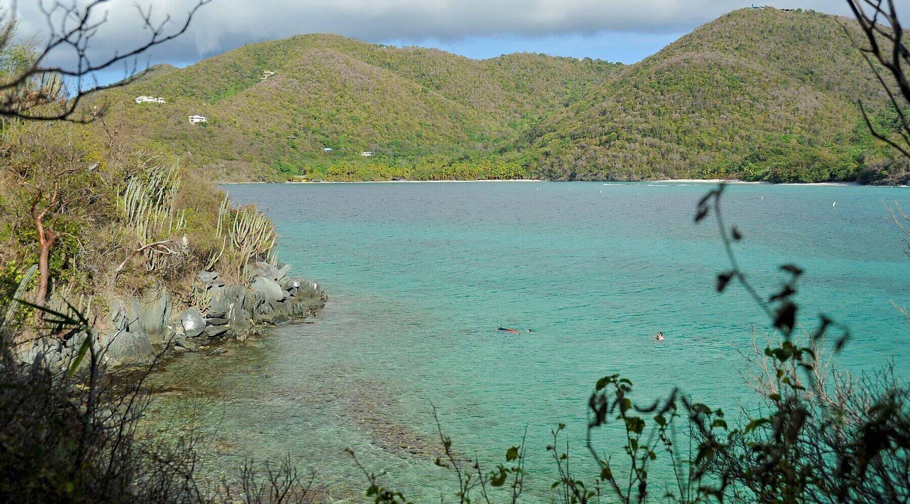
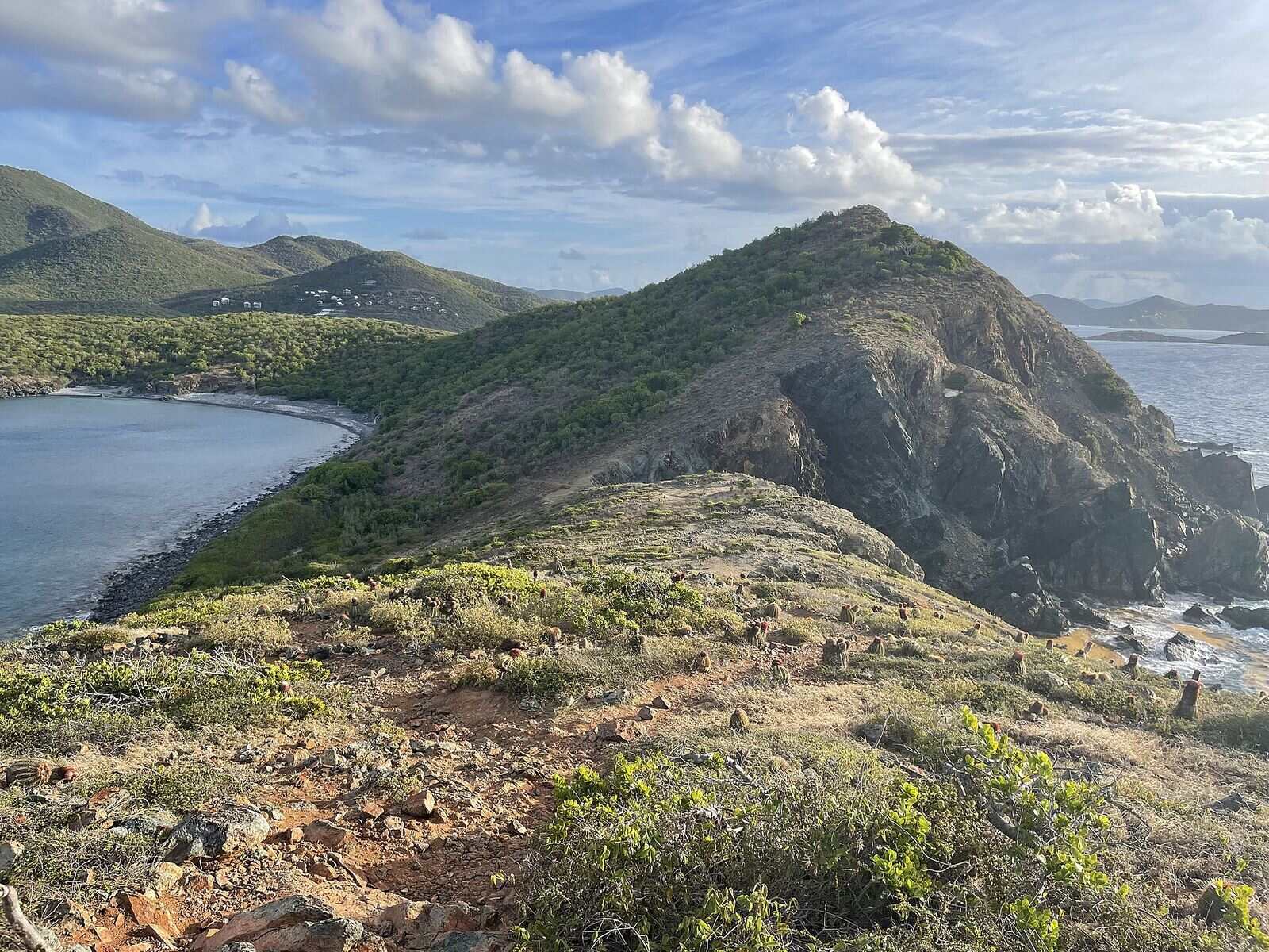
Salt Pond Bay from the Ram Head Trail in April 2022: the bay on the left, with the beach at its head and the cobbles of Blue Cobblestone Beach nearer, the ridge of the Ram Head peninsula, and houses on the hill above — Eoghanacht, CC0, via Wikimedia Commons (resized).
 Skip today today
 Skip today today
 Skip today today
 Skip today today
 Skip today today
 Skip today today
 Think twice today
 Skip today today