The fourth and smallest of the U.S. Virgin Islands: about 490 acres of dry hills just south of St. Thomas, home to fewer than 200 people, with no hotels, no car ferry and no cruise pier. The little ferry from Crown Bay Marina lands at Phillips Landing, a short walk from Honeymoon Beach.
Water Island drawn from the U.S. Census shoreline, with St. Thomas to the north and Hassel Island (National Park Service land, green) at the mouth of Charlotte Amalie harbour. Tap a pin for its page.
Water Island has no airport and no car ferry. Fly into Cyril E. King Airport (STT) on St. Thomas, take a taxi a few minutes east to Crown Bay Marina, and ride the Water Island Ferry across to Phillips Landing on the island's north-west shore. The boat leaves from the marina's dock in front of Tickles Dockside restaurant.
The ferry runs about every hour through the day, starting later on Saturdays and running a shorter day on Sundays and public holidays — the table and the countdown on this page show today's boats, and the last one back is the one to plan around. There is no other scheduled boat, so if you are staying in Charlotte Amalie or Frenchtown it is still Crown Bay first.
From the airport: a taxi from Airport (STT) to Crown Bay is $8 for one rider, $6 each for two or more, about 5–10 minutes — see the fare.
Crown Bay on St. Thomas from the water, a cruise ship at the pier — the Water Island ferry leaves from Crown Bay Marina here Photo: elisfkc, CC BY-SA 2.0
Fastest: Crown Bay Marina, St. Thomas ↔ Phillips Landing, 15 min. Children and bag fees vary by route — each timetable page has the full fare table and booking links.
Residents with a USVI ID pay less, and bags and boxes carry a small cargo fee — the ferry page has the full fare table.
Crown Bay is also one of St. Thomas's two cruise piers. On a big ship day the waterfront road and the taxi lots there are busier; allow extra time to make the boat.
Coming on a day sail instead? Many St. Thomas day charters anchor off Honeymoon Beach — you swim or dinghy ashore.
Bring what you need for the day: Water Island has very little in the way of shops, and nothing open late.
There are no taxis, buses or rental cars on Water Island, and it is small enough not to need them. Honeymoon Beach is a short walk over the hill from Phillips Landing; the rest of the island is a network of a few narrow, hilly roads that residents drive in golf carts and trucks.
Visitors walk or rent a golf cart for the day — carts are rented near the landing — and some residents get around by bike. Carry water and sun cover if you walk: the roads are steep, exposed and hot by midday. The eastern third of the island is a gated private community, so keep to the public roads.
Beaches
The best beaches on Water Island
Water Island's beaches are few and small. Honeymoon is the one with sand, shade and a bar; the others are quiet coves with nothing on them. Every beach in the U.S. Virgin Islands is public from the water, but much of the land behind them is private — keep to the roads and paths. Numbers match the map. For which one is calm and uncrowded today, open the beach report.
The island's main beach, at the head of Druif Bay on the west side and a short walk over the hill from Phillips Landing. A long, sheltered stretch of sand, cleared and built up in the 1950s, with palms, a beach bar, water-sport rentals and the moorings where St. Thomas day boats stop. Usually calm; the live webcam looks straight down it.
A small cove south of Honeymoon, on the point between Druif Bay and Flamingo Bay. No facilities — bring water and shade, and expect to have it largely to yourself.
At the head of Limestone Bay on the east side, across the island from Honeymoon. Small and usually quiet, with reef in the bay — the dive site known as Supermarket Reef lies in Limestone Bay. No facilities.
A small, undeveloped beach on the south-east shore, near the hill where Fort Segarra was dug in the 1940s. No facilities and little shade; pair it with a walk up to the fort.
Most visitors come for this: the short walk from the ferry, then a day on calm water under the palms with the bar behind you. Check the live camera before you leave St. Thomas to see how many boats are on the moorings.
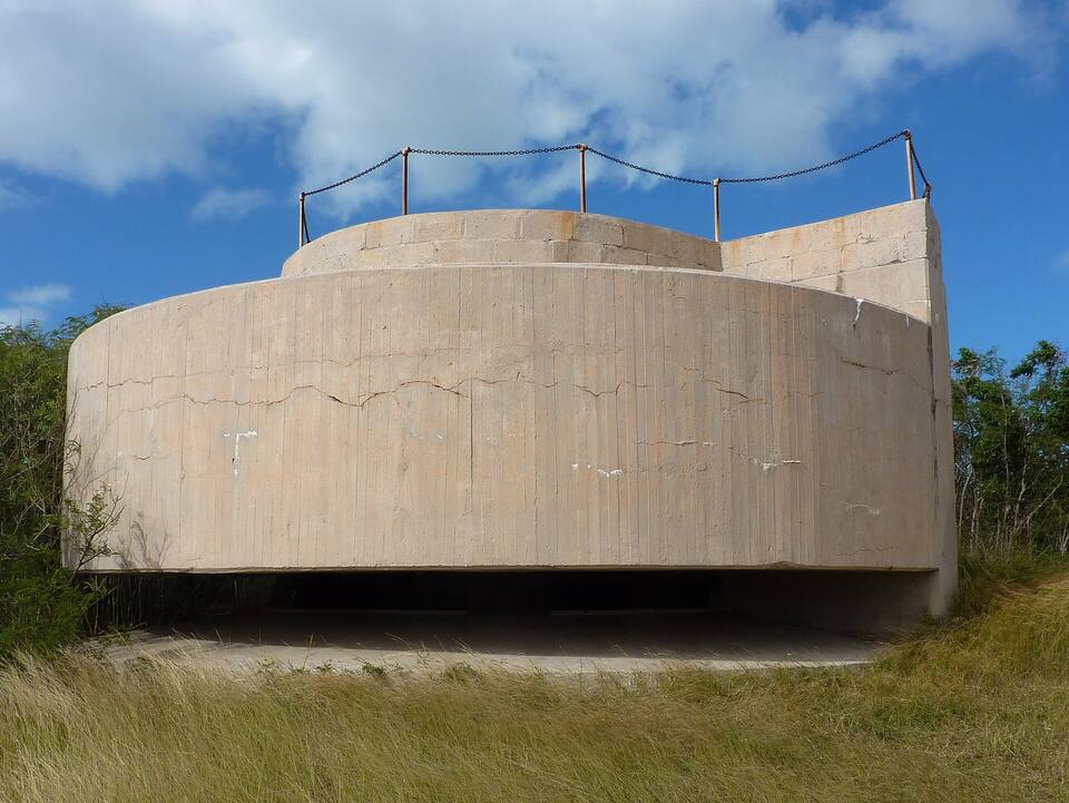
On the hill above the south shore, the U.S. Army began an underground fort in 1944 to guard the submarine base at St. Thomas; it was abandoned unfinished after the war. The concrete gun emplacements and tunnel entrances are still there, with a wide view back to St. Thomas. The site is not staffed: wear proper shoes, take a light, and do not go into the tunnels alone.
An hour is enough to drive or walk every public road: down to Limestone Bay on the east side, up over the hills for views of Charlotte Amalie harbour and the ships at Crown Bay, and out towards the fort. The roads are narrow and steep — go slowly, and keep left like the rest of the territory.
The reef in Limestone Bay, known to divers as Supermarket Reef, is the island's best-known underwater site. From the beach, snorkel only on a calm day and stay inside the bay; there is no lifeguard and nothing ashore.
Honeymoon faces west, out of Druif Bay to open water, so the sun goes down in front of you. Check the time of the last ferry back to Crown Bay before you settle in: the ferry is the only scheduled way off the island.
Honeymoon Beach is a regular stop for day charters out of St. Thomas, often paired with the turtles at Buck Island, just south of St. Thomas. You see the island from the water and swim ashore for lunch.
Warm all year: highs in the mid-80s °F, a steady easterly trade wind, and short showers rather than all-day rain. Water Island is low and dry, with little shade away from Honeymoon. December to April is the dry, busy season; June to November is hurricane season, peaking from mid-August to mid-October.
Water Island sits in St. Thomas's waters, so these are St. Thomas's sea temperatures. Daily-mean sea-surface temperature, averaged 2021–2024 (Open-Meteo marine reanalysis): warmest in Sep (86.4°F), coolest in Feb (79.8°F). Hurricane history map
Live cameras
Water Island webcams
One live camera on Water Island — check the water, the ferry dock or the sunset before you go.
Water Island — The length of Honeymoon Beach on Druif Bay
The U.S. Interior Department hands Water Island, off Charlotte Amalie, to the U.S. Virgin Islands government — the fourth Virgin Island.
Today
Two flags, one archipelago
St. Thomas, St. John, St. Croix and Water Island are the U.S. Virgin Islands. Tortola, Virgin Gorda, Jost Van Dyke and Anegada are the British Virgin Islands. Cruise ships and ferries cross the line every day.
Take the Water Island Ferry from Crown Bay Marina on St. Thomas to Phillips Landing on Water Island. It runs about every hour through the day, with a later start on Saturdays and a shorter day on Sundays and holidays. From Cyril E. King Airport (STT) a taxi to Crown Bay takes a few minutes.
Is Water Island one of the U.S. Virgin Islands?
Yes. It is the fourth of the main U.S. Virgin Islands, after St. Thomas, St. John and St. Croix. Denmark's East Asiatic Company kept it after the 1917 sale of the Danish West Indies; the United States bought it in 1944, and the federal government handed it to the territory on December 12, 1996 — which is why it is sometimes called the "last Virgin".
Do you need a passport to visit Water Island?
Not if you are a U.S. citizen: Water Island is part of the U.S. Virgin Islands, so a trip from St. Thomas is domestic. Non-U.S. visitors need the same documents as for the U.S. mainland.
What is there to do on Water Island?
Mostly the beach: Honeymoon Beach on Druif Bay, a short walk from the ferry, with calm water and a beach bar. Beyond it, visitors explore the ruins of Fort Segarra, an unfinished Second World War fort, snorkel or dive Limestone Bay, and ride a golf cart round the island's few roads. It is quiet and residential — a beach day, not a nightlife trip.
Can you bring a car to Water Island?
No. There is no car ferry and no rental cars on the island. Visitors walk or rent a golf cart; the passenger ferry carries luggage and boxes for a small cargo fee.
Are there hotels on Water Island?
No. The island's last hotel closed after Hurricane Hugo in 1989. A few private homes and villas are rented to visitors; most people come over from St. Thomas for the day.
What is Fort Segarra?
An underground coastal fort the U.S. Army began building on Water Island in 1944 to protect the submarine base on St. Thomas. The war ended before it was finished and it was abandoned; the concrete gun emplacements, bunkers and tunnel entrances still stand on the hill above the south shore.
Is Honeymoon Beach on Water Island free?
Yes. Like every beach in the U.S. Virgin Islands it is public. You pay only for the ferry over, and for anything you rent or buy on the beach.
Photo & map credits
Water Island's hills and bays seen from Fort Segarra, with St. Thomas across the water behind — Gruepig, CC BY-SA 4.0, via Wikimedia Commons (resized).
A concrete gun emplacement at Fort Segarra, the unfinished Second World War fort on Water Island — Gruepig, CC BY-SA 4.0, via Wikimedia Commons (resized).
Honeymoon Beach on Water Island: palms, beach umbrellas and calm water in Druif Bay — Jim Wilkinson, Public domain, via Wikimedia Commons (resized).
Crown Bay on St. Thomas from the water, a cruise ship at the pier — the Water Island ferry leaves from Crown Bay Marina here — elisfkc, CC BY-SA 2.0, via Wikimedia Commons (resized).
Map: shoreline from U.S. Census Bureau TIGER/Line 2023; park boundary from the National Park Service; roads from our taxi-route data.
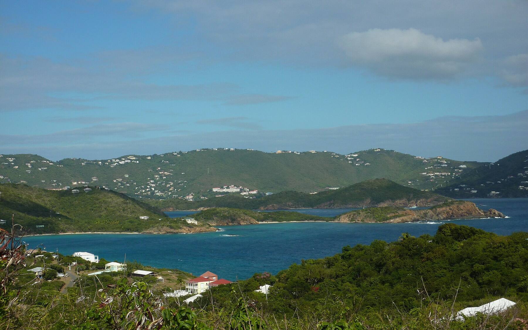
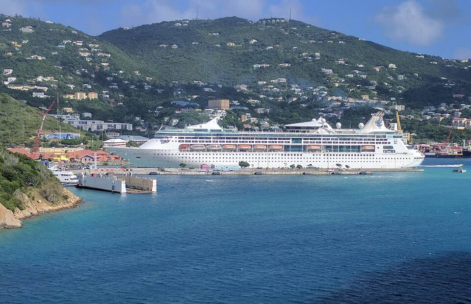
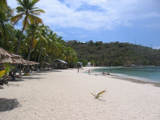 Photo: Jim Wilkinson, Public domain