Map of the U.S. & British Virgin Islands

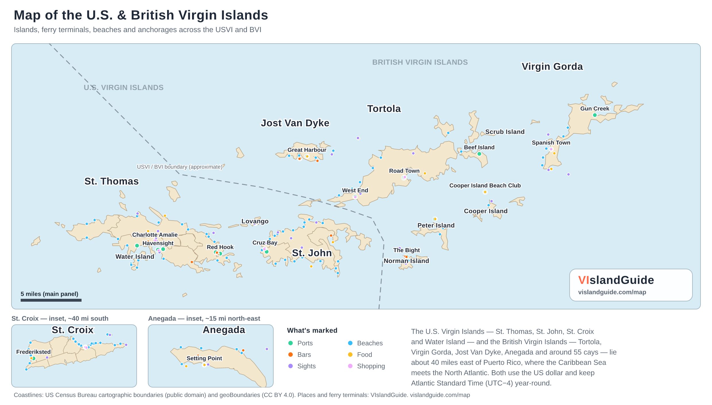
Every island across the USVI and the BVI on one map — St. Thomas, St. John, St. Croix and Water Island on the American side, Tortola, Virgin Gorda, Jost Van Dyke and Anegada on the British side — with the ferry terminals that connect them, the beaches, bars and anchorages worth finding, and the territorial boundary that runs between the two.

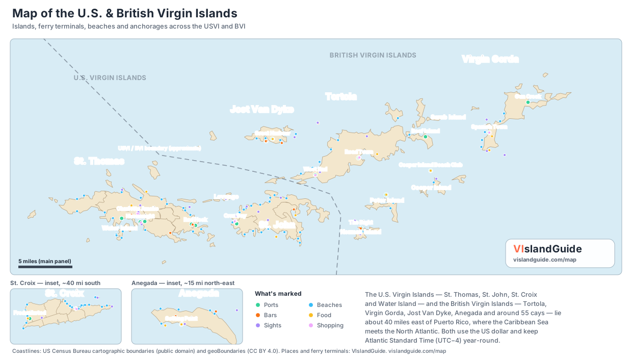
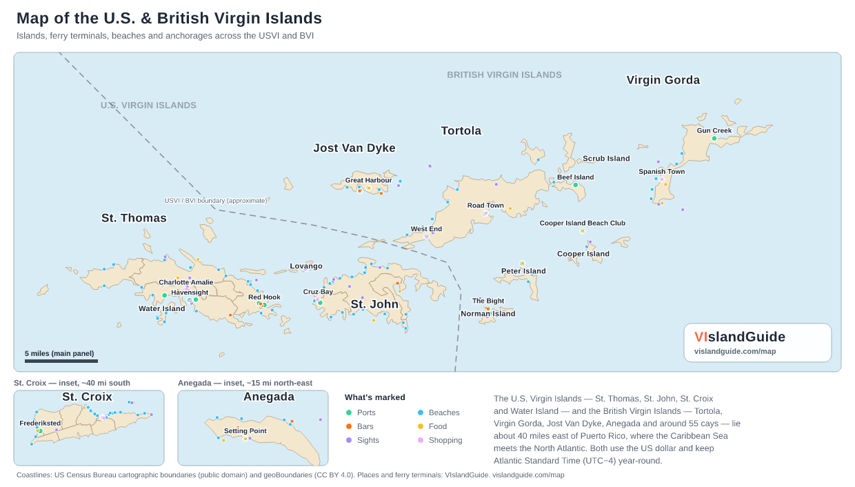
Map of the U.S. & British Virgin Islands Reference map of the Virgin Islands showing St. Thomas, St. John, St. Croix, Water Island, Tortola, Virgin Gorda, Jost Van Dyke, Anegada and the surrounding cays, with ferry terminals, beaches, bars, restaurants and anchorages marked. St. Croix and Anegada are shown as insets. Map of the U.S. & British Virgin Islands Islands, ferry terminals, beaches and anchorages across the USVI and BVI USVI / BVI boundary (approximate) U.S. VIRGIN ISLANDS BRITISH VIRGIN ISLANDS Red Hook Ferry Terminal — Ports Charlotte Amalie Ferry Dock — Ports Havensight Cruise Pier (West Indian Dock) — Ports Crown Bay Cruise Pier — Ports Yacht Haven Grande Marina — Ports Red Hook Car Barge Ramp — Ports Magens Bay — Beaches Coki Beach — Beaches Sapphire Beach — Beaches Lindquist Beach — Beaches Secret Harbour — Beaches Hull Bay — Beaches Brewers Bay — Beaches Morningstar Beach — Beaches Bordeaux Beach — Beaches Stumpy Bay — Beaches Fortuna Bay — Beaches Lindbergh Bay — Beaches Mandahl Bay — Beaches Tutu Bay — Beaches Pineapple Beach — Beaches Turquoise Beach — Beaches Duffy's Love Shack — Bars Iggies Beach Bar — Bars Latitude 18 — Bars XO Bistro — Bars Tap & Still — Bars Frenchtown Brewing — Bars Oceana Restaurant & Bistro — Food Gladys' Café — Food Greenhouse Restaurant — Food Old Stone Farmhouse — Food Petite Pump Room — Food Mafolie Restaurant — Food Room With A View — Food Cuzzins Caribbean Restaurant — Food Fort Christian — Sights 99 Steps — Sights Blackbeard's Castle — Sights Mountain Top — Sights Paradise Point Skyride — Sights Drake's Seat — Sights Coral World Ocean Park — Sights Main Street (Dronningens Gade) — Shopping Havensight Mall — Shopping Vendors Plaza — Shopping Cruz Bay Ferry Terminal — Ports Enighed Pond Car Barge Dock — Ports Trunk Bay — Beaches Cinnamon Bay — Beaches Maho Bay — Beaches Hawksnest — Beaches Honeymoon — Beaches Francis — Beaches Leinster / Waterlemon Cay — Beaches Salt Pond — Beaches Lameshur — Beaches Oppenheimer — Beaches Cruz Bay — Beaches Caneel Bay — Beaches Blue Cobblestone — Beaches Reef Bay — Beaches Little Reef Bay — Beaches Johns Folly — Beaches Ditleff — Beaches St. Mary's Creek — Beaches Hart Bay — Beaches Woody's Seafood Saloon — Bars The Longboard — Bars Joe's Rum Hut — Bars Skinny Legs Bar & Grill — Bars High Tide Bar & Seafood Grill — Bars Driftwood Dave's — Bars Lime Inn — Food Extra Virgin Bistro — Food Morgan's Mango — Food Rhumb Lines — Food Sun Dog Café — Food Miss Lucy's — Food Shipwreck Landing — Food VI National Park Visitor Center — Sights Annaberg Sugar Plantation Ruins — Sights Reef Bay Trail — Sights Peace Hill — Sights Catherineberg Ruins — Sights Lind Point Trail & Salomon Beach — Sights Mongoose Junction — Shopping Wharfside Village — Shopping Lovango Resort Dock — Ports Lovango Cay Beach — Beaches Lovango Cay Snorkeling — Sights Great Harbour Entry Dock — Ports White Bay Beach Landing — Ports White Bay — Beaches Great Harbour — Beaches Sandy Spit — Beaches Little Harbour — Beaches Soggy Dollar Bar — Bars Foxy's Tamarind Bar — Bars Ivan's Stress Free Bar — Bars One Love Bar & Restaurant — Bars Ali Baba's Heavenly Bar & Restaurant — Food Corsairs Beach Bar & Restaurant — Food Diamond Cay National Park — Sights Road Town Ferry Terminal — Ports Soper's Hole / West End Ferry Terminal — Ports Village Cay Marina — Ports Beef Island Ferry Dock (Trellis Bay) — Ports Cane Garden Bay — Beaches Brewers Bay — Beaches Apple Bay — Beaches Smuggler's Cove — Beaches Long Bay — Beaches Long Bay Beach — Beaches Bigalow — Beaches Pusser's Landing — Bars Myetts Garden Grille & Bar — Bars Rhythm & Sands (was Quito's) — Bars Bomba's Surfside Shack — Bars Village Cay Restaurant & Bar — Food Brandywine Bay Restaurant — Food The Dove Restaurant — Food Capriccio di Mare — Food Sage Mountain National Park — Sights Callwood Rum Distillery — Sights Fort Recovery — Sights J.R. O'Neal Botanic Gardens — Sights Road Town Market Square — Shopping Soper's Hole Wharf & Market — Shopping The Bight (Norman Island) — Ports Peter Island Resort Dock — Ports Cooper Island Beach Club Dock — Ports Deadman's Bay — Beaches Cooper Island Beach — Beaches The Bight — Beaches White Bay — Beaches Willie T's Floating Bar (Norman Island) — Bars Pirates Bight (Norman Island) — Bars Cooper Island Beach Club — Food Peter Island Resort Restaurant — Food The Indians (Norman Island) — Sights Norman Island Treasure Caves — Sights RMS Rhone Wreck (Salt Island) — Sights Pelican Island Snorkel — Sights Spanish Town Ferry Dock (The Valley) — Ports Gun Creek Dock (North Sound) — Ports The Baths — Beaches Spring Bay — Beaches Savannah Bay — Beaches Mahoe Bay — Beaches Fishers Cove — Beaches Mad Dog Bar & Grill — Bars Bath & Turtle Restaurant & Bar — Bars Chez Bamboo — Bars The Rock Café — Food Fischer's Cove Beach Restaurant — Food Top of the Baths Restaurant — Food The Baths National Park — Sights Copper Mine Point Ruins — Sights Gorda Peak National Park — Sights Virgin Gorda Yacht Harbour Shops — Shopping Setting Point Ferry Dock — Ports Loblolly Bay — Beaches Cow Wreck Beach — Beaches Flash of Beauty — Beaches Pomato Point Beach — Beaches Keel Point Beach — Beaches Cow Wreck Beach Bar — Bars Big Bamboo Beach Bar (Loblolly Bay) — Bars Neptune's Treasure Bar — Bars Anegada Beach Club — Food Lobster Trap Restaurant — Food Potter's by the Sea — Food Anegada Flamingo Colony — Sights The Settlement (Anegada Village) — Sights Frederiksted Cruise Pier — Ports Christiansted Harbor Dock — Ports Sandy Point — Beaches Cane Bay Beach — Beaches Rainbow Beach — Beaches Protestant Cay Beach — Beaches Buck Island Reef — Beaches Frederiksted — Beaches Shoys Beach — Beaches Mermaid Beach — Beaches Buccaneer Beach — Beaches West Beach — Beaches Monk's Bath — Beaches Coconuts Beach — Beaches Tamarind Reef Beach — Beaches Sugar Beach — Beaches LaGrange Beach — Beaches Pelican Cove Beach — Beaches Cottongarden Bay — Beaches Judith's Fancy Beach — Beaches Whistle Beach — Beaches Altona Lagoon Beach — Beaches Cathy's Fancy Beach — Beaches Reef Beach — Beaches Sprat Hall Beach — Beaches Prune Beach — Beaches Honeymoon Beach — Beaches Sugarbird Beach — Beaches Limestone Beach — Beaches Revenge Beach — Beaches Rhythms at Rainbow Beach — Bars Brew STX — Bars Stiix Bar & Restaurant — Bars Deep End Bar & Grill — Bars Tutto Bene — Food Savant Restaurant — Food Polly's at the Pier — Food Rum Runners — Food Christiansted National Historic Site — Sights Fort Christiansvaern — Sights Point Udall — Sights St. George Village Botanical Garden — Sights Buck Island Reef NM (Day Trip) — Sights Christiansted Boardwalk (Pan Am Pavilion) — Shopping Gallows Bay Shopping District — Shopping Anegada Reef Hotel — Food Drunken Pelican (Peter Island Yacht Club) — Food Sail Caribbean Divers (Cooper Island) — Sights Cooper Island Beach Club Boutique — Shopping Scrub Island Marina — Ports Donovan's Reef (Scrub Island) — Food Cardamom & Co. (Scrub Island) — Food One Shoe Beach Bar (Scrub Island) — Bars Scrub Island Outpost — Shopping Marina Cay Bar & Grill — Food Waterfront Restaurant (Lovango) — Food The Sandpit (Lovango) — Food The Shops on Lovango — Shopping Red Hook Charlotte Amalie Cruz Bay Great Harbour Road Town West End Beef Island Cooper Island Beach Club Spanish Town Gun Creek Setting Point Frederiksted St. Thomas St. John Jost Van Dyke Tortola Lovango Norman Island Peter Island Cooper Island Scrub Island Virgin Gorda Anegada St. Croix Water Island Anegada — inset, ~15 mi north-east St. Croix — inset, ~40 mi south What's marked Ports Beaches Bars Food Sights Shopping 5 miles (main panel) VIslandGuide vislandguide.com/map The U.S. Virgin Islands — St. Thomas, St. John, St. Croix and Water Island — and the British Virgin Islands — Tortola, Virgin Gorda, Jost Van Dyke, Anegada and around 55 cays — lie about 40 miles east of Puerto Rico, where the Caribbean Sea meets the North Atlantic. Both use the US dollar and keep Atlantic Standard Time (UTC−4) year-round. Coastlines: US Census Bureau cartographic boundaries (public domain) and geoBoundaries (CC BY 4.0). Places and ferry terminals: VIslandGuide. vislandguide.com/map
Open the full-size map ↗ — 2480px, print quality. St. Croix and Anegada are shown as insets — at one shared scale the archipelago is taller than it is wide. The USVI/BVI boundary is drawn approximately and is not a navigational aid.

More maps of the Virgin Islands

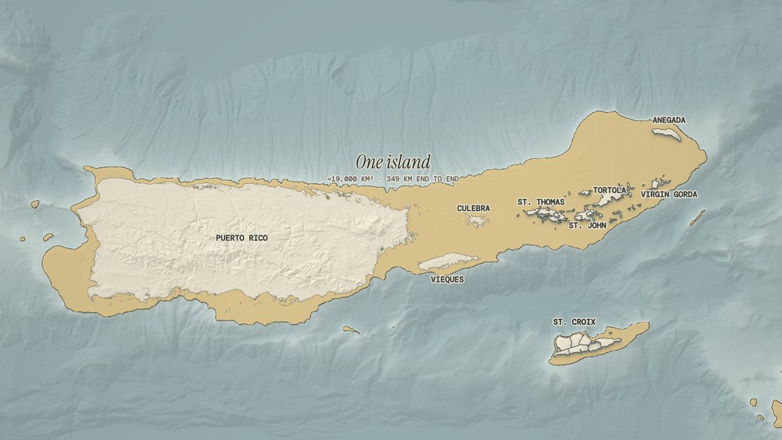
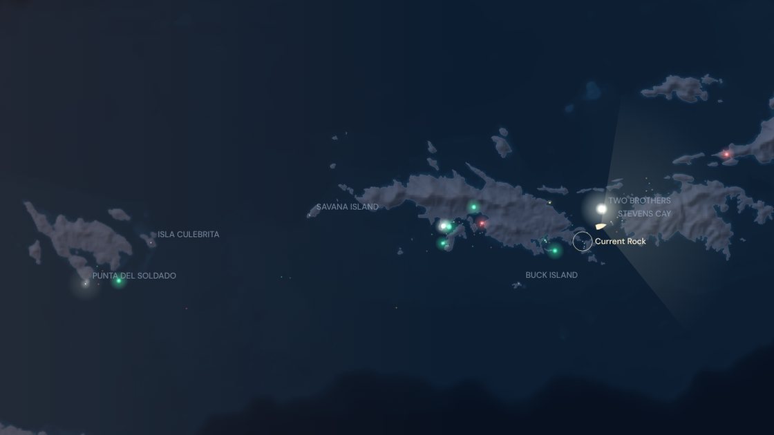
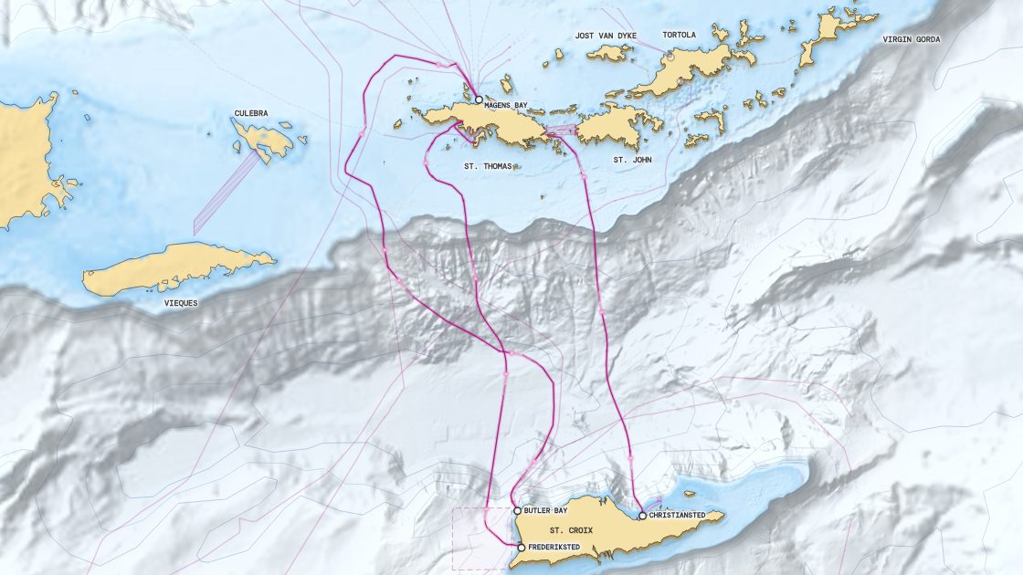
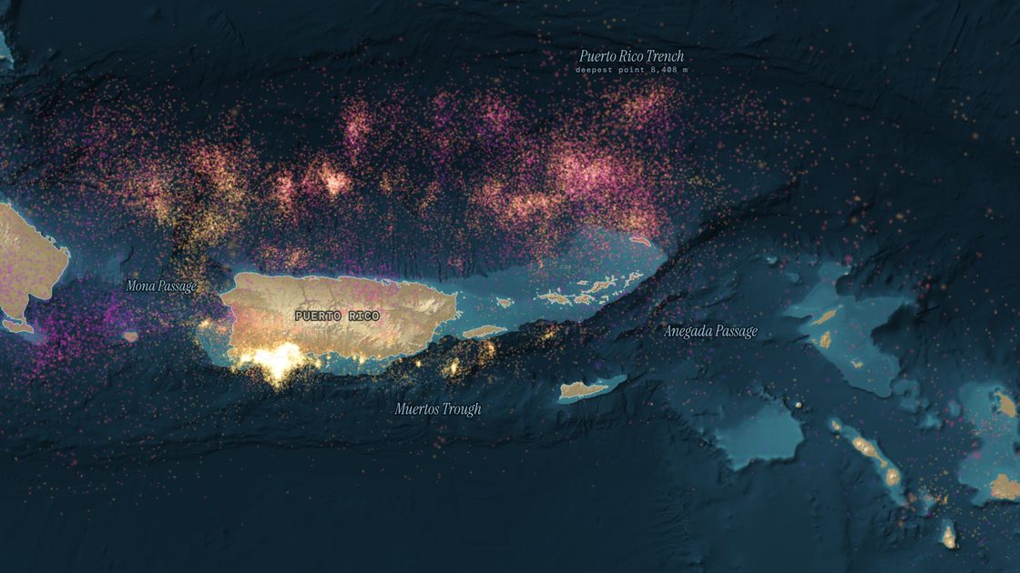
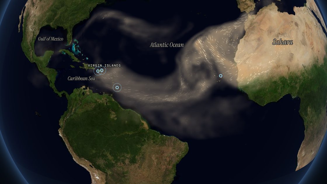
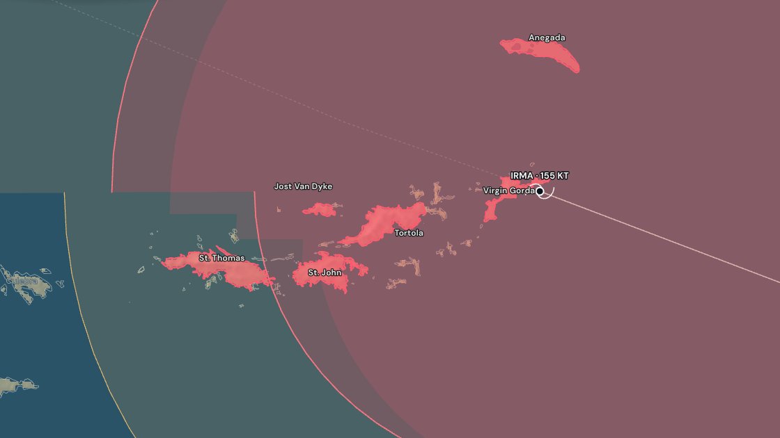
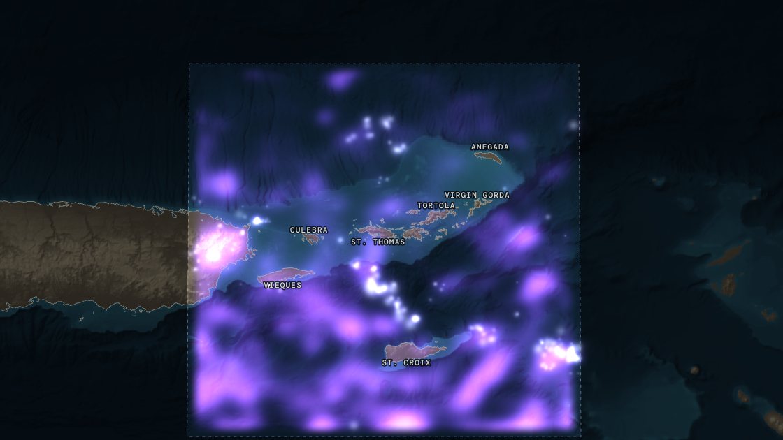
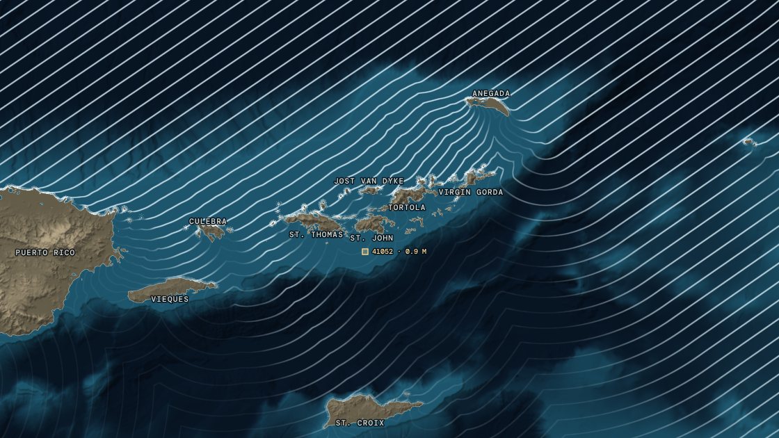
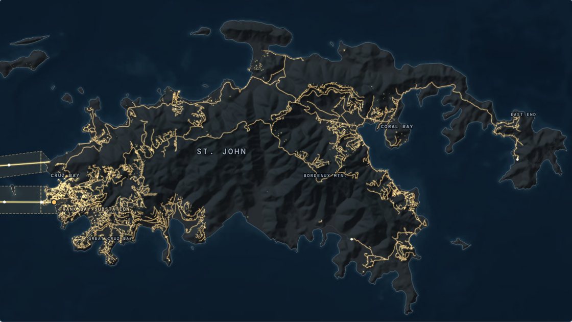
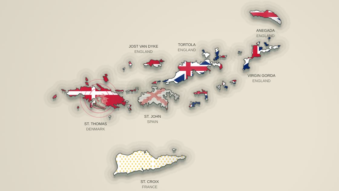
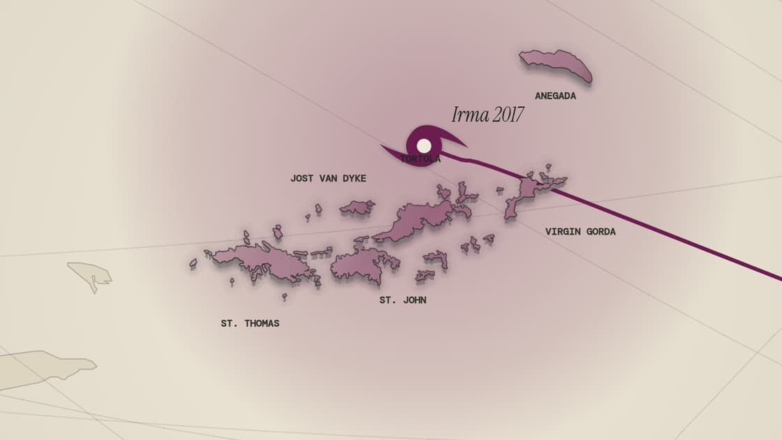
The Virgin Islands in 1672, each island drawn in the flag of the power that held it: Denmark on St. Thomas, Spain on St. John, France on St. Croix, England on the BVIHistory mapWho ruled the Virgin IslandsFive centuries of flags over every island, 1493 to today — each island wears the flag of whoever held it.Play the map →Hurricane Irma's track and wind field crossing the British Virgin Islands in September 2017Hurricane mapEvery major hurricane since 1851Hugo, Marilyn, Irma, Maria and the rest, replayed on their real tracks over the islands.Play the map →Puerto Rico and the Virgin Islands as one island 20,000 years ago, the sea 120 m lower, with St. Croix alone to the southIce age mapWhen the islands were oneThe sea drained to its ice-age low and risen back: every island parts on its real date.Play the map →The Virgin Islands at night: St. Thomas, St. John and the BVI in moonlit relief, every navigation light glowing in its colourNight mapEvery light, at nightAll the lighthouses and buoys flashing their real rhythm, and the horizon a boat sees from anywhere on the water.Play the map →The drained seabed between St. Thomas and St. Croix, with the charted internet cables crossing the basinSeabed mapThe cables under the seaEvery internet and power cable on the seabed, where NOAA's charts put it: Magens Bay, the basin to St. Croix, the islands lit by cable.Play the map →Every earthquake the USGS has recorded under Puerto Rico and the Virgin Islands since 1906, glowing over the seabed between the Puerto Rico Trench and the Muertos TroughEarthquake mapEvery earthquake under the islandsEvery quake the USGS has recorded since 1906, down to the sinking plate, the 1867 tsunami replayed and this month's quakes.Play the map →Saharan dust streaming west from Africa across the Atlantic to the Caribbean and the Virgin Islands in the summer of 2026, from NASA's GEOS-FP modelDust mapThe Sahara crossingA summer of Saharan dust crossing the Atlantic to the islands, measured from space and on the ground, and today's dust forecast.Play the map →Hurricane Irma's hurricane-force wind field over the British Virgin Islands on September 6, 2017, the islands lit red where the 64-knot radius reached them, over the seabed reliefWind mapThe wind the islands feltIrma, Maria and Dorian on their real tracks with their real wind fields, and the hours of hurricane-force wind on every island.Play the map →A year of lightning over the Virgin Islands from NOAA's GOES-19 satellite: violet where flashes were most frequent, thickest over the sea round St. Croix and over eastern Puerto RicoLightning mapA year of lightningEvery flash GOES-19 recorded over the islands in a year, slowed down for the biggest storms, and the hour storms come.Play the map →The February 2026 north swell's crests bending round the U.S. and British Virgin Islands over the seabed, the north shores lit by surfSwell mapNorth swell seasonThe winter's north swells bending round the islands onto the north shores, the storm behind the most powerful, and this week's forecast.Play the map →St. John at night with the power from St. Thomas running out along every road from the Frank Bay substation, the two cables lit across Pillsbury SoundUtility mapHow St. John gets its water and powerNo power plant, no river: the cables and the one waterline under Pillsbury Sound, a cistern under most roofs, and the trucks.Play the map →

Download this map — free

PNG — print quality2480px wideSVG — vectorscales to any sizePNG — web1240px wide

Free to use with credit to VIslandGuide. Coastlines from the US Census Bureau (public domain) and geoBoundaries (CC BY 4.0).

Where are the Virgin Islands?

The Virgin Islands lie at roughly 18°20′ N, 64°55′ W — about 40 miles (64 km) east of Puerto Rico, at the northern end of the Lesser Antilles where the Caribbean Sea meets the North Atlantic. They split into two territories that sit side by side on the map above: the U.S. Virgin Islands — St. Thomas, St. John, St. Croix and Water Island — and the British Virgin Islands — Tortola, Virgin Gorda, Jost Van Dyke, Anegada and some 55 smaller islands and cays. Both use the US dollar and keep Atlantic Standard Time year-round, but crossing between them is an international trip with a passport check.

U.S. Virgin Islands

US territory
Status
Unincorporated territory of the United States
Capital
Charlotte Amalie, St. Thomas
Land area
133.73 sq mi (346.36 km²)
Population
87,146 (2020 U.S. Census)
Highest point
Crown Mountain, St. Thomas — 1,555 ft

No passport needed for US citizens — it is US soil, so a flight from the mainland is a domestic flight.

British Virgin Islands

British Overseas Territory
Status
British Overseas Territory
Capital
Road Town, Tortola
Land area
59 sq mi (153 km²)
Population
28,054 (2010 census — the most recent full count published)
Highest point
Mount Sage, Tortola — 1,709 ft

A passport is required, including on a day-trip ferry from St. Thomas or St. John — that is an international border.

How far apart are the islands?

Every scheduled passenger ferry between the islands, shortest crossing first. Distance is measured dock to dock in a straight line — the boat's track is longer. Crossing times and fares come from the same data as the ferry schedules, so they stay in step.

CrossingIslandsDistanceTimeAdult fare
Crown Bay Marina → Phillips LandingSt. Thomas → Water Island1 mi15 min$10
Red Hook → Cruz BaySt. Thomas → St. John3.5 mi20 min$8.15
West End → Great HarbourTortola → Jost Van Dyke5.1 mi10–15 min$30
Hannah Bay → The BightTortola → Norman Island5.5 mi20–30 min$20
Trellis Bay → Spanish TownTortola → Virgin Gorda6.4 mi20 min$25
Cruz Bay → Great HarbourSt. John → Jost Van Dyke 🛂8.2 mi30 min$120
Charlotte Amalie → Cruz BaySt. Thomas → St. John9.4 mi45 min$13
Crown Bay → Cruz BaySt. Thomas → St. John10.2 mi35 min$20
Red Hook → Great HarbourSt. Thomas → Jost Van Dyke 🛂10.3 mi35 min$120
Red Hook → West EndSt. Thomas → Tortola 🛂10.5 mi30 min$65
Road Town → Spanish TownTortola → Virgin Gorda12.1 mi30 min$25
Road Town → Red HookTortola → St. Thomas 🛂16.5 mi45 min$65
Great Harbour → Spanish TownJost Van Dyke → Virgin Gorda20.7 mi60 min$80
Charlotte Amalie → Road TownSt. Thomas → Tortola 🛂21.8 mi45 min$60
Cruz Bay → Spanish TownSt. John → Virgin Gorda 🛂24.9 mi75 min$130
Road Town → Setting PointTortola → Anegada26.1 mi90 min$55
Red Hook → Spanish TownSt. Thomas → Virgin Gorda 🛂28.4 mi90 min$130
Spanish Town → Charlotte AmalieVirgin Gorda → St. Thomas 🛂33.8 mi90 min$130
Cruz Bay → Setting PointSt. John → Anegada 🛂38.3 mi1 hr 45 min$150
Red Hook → Setting PointSt. Thomas → Anegada 🛂41.1 mi2 hr$150
Gallows Bay → Charlotte AmalieSt. Croix → St. Thomas43.8 mi2 hr 10 min$85

🛂 marks an international crossing between the USVI and the BVI — passport required in both directions. St. Croix is the outlier: it sits roughly 44 miles south of St. Thomas across the Virgin Islands Trough, and the one ferry that makes the trip does not run on Tuesdays.

Every island on the map

Thirteen islands carry places on this map. The four U.S. Virgin Islands and the four main British Virgin Islands are where people stay; the rest are charter stops and day anchorages with a dock, a beach bar, or both.

U.S. Virgin Islands

St. Croix

USVI

The largest of the U.S. Virgin Islands by far, and the odd one out geographically — St. Croix sits roughly 40 miles south of the rest of the chain, across the Virgin Islands Trough. Most people fly in; the one passenger ferry, Christiansted to Charlotte Amalie, runs a single round trip a day, Wednesday through Monday, and takes 2 hr 10 min.

Land area
82.88 sq mi (214.66 km²)
Population
41,004 (2020 census)
Highest point
Mount Eagle — 1,165 ft (355 m)
Main town
Christiansted and Frederiksted
Airport
Henry E. Rohlsen International Airport (STX)
Ferry terminals
Frederiksted Cruise Pier, Christiansted Harbor Dock
Places on the map
41 marked

Figures: Wikipedia — Saint Croix. Checked 2026-09-14.

St. Thomas

USVI

The busiest of the Virgin Islands and the arrival point for most visitors — the territory's capital, its main airport, and its cruise piers are all here. Ferries to St. John leave from Red Hook on the east end; ferries to the BVI leave from Red Hook and the Charlotte Amalie waterfront.

Land area
32 sq mi (83 km²)
Population
42,261 (2020 census)
Highest point
Crown Mountain — 1,555 ft (474 m)
Main town
Charlotte Amalie
Airport
Cyril E. King International Airport (STT)
Ferry terminals
Red Hook Ferry Terminal, Charlotte Amalie Ferry Dock, Havensight Cruise Pier (West Indian Dock), Crown Bay Cruise Pier, Yacht Haven Grande Marina, Red Hook Car Barge Ramp
Places on the map
46 marked

Figures: Wikipedia — Saint Thomas, U.S. Virgin Islands. Checked 2026-09-14.

St. John

USVI

About 60% of St. John is protected as Virgin Islands National Park, which is why it stays green and undeveloped next to St. Thomas. There is no airport — everyone arrives by ferry, most of them on the 20-minute crossing from Red Hook into Cruz Bay.

Land area
19.6 sq mi (50.8 km²)
Population
3,881 (2020 census)
Highest point
Bordeaux Mountain — 1,286 ft (392 m)
Main town
Cruz Bay
Ferry terminals
Cruz Bay Ferry Terminal, Enighed Pond Car Barge Dock
Places on the map
42 marked

Figures: Wikipedia — Saint John, U.S. Virgin Islands. Checked 2026-09-14.

Water Island

USVI

The fourth U.S. Virgin Island, a short ferry hop off St. Thomas's south shore. Residential rather than resort — most day visitors come for Honeymoon Beach.

Land area
0.768 sq mi (1.989 km²)
Population
182 (2010 census)
Main town
Honeymoon Beach, Druif Bay
Ferry terminals
None — reached by private boat
Places on the map
4 marked

Figures: Wikipedia — Water Island, U.S. Virgin Islands. Checked 2026-09-14.

Lovango

USVI

A small island between St. Thomas and St. John, reached by private ferry — a restaurant, beach club and a handful of villas rather than a town.

Ferry terminals
Lovango Resort Dock
Places on the map
6 marked

British Virgin Islands

Tortola

BVI

The largest British Virgin Island and the territory's capital, government and charter-boat hub. Most BVI bareboat charters start here, and the ferries from St. Thomas land at West End or Road Town.

Land area
21.5 sq mi (55.7 km²)
Population
23,908 (2010 census)
Highest point
Mount Sage — 1,709 ft (521 m)
Main town
Road Town
Airport
Terrance B. Lettsome International Airport (EIS)
Ferry terminals
Road Town Ferry Terminal, Soper's Hole / West End Ferry Terminal, Village Cay Marina, Beef Island Ferry Dock (Trellis Bay)
Places on the map
25 marked

Figures: Wikipedia — Tortola. Checked 2026-09-14.

Anegada

BVI

The geological outlier: the only inhabited British Virgin Island built from coral and limestone rather than volcanic rock, which is why it is flat — barely 28 feet at its highest — while everything else in the chain is mountainous. It sits behind Horseshoe Reef, the largest barrier reef in the Caribbean.

Land area
14 sq mi (36 km²)
Population
450 (2024 census)
Highest point
highest natural elevation — 28 ft (8.5 m)
Main town
The Settlement
Ferry terminals
Setting Point Ferry Dock
Places on the map
16 marked

Figures: Wikipedia — Anegada. Checked 2026-09-14.

Virgin Gorda

BVI

Home to The Baths — the granite boulder formations that are the single most visited sight in the BVI — and to North Sound, the sheltered anchorage at the top of the island. Ferries run from Road Town and Trellis Bay on Tortola.

Land area
8 sq mi (21 km²)
Population
3,930 (2010 census)
Highest point
Gorda Peak — 1,370 ft (418 m)
Main town
Spanish Town
Airport
Virgin Gorda Airport
Ferry terminals
Spanish Town Ferry Dock (The Valley), Gun Creek Dock (North Sound)
Places on the map
17 marked

Figures: Wikipedia — Virgin Gorda. Checked 2026-09-14.

Jost Van Dyke

BVI

Fewer than 300 residents and one of the best-known beach-bar strips in the Caribbean — Great Harbour and White Bay, home of the Soggy Dollar. Reached by ferry from St. Thomas, St. John and Tortola.

Land area
3.1 sq mi (8 km²)
Population
298 (2010 census)
Highest point
Majohnny Hill — 1,054 ft (321 m)
Main town
Great Harbour
Ferry terminals
Great Harbour Entry Dock, White Bay Beach Landing
Places on the map
13 marked

Figures: Wikipedia — Jost Van Dyke. Checked 2026-09-14.

Cooper Island

BVI

A small BVI island on the east side of Sir Francis Drake Channel, with a single beach club, dive shop and mooring field.

Ferry terminals
Cooper Island Beach Club Dock
Places on the map
6 marked

Norman Island

BVI

An uninhabited BVI charter stop, best known for The Indians snorkel pinnacles and the Willy T floating bar in The Bight.

Ferry terminals
The Bight (Norman Island)
Places on the map
7 marked

Peter Island

BVI

A privately held BVI island south of Tortola, ringed by anchorages — Deadman's Bay is the one most charter itineraries stop at.

Ferry terminals
Peter Island Resort Dock
Places on the map
5 marked

Scrub Island

BVI

A small resort island off Tortola's northeast coast, connected by private launch from Trellis Bay.

Ferry terminals
Scrub Island Marina
Places on the map
6 marked

Every place marked on the map

All 234 places plotted above, by island. Beaches link through to their own guide with directions, parking and taxi fares.

St. Croix

41 places

Ports

Frederiksted Cruise Pier · Christiansted Harbor Dock

Bars

Rhythms at Rainbow Beach · Brew STX · Stiix Bar & Restaurant · Deep End Bar & Grill

Food

Tutto Bene · Savant Restaurant · Polly's at the Pier · Rum Runners

Sights

Christiansted National Historic Site · Fort Christiansvaern · Point Udall · St. George Village Botanical Garden · Buck Island Reef NM (Day Trip)

Shopping

Christiansted Boardwalk (Pan Am Pavilion) · Gallows Bay Shopping District

St. Thomas

46 places

Ports

Red Hook Ferry Terminal · Charlotte Amalie Ferry Dock · Havensight Cruise Pier (West Indian Dock) · Crown Bay Cruise Pier · Yacht Haven Grande Marina · Red Hook Car Barge Ramp

Bars

Duffy's Love Shack · Iggies Beach Bar · Latitude 18 · XO Bistro · Tap & Still · Frenchtown Brewing

Food

Oceana Restaurant & Bistro · Gladys' Café · Greenhouse Restaurant · Old Stone Farmhouse · Petite Pump Room · Mafolie Restaurant · Room With A View · Cuzzins Caribbean Restaurant

Sights

Fort Christian · 99 Steps · Blackbeard's Castle · Mountain Top · Paradise Point Skyride · Drake's Seat · Coral World Ocean Park

Shopping

Main Street (Dronningens Gade) · Havensight Mall · Vendors Plaza

St. John

42 places

Ports

Cruz Bay Ferry Terminal · Enighed Pond Car Barge Dock

Bars

Woody's Seafood Saloon · The Longboard · Joe's Rum Hut · Skinny Legs Bar & Grill · High Tide Bar & Seafood Grill · Driftwood Dave's

Food

Lime Inn · Extra Virgin Bistro · Morgan's Mango · Rhumb Lines · Sun Dog Café · Miss Lucy's · Shipwreck Landing

Sights

VI National Park Visitor Center · Annaberg Sugar Plantation Ruins · Reef Bay Trail · Peace Hill · Catherineberg Ruins · Lind Point Trail & Salomon Beach

Shopping

Mongoose Junction · Wharfside Village

Water Island

4 places

Lovango

6 places

Ports

Lovango Resort Dock

Food

Waterfront Restaurant (Lovango) · The Sandpit (Lovango)

Sights

Lovango Cay Snorkeling

Shopping

The Shops on Lovango

Tortola

25 places

Ports

Road Town Ferry Terminal · Soper's Hole / West End Ferry Terminal · Village Cay Marina · Beef Island Ferry Dock (Trellis Bay)

Bars

Pusser's Landing · Myetts Garden Grille & Bar · Rhythm & Sands (was Quito's) · Bomba's Surfside Shack

Food

Village Cay Restaurant & Bar · Brandywine Bay Restaurant · The Dove Restaurant · Capriccio di Mare

Sights

Sage Mountain National Park · Callwood Rum Distillery · Fort Recovery · J.R. O'Neal Botanic Gardens

Shopping

Road Town Market Square · Soper's Hole Wharf & Market

Anegada

16 places

Ports

Setting Point Ferry Dock

Bars

Cow Wreck Beach Bar · Big Bamboo Beach Bar (Loblolly Bay) · Neptune's Treasure Bar

Food

Anegada Beach Club · Lobster Trap Restaurant · Potter's by the Sea · Anegada Reef Hotel

Sights

Anegada Flamingo Colony · Horseshoe Reef (Dive & Snorkel) · The Settlement (Anegada Village)

Virgin Gorda

17 places

Ports

Spanish Town Ferry Dock (The Valley) · Gun Creek Dock (North Sound)

Bars

Mad Dog Bar & Grill · Bath & Turtle Restaurant & Bar · Chez Bamboo

Food

The Rock Café · Fischer's Cove Beach Restaurant · Top of the Baths Restaurant

Sights

The Baths National Park · Copper Mine Point Ruins · Gorda Peak National Park

Shopping

Virgin Gorda Yacht Harbour Shops

Jost Van Dyke

13 places

Ports

Great Harbour Entry Dock · White Bay Beach Landing

Bars

Soggy Dollar Bar · Foxy's Tamarind Bar · Ivan's Stress Free Bar · One Love Bar & Restaurant

Food

Ali Baba's Heavenly Bar & Restaurant · Corsairs Beach Bar & Restaurant

Sights

Diamond Cay National Park

Cooper Island

6 places

Ports

Cooper Island Beach Club Dock

Food

Cooper Island Beach Club

Sights

RMS Rhone Wreck (Salt Island) · Sail Caribbean Divers (Cooper Island)

Shopping

Cooper Island Beach Club Boutique

Norman Island

7 places

Ports

The Bight (Norman Island)

Beaches

The Bight

Bars

Willie T's Floating Bar (Norman Island) · Pirates Bight (Norman Island)

Sights

The Indians (Norman Island) · Norman Island Treasure Caves · Pelican Island Snorkel

Peter Island

5 places

Ports

Peter Island Resort Dock

Food

Peter Island Resort Restaurant · Drunken Pelican (Peter Island Yacht Club)

Scrub Island

6 places

Ports

Scrub Island Marina

Bars

One Shoe Beach Bar (Scrub Island)

Food

Donovan's Reef (Scrub Island) · Cardamom & Co. (Scrub Island) · Marina Cay Bar & Grill

Shopping

Scrub Island Outpost

Virgin Islands geography questions

Where are the Virgin Islands?

The Virgin Islands sit at roughly 18°20′ N, 64°55′ W, about 40 miles (64 km) east of Puerto Rico. They mark the northern end of the Lesser Antilles, where the Caribbean Sea meets the North Atlantic, and form the western end of the Leeward Islands chain.

Which Virgin Islands are American and which are British?

St. Thomas, St. John, St. Croix and Water Island are the U.S. Virgin Islands, an unincorporated U.S. territory. Tortola, Virgin Gorda, Jost Van Dyke, Anegada and around 55 smaller islands and cays are the British Virgin Islands, a British Overseas Territory. They are neighbours — St. John and Tortola are about four miles apart — but they are separate customs and immigration jurisdictions, so crossing between them is an international trip.

What ocean are the Virgin Islands in?

Both. The islands straddle the boundary: their southern shores face the Caribbean Sea and their northern shores face the North Atlantic Ocean. Anegada, the northernmost of the British Virgin Islands, sits fully on the Atlantic side behind Horseshoe Reef.

How many Virgin Islands are there?

The U.S. Virgin Islands comprise four main islands — St. Thomas, St. John, St. Croix and Water Island — plus about 50 surrounding cays. The British Virgin Islands comprise around 60 islands, islets and cays, of which four are significantly populated: Tortola, Virgin Gorda, Jost Van Dyke and Anegada.

How big are the Virgin Islands?

The U.S. Virgin Islands cover 133.73 square miles (346.36 km²) with a population of 87,146 at the 2020 census. The British Virgin Islands cover 59 square miles (153 km²) with 28,054 residents at the 2010 census. St. Croix alone accounts for more than half the USVI land area.

What is the highest point in the Virgin Islands?

Mount Sage on Tortola is the highest point in the archipelago at 1,709 feet (521 m). Crown Mountain on St. Thomas is the highest point in the U.S. Virgin Islands at 1,555 feet (474 m). The islands are volcanic and steep — the exception is Anegada, a flat coral and limestone island whose highest ground is about 28 feet.

What time zone are the Virgin Islands in?

Atlantic Standard Time (UTC−4), all year. Neither territory observes daylight saving, so the islands are one hour ahead of US Eastern Time in winter and level with it during US daylight saving.

What currency do the Virgin Islands use?

The US dollar, in both territories. The British Virgin Islands adopted the US dollar as their official currency despite being a British Overseas Territory, so you do not need to change money crossing between the USVI and the BVI.

Do you need a passport to visit the Virgin Islands?

US citizens do not need a passport to enter the U.S. Virgin Islands — it is US territory, and a government-issued photo ID is enough for travel from the US mainland. A passport is required to enter the British Virgin Islands, including on a day-trip ferry from St. Thomas or St. John, because that is an international border crossing.

How far apart are the Virgin Islands?

The main chain is compact: Red Hook on St. Thomas to Cruz Bay on St. John is about 4 miles, a 20-minute ferry, and St. John to Tortola is a similar hop across the Narrows. Ferries link the whole northern group in under an hour. St. Croix is the outlier — roughly 44 miles south of St. Thomas across the Virgin Islands Trough. Most visitors fly; the single passenger ferry between Christiansted and Charlotte Amalie takes 2 hr 10 min and does not run on Tuesdays.
Explore the islands live

The same map that runs on the VIslandGuide home page. Tap an island for today's ferries, weather, taxi fares and cruise-ship crowds.

Charting the islands…

VIslandGuide

Tap an island. Dive in.

© OpenStreetMap contributors · © Protomaps

13 islands · one guide

Where are you headed?

Tap an island on the map — or a card below — to open its beaches, ferries and live conditions.

Share this page

Also on VIslandGuide