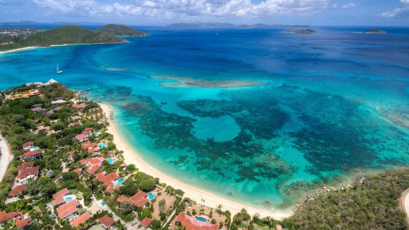
A long curve of white sand on Virgin Gorda's north-west coast, where the island narrows, with a reef across the bay that keeps the water inside it shallow and calm. Nothing is built on it: no bar, no chairs, no restrooms. A few minutes up the North Sound Road from the Spanish Town ferry dock, and down an unpaved lane.
Sargassum offshore · Choppy — NNE swell into the bay
10 am–1 pm
None
Gentle · 1.7 ft
36%
Tue, Nov 10
Think twice
Sargassum offshore · No cruise crowd today
1 pm–4 pm
None
Gentle · 1.2 ft
43%
The call is the same one our beach report makes, refreshed every half hour: the swell reaching the bay (Open-Meteo's marine forecast off the island), the cruise passengers our crowd model puts on the sand, NOAA's sargassum satellite and the rain forecast. It is a model, not a lifeguard's report — there are no lifeguards at Savannah Bay, and the sea in front of you has the last word. The bars under each call are the hours from 8 am to 5 pm. Today's beach report
The taxi fare from the ferry, the boats across from Tortola and St. Thomas, the ships off the island, today's beach and weather reads and the island around it — each one opens the full page.
Savannah Bay from OpenStreetMap: the sand, the North Sound Road along the narrow middle of the island, the unpaved access road down to the beach, and the next cove to the north-east — each pin where OpenStreetMap's mappers put it. The reef and the anchorage are not on OpenStreetMap, so they have no pin. Tap a pin for its section.
Getting there
How to get to Savannah Bay
Savannah Bay is on the north-west coast of Virgin Gorda, where the island narrows between The Valley and the hills that run on to North Sound. From the ferry dock in Spanish Town the North Sound Road climbs north-east; where it runs along the narrow middle of the island, the Savannah Bay Access Road — unpaved, on OpenStreetMap's map — turns off toward the sea and runs down to the sand. Open-air taxis meet the ferries at Spanish Town and charge the official BVI fare in the table: per person, and less each as the party grows.
Ferries cross to Spanish Town from Road Town and from Trellis Bay, by Tortola's airport; from St. Thomas and St. John there are direct international boats on some days of the week, and you clear BVI customs at the dock. By sea, sailors anchor inside the reef in settled weather.
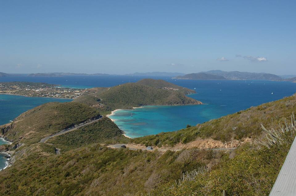
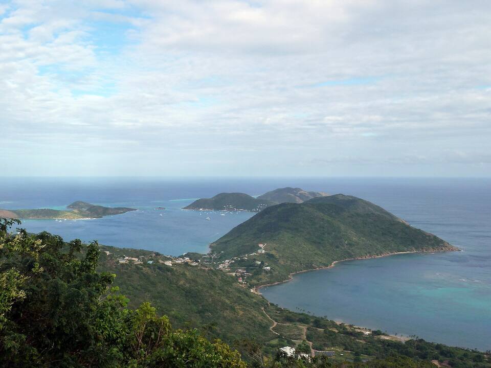
The view south-west from Gorda Peak (2006): the North Sound Road winding down to the narrow middle of the island, the reef-sheltered water of Savannah Bay in the centre, The Valley flat beyond, and Tortola on the horizon Photo: Jerrye and Roy Klotz MD, CC BY-SA 3.0
One way, per person by the size of the party: fares set by the BVI Road Traffic (Passenger Fares) Regulations (rates revised December 2022). Drive times are Google's for an ordinary day. Fare calculator for any two stops
Agree the fare and a pick-up time before you set off: there is no taxi stand at Savannah Bay, and nobody passing to wave down.
In a rental car, take the access road slowly — it is unpaved — and leave nothing in the car.
From the U.S. Virgin Islands it is an international crossing: bring a passport and expect the BVI entry fees.
On a day trip from Tortola, check the last ferry back to Road Town or Trellis Bay before you settle in.
Savannah Bay: entry, the law on beaches, and papers from St. Thomas
Savannah Bay has no gate, no posted hours and no entry fee. It is not a national park: the National Parks Trust's six Virgin Gorda parks are The Baths, Devil's Bay, Spring Bay, Copper Mine Point, Little Fort and Gorda Peak. What a visitor coming over from St. Thomas or St. John does pay is the BVI's charges at the border, on the Spanish Town ferry dock.
Charges
The beach
Free
BVI environmental and tourism levy, arriving from the USVI
$10
BVI departure tax, leaving by ferry
$20
The same, for BVI residents
$15
The levy and the departure tax are the UK government's figures for the BVI; from Tortola or anywhere else in the BVI none of them apply. Nothing is for sale or for rent at the beach.
Papers and the law
✓Using the beach — "All BVI beaches are public," the Minister for Natural Resources told the House of Assembly on March 9, 2023
✓A passport, for everyone arriving from the USVI — U.S. citizens and children included
✓The BVI's online ED card — required of every traveller entering the BVI since January 1, 2025
✕Swimming in heavy sargassum — the Government's advice when mats of it come ashore, to avoid skin irritation
Sand, water and the reef — and nothing else. Below is what OpenStreetMap maps and what the territory's sources say; where we lean on sailors' and travel guides' accounts, we say so.
Getting in
The access road
The Savannah Bay Access Road leaves the North Sound Road on the island's narrow middle and runs down to the back of the sand. OpenStreetMap maps it as unpaved. We found no car park on any map and no attendant; travel guides describe a small parking area at the end of the road. There is no taxi stand: book your ride back before you go.
The beach
The long stretch of sand
White sand along the head of the bay, facing north-west, with low scrub behind it rather than palms — bring your own shade. OpenStreetMap's outline of this stretch is about 550 m long. Travel guides agree there are no restrooms, no food or drink and no chairs; we found none either.
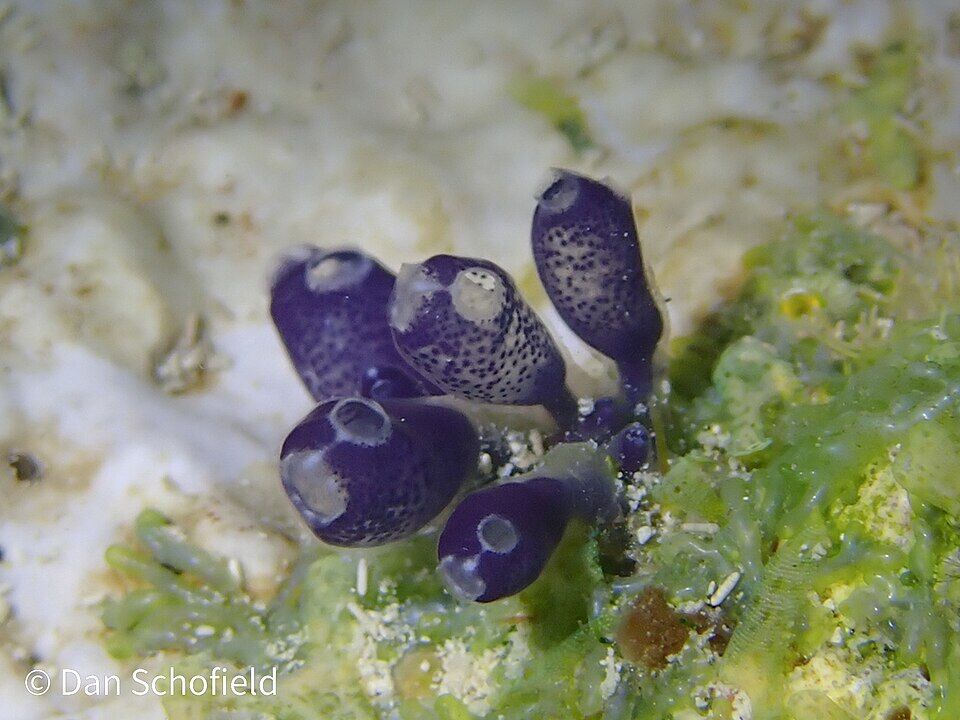
A reef runs across the bay, and inside it the water is shallow over sand, sailing guides say — calm on most days, with the deeper water beyond the reef. The fish and the coral are along the reef and the rocks at the ends of the beach: bluebell tunicates, small purple sea squirts, were recorded on iNaturalist in the bay in June 2022. Swim out only as far as you can comfortably swim back, and stay off the coral.
The beach
The west stretch
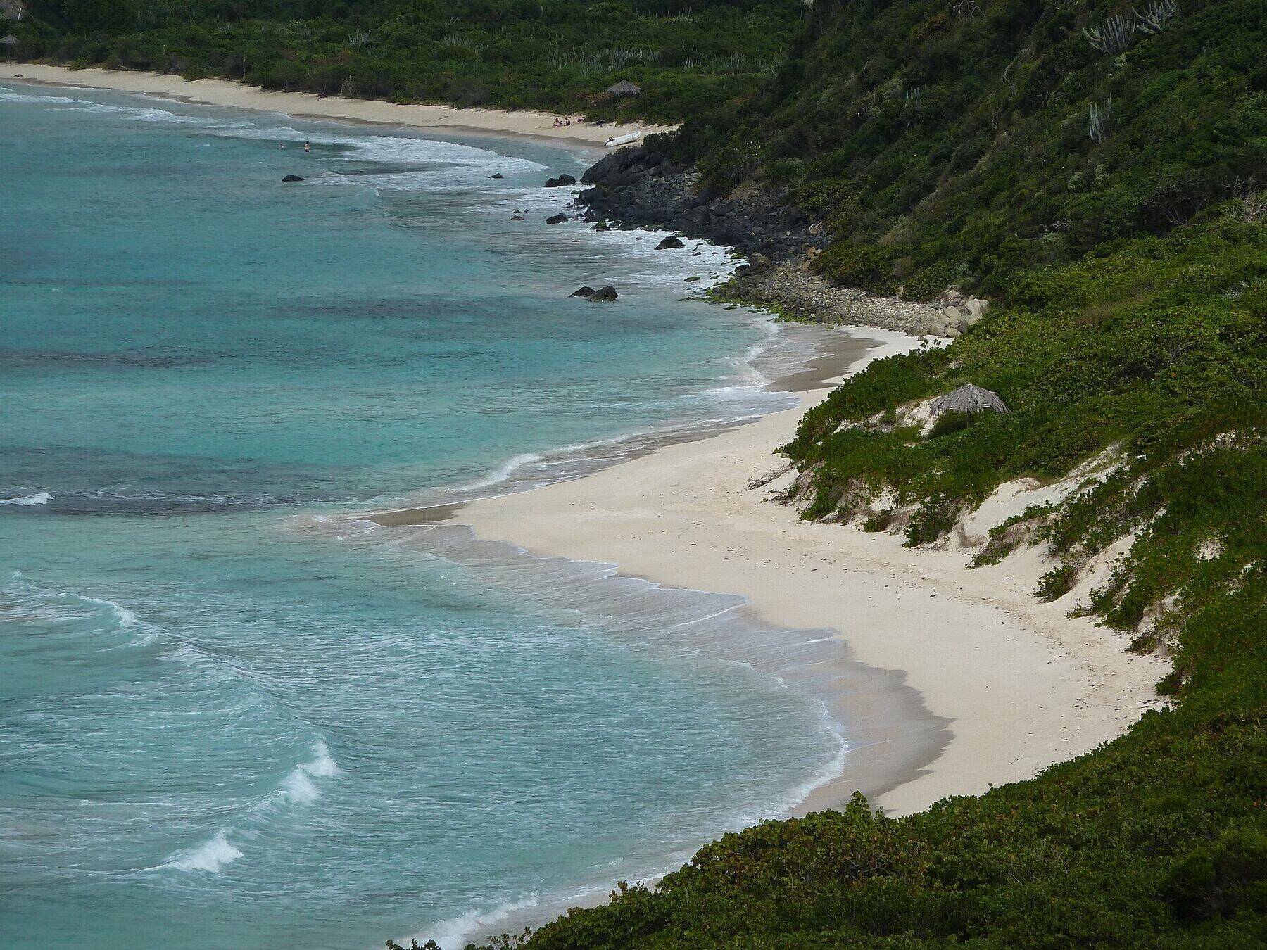
OpenStreetMap maps a second, shorter stretch of sand to the south-west, toward the point — the same bay, a short walk along the shore. The hill above it is where the photo at the top of this page was taken.
By boat
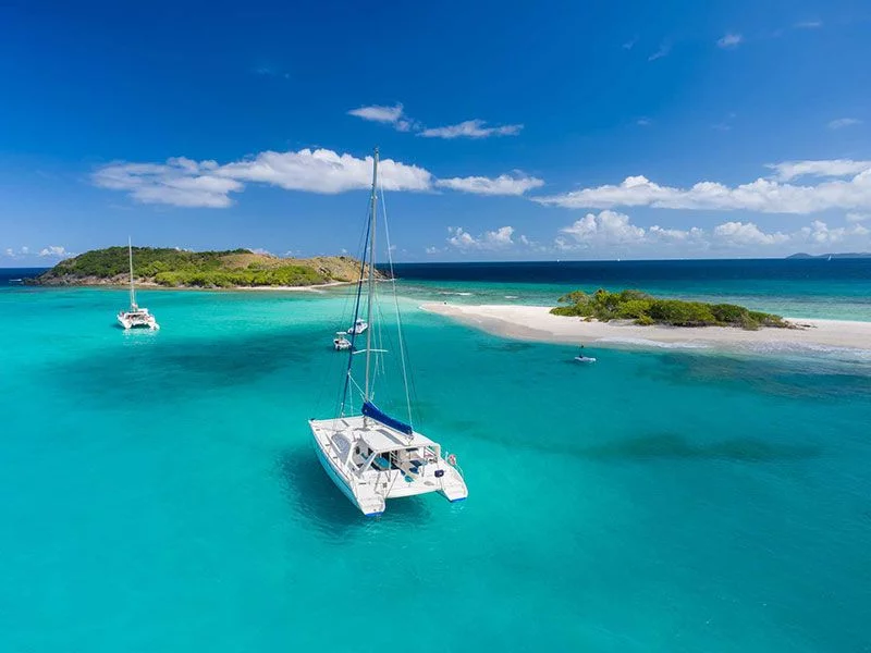
Anchoring inside the reef
Savannah Bay is an anchorage, not a mooring field: there are no balls, and sailing guides describe anchoring in about 10 to 12 ft of sand inside the reef, coming in through the gap at its southern end — settled weather only, and with the chart. Our charter pages list it among the BVI anchorages.
Past the rocks at the north-east end of the sand, OpenStreetMap maps another beach of about 350 m with a wetland behind it, unnamed on its map; sailing guides name Pond Bay as Savannah Bay's neighbour, and Mahoe Bay lies on along the coast, under the villas on the hill. Nail Bay Road leaves the North Sound Road just behind them; OpenStreetMap maps no path along the shore from Savannah Bay.
In July 2025 Handsome Bay, on the other side of the island's neck, had what the district representative called one of the largest buildups of sargassum seaweed in over a decade, and the Government advised against swimming where heavy mats come ashore. NOAA's satellite reading for the whole coast is part of the call at the top of the page.
The reason to come: shallow, calm water over sand behind the reef, the kind travel guides recommend for small children and anyone who wants to float for an hour. There are no lifeguards — keep children within reach.
Bring your own mask and fins — nobody rents them here — and snorkel along the reef and the rocks at the ends of the beach. Go on a calm morning, with a buddy, and keep clear of any boat coming in through the gap in the reef.
Walk the beach from the access road to the west stretch, and on to the rocks at the north-east end and back. The card at the top of the page has tonight's sunset time.
The North Sound Road carries on north-east from Savannah Bay, climbing past Gorda Peak to the overlook above North Sound and down to Gun Creek and Leverick Bay. The posted taxi fare runs from Spanish Town to North Sound.
South-west of Savannah Bay, round the point toward Spanish Town, is Little Dix Bay, where Laurance Rockefeller founded the resort in 1964. It reopened in January 2020 after a four-year closure and rebuild; it is a resort, so check its own site for what is open to visitors who are not staying there.
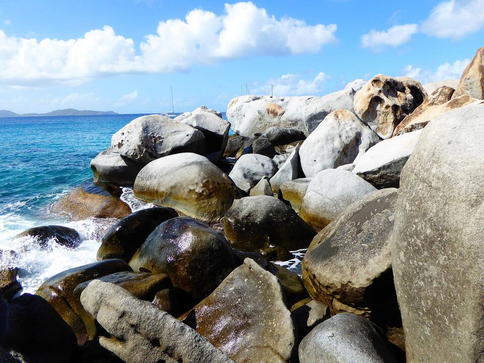
The granite boulders and grottos of The Baths are at the island's south-west tip, the other side of Spanish Town: a national park with an entry fee, opening hours, a bar on the sand and the Caves trail to Devil's Bay. Do The Baths when it opens and the crowds are thin, then come to Savannah Bay for a quiet swim.
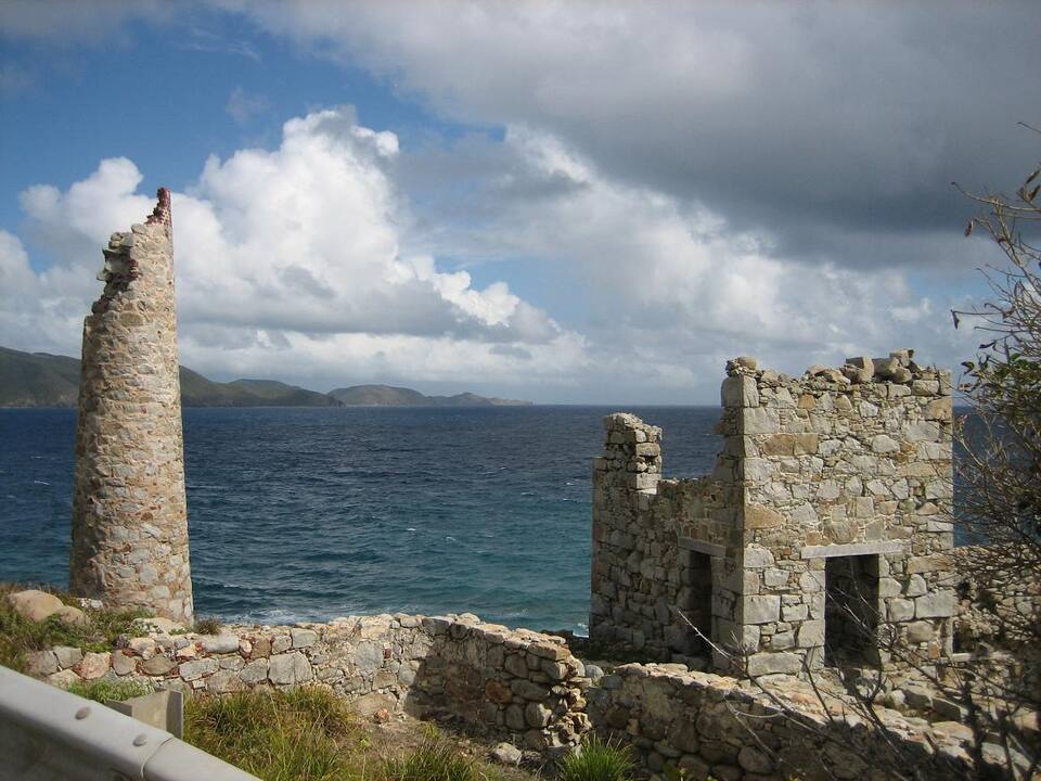
The stone chimney and ruined buildings of the old copper mine on the cliffs at the island's south-east end, a National Parks Trust site. A short taxi ride from Spanish Town.
There is nothing to buy at Savannah Bay: bring water, food and shade, and take your rubbish home. There are no bins we know of.
Spanish Town is a few minutes back down the road: the bars and restaurants round the Virgin Gorda Yacht Harbour, by the ferry dock, are the nearest places to eat that we can source.
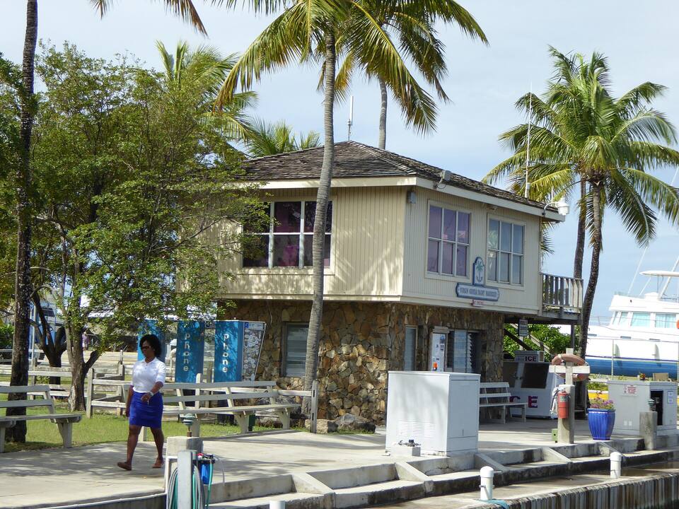
A building at the Virgin Gorda Yacht Harbour in Spanish Town, under the palms beside the docks Photo: Mattes, CC BY 2.0 de
At the beach
Bring your ownNothing is sold here. A cooler, water, and an umbrella for shade.
In Spanish Town
The Yacht HarbourRestaurants, bars and shops round the marina by the ferry dock.
The Virgin Gorda guideWhere to eat across the island, North Sound included, and who closes for the autumn.
Weather & sea
Savannah Bay weather and the best time to go
Warm all year: highs in the mid-80s °F, a steady easterly trade wind and short tropical showers rather than all-day rain. December to April is the dry season and the busy one; June to November is hurricane season.
Savannah Bay faces north-west, so the island shelters it from the easterly trade-wind sea, and the reef across the bay takes most of what is left: on most days the water inside is flat. Its trouble is the winter north swell, from storms far out in the North Atlantic, which can break on the reef and push into the bay for a day or two. The call at the top of the page reads the swell every half hour.
The next 7 days on Virgin Gorda
Day
Sky
High / low
Rain
Wind
Seas offshore
Today
Thunderstorms
85° / 80°F
99%
SW 18 mph, gusts 24
2.8 ft
Tomorrow
Thunderstorms
83° / 80°F
88%
WSW 20 mph, gusts 27
3.4 ft
Sun, Nov 8
Drizzle
85° / 81°F
82%
W 13 mph
2.9 ft
Mon, Nov 9
Drizzle
84° / 82°F
36%
NW 8 mph
2.2 ft
Tue, Nov 10
Drizzle
83° / 81°F
46%
NE 13 mph
1.8 ft
Wed, Nov 11
Overcast
84° / 83°F
20%
ENE 13 mph
2.1 ft
Thu, Nov 12
Drizzle
84° / 82°F
25%
ESE 11 mph
2.6 ft
Open-Meteo forecast for Virgin Gorda, refreshed every half hour. The seas are offshore; how much of it reaches the sand is the call above. BVI weather & sailing week · North swell season
Sea temperature by month
80°Jan
80°Feb
80°Mar
81°Apr
83°May
85°Jun
85°Jul
85°Aug
86°Sep
86°Oct
84°Nov
82°Dec
Daily-mean sea-surface temperature off Virgin Gorda, averaged 2021–2024 (Open-Meteo marine reanalysis): warmest in Sep (86.3°F), coolest in Feb (79.5°F).
Cruise crowds
Cruise ships and the crowd at Savannah Bay
Virgin Gorda has no cruise pier: small ships — sailing yachts, expedition and small luxury vessels — anchor off Spanish Town or in North Sound and send their guests ashore by tender. Most of them go to The Baths; a few find their way to Savannah Bay, and on a day with no ships off the island the beach is yours.
15 of the next 31 days have a ship in off Virgin Gorda. The busiest at Savannah Bay, by our model:
Sun, Nov 29 — 1 ship, 148 guests in port. Quiet: ~10 expected here
Mon, Nov 30 — 1 ship, 110 guests in port. Quiet: ~10 expected here
Thu, Dec 3 — 2 ships, 284 guests in port. Quiet: ~10 expected here
Sat, Dec 5 — 2 ships, 460 guests in port. Quiet: ~10 expected here
Our crowd model, not a head count: it puts about 8% of the passengers of the small ships at Virgin Gorda (off Spanish Town and in North Sound) on Savannah Bay; past 500 on the sand we call it packed. The big ships in Road Town send their excursions to The Baths, not here, in the model. The same model makes the call at the top of the page.
No — there is no public live webcam at Savannah Bay. Virgin Gorda's one live camera is at Saba Rock in North Sound, at the island's north-east end: it shows the boats in the sound. We would rather say so than show a still photo dressed up as live.
The National Parks Ordinance sets up the Trust that later draws up the territory's plans for protected areas.
1964
Little Dix Bay, next door
Laurance Rockefeller founds the Little Dix Bay resort, round the point to the south-west.
1974
Gorda Peak
Rockefeller gives the land at the top of the island, the hill above the North Sound Road, for Gorda Peak National Park.
2008
Proposed for protection
Lawmakers approve the Trust's Protected Areas System Plan 2007–2017, which lists Savannah Bay among the Virgin Gorda sites slated for protection, the BVI Beacon reported in 2020. In October 2026 it is still not among the Trust's parks.
2016–2020
Little Dix rebuilt
Little Dix Bay closes for refurbishment in 2016, is damaged by Hurricane Irma in September 2017, and reopens in January 2020 after four years.
March 9, 2023
"All BVI beaches are public"
After complaints that an estate at Little Trunk Bay, on the island's south-west coast, was blocking the way to the sand, the Minister for Natural Resources tells the House of Assembly that every beach in the territory is public.
July 2025
Sargassum at Handsome Bay
Handsome Bay, across the island's neck from Savannah Bay, fills with one of the largest buildups of sargassum seen in over a decade; on August 1 the Government advises against swimming where heavy mats come ashore.
Nothing is sold at Savannah Bay and there are no restrooms: bring water, food, shade and a bag for your rubbish. Spanish Town is the nearest place to buy any of it.
Shade is yours to bring
The sand is backed by low scrub, not palms. An umbrella or a pop-up shade makes the difference by late morning.
Book the ride back
There is no taxi stand and little passing traffic on the access road. Agree a pick-up time with your driver, or keep their number.
No lifeguards
We found none. Stay where you can stand unless you are a strong swimmer, and snorkel with someone.
Reef shoes help
The sand is soft, but the reef and the rocks at the ends of the beach are not. Do not stand on coral.
Mornings for snorkelling
The water is usually calmest early, before the afternoon breeze. In a winter north swell, stay inside the reef or skip the snorkel.
No. Savannah Bay has no gate and no entry fee, and it is not a national park. Every beach in the British Virgin Islands is public, as the Minister for Natural Resources told the House of Assembly in 2023. Visitors arriving from the U.S. Virgin Islands pay the BVI's own border charges at the ferry dock.
Where is Savannah Bay?
On the north-west coast of Virgin Gorda in the British Virgin Islands, where the island narrows between The Valley and the hills that run on to North Sound. An unpaved access road runs down to it from the North Sound Road, a few minutes from Spanish Town.
How do you get to Savannah Bay from the ferry?
Take a taxi from the ferry dock in Spanish Town: about 6 minutes (3 km) by road, up the North Sound Road and down the access road to the beach. The official fare is $10 for one rider, $6 each for three or more. Ferries reach Spanish Town from Road Town and Trellis Bay on Tortola, and direct from St. Thomas and St. John on some days.
How much is a taxi to Savannah Bay?
Virgin Gorda's taxis charge the official BVI fares, per person and less each as the party grows. From the Spanish Town ferry dock to Savannah Bay it is $10 for one rider, $6 each for three or more. Agree the fare and a pick-up time before you set off: there is no taxi stand at the beach.
Are there facilities at Savannah Bay?
No. There are no restrooms, showers, bar, food, chairs or lifeguards at Savannah Bay, and travel guides agree on it. Bring water, food and shade, and take your rubbish with you. The nearest places to eat are in Spanish Town.
Is Savannah Bay good for snorkelling?
Yes, on a calm day. A reef runs across the bay; snorkel along it and the rocks at the ends of the beach. Inside the reef the water is shallow over sand. Bring your own gear — nothing is rented here — and do not snorkel alone.
Is Savannah Bay good for children?
On most days, yes: inside the reef the water is shallow and calm. There are no lifeguards and no shade on the sand, so keep children within reach and bring an umbrella and water.
Is Savannah Bay crowded?
Rarely. It is one of Virgin Gorda's quiet beaches: the day boats and ship excursions go to The Baths. The call at the top of this page reads each day's ship crowd from the small ships off the island.
Can you anchor at Savannah Bay?
Sailing guides describe anchoring in about 10 to 12 ft of sand inside the reef, entering through the gap at its southern end, in settled weather only. There are no mooring balls. Use the chart, and keep out in a north swell.
Is Savannah Bay a national park?
No. The National Parks Trust's 2007–2017 Protected Areas System Plan proposed protecting it, but in October 2026 the Trust's Virgin Gorda parks are The Baths, Devil's Bay, Spring Bay, Copper Mine Point, Little Fort and Gorda Peak.
Savannah Bay or The Baths?
The Baths has the granite boulders, the grottos and the Caves trail, a bar and bathrooms — and an entry fee, opening hours and the day-boat crowds. Savannah Bay has a long, empty beach and calm water inside a reef, and nothing else. Many visitors do The Baths early and swim at Savannah Bay after.
Is there a webcam at Savannah Bay?
No public live camera. Virgin Gorda's only live webcam is at Saba Rock in North Sound, at the island's north-east end, and it shows the boats in the sound.
Photo & map credits
Savannah Bay from the hill above it: white sand curving away under the scrub, the reef showing dark through the turquoise water, a rocky point and more sand beyond (December 2010) — Gruepig, CC BY-SA 4.0, via Wikimedia Commons (resized).
The view south-west from Gorda Peak (2006): the North Sound Road winding down to the narrow middle of the island, the reef-sheltered water of Savannah Bay in the centre, The Valley flat beyond, and Tortola on the horizon — Jerrye and Roy Klotz MD, CC BY-SA 3.0, via Wikimedia Commons (resized).
Bluebell tunicates, small purple sea squirts, on the reef rock in Savannah Bay (June 2022) — Dan Schofield, CC BY 4.0, via Wikimedia Commons (resized).
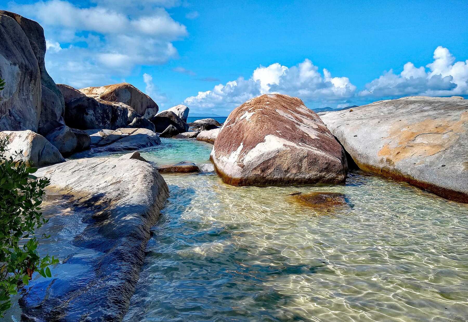
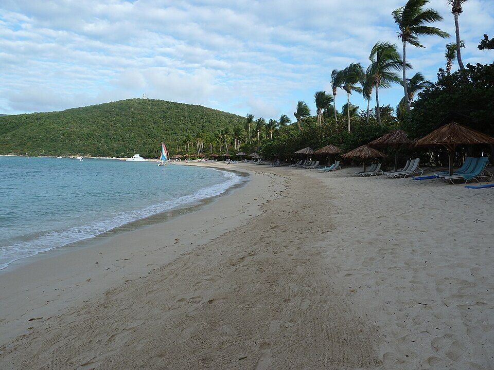
The beach at Little Dix Bay, the resort beach south-west of Savannah Bay, with loungers under thatched umbrellas (December 2010) — Gruepig, CC BY-SA 4.0, via Wikimedia Commons (resized).
North Sound from the overlook on the North Sound road: the sound and its islands, the road winding down to the shore — Gruepig, CC BY-SA 4.0, via Wikimedia Commons (resized).
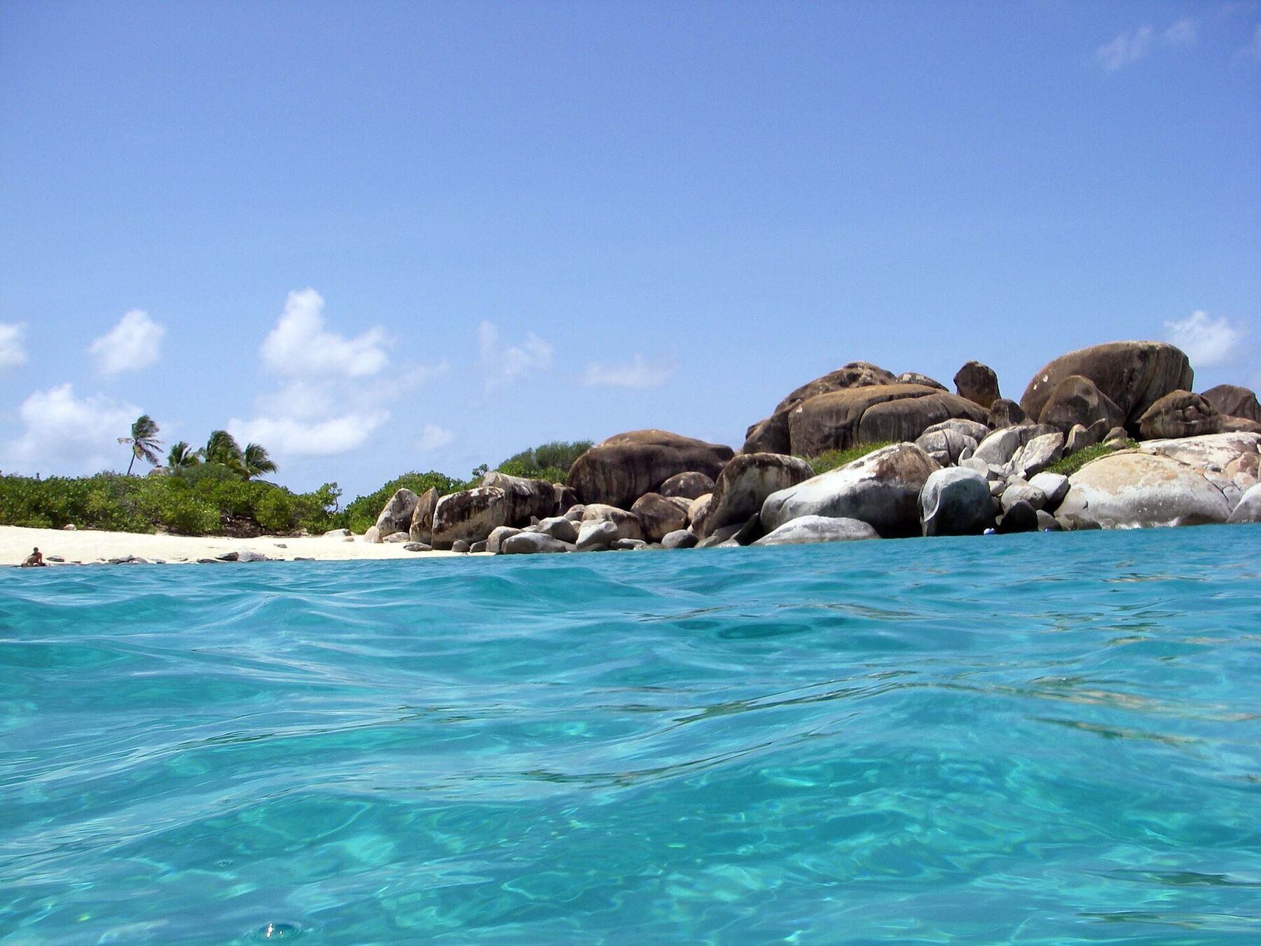
The Baths from the water: the white sand on the left, the granite boulders stacked along the shore to the right (2007) — Daniel Lobo, CC BY 2.0, via Wikimedia Commons (resized).
A building at the Virgin Gorda Yacht Harbour in Spanish Town, under the palms beside the docks — Mattes, CC BY 2.0 de, via Wikimedia Commons (resized).
The stone chimney and ruined mine buildings at Copper Mine, above the sea on Virgin Gorda — Legis, Public domain, via Wikimedia Commons (resized).
Granite boulders piled along the shore at The Baths, with the sea breaking between them — Mattes, CC BY 2.0 de, via Wikimedia Commons (resized).
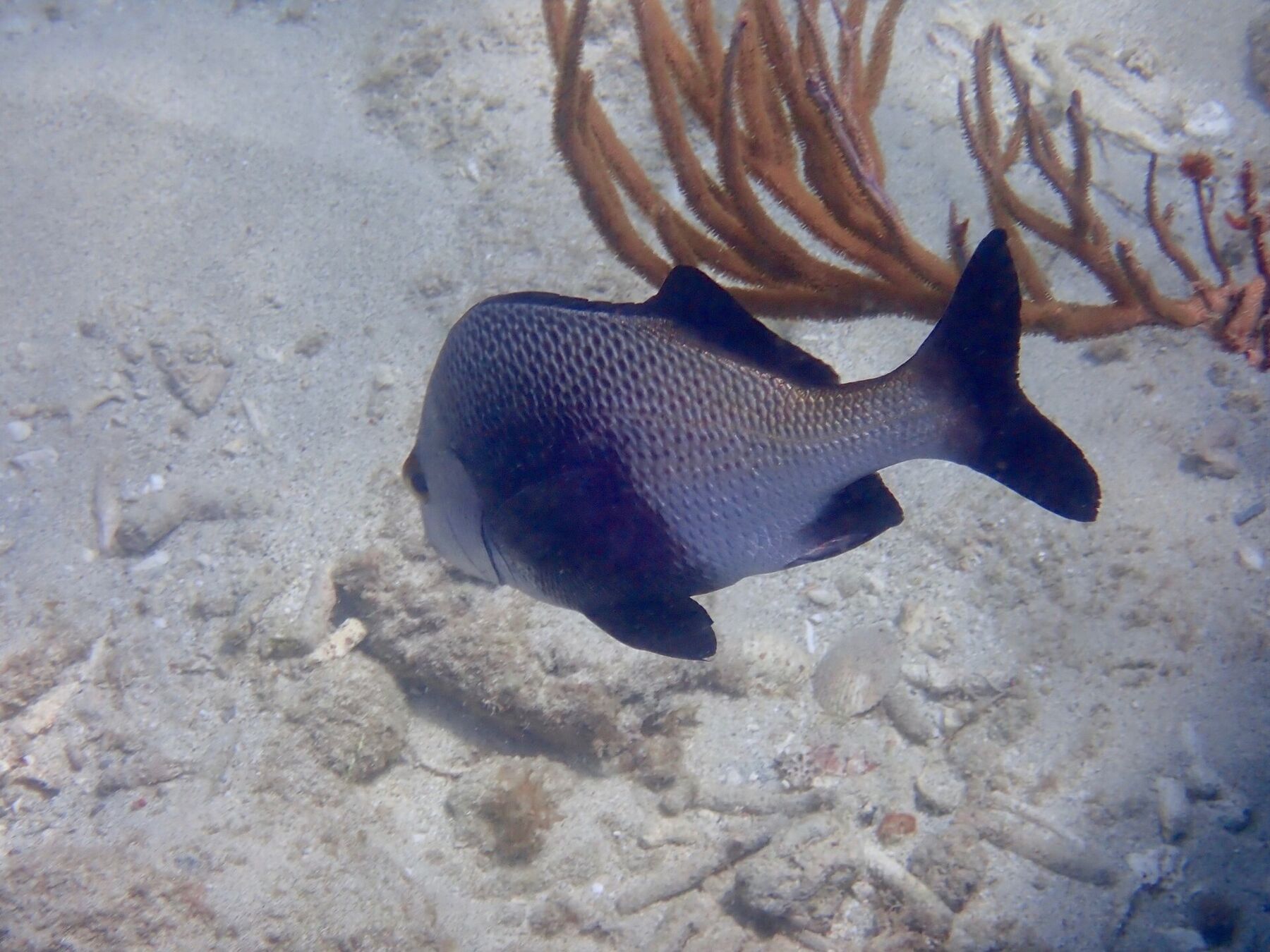
A black margate swimming over the sand by a sea rod, snorkelling at Spring Bay (September 2018) — saralovo, CC BY 4.0, via Wikimedia Commons (resized).
 Think twice today
 Think twice today
 Skip today today