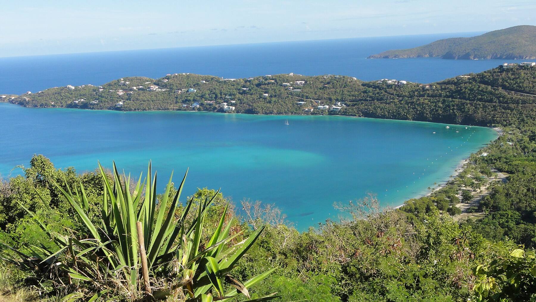
A wide, soft-sand beach on the south-west shore of St. Thomas, beside the University of the Virgin Islands, with the airport runway reaching out into the sea across the bay. Calm, free and local: sea turtles graze the seagrass, planes come and go on the runway, and at weekends the families come with their barbecues.
The south-west shore of St. Thomas, U.S. Virgin Islands — beside the University of the Virgin Islands campus, about three miles west of Charlotte Amalie, on Route 30
The beach
A wide beach of soft sand at the head of John Brewers Bay, its name on the charts, with mature shade trees set back from the water
Entry
Free. There is no gate and no fee: the shoreline is public under the Virgin Islands' Open Shorelines Act
The water
Often calm and clear, over seagrass and sand; the bay is closed on its south side by the airport runway
Turtles
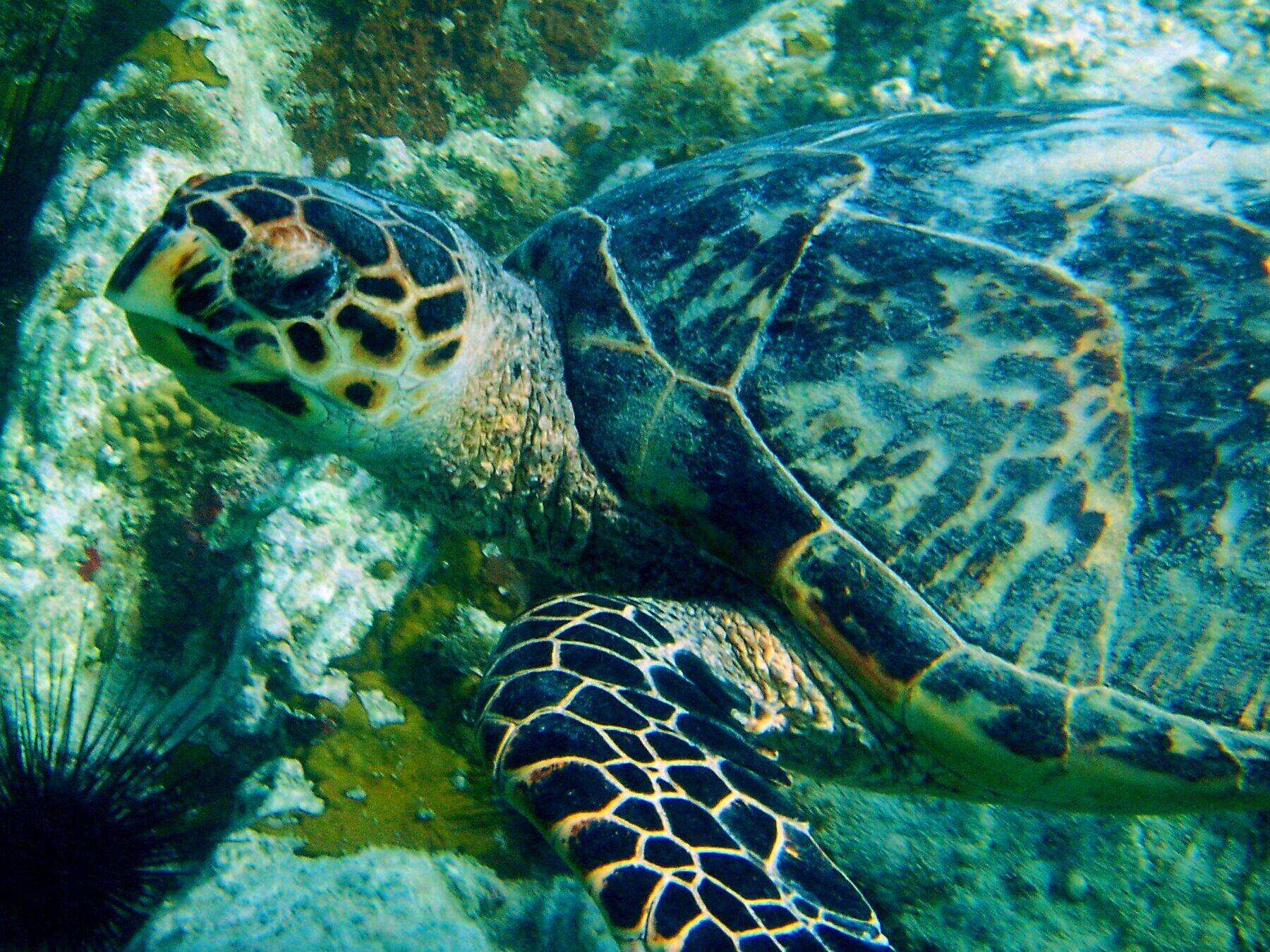
Green and hawksbill sea turtles live in the bay; UVI's researchers have caught, measured and tagged them for more than a decade
Planes
The west end of Cyril E. King Airport's 7,000-foot runway reaches out into the sea beside the bay: you watch the planes take off and land
On the sand
A restroom and shower block behind the beach, food vans along the road, shade trees. No rentals and no lifeguard that we found
Water quality
One of DPNR's weekly-monitored beaches: it met the standard in the October 9, 2026 advisory
Crowds
Quiet on weekdays; busy with barbecues and parties at weekends and on holidays. No cruise excursions — a local beach
History
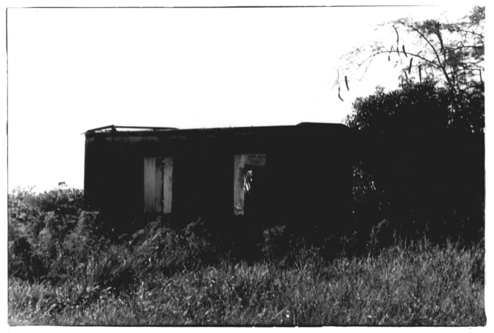
The ruins of the Estate Brewers Bay sugar works stand by the road behind the beach, on the National Register of Historic Places since 1978
Today
Is Brewers Bay good today?
Skip today Rough — 3.0 ft SW swell, shore break · Thunderstorms in the forecast. If you go, the least bad stretch left is 8 am–11 am.
Day
The call
Why
Best time
Cruise guests here
Sea at the beach
Rain
Today
Skip today
Rough — 3.0 ft SW swell, shore break · Thunderstorms in the forecast
8 am–11 am
—
Some chop · 2.7 ft
Thunder
Tomorrow
Skip today
Rough — 3.3 ft SW swell, shore break · Thunderstorms in the forecast
10 am–1 pm
—
Rough · 3.2 ft
Thunder
Sun, Nov 8
Think twice
Choppy — WSW swell into the bay · Showers likely (67%)
11 am–2 pm
—
Some chop · 2.3 ft
67%
Mon, Nov 9
Go
Calm, glassy water
10 am–1 pm
—
Calm · 0.4 ft
41%
Tue, Nov 10
Go
Calm, glassy water
10 am–1 pm
—
Calm · 0.2 ft
28%
The call is the same one our beach report makes, refreshed every half hour: the swell reaching the island (Open-Meteo's marine forecast), NOAA's sargassum satellite and the rain forecast. Brewers Bay has no cruise-crowd term — no excursions come here. It is a model, not a lifeguard's report, and we found no lifeguard at Brewers Bay. The bars under each call are the hours from 8 am to 5 pm. Today's beach report
Brewers Bay from OpenStreetMap: the sand at the head of the bay, Route 30 along the shore, the University of the Virgin Islands campus behind the beach and the airport runway across the bay's south side. OpenStreetMap maps no parking for the beach and no food vans, so they carry no pin: people park along the road. Tap a pin for its section.
Getting there
How to get to Brewers Bay
Brewers Bay is on the south-west shore of St. Thomas, about three miles west of Charlotte Amalie. Route 30 runs out of town past the airport, climbs through the University of the Virgin Islands campus and comes down the far side to the beach, which it runs along. From the airport terminal it is a short drive round the airfield.
The official taxi tariff has no fare to Brewers Bay itself: the fare in the table is to UVI, and the beach is beside the campus — agree with the driver before you set off that you are going to the beach. We found no taxi stand at the beach, so agree a pick-up time or keep the driver's number. Driving, people park along the road behind the sand — and drive on the left.
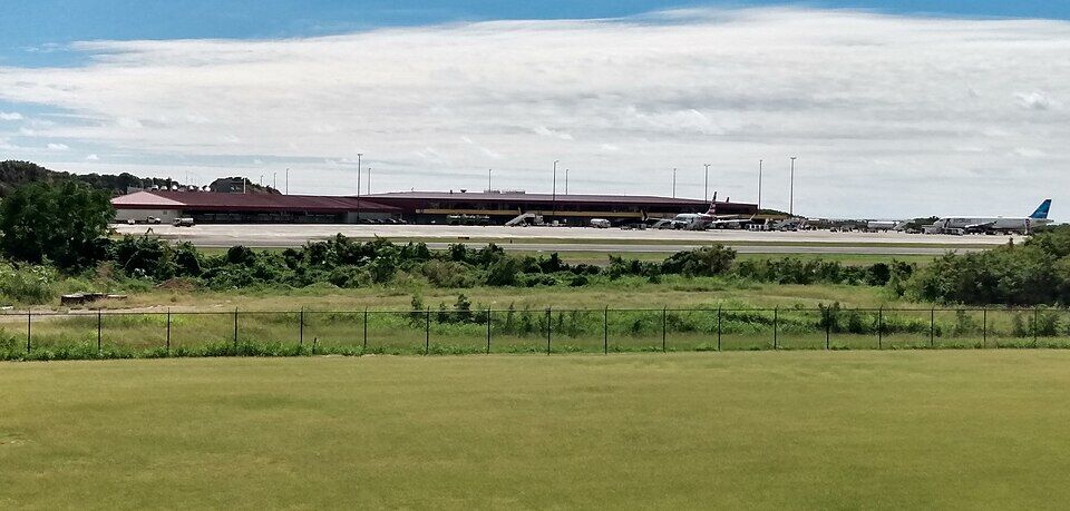
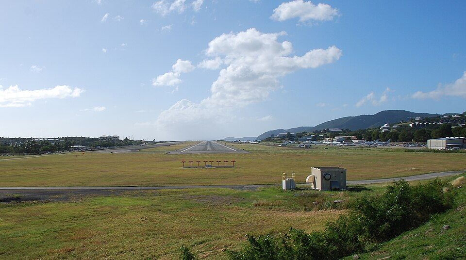
The airport terminal across the airfield, seen from the University of the Virgin Islands campus (January 2025) Photo: Calettso2, CC0
Official taxi fares to Brewers Bay
From
1 passenger
2+ (each)
Drive
Charlotte Amalie
$11
$9
9 min · 5.1 km
Airport (STT)
$8
$8
7 min · 3.5 km
Per person, one way: fares set by the VI Taxicab Commission (rates revised October 24, 2022); night, luggage and waiting surcharges apply. Drive times are Google's for an ordinary day. Fare calculator for any two stops
Ask for the UVI fare to Brewers Bay beach and agree it before you set off — fares are per person, one way — and agree a pick-up time.
Parking is along the road behind the beach, free and with no attendant; leave nothing in the car.
The beach is a short ride from the airport: with a late flight out, an afternoon here is easy to fit in — keep an eye on the clock.
We could not confirm a current public bus timetable to UVI; ask at the VITRAN terminal before relying on one.
Brewers Bay is free. Under the Virgin Islands' Open Shorelines Act the public has the right to use and enjoy the shoreline — from the low-tide line inland 50 feet, or to the line of vegetation or a natural barrier, whichever is shorter — and no one may block it. There is no gate, no attendant and no closing time. The land behind the beach is the University of the Virgin Islands' St. Thomas campus, which counts the beach among its grounds.
Using the beach
✓The sand and the water — public shoreline, by law
✓Snorkeling over the seagrass — look at the turtles from a distance
✕Touching, chasing or holding sea turtles — against the law without a federal permit — the researchers you may see catching them have one
✕Fencing or blocking the shoreline — the Act forbids any obstruction that keeps the public off it
✕Sunscreen with oxybenzone, octinoxate or octocrylene — banned throughout the U.S. Virgin Islands
A wide strip of sand, shade trees, a restroom block and the road behind it — and the bay, which is the point. Bring water, snorkel gear and anything you want to sit on.
Facilities
Restrooms and showers
OpenStreetMap maps a beach restroom and shower block, a university building, behind the middle of the sand. We could not find who runs it or when it is open, so do not count on it — and there are no changing rooms or lockers that we know of.
Green and hawksbill turtles live in the bay year round, grazing the seagrass. The University of the Virgin Islands and the VI Sea Turtle Project catch, measure and tag them here — UVI dates its tagging to the fall of 2014; by April 2017 they had their 100th turtle, and in 2020 UVI's Paul Jobsis put the bay's population at 120 to 130 greens and 75 to 80 hawksbills. UVI's MacLean Marine Science Center, on the point at the south end of the beach, reopened renovated in 2025. Watch the turtles from a distance: touching or chasing them is against the law.
The west end of Cyril E. King Airport's runway — extended in 1992 from 4,200 feet to 7,002, the Port Authority says — reaches out into the sea on the south side of the bay, so the beach is a place to watch planes take off and land. Since April 28, 2026 the runway has been resurfaced overnight, about 10 pm to 5 am; the work is due to run through the end of the year.
Food vans have parked along the road behind the beach for years, from late morning to early evening, selling beach food, drinks and some local dishes, the Source wrote in 2009, and visitors still report a couple of food trucks. We could not confirm who is there now or when, so bring water and a snack.
History
The Estate Brewers Bay ruins
By the road behind the beach are the ruins of the estate's sugar works: an animal-powered mill on a raised circular platform 86 feet across north of the road, and the T-plan factory of rubble, coral block and brick south of it, later used as a house. They were listed on the National Register of Historic Places in 1978. The nomination recorded them on private land in 1977: look from the road.
Brewers Bay is one of the beaches the Department of Planning and Natural Resources samples each week for bacteria and turbidity. In its advisory of October 9, 2026 it met the standard and was listed safe for swimming and fishing. DPNR's standing advice is to stay out of water near guts and drainage after heavy rain, or where sargassum has piled up.
The snorkeling is mostly over seagrass and sand, and that is where the turtles feed: swim out slowly over the grass and look down. There is coral at the edges of the bay. Bring your own mask and fins — we found no rentals at the beach.
From the sand you watch the jets and the island props on the runway across the bay. The day's flights, and when the big jets leave, are on our flights page.
The Source's 2009 beach profile describes a shoreline walk from the beach toward Black Point, on university land, with an unmarked trail up a hill to views of the undeveloped coast of Perseverance and Runnel bays — 1½ to 2 miles there and back. The other way, to the point and a cave, is a scramble over rocks with no trail. We could not check its state today: go with water, shoes and someone who knows it.
On weekdays you may have the sand nearly to yourself. At weekends and on holidays families come with barbecues and coolers and the shade under the trees fills up — come early for a spot.
On the other side of the airport, Lindbergh Bay has a hotel beach and, anchored offshore, Lime Out's floating taco bar, reached by its own boat. It is a short drive round the airfield, not a walk along the shore.
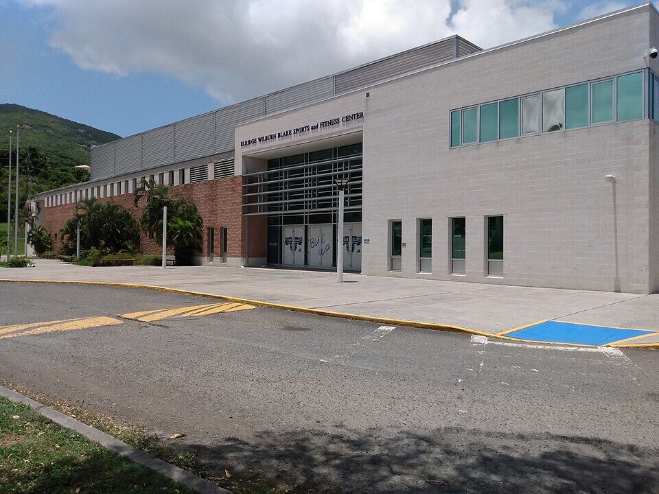
The campus above the beach is the University of the Virgin Islands' Orville E. Kean Campus, 388 acres overlooking the bay, opened in 1963. Its Sports and Fitness Center was dedicated in January 2001. UVI lists the beach among the campus's grounds.
There is no restaurant at Brewers Bay. Food vans have long parked along the road behind the beach, but we could not confirm who is there now or their hours: bring water and food, and take your trash home.
For a sit-down meal, Charlotte Amalie is back along Route 30, and Lime Out floats off Lindbergh Bay on the other side of the airport.
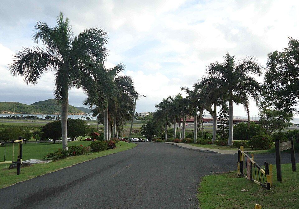
A palm-lined road on the University of the Virgin Islands campus, with the airport and the sea in the distance (November 2012) Photo: Sphilbrick, CC BY-SA 3.0
At the beach
Food vansAlong the road behind the sand, late morning to early evening when they come; not confirmed by name or hours.
Bring your ownA cooler and a barbecue is how the island does Brewers Bay at weekends.
Nearby
Lime Out, Lindbergh BayThe floating taco bar in the next bay east, reached by its own boat from the beach there.
Charlotte AmalieThe capital's restaurants and bars, back along Route 30.
Weather & sea
Brewers Bay weather and the best time to go
Warm all year: highs in the mid-80s °F in winter and around 90 °F in late summer, a steady easterly trade wind and short showers rather than all-day rain. December to April is the dry season.
Brewers Bay sits on the south-west side of St. Thomas, its mouth closed on the south side by the runway, so the easterly trade-wind sea and the winter north swells that reach the north shore rarely get in: on most days the water is calm and clear. The call at the top of the page reads the swell, the rain and the sargassum every half hour.
The next 7 days on St. Thomas
Day
Sky
High / low
Rain
Wind
Seas offshore
Today
Thunderstorms
84° / 78°F
95%
SW 17 mph, gusts 24
3.1 ft
Tomorrow
Thunderstorms
82° / 79°F
88%
WSW 19 mph, gusts 26
3.3 ft
Sun, Nov 8
Drizzle
83° / 81°F
67%
WSW 13 mph
3 ft
Mon, Nov 9
Partly cloudy
83° / 81°F
41%
NNW 7 mph
2.4 ft
Tue, Nov 10
Drizzle
83° / 80°F
31%
NE 14 mph
1.8 ft
Wed, Nov 11
Overcast
83° / 82°F
25%
E 14 mph
2.2 ft
Thu, Nov 12
Drizzle
84° / 82°F
25%
ESE 12 mph
2.6 ft
Open-Meteo forecast for St. Thomas, refreshed every half hour. The seas are offshore; how much of it reaches the sand is the call above. NWS alerts & marine forecast · North swell season
Sea temperature by month
80°Jan
80°Feb
80°Mar
81°Apr
83°May
85°Jun
85°Jul
85°Aug
86°Sep
86°Oct
84°Nov
82°Dec
Daily-mean sea-surface temperature off St. Thomas, averaged 2021–2024 (Open-Meteo marine reanalysis): warmest in Sep (86.4°F), coolest in Feb (79.8°F).
Live cameras
Is there a Brewers Bay webcam?
No — there is no public live camera at Brewers Bay. The nearest live camera is Lime Out's in Lindbergh Bay, on the other side of the airport, which shows the same planes from the water; the other St. Thomas camera is at Sapphire Beach on the East End.
The bay appears on the maps of St. Thomas as Janprubay (Dewitz, 1732), Baye de Jean Krameur (Bellin, 1764), John Brucebay (Oldendorp, 1777) and Johns Brewers Bay (Hornbeck, 1856), which shows several buildings on the estate.
1855
The first owners on record
The estate of Peter James Souffrain passes to his sister, Hortense Souffrain — the first record of ownership. In 1883 it is sold to L. E. de Lafarde for $1,250.
January 22, 1928
The first passengers by air
A monoplane of the Aerial Express Company of San Juan lands four passengers at the airstrip at Mosquito Bay — later filled in and renamed Lindbergh Bay — next door to Brewers Bay.
1935
Bourne Field
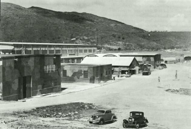
The U.S. government buys the airstrip and expands it as a military airfield, Bourne Field. After the Second World War it passes to the Virgin Islands government, and its old hangar becomes the terminal of an airport named for President Truman.
March 16, 1962
A college on the bay
The College of the Virgin Islands is founded; its St. Thomas campus opens above Brewers Bay in 1963. In 1986 it becomes the University of the Virgin Islands.
July 31, 1978
On the National Register
The ruins of the Estate Brewers Bay sugar works — the animal mill and the T-plan factory — are listed on the National Register of Historic Places.
October 3, 1984
Cyril E. King Airport
The airport is renamed for Cyril Emmanuel King, the second elected governor of the U.S. Virgin Islands.
1992
The long runway
The runway is extended from 4,200 feet to 7,002 feet; its west end reaches out into the sea beside Brewers Bay.
Fall 2014
Counting the turtles
UVI's Center for Marine and Environmental Studies and the VI Sea Turtle Project begin catching and tagging the turtles of Brewers Bay; in April 2017 they record their 100th.
October 30, 2025
The marine lab reopens
UVI opens the newly renovated MacLean Marine Science Building on the beach to visitors: turtle tracking, coral and mangrove restoration, robotics.
April 28, 2026
The runway resurfaced
Overnight work begins to mill and repave the runway and fit new LED lights, planned to continue through the end of the year.
The ruined Estate Brewers Bay sugar factory, photographed for its National Register nomination on December 8, 1977 Photo: Douglas Richards, Public domainBourne Field, the military airfield that became St. Thomas's airport, in a U.S. Navy Bureau of Yards and Docks photograph Photo: United States Bureau of Yards and Docks, Public domain
The beach is a local one: nearly empty on many weekdays, busy with families and barbecues at weekends and on holidays.
Bring everything
There are no rentals and no lifeguard that we found, and the food vans are not a sure thing. Bring water, shade, snorkel gear and a snack.
Leave the turtles be
Float above them and let them come and go. Touching, chasing or feeding sea turtles is against the law.
Reef-safe sunscreen is the law
The U.S. Virgin Islands ban sunscreens with oxybenzone, octinoxate or octocrylene. Bring a mineral (zinc or titanium) one.
Close to the airport
The beach is a short drive from the terminal, which makes it a place to spend the last hours before an afternoon flight — with your bags in the taxi, not the car.
Leave nothing in the car
Parking is along an open road with no attendant. Take valuables to the beach or leave them at home.
Yes. There is no gate and no entry fee: under the Virgin Islands' Open Shorelines Act the shoreline is public — the sand from the low-tide line inland 50 feet, or to the vegetation line if that is shorter. The land behind it is the University of the Virgin Islands' campus.
How do I get to Brewers Bay?
By car or taxi along Route 30, which runs from Charlotte Amalie past the airport and through the University of the Virgin Islands campus to the beach — about 9 minutes (5.1 km) from town. The official taxi fare to UVI, beside the beach, from Charlotte Amalie is $11 for one rider, $9 each for two or more. There is no taxi stand at the beach, so agree a pick-up time.
How much is a taxi to Brewers Bay?
The official tariff has no Brewers Bay fare; drivers charge the fixed per-person fare to UVI, which is beside the beach. From Charlotte Amalie it is $11 for one rider, $9 each for two or more; from the airport $8 for one rider, $8 each for two or more. Agree the fare before you set off; night, luggage and waiting surcharges apply.
Is Brewers Bay near the airport?
Yes. The west end of Cyril E. King Airport's runway reaches out into the sea on the south side of the bay, and the terminal is a short drive away round the airfield. From the beach you watch the planes take off and land.
Are there turtles at Brewers Bay?
Yes — green and hawksbill sea turtles live in the bay year round, feeding on the seagrass. UVI's researchers, who catch and tag them, estimated in 2020 that 120 to 130 greens and 75 to 80 hawksbills use the bay. Watch them from a distance: touching or chasing them is against the law.
Is Brewers Bay good for snorkeling?
For turtles, yes: the snorkeling is mostly over seagrass and sand, where they feed, with some coral at the edges of the bay. Bring your own gear — we found no rentals at the beach.
Are there bathrooms at Brewers Bay?
OpenStreetMap maps a restroom and shower block behind the sand, a university building. We could not find who runs it or its hours, so do not count on it being open.
Is there food at Brewers Bay?
There is no restaurant. Food vans have long parked along the road behind the beach from late morning, but we could not confirm who is there now — bring water and food. Charlotte Amalie's restaurants are back along Route 30.
Is there a lifeguard at Brewers Bay?
We found no lifeguard at Brewers Bay. The water is calm on most days, but you swim at your own risk.
Is the water at Brewers Bay clean?
Brewers Bay is one of the beaches DPNR samples every week. In its advisory of October 9, 2026 it met the water-quality standard and was listed safe for swimming and fishing. Stay out of water near drainage after heavy rain.
Is Brewers Bay part of the University of the Virgin Islands?
The beach is beside the university's St. Thomas campus, which overlooks John Brewers Bay and counts the beach among its grounds, and UVI's marine science center is on the point at its south end. The shoreline itself is public under the Open Shorelines Act.
Is there a Brewers Bay webcam?
No public live camera looks at Brewers Bay. The nearest is Lime Out's camera in Lindbergh Bay, on the other side of the airport; the other St. Thomas camera is at Sapphire Beach on the East End.
Is this the same Brewers Bay as on Tortola?
No. Brewers Bay on Tortola, in the British Virgin Islands, is a different beach on that island's north shore, next to Cane Garden Bay. This one is on St. Thomas, in the U.S. Virgin Islands, beside UVI and the airport.
Photo & map credits
Brewers Bay from the hillside above its north shore in September 2013: the calm bay below, a wooded point, and beyond it the airport runway reaching out into the sea (cropped from a panorama) — Kberg115, CC BY-SA 3.0, via Wikimedia Commons (cropped and resized).
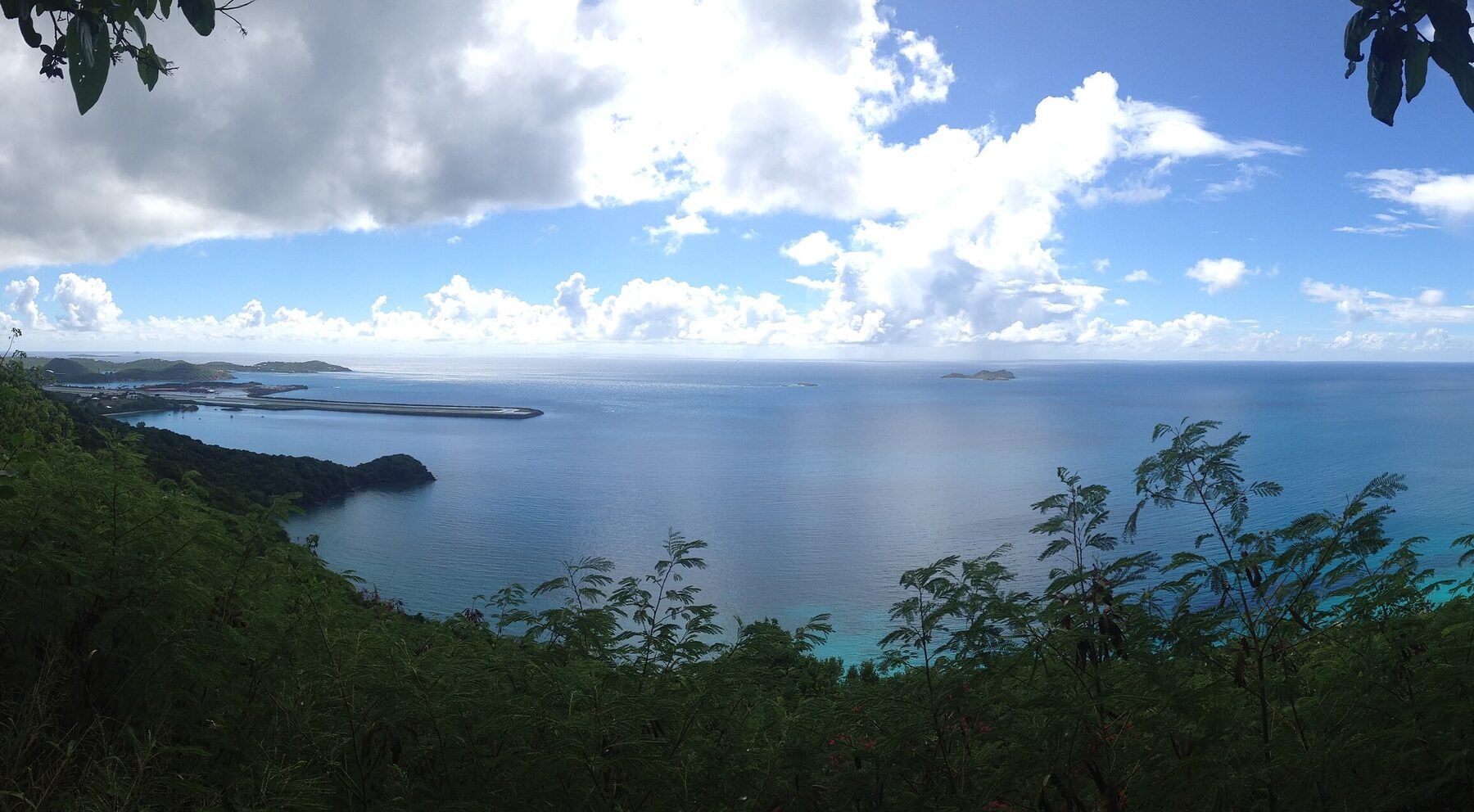
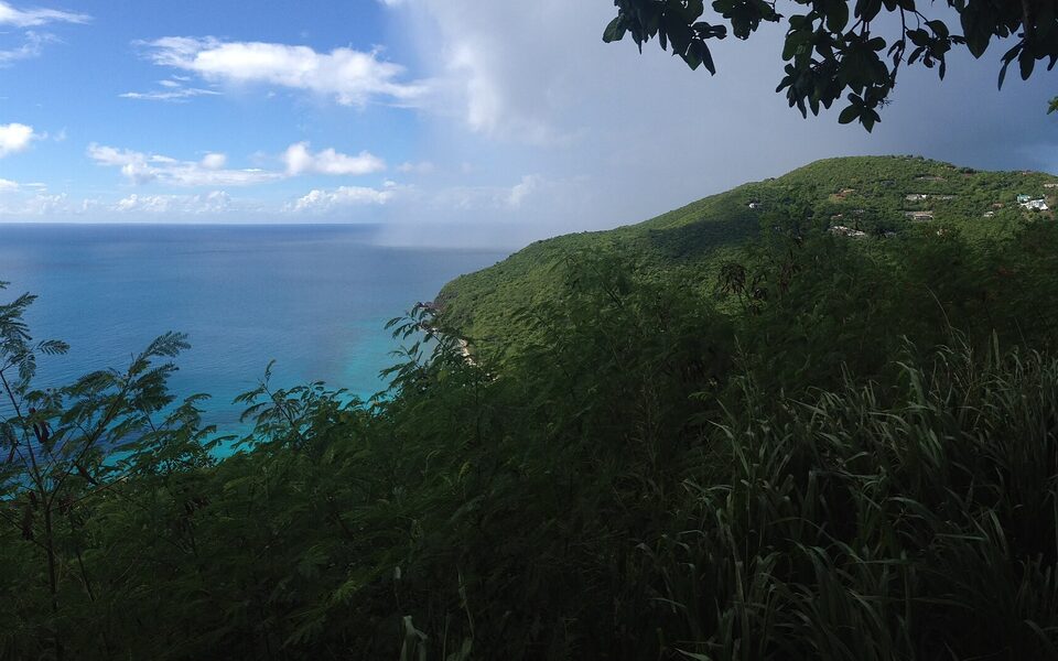
Looking west along the wooded shore from the same hillside above Brewers Bay, a rain shower out at sea (September 2013, cropped from a panorama) — Kberg115, CC BY-SA 3.0, via Wikimedia Commons (cropped and resized).
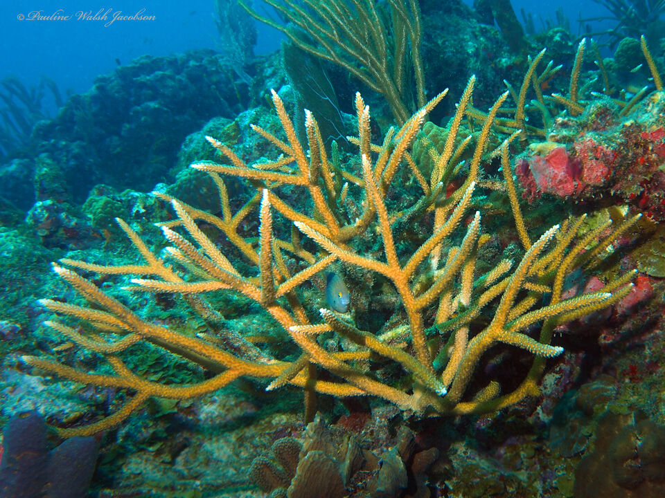
Staghorn coral on the reef in Brewers Bay (November 2016) — Pauline Walsh Jacobson, CC BY 4.0, via Wikimedia Commons (resized).
The Cyril E. King runway seen from its east end in January 2012; its west end reaches out into the sea beside Brewers Bay — Lars Schmidt, CC BY-SA 3.0, via Wikimedia Commons (resized).
The airport terminal across the airfield, seen from the University of the Virgin Islands campus (January 2025) — Calettso2, CC0, via Wikimedia Commons (resized).
A palm-lined road on the University of the Virgin Islands campus, with the airport and the sea in the distance (November 2012) — Sphilbrick, CC BY-SA 3.0, via Wikimedia Commons (resized).
The Eldridge Wilburn Blake Sports and Fitness Center on the UVI campus (May 2025) — Calettso2, CC BY-SA 4.0, via Wikimedia Commons (resized).
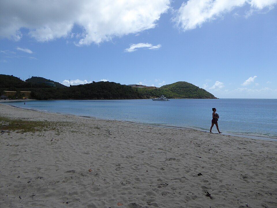
The beach at Lindbergh Bay, on the other side of the airport (February 2015) — Mattes, CC BY 2.0 de, via Wikimedia Commons (resized).
The ruined Estate Brewers Bay sugar factory, photographed for its National Register nomination on December 8, 1977 — Douglas Richards, Public domain, via Wikimedia Commons (resized).
Bourne Field, the military airfield that became St. Thomas's airport, in a U.S. Navy Bureau of Yards and Docks photograph — United States Bureau of Yards and Docks, Public domain, via Wikimedia Commons (resized).
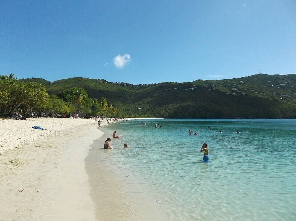
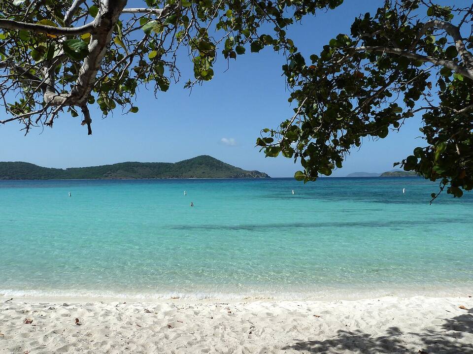
The sand and shallow, calm water at Magens Bay — socaltraveler, CC BY-SA 3.0, via Wikimedia Commons (resized).
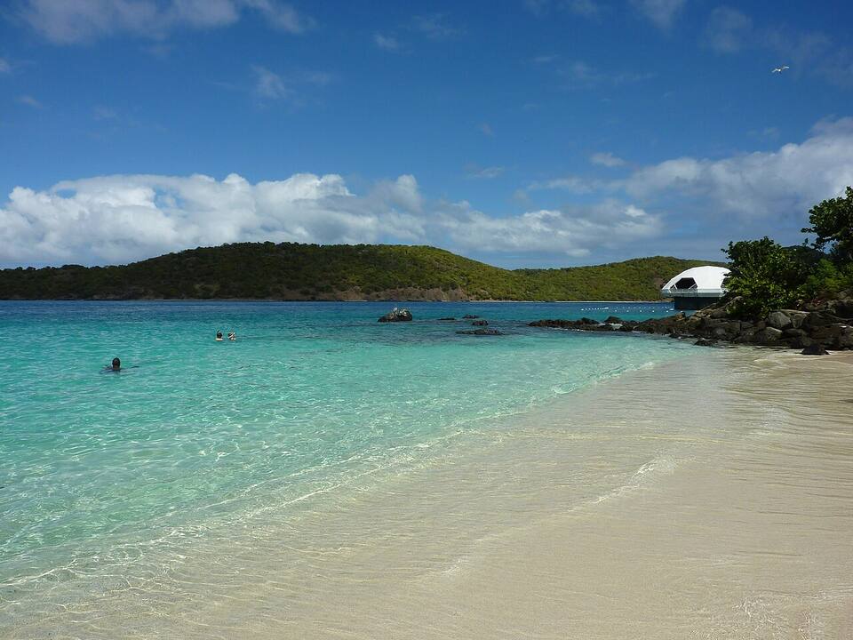
Coki Beach, looking out to Thatch Cay, with the Coral World observatory tower on the point — Gruepig, CC BY-SA 3.0, via Wikimedia Commons (resized).
Lindquist Beach in Smith Bay Park, on the east end of St. Thomas — Gruepig, CC BY-SA 4.0, via Wikimedia Commons (resized).
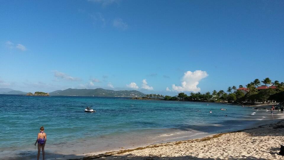
Sapphire Beach on the east end, looking out over Pillsbury Sound — PunctuatedArt, CC0, via Wikimedia Commons (resized).
An adult hawksbill turtle over the rocks and coral at Secret Harbor, with a long-spined sea urchin in the corner (2004) — Becky A. Dayhuff, Environmental Educator, NOAA, Public domain, via Wikimedia Commons (resized).
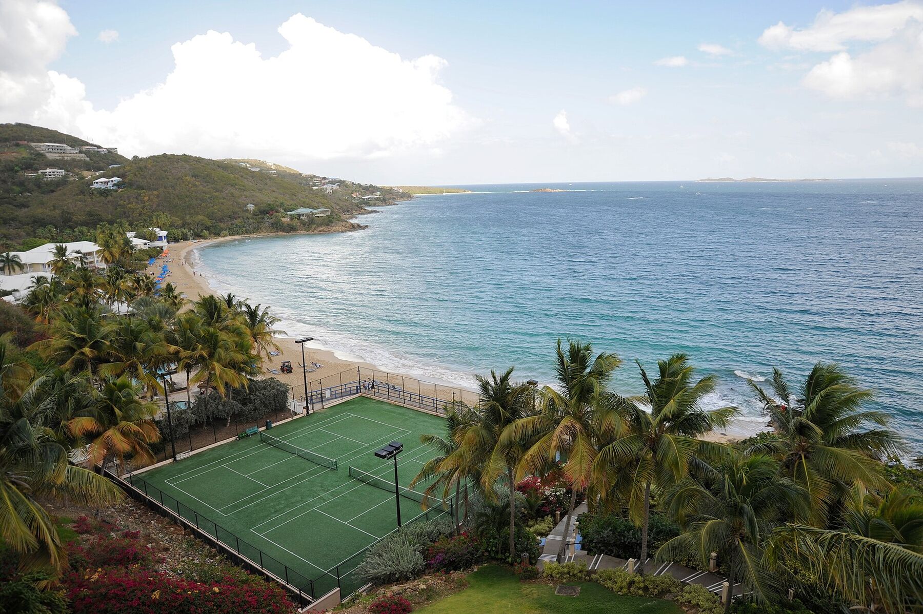
Morningstar Beach from the Frenchman's Reef bluff in May 2009, looking east along the sand: the tennis courts below, palms and beach umbrellas, the headland at the far end and the open sea to the south — Fred Hsu, CC BY-SA 3.0, via Wikimedia Commons (resized).
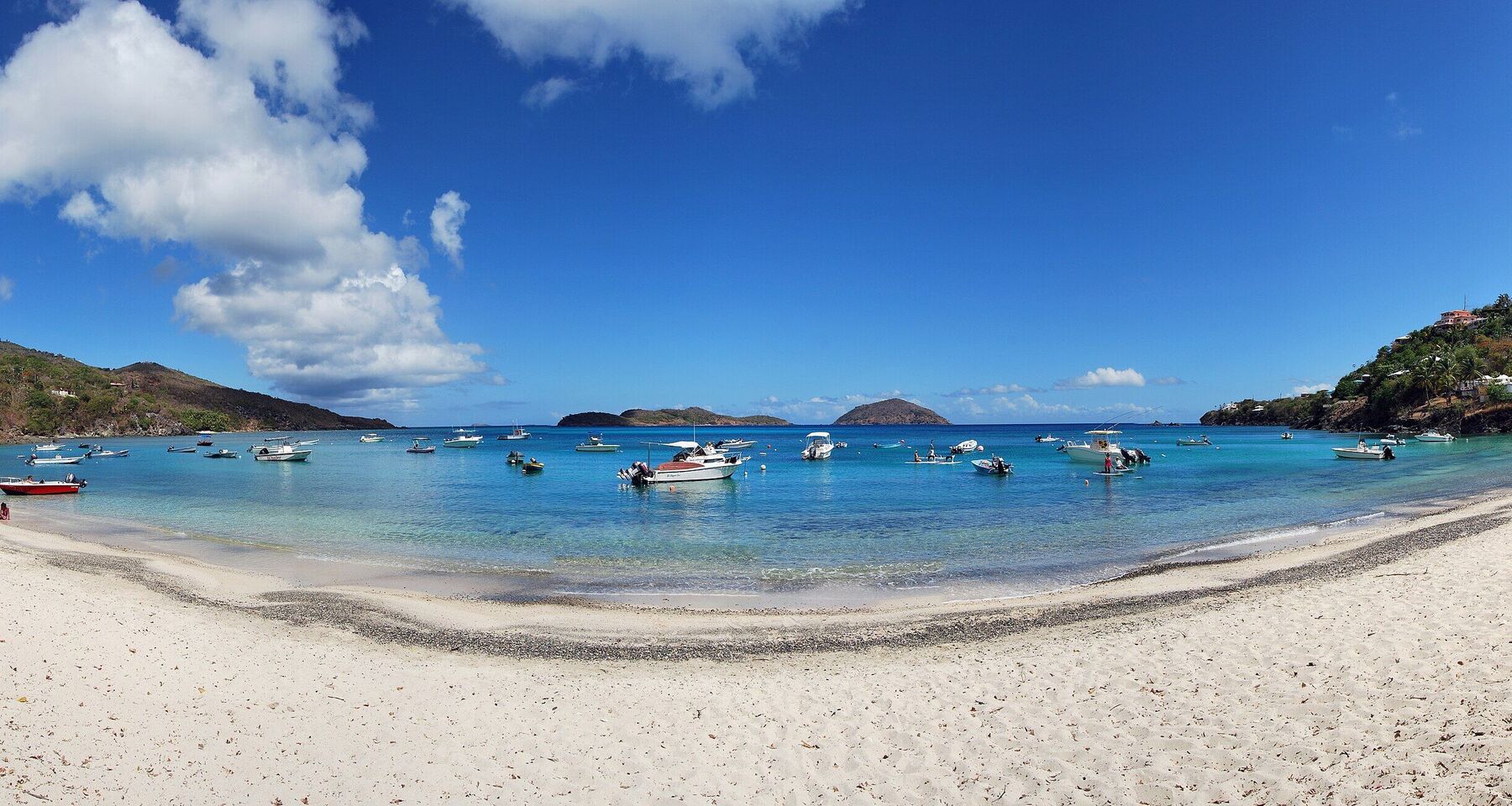
Hull Bay from the sand: the curve of the beach, small boats on their moorings and the cays offshore on the horizon (July 2015, cropped from a panorama) — Matt H. Wade, CC BY-SA 4.0, via Wikimedia Commons (cropped and resized).
 Skip today today
 Skip today today
 Skip today today
 Skip today today
 Good today
 Skip today today
 Skip today today