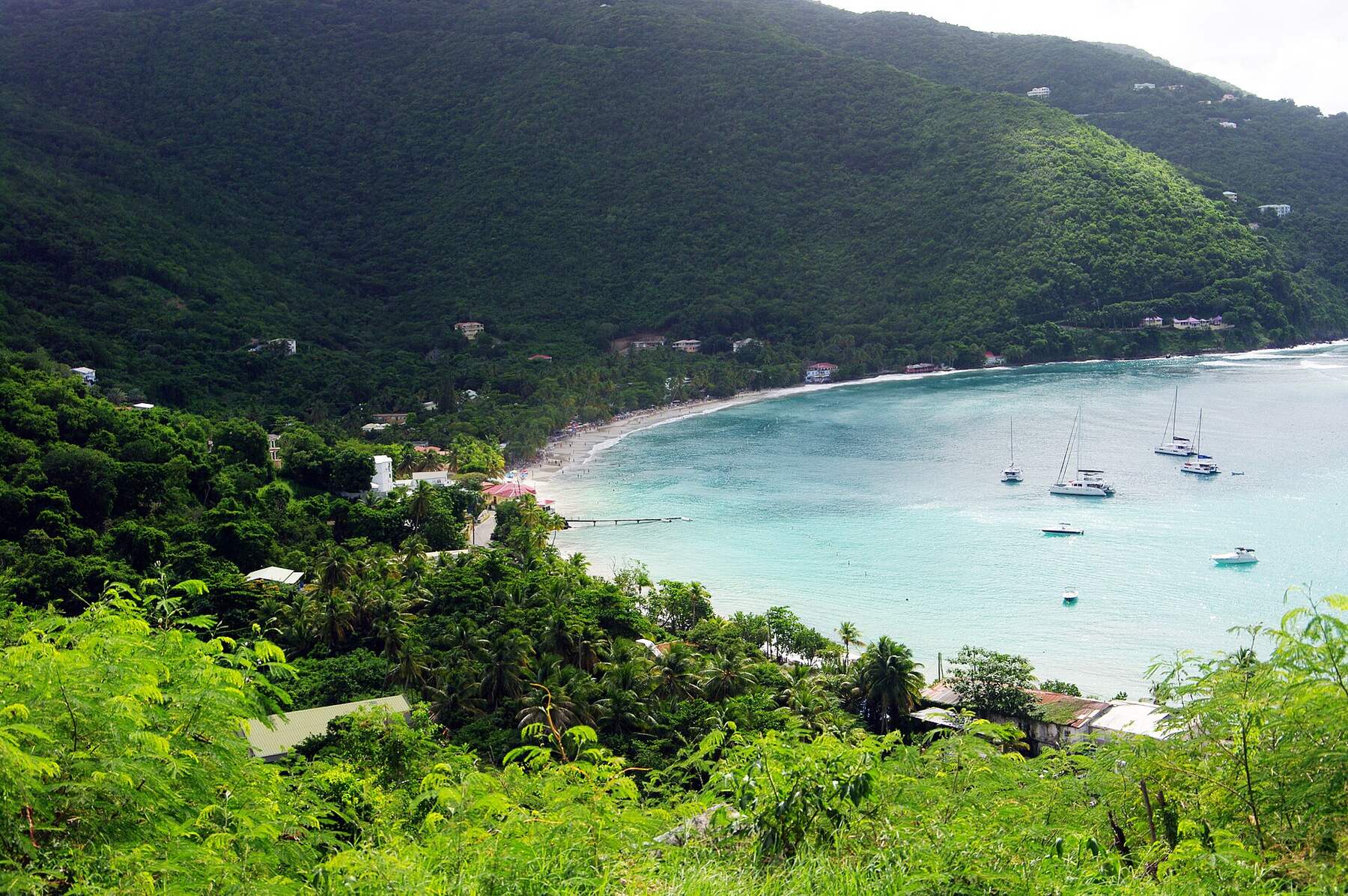
A small, quiet beach on Tortola's north shore, the next bay north-east of Cane Garden Bay, at the bottom of a steep, winding road. One beach bar, reef to snorkel, the ruins of a sugar works under the trees and the Mount Healthy windmill on the hill above. Not to be confused with Brewers Bay on St. Thomas, in the U.S. Virgin Islands.
At a glance
Brewers Bay in ten facts
Where
The north shore of Tortola, British Virgin Islands — the next bay north-east of Cane Garden Bay, over the hill from Road Town
The beach
About 250 m of sand at the head of a bay that opens north-west, by our tracing; Anderson Point closes it on the north side
The road in
Brewer's Bay Road, paved but steep and full of switchbacks, from Cane Garden Bay Road on one side and the Ridge Road on the other
Entry
Free. No gate, no posted hours and no entry fee that we could find
On the sand
One beach bar, Nicole's, which rents chairs and snorkel gear and has restrooms, travel guides say
The water
Usually calm, with reef along the edges of the bay to snorkel from the beach; open to the north swell in winter
No yachts
Two undersea internet cables come ashore here, and charter companies tell their boats to stay out of the bay
History
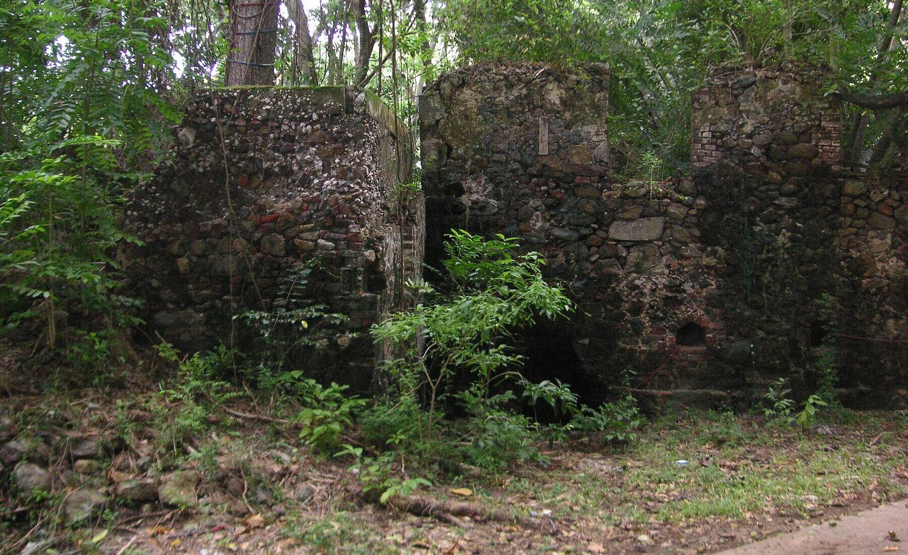
The ruins of a sugar works and rum distillery by the road behind the beach
Up the hill
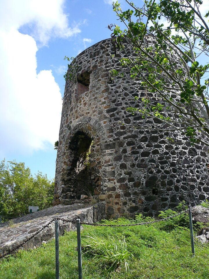
The Mount Healthy windmill, the last windmill standing in the BVI, a national park since 1983
Not to be confused with
Brewers Bay on St. Thomas, beside the University of the Virgin Islands — another beach, another country
Today
Is Brewers Bay good today?
Skip today Rough — 3.8 ft NNW swell, shore break · Thunderstorms in the forecast. If you go, the least bad stretch left is 9 am–12 pm.
Day
The call
Why
Best time
Cruise guests here
Sea at the beach
Rain
Today
Skip today
Rough — 3.8 ft NNW swell, shore break · Thunderstorms in the forecast
9 am–12 pm
~70
Rough · 3.2 ft
Thunder
Tomorrow
Skip today
Rough — 4.3 ft WNW swell, shore break · Thunderstorms in the forecast
Rough — 3.1 ft NNE swell, shore break · Sargassum offshore
8 am–11 am
None
Some chop · 2.6 ft
36%
Tue, Nov 10
Skip today
Sargassum offshore · Choppy — NNE swell into the bay
3 pm–6 pm
~200, 10 am–3 pm
Some chop · 2.4 ft
43%
The call is the same one our beach report makes, refreshed every half hour: the swell reaching the north shore (Open-Meteo's marine forecast), the cruise passengers our crowd model puts on the sand, NOAA's sargassum satellite and the rain forecast. It is a model, not a lifeguard's report — we found no lifeguard at Brewers Bay, so look at the water before you swim, above all in a winter north swell. The bars under each call are the hours from 8 am to 5 pm. Today's beach report
Taxi fares from Road Town, the cruise pier and the ferries, the boats over from St. Thomas, the ships that send a crowd, today's beach and weather reads and the island around it — each one opens the full page.
Brewers Bay from OpenStreetMap: the sand at the head of the bay, Brewer's Bay Road coming down the hill in its switchbacks from Cane Garden Bay (bottom left) and the Ridge Road (right), the houses along it, and each facility where OpenStreetMap's mappers put it. The Mount Healthy windmill is up the hill to the east. Tap a pin for its section.
Getting there
How to get to Brewers Bay
Brewers Bay is on the north side of Tortola, over the island's spine from Road Town. Brewer's Bay Road comes down to it from two directions: from Cane Garden Bay Road, south-west of the beach, and from the Ridge Road along the top of the island, past the Mount Healthy windmill. Both are paved, and both are steep: Lonely Planet calls the descent "brake-smoking". There is no bus. Visitors come by taxi or rental car; yachts are not allowed in (see below).
Taxis charge the official BVI fares in the table, per person and cheaper each as the party grows. From Road Town's ferry terminal and the cruise pier the ride goes up over the hill and down the north side; from the West End ferry it runs along the north shore through Cane Garden Bay. Driving, you keep left.
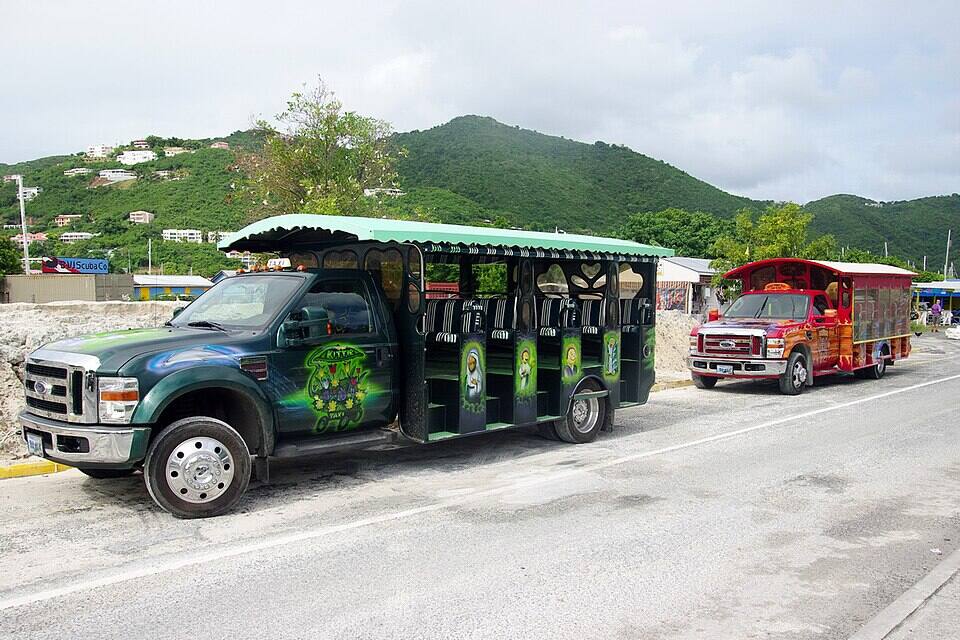
Open-air safari taxis waiting in Road Town Photo: Bgabel, CC BY-SA 3.0
One way, per person by the size of the party: fares set by the BVI Road Traffic (Passenger Fares) Regulations (rates revised December 2022). Drive times are Google's for an ordinary day. Fare calculator for any two stops
Agree the fare for your whole party before you set off, and agree a pick-up time: there is no taxi stand at the beach, and a phone signal is not a sure thing in the bay.
In a rental car, use a low gear on the way down and take the switchbacks slowly; after heavy rain, watch for gravel and sediment washed onto the road.
From a ship, keep the all-aboard time in mind: the cruise pier is on the other side of the island's ridge.
Crossing from St. Thomas? The BVI is a different country: bring a passport, fill in the online ED card before you arrive and clear immigration at the ferry dock.
Brewers Bay has no gate, no posted hours and no entry fee that we could find. What a visitor coming over from St. Thomas or St. John does pay is the BVI's charges at the border, at the ferry dock.
Charges
The beach
Free
BVI environmental and tourism levy, arriving from the USVI
$10
BVI departure tax, leaving by ferry
$20
The same, for BVI residents
$15
The levy and the departure tax are the UK government's figures for the BVI; from anywhere else in the BVI none of them apply. Nicole's rents chairs and snorkel gear at prices it does not publish: ask before you sit down.
Papers and the bay
✓A passport, for everyone arriving from the USVI — U.S. citizens and children included
✓The BVI's online ED card — required of every traveller entering the BVI since January 1, 2025
✓U.S. customs on the way back — when the ferry lands in Charlotte Amalie or Red Hook
✕Anchoring a yacht in the bay — undersea cables come ashore here, and the charter companies put the bay off limits
Very little, which is why people come: one bar, the sand, the reef and the ruins. Nicole's publishes no prices; what follows is what we could check, and where we lean on travel guides we say so.
Food & drink
Nicole's Brewers Bay Beach Bar
The bar on the sand at the south-west end of the beach, where the road comes down — mapped on OpenStreetMap as Nicole's Brewers Bay Beach Bar. Google lists it open from 10 am, until 10 pm most days and 7 pm on Sundays (as listed in October 2026). Lonely Planet says it has restrooms, rents chairs and snorkel gear, and serves food and drinks, and that the other businesses on the bay were destroyed by the 2017 hurricanes. It publishes no prices: agree them first.
Reef and coral heads line the edges of the bay, reachable from the sand; travel guides rate it among the best shore snorkelling on Tortola. Nicole's rents gear, the guides say, but bring your own if you can. Stay off the coral, keep clear of the middle of the bay on a swell day, and swim with someone.
Under the water
Why there are no yachts
Two cables of PCCS, the internet system that runs from Florida and Puerto Rico to Curaçao, Colombia, Panama and Ecuador, come ashore on Tortola here, Cable & Wireless BVI's notice to mariners says; in 1992 the U.S. regulator licensed the Taino-Carib cable from St. Thomas to land here too. An anchor can cut a cable, so the charter companies put the bay off limits, and you will usually have the water to yourselves.
Stone walls of an old sugar works and rum distillery stand under the trees by the road behind the beach. A cruising couple anchored here in April 2011 found the abandoned distillery with its copper stills still in place. We found no owner or visiting rule published for the ruins: look from the road and do not climb the walls.
Community
The community centre
The George W. Christopher Community Centre stands behind the beach: a clinic, after-school programmes and seniors' gatherings, and a hurricane shelter. Damaged by Hurricane Irma in 2017, it was being repaired in October 2024, Virgin Islands News Online reported.
We found no lifeguard service at Brewers Bay, and there is no shop at the beach. Bring water and sunscreen. In winter a north swell can break across the bay for a day or two: on those days, look before you go in, or go round to a sheltered south-shore beach instead.
Staying
The campground
Travel guides have long mentioned a campground at Brewers Bay, and Virgin Islands News Online called the area known for its campgrounds in 2024. We could not find a booking page, an owner or rates for one operating today, so we do not list it: ask locally before you plan to camp.
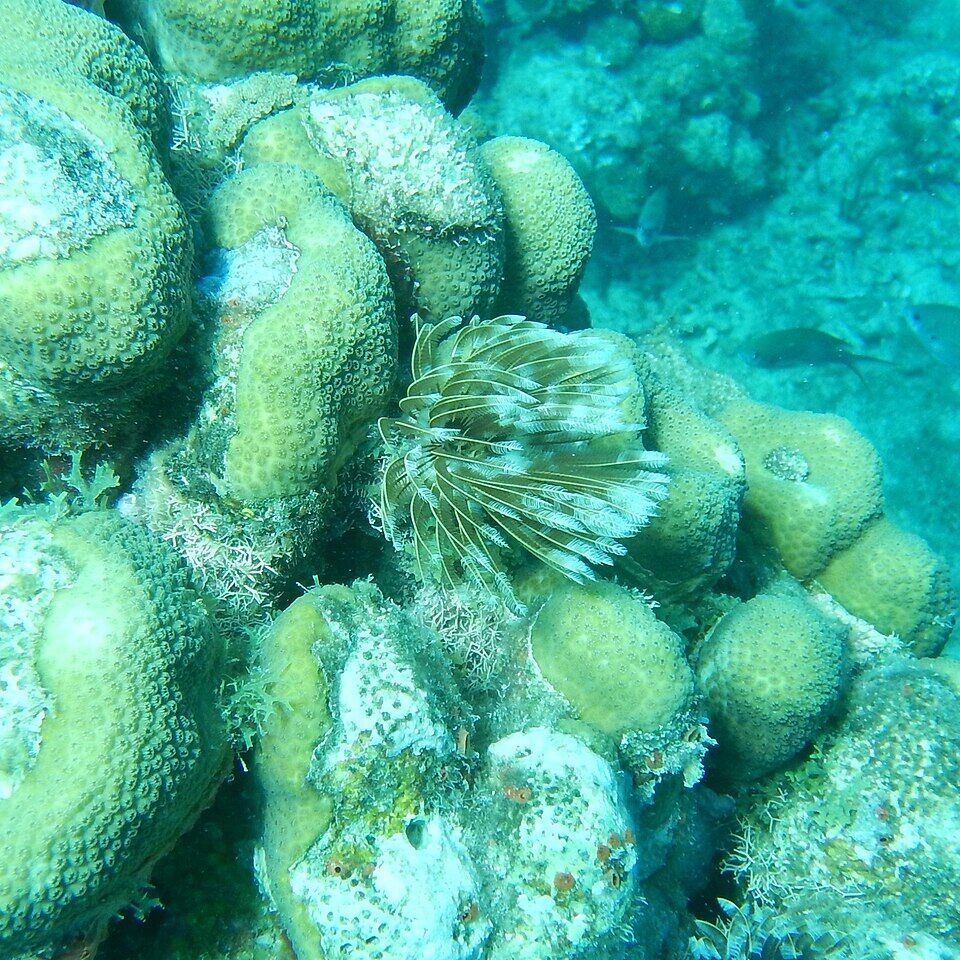
The reason most people make the trip. Swim out from the sand to the reef along the edges of the bay: coral heads, sea fans, feather dusters and reef fish in shallow water. Calm mornings are clearest; the call at the top of the page reads the swell every half hour.
Up the hill on the road to the Ridge Road stands the stone tower of an 18th-century windmill, built of field rubble — the last windmill left in the BVI, the National Parks Trust says, at the heart of a 250-acre sugar plantation worked by enslaved Africans. It crushed cane for the sugar works and rum distillery down at Brewers Bay. Across the road are the ruins of an animal mill, a boiling house, a distillery, a hospital and housing. It has been a national park, Mount Healthy, since 1983; the Trust publishes no fee for it.
The next bay south-west is Tortola's best-known beach: a long curve of sand with bars, chairs, water-sport rentals and the Callwood rum distillery. Brewers Bay is the quiet alternative when the ships send their tours to Cane Garden Bay.
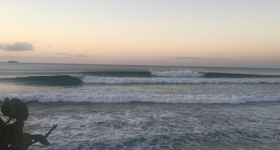
Along the north shore past Cane Garden Bay, Apple Bay is where Tortola's winter surf breaks when a north swell runs, with Bomba's Surfside Shack beside it.
Over the ridge to the south: the capital, the ferry terminal, the cruise pier and the charter docks. Most visitors start their day at Brewers Bay from here.
Nicole's is the only place to eat and drink on the bay: drinks and food at hours Google lists, prices it does not publish. Bring water and a snack in case it is closed, and cash.
Over the hill, Cane Garden Bay has a row of beach bars and restaurants along its sand. Several north-shore places close for part of the August–October off-season; our closures tracker lists who is open.
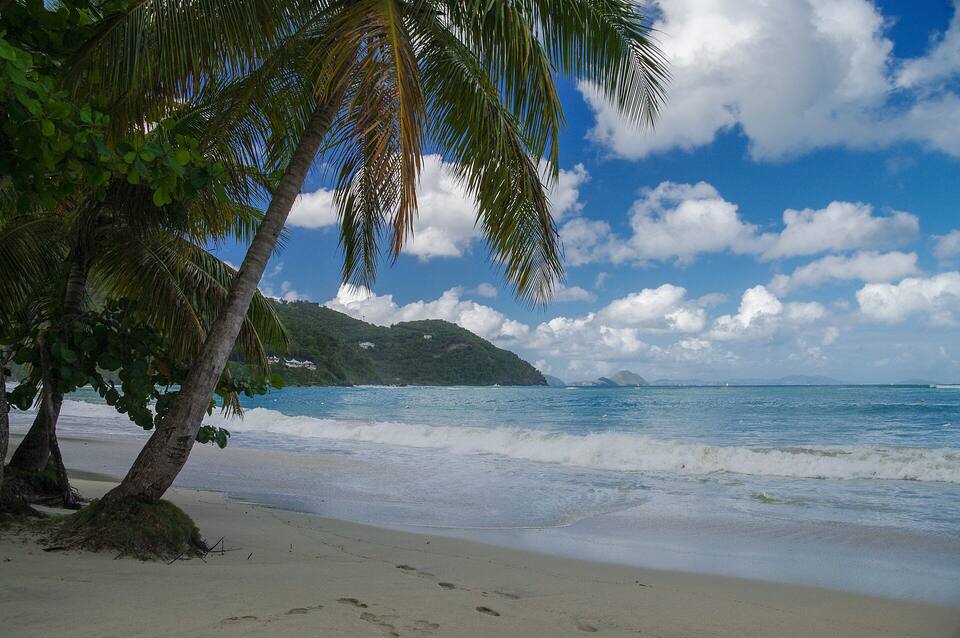
The sand at Cane Garden Bay under the palms, looking out to sea Photo: Jean-Marc Astesana, CC BY-SA 2.0
On the sand
Nicole's Brewers Bay Beach BarDrinks and food where the road meets the beach; chairs, snorkel gear and restrooms, travel guides say. Open from 10 am by Google's listing.
Over the hill
Cane Garden BayThe beach bars and restaurants along Tortola's best-known beach, a short drive south-west.
Road TownThe capital's restaurants and shops, over the ridge to the south.
Weather & sea
Brewers Bay weather and the best time to go
Warm all year: highs in the mid-80s °F, a steady easterly trade wind and short showers rather than all-day rain. December to April is the dry season and the heart of the cruise season; June to November is hurricane season.
Brewers Bay opens north-west, so on most days the trade wind comes over the land behind it and the water is calm. Winter is the exception: swells from storms far out in the North Atlantic reach Tortola's north shore for a day or two at a time, and then the bay can break. The call at the top of this page reads the swell every half hour.
The next 7 days on Tortola
Day
Sky
High / low
Rain
Wind
Seas offshore
Today
Thunderstorms
81° / 76°F
89%
SW 18 mph, gusts 25
3.1 ft
Tomorrow
Thunderstorms
80° / 77°F
90%
WSW 20 mph, gusts 26
3.5 ft
Sun, Nov 8
Drizzle
81° / 79°F
58%
W 12 mph
3.1 ft
Mon, Nov 9
Drizzle
80° / 78°F
18%
NNW 8 mph
2.4 ft
Tue, Nov 10
Drizzle
80° / 78°F
32%
NE 14 mph
2 ft
Wed, Nov 11
Overcast
81° / 79°F
25%
E 14 mph
2.2 ft
Thu, Nov 12
Drizzle
81° / 79°F
18%
ESE 12 mph
2.1 ft
Open-Meteo forecast for Tortola, refreshed every half hour. The seas are offshore; how much of it reaches the sand is the call above. BVI weather & sailing week · North swell season
Sea temperature by month
80°Jan
79°Feb
80°Mar
81°Apr
83°May
85°Jun
85°Jul
85°Aug
86°Sep
86°Oct
84°Nov
81°Dec
Daily-mean sea-surface temperature off Tortola, averaged 2021–2024 (Open-Meteo marine reanalysis): warmest in Sep (86.3°F), coolest in Feb (79.3°F).
Cruise crowds
Cruise ships and the crowd at Brewers Bay
Brewers Bay is over the hill from Road Town's cruise pier, but it is not where the excursions go: the tours fill Cane Garden Bay next door. Our crowd model sends only a small share of each ship's passengers here, but on a day with two or three big ships in that can still fill a small beach. Lonely Planet says it gets moderately busy with families on a ship day and is nearly empty otherwise.
28 of the next 31 days have a ship in Road Town. The busiest at Brewers Bay, by our model:
Thu, Nov 12 — 2 ships, 6,341 guests in port. Busy: ~550 expected here, 9 am–4 pm
Sun, Nov 15 — 2 ships, 7,673 guests in port. Packed: ~650 expected here, 9 am–4 pm
Thu, Nov 19 — 3 ships, 8,841 guests in port. Packed: ~700 expected here, 8 am–4 pm
Sun, Nov 29 — 3 ships, 8,223 guests in port. Packed: ~700 expected here, 10 am–4 pm
Tue, Dec 1 — 2 ships, 7,036 guests in port. Busy: ~550 expected here, 9 am–4 pm
Sun, Dec 6 — 4 ships, 7,865 guests in port. Packed: ~650 expected here, 9 am–4 pm
Our crowd model, not a head count: it puts about 8% of the passengers of a ship in Road Town on the sand at Brewers Bay, starting about 75 minutes after the ship is in and gone 90 minutes before it sails; past 600 on the sand we call it packed. The same model makes the call at the top of the page and on our beach report.
No. There is no public live camera on Tortola that we can show — not at Brewers Bay, not at Cane Garden Bay — and we would rather say so than pass off a photo as live. The nearest live views in the BVI are at Scrub Island, off Tortola's north-east tip, and Cooper Island across the channel.
The Mount Healthy windmill is built on the hill above the bay to crush cane for the sugar works and rum distillery at Brewers Bay — the work of enslaved people on one of the area's largest plantations, owned at one time by Balziel Hodge.
1830s–1850s
The sugar years end
Slavery ends in 1834 and estate workers begin to buy land; hurricanes in the 1830s and a drought in the 1850s finish the sugar estates, the National Parks Trust says, and the mill and the works fall out of use.
1983
Mount Healthy National Park
The windmill and about an acre round it are declared a national park, kept by the National Parks Trust of the Virgin Islands.
1992
A cable licence
The U.S. Federal Communications Commission licenses the Taino-Carib cable from Puerto Rico and St. Thomas to land at Brewers Bay, Tortola, and run up to the Chalwell cable station.
April 28, 2011
The bay to themselves
A cruising couple anchor in the bay — out of bounds to charter yachts, their pilot book warns — and find one camper, one bar open, cows on the beach and the abandoned distillery with its copper stills.
April 2015
PCCS comes ashore
Cable & Wireless BVI's notice to mariners gives the routes of two PCCS cables landing at Brewers Bay; the system opens that year.
September 6, 2017
Hurricane Irma
The category 5 hurricane crosses the BVI. The community centre is damaged, and Lonely Planet later finds every business on the bay but Nicole's gone.
October 2024
The repairs
A year after Tropical Storm Philippe washed sediment from the gullies onto the beach and eroded the roads, Virgin Islands News Online reports road and drainage works under way and the community centre being repaired.
The stone tower of the Mount Healthy windmill on the hill above Brewers Bay, the last windmill standing in the British Virgin Islands (August 2007) Photo: Legis at English Wikipedia, Public domain
Brewer's Bay Road is paved but steep, with tight switchbacks. Drive down in a low gear, keep left, and if you are not used to hills like these, take a taxi.
Bring cash and water
The money is the U.S. dollar. Nicole's is the only bar and does not publish prices; there is no shop. Bring water, sunscreen and cash.
Bring your own snorkel gear
The reef is the reason to come, and rentals depend on the bar being open. Reef shoes help on the rocks at the edges of the bay.
Skip it in a big north swell
In winter, a north swell can break across the bay. The call at the top of the page reads it; on those days the south-shore beaches are calmer.
Passport from St. Thomas
The BVI is British, not American: U.S. citizens need a passport for the ferry from St. Thomas, an ED card filled in online, and U.S. customs on the way back.
The right Brewers Bay
Telling a taxi "Brewers Bay" on St. Thomas takes you to the beach by the airport there. This one is on Tortola, in the BVI.
On the north shore of Tortola in the British Virgin Islands, the next bay north-east of Cane Garden Bay. It sits at the bottom of Brewer's Bay Road, which comes down from Cane Garden Bay Road and from the Ridge Road along the top of the island.
How do you get to Brewers Bay?
By taxi or rental car, down the steep Brewer's Bay Road. From Road Town it is about 16 minutes (6.8 km) by road, and the official taxi fare is $18 for one rider, $10 each for three or more. There is no bus, and yachts are not allowed to anchor in the bay.
How much is a taxi to Brewers Bay?
BVI taxi fares are set by regulation and charged per person, cheaper each as the party grows. From Road Town it is $18 for one rider, $10 each for three or more; from the cruise pier $24 for one rider, $12 each for three or more; from the West End ferry $40 for one rider, $20 each for two, $15 each for three or more; from Beef Island airport $50 for one rider, $25 each for two, $20 each for three or more. Confirm the total for your group before you set off, and agree a pick-up time.
How far is Brewers Bay from the cruise port?
Over the hill from Road Town's cruise pier: about 15 minutes (7.5 km) by road. The official taxi fare is $24 for one rider, $12 each for three or more. The road is steep and winding; keep the all-aboard time in mind.
Is Brewers Bay good for snorkeling?
Yes — it is why most people go. Reef runs along the edges of the bay, close enough to swim to from the sand. Nicole's rents snorkel gear, travel guides say, but bring your own if you can, and skip it when a winter north swell is running.
Is there a beach bar at Brewers Bay?
One: Nicole's Brewers Bay Beach Bar, on the sand where the road comes down. Google lists it open from 10 am, to 10 pm most days and 7 pm on Sundays (October 2026). Travel guides say it has restrooms and rents chairs and snorkel gear.
Are there restrooms at Brewers Bay?
Only at Nicole's, for its customers, travel guides say. We found no public restroom, shower or shop at the beach.
Is Brewers Bay free?
Yes. There is no gate and no entry fee that we could find. You pay for what you use at Nicole's.
Can you anchor a boat at Brewers Bay?
Charter companies put the bay off limits. Two PCCS internet cables come ashore here, and an anchor can cut a cable; the bay is also open to the winter north swell. Come by land.
Is there a campground at Brewers Bay?
Travel guides have long mentioned one, and a 2024 news story called the area known for its campgrounds, but we could not find a booking page, owner or rates for a campground operating today. Ask locally before you plan to camp.
What is the windmill above Brewers Bay?
The Mount Healthy windmill: an 18th-century stone tower that crushed cane for the sugar works and rum distillery at Brewers Bay, the last windmill standing in the BVI. It and the ruins around it have been Mount Healthy National Park since 1983.
Is this the same Brewers Bay as on St. Thomas?
No. Brewers Bay on St. Thomas, in the U.S. Virgin Islands, is a different beach beside the University of the Virgin Islands and the airport runway. This one is on Tortola, in the British Virgin Islands — a ferry ride and a border away.
Is there a Brewers Bay webcam?
No public live camera we can embed. There is no live webcam on Tortola; the nearest live views in the BVI are at Scrub Island and Cooper Island.
Photo & map credits
The stone walls of the old sugar works at Brewers Bay, Tortola, under the trees beside the road, in August 2006 (cropped) — Legis at English Wikipedia, Public domain, via Wikimedia Commons (cropped and resized).
The stone tower of the Mount Healthy windmill on the hill above Brewers Bay, the last windmill standing in the British Virgin Islands (August 2007) — Legis at English Wikipedia, Public domain, via Wikimedia Commons (resized).
A magnificent feather duster worm on star coral, photographed in April 2023 at a position the diver recorded just off Brewers Bay — Addshore, CC BY 4.0, via Wikimedia Commons (resized).
The sand at Cane Garden Bay under the palms, looking out to sea — Jean-Marc Astesana, CC BY-SA 2.0, via Wikimedia Commons (resized).
Swell breaking at Apple Bay, further down Tortola's north shore, at dusk (October 2019) — Gdebsoc, CC BY-SA 4.0, via Wikimedia Commons (resized).
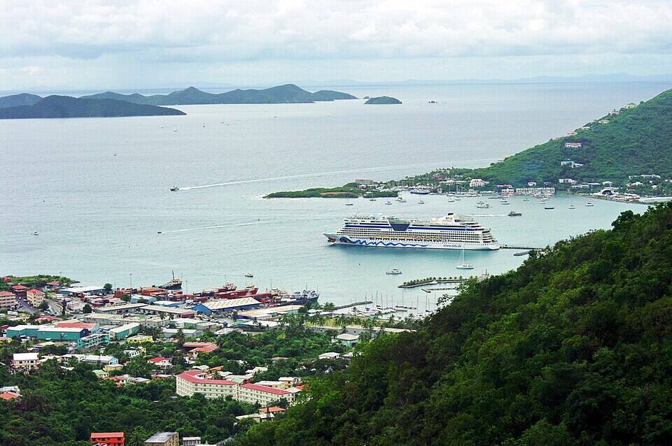
Road Town and Road Harbour from the hills, a cruise ship in the harbour and the Sir Francis Drake Channel beyond — Bgabel, CC BY-SA 3.0, via Wikimedia Commons (resized).
Open-air safari taxis waiting in Road Town — Bgabel, CC BY-SA 3.0, via Wikimedia Commons (resized).
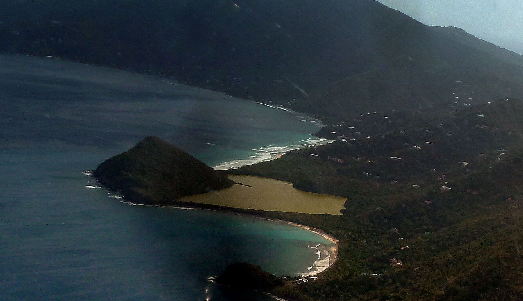
Long Bay from the air, looking north-east along Tortola's north shore: surf breaking along the sand beyond the steep hill of Belmont Point, Belmont Pond behind the beach, and Smuggler's Cove curving round below (cropped from a panorama of the West End) — giggel, CC BY 3.0, via Wikimedia Commons (cropped and resized).
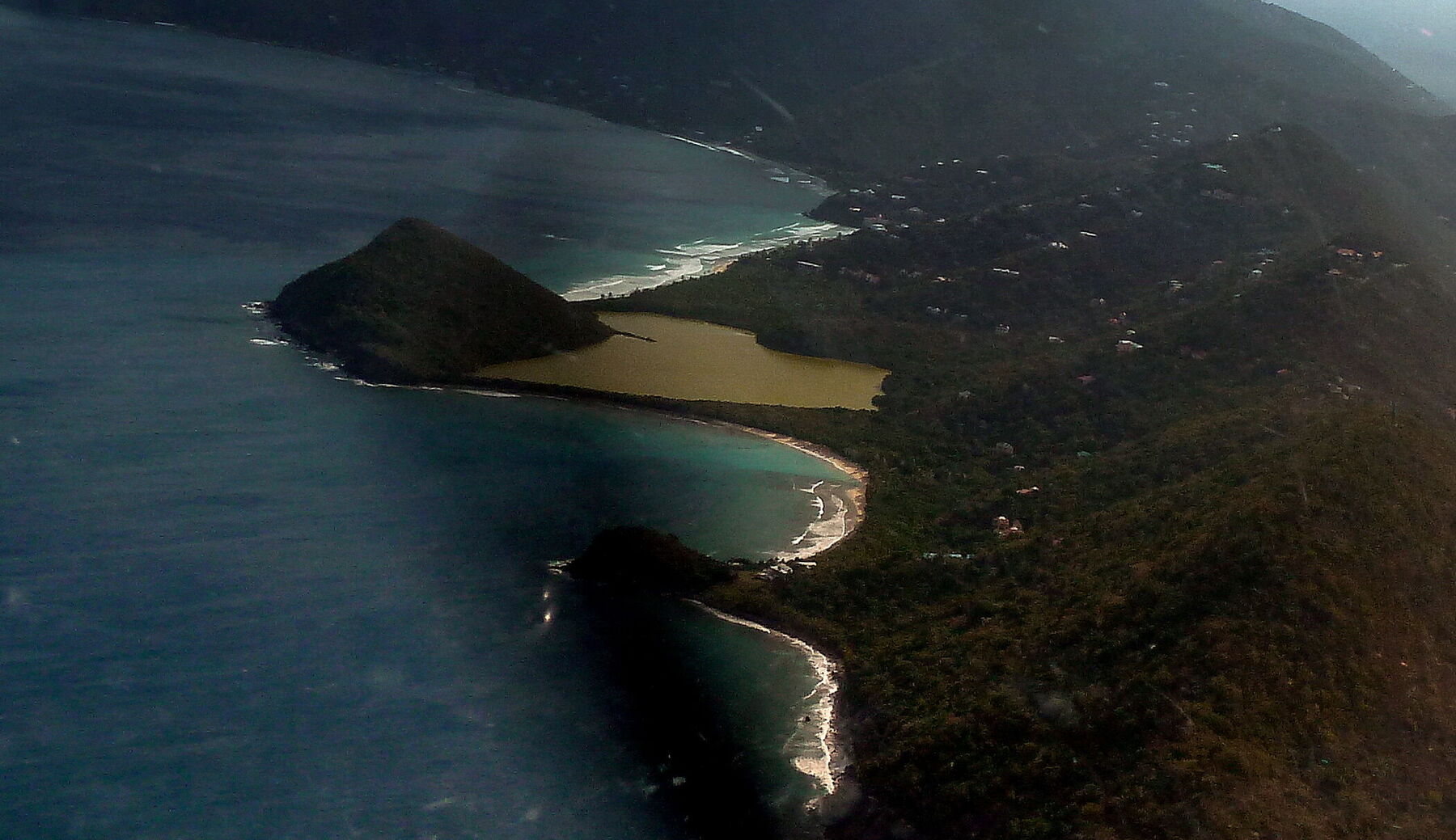
Smuggler's Cove from the air, looking east: the curve of sand below Belmont Pond, Belmont Point on the left with Long Bay's surf beyond it, and rocks and a smaller beach at the cove's south end (cropped from a panorama of the West End) — giggel, CC BY 3.0, via Wikimedia Commons (cropped and resized).
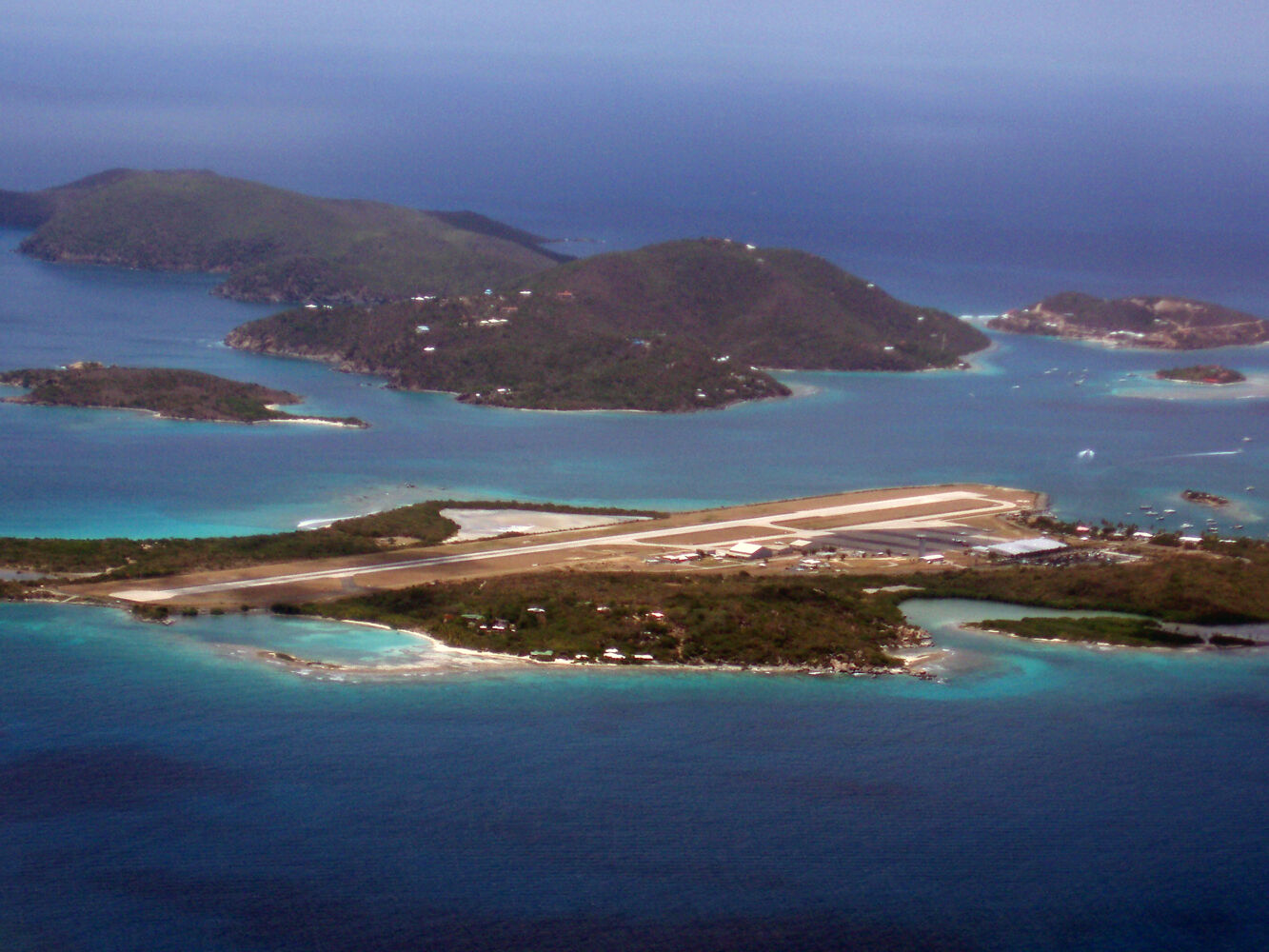
Beef Island from the air, looking north (July 2008): the airport runway across the island, with Long Bay's sand and its salt pond on the far side at the left; Little Camanoe and Great Camanoe beyond, Trellis Bay on the right — Robert Rexach, CC BY-SA 3.0, via Wikimedia Commons (resized).
 Think twice today
 Skip today today
 Skip today today