A speck of white sand and low bush a few hundred metres off the east tip of Little Jost Van Dyke, with Green Cay just to the north. Nobody lives on it and nothing is sold on it: there is no dock, no road and no ferry. Boats anchor off on the sand and you swim or wade ashore — so the sea on the day decides whether you go.
Off the east end of Little Jost Van Dyke, British Virgin Islands, just south of Green Cay — about 3 miles (5 km) east of the Great Harbour ferry dock as the crow flies (OpenStreetMap)
Size
About a quarter of an acre (0.1 ha) in the 2009 Environmental Profile of Jost Van Dyke — and the shape shifts with every big storm
Height
Flat: barely 2 m (6 ft) above the sea, the same Profile says — the only one of the five islands it covers that is not volcanic rock
Getting there
By boat only: a day charter, a water taxi or your own boat. No dock, no moorings — boats anchor off and you swim or wade in
On the islet
Nothing: no bar, no toilets, no fresh water, no shade but the bush. Bring what you need and take it all away again
Owner
The BVI Government: the Profile records it, with Green Cay, as Crown land, bought from private owners in 2005
The water round it
A fisheries protected area of 15.5 ha (38 acres) to the east of Green Cay and Sandy Spit, declared in 2003
Papers
From the U.S. Virgin Islands you are crossing a border: a passport for everyone, the BVI's online ED card, and clearing in at a port of entry before you land
Hurricane Irma
September 6, 2017 took the islet's trees, News of St. John reported; two St. John residents replanted coconut palms that November
Wildlife
Sea turtles have nested on its beach; brown pelicans roost on Green Cay's rocky south shore next door
Today
Is Sandy Spit good today?
Skip today Thunderstorms in the forecast · Sargassum offshore. If you go, the least bad stretch left is 3 pm–6 pm.
Day
The call
Why
Best time
Cruise guests here
Sea at the beach
Rain
Today
Skip today
Thunderstorms in the forecast · Sargassum offshore
3 pm–6 pm
—
Gentle · 1.8 ft
Thunder
Tomorrow
Think twice
Thunderstorms in the forecast · Sargassum offshore
11 am–2 pm
—
Calm · 0.5 ft
Thunder
Sun, Nov 8
Think twice
Sargassum offshore · Choppy — N swell into the bay
8 am–11 am
—
Some chop · 2.1 ft
53%
Mon, Nov 9
Skip today
Rough — 3.0 ft NNE swell, shore break · Sargassum offshore
8 am–11 am
—
Some chop · 2.6 ft
29%
Tue, Nov 10
Skip today
Rough — 2.9 ft NNE swell, shore break · Sargassum offshore
2 pm–5 pm
—
Some chop · 2.8 ft
37%
The call is the same one our beach report makes, refreshed every half hour: the swell reaching the islet (Open-Meteo's marine forecast off Jost Van Dyke), NOAA's sargassum satellite and the rain forecast. Our model treats Sandy Spit as open to every direction — a bare sand islet with no bay to shelter in — so a swell the bigger beaches shrug off can make the swim in a no. It is a model, not a report from the water: the captain looking at the sea has the last word. The bars under each call are the hours from 8 am to 5 pm. Today's beach report
What the BVI asks at the border, the anchorages and moorings round Jost Van Dyke, today's sea and weather reads, the live cameras nearest the islet and the island it belongs to — each one opens the full page.
Sandy Spit from OpenStreetMap: the islet in the middle, Green Cay across the shallow bar to the north and the east end of Little Jost Van Dyke to the west, with the anchorage between them. Sandy Cay, the national park, is about a mile south. Tap a pin for its section.
Getting there
How to get to Sandy Spit
Sandy Spit has no dock, no road and no ferry. You come by boat: a day charter from St. John, St. Thomas or Tortola, a water taxi, or your own boat. There are no moorings at the islet; boats anchor on the sand bottom off its west side, between the spit and Little Jost Van Dyke, and you swim or wade the last stretch to the beach.
Coming from the U.S. Virgin Islands you are crossing a border. Every boat entering the BVI clears customs and immigration at a port of entry on arrival — for Sandy Spit usually Great Harbour on Jost Van Dyke or West End on Tortola — and everyone aboard shows a passport, U.S. citizens included. A charter captain handles the stop and the boat's BVI charges; ask what the price includes. In a straight line the islet is about 10 miles from Cruz Bay on St. John and 4½ from West End on Tortola (OpenStreetMap).
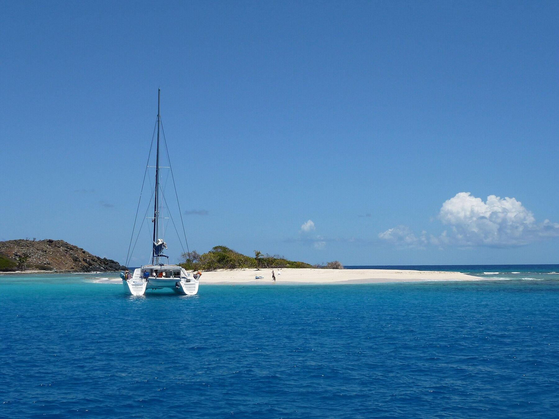
A catamaran anchored off Sandy Spit, people on the sand and the islet's bush and palms behind, with the rocky south end of Green Cay on the left (April 2011) Photo: Cayeldo, CC BY-SA 3.0
Fill in the BVI's online ED card before you go — it can be done up to 72 hours ahead — and bring a passport for everyone, children included.
Go on a calm day. With no bay round it, a swell or a strong wind makes the anchorage rolly and the swim in hard work; the call at the top of this page reads the swell.
Everything you take ashore goes in a dry bag — phone, passport, cash — and comes back on the boat.
Sailing yourself? It is a day stop: anchor on sand, clear of the coral and the seagrass, and move to Great Harbour or Little Harbour for the night.
Sandy Spit from the U.S. Virgin Islands: entry fees, papers and ports
Sandy Spit itself is free — Crown land with no gate and no one to pay. What a visitor from St. Thomas or St. John pays is the British Virgin Islands' charges at the border, where the boat clears in. From Tortola or anywhere else in the BVI none of it applies: the trip is domestic.
Charges, arriving from the USVI
Sandy Spit
Free
BVI environmental and tourism levy, on arrival
$10
BVI departure tax, leaving by ferry
$20
The same, for BVI residents
$15
The levy and the departure tax are the UK government's figures. A day charter or water taxi from the USVI also pays BVI charges for the boat, through the captain: ask what the price includes before you book.
Ports of entry nearest Sandy Spit
Great Harbour, Jost Van Dyke
8:30 am – 4:30 pm daily
West End, Tortola (customs & immigration)
8:00 am – 9:00 pm daily
The BVI Tourist Board's hours, as listed in October 2026. West End's port itself keeps shorter hours (8:30 am to 4:30 pm Monday to Thursday, to 6 pm Friday to Sunday). Clearing outside the hours has to be arranged in advance and costs extra.
Papers and the rules
✓A passport, for everyone — arriving from the USVI — U.S. citizens and children included
✓The BVI's online ED card — required of every traveller entering the BVI since January 1, 2025; up to 72 hours ahead
✓Clear in on arrival — every boat entering the BVI clears customs and immigration immediately, at a port of entry
✓U.S. customs on the way back — when the boat returns to St. John or St. Thomas
✕Landing at Sandy Spit before the boat has cleared in
Very little, which is the point: sand, a patch of bush in the middle, the shallows and the reef round the edge. There is no business of any kind on the islet.
The islet
Sand and bush
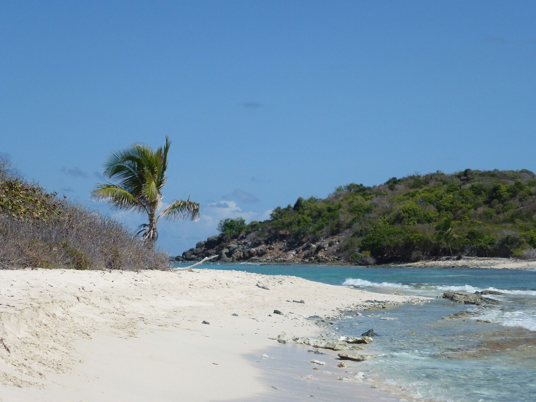
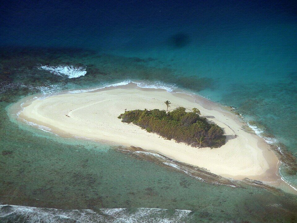
About a quarter of an acre in the 2009 Environmental Profile of Jost Van Dyke, and barely 2 m above the sea: beach round about three-quarters of the edge, 20 to 45 m of sand from the bush to the low-water mark, and coconut palm, seagrape and sea purslane in the middle. Hurricane Irma took its trees in September 2017; how much has grown back since, we could not confirm — the photos on this page are from before the storm.
No bar, no toilets, no fresh water, no bins and no shade beyond the bush. Bring water, sunscreen and a hat from the boat, and take every scrap back with you — whatever is left on an islet this size stays there.
There is no dock and no mooring. Boats anchor on the sand off the islet's west side, in the pale water between it and Little Jost Van Dyke, and the dinghy or a swim brings you in. The Profile found seagrass round the spit, and a bottom where the yachts anchor that probably held more seagrass once: drop the hook on clear sand, never on grass or coral.
Next door
Green Cay
The rocky islet just north of the spit: about 15 acres and 30 m (98 ft) high, Crown land like Sandy Spit. An underwater bar of stones joins the two. Brown pelicans roost on Green Cay's rocky south coast, and the 2009 Profile found goats grazing its slopes. OpenStreetMap maps a small beach on its south-west side, facing the spit.
The water east of Green Cay and Sandy Spit — 15.5 ha, about 38 acres — was declared a fisheries protected area under the BVI's Fisheries Regulations in 2003, managed by the Conservation and Fisheries Department. Leave the speargun and the fishing line on the boat and take nothing from the reef.
The arrival is the experience: off the back of the boat, over the sand and the shallows to a beach with nothing on it but sand and bush. Calm mornings are best, before the day boats come in; on a swell day leave it for another time.
It takes a few minutes. Keep to the sand: the bush in the middle is the islet's only cover, and sea turtles have nested on its beach. Look across to Green Cay, the open sea beyond it and Jost Van Dyke's hills to the west.
Reef and rock fringe the islet, a bar of stones runs across to Green Cay, and toward Jost Van Dyke there is seagrass, where turtles are sometimes seen. Stay off the coral, keep away from where the breakers run on the exposed side, and watch for dinghies on the anchorage side.
The bigger, greener cay to the south, owned for four decades by Laurance S. Rockefeller, who kept it open to the public and cut its walking trail, then given by his estate to the BVI National Parks Trust in May 2008. Its moorings are the Trust's, for day use.
Lunch is on Jost Van Dyke: White Bay and the Soggy Dollar on the south-west coast, Foxy's and the waterfront in Great Harbour, where the boats from the USVI clear in. The classic day sail strings them together with the spit.
Nothing is sold on Sandy Spit. Bring water and lunch on the boat — ask your charter what it carries — and take everything back with you.
The nearest bars are on Jost Van Dyke, a short sail west: White Bay's beach bars and the Great Harbour waterfront. Several of the island's bars close for a few weeks between August and October; our closures list says who.
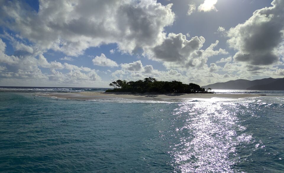
Sandy Spit in 2016, the year before Hurricane Irma: a low ring of sand round a thicket of trees, hills on the horizon to the right Photo: Rankshift, CC BY-SA 4.0
On the islet
Bring your ownWater, food, sunscreen and a bag for your rubbish. There is no shop, tap or bin.
A short sail west
White BayThe Soggy Dollar, Hendo's Hideout and Ivan's — see the White Bay guide for each one's hours.
Great HarbourFoxy's and the waterfront bars and restaurants by the ferry dock and customs.
Weather & sea
Sandy Spit weather and the best time to go
Warm all year, with a steady easterly trade wind and short tropical showers rather than all-day rain; the forecast below has this week's numbers. December to April is the dry season and the busy sailing season. June to November is hurricane season — Irma, in September 2017, stripped the islet's trees.
Sandy Spit is a flat sand islet with no bay round it, so it takes whatever the sea is doing. Green Cay breaks some of the swell from the north, but the anchorage is a day stop only, and on a day of big trade-wind seas or a winter north swell the boat rolls and the swim to the sand gets rough. The call at the top of this page reads the swell every half hour.
The next 7 days on Jost Van Dyke
Day
Sky
High / low
Rain
Wind
Seas offshore
Today
Thunderstorms
84° / 79°F
96%
SW 18 mph, gusts 24
3.2 ft
Tomorrow
Thunderstorms
83° / 80°F
85%
WSW 20 mph, gusts 27
3.7 ft
Sun, Nov 8
Drizzle
84° / 82°F
63%
W 12 mph
3.3 ft
Mon, Nov 9
Clear
83° / 82°F
32%
NNW 8 mph
2.6 ft
Tue, Nov 10
Drizzle
83° / 81°F
45%
NE 14 mph
2.1 ft
Wed, Nov 11
Overcast
84° / 83°F
22%
E 14 mph
2.3 ft
Thu, Nov 12
Drizzle
85° / 82°F
25%
ESE 12 mph
2.9 ft
Open-Meteo forecast for Jost Van Dyke, refreshed every half hour. The seas are offshore; how much of it reaches the sand is the call above. BVI weather & sailing week · North swell season
Sea temperature by month
80°Jan
80°Feb
80°Mar
81°Apr
83°May
85°Jun
85°Jul
85°Aug
86°Sep
86°Oct
84°Nov
82°Dec
Daily-mean sea-surface temperature off Jost Van Dyke, averaged 2021–2024 (Open-Meteo marine reanalysis): warmest in Sep (86.3°F), coolest in Feb (79.6°F).
Live cameras
Is there a Sandy Spit webcam?
No — there is no live camera on Sandy Spit or anywhere that looks at it. The nearest cameras are at White Bay on Jost Van Dyke, about 3½ miles west: the Soggy Dollar's and Pink House Villas'. They show the weather and the sea on the island's south side, not the islet itself.
The Lettsom family of Little Jost Van Dyke own Green Cay and Sandy Cay and grow cotton on them; Sandy Spit, almost all beach, is never farmed. There is no sign that anyone ever lived on any of the three.
Early 1980s
Proposed for protection
Green Cay and Sandy Spit are first proposed as protected areas.
2003
For sale
The two privately owned islets are offered for sale through a German private-island broker — $1.7 million for about 15 acres, MercoPress reports. Foxy Callwood leads a fundraising drive through the Jost Van Dykes Preservation Society, and the BVI Government says it will buy them.
2003
The water protected
The Fisheries Regulations declare 15.5 ha east of Green Cay and Sandy Spit a fisheries protected area — one of fourteen in the territory.
2005
Bought by the Government
The Government completes its purchase of Green Cay and Sandy Spit, which become Crown land.
May 2008
Sandy Cay becomes a park
The estate of Laurance S. Rockefeller gives Sandy Cay, a mile to the south, to the BVI National Parks Trust. The BVI's protected-areas plan, approved that year, proposes one protected area for Sandy Cay, Green Cay and Sandy Spit together.
September 6, 2017
Hurricane Irma
Irma takes all of Sandy Spit's trees, News of St. John reports.
November 2017
Replanted
Two St. John residents, Monica Knaggs and Connor Masterson, go over and plant rooted coconut palms in the shape of a heart, with soil given free by St. John Hardware.
Sandy Spit in 2016, the year before Hurricane Irma: a low ring of sand round a thicket of trees, hills on the horizon to the right Photo: Rankshift, CC BY-SA 4.0
From St. John or St. Thomas you are crossing into the British Virgin Islands: everyone shows a passport where the boat clears in, U.S. citizens included, and again at U.S. customs on the way home.
Fill in the ED card first
The BVI's online embarkation card is required of every traveller; do it on your phone up to 72 hours before you go.
Pick a calm day
A bare sand islet has no lee. Check the call at the top of this page and the swell before you book, and let the captain decide on the day.
Shade is scarce
Bring a hat and a shirt: the bush in the middle is the only shade, and there is no awning or umbrella to rent.
Leave nothing
No bins and no one to clear up: every can, bottle and wrapper goes back on the boat.
Mind the nests
Sea turtles have nested on Sandy Spit's beach. Keep clear of any marked nest, and do not dig at the bush line.
Only by boat: a day charter from St. John, St. Thomas or Tortola, a water taxi, or your own boat. There is no dock, no ferry and no moorings — boats anchor on the sand off the islet and you swim or wade ashore. From the U.S. Virgin Islands the boat first clears BVI customs and immigration, usually at Great Harbour on Jost Van Dyke or West End on Tortola.
Do you need a passport to go to Sandy Spit from St. John or St. Thomas?
Yes. Sandy Spit is in the British Virgin Islands, so everyone arriving from the U.S. Virgin Islands — U.S. citizens and children included — needs a passport and the BVI's online ED card, and the boat clears in at a port of entry before anyone goes ashore. You clear U.S. customs again on the way back.
How much does it cost to visit Sandy Spit?
The islet is free: it is Crown land with no gate. From the USVI the BVI charges visitors a $10 environmental and tourism levy on arrival, and the boat pays its own BVI charges through the captain. The price of the boat itself is the charter operator's: ask what it includes.
Is there anything on Sandy Spit?
No. There is no bar, no toilets, no fresh water, no bins and no shade beyond the bush in the middle. Bring water and food on the boat and take everything back with you.
How big is Sandy Spit?
Tiny — about a quarter of an acre (0.1 ha) in the 2009 Environmental Profile of Jost Van Dyke, and barely 2 m (6 ft) above the sea. You can walk round it in a few minutes. Its shape changes with the storms, and Hurricane Irma took its trees in 2017.
Who owns Sandy Spit?
The BVI Government. Sandy Spit and Green Cay were privately owned and up for sale in 2003; the Government completed its purchase of both in 2005, and the 2009 Environmental Profile records them as Crown land. The water to the east of them has been a fisheries protected area since 2003.
What happened to Sandy Spit in Hurricane Irma?
Irma, on September 6, 2017, took all of the islet's trees, News of St. John reported. Two months later two St. John residents planted rooted coconut palms there to start it growing again. How much has come back since, we could not confirm.
Is Sandy Spit good for snorkeling?
There is reef and rock round the edges and along the bar to Green Cay, and seagrass toward Jost Van Dyke. Snorkel on a calm day, stay off the coral and away from breaking water, and do not fish: the water east of the islet is a fisheries protected area.
Can you anchor overnight at Sandy Spit?
It is a day stop. There are no moorings and no shelter from the sea round a flat islet; sailors anchor on the sand for a swim and move to Great Harbour or Little Harbour on Jost Van Dyke for the night.
What is the difference between Sandy Spit and Sandy Cay?
They are two islets about a mile apart. Sandy Spit is the tiny sand islet next to Green Cay; Sandy Cay, to the south, is bigger, green and hilly, with a walking trail, and has been a BVI National Parks Trust park since the Rockefeller estate gave it in 2008.
Is there a webcam at Sandy Spit?
No. No live camera looks at the islet. The nearest are at White Bay on Jost Van Dyke, about 3½ miles west — the Soggy Dollar's and Pink House Villas' — on our Jost Van Dyke webcams page.
Photo & map credits
A catamaran anchored off Sandy Spit, people on the sand and the islet's bush and palms behind, with the rocky south end of Green Cay on the left (April 2011) — Cayeldo, CC BY-SA 3.0, via Wikimedia Commons (resized).
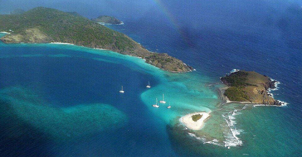
Sandy Spit and Green Cay from the air: the sand islet ringed by shallows in front, Green Cay on the right, yachts at anchor in the pale water between them and the east end of Little Jost Van Dyke (March 2012) — giggel, CC BY 3.0, via Wikimedia Commons (resized).
Sandy Spit from the air: an oval of white sand with a clump of bush and a palm in the middle, reef and seagrass showing through the shallows around it (March 2012) — giggel, CC BY 3.0, via Wikimedia Commons (resized).
On Sandy Spit: soft sand, a young coconut palm and seagrape bush, and beachrock at the water's edge, looking across the shallows to the hill of a neighbouring island (April 2011) — Cayeldo, CC BY-SA 3.0, via Wikimedia Commons (resized).
Sandy Spit in 2016, the year before Hurricane Irma: a low ring of sand round a thicket of trees, hills on the horizon to the right — Rankshift, CC BY-SA 4.0, via Wikimedia Commons (resized).
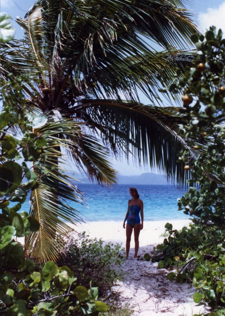
On Sandy Cay, the national park a mile to the south: a path through seagrape and coconut palms opening onto the beach (before 2009) — David Broad, CC BY 3.0, via Wikimedia Commons (resized).
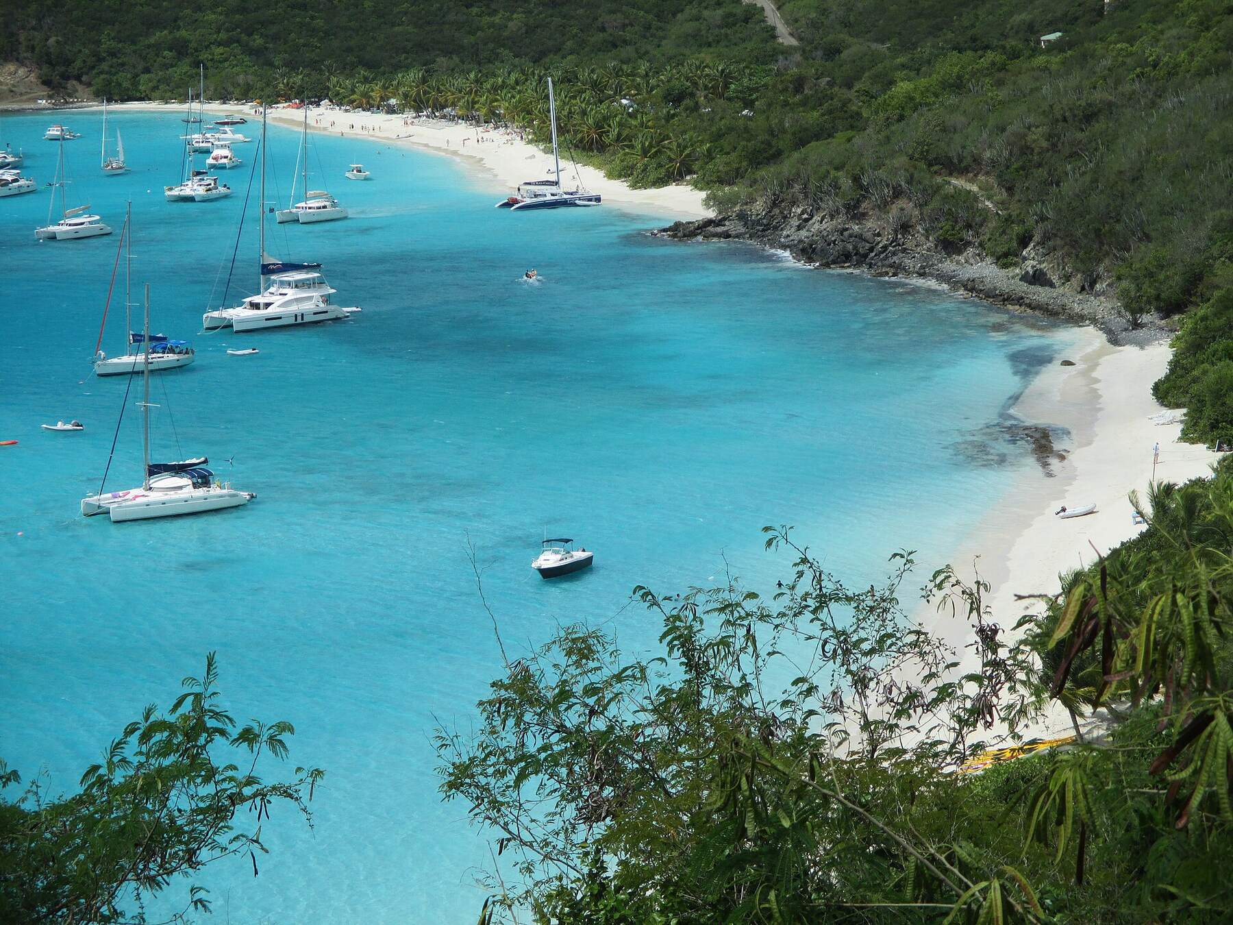
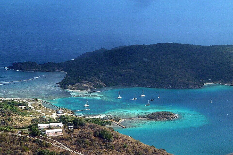
The east end of Jost Van Dyke from the air, with Little Jost Van Dyke beyond the anchorage; Sandy Spit lies off Little Jost's far end, out of frame (March 2012) — giggel, CC BY 3.0, via Wikimedia Commons (resized).
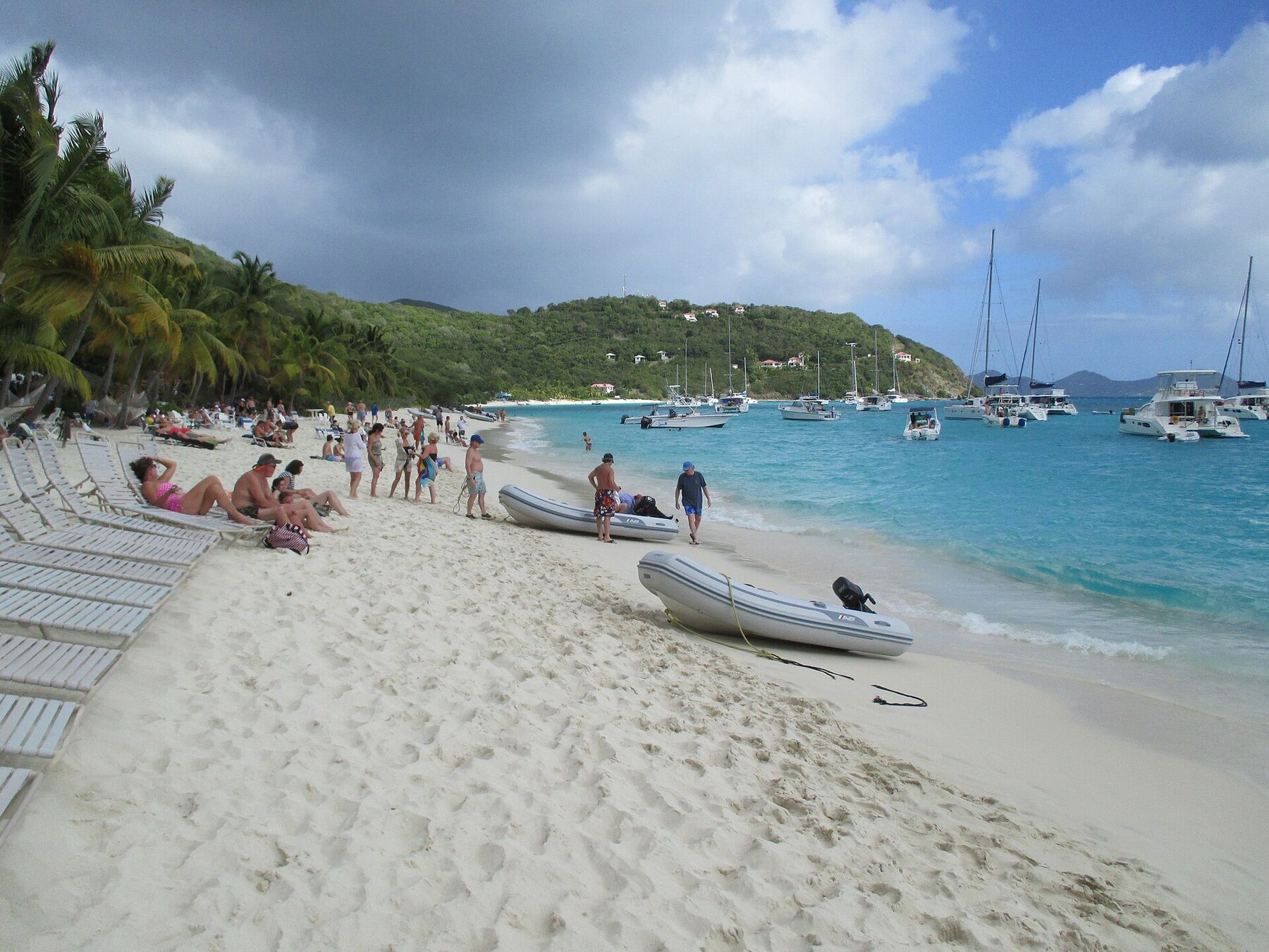
White Bay's main beach looking east: dinghies pulled up on the sand, sunbathers on loungers under the palms and yachts at anchor in the bay (February 2015) — User:Mattes, CC BY 2.0 de, via Wikimedia Commons (resized).
 Skip today today
 Skip today today