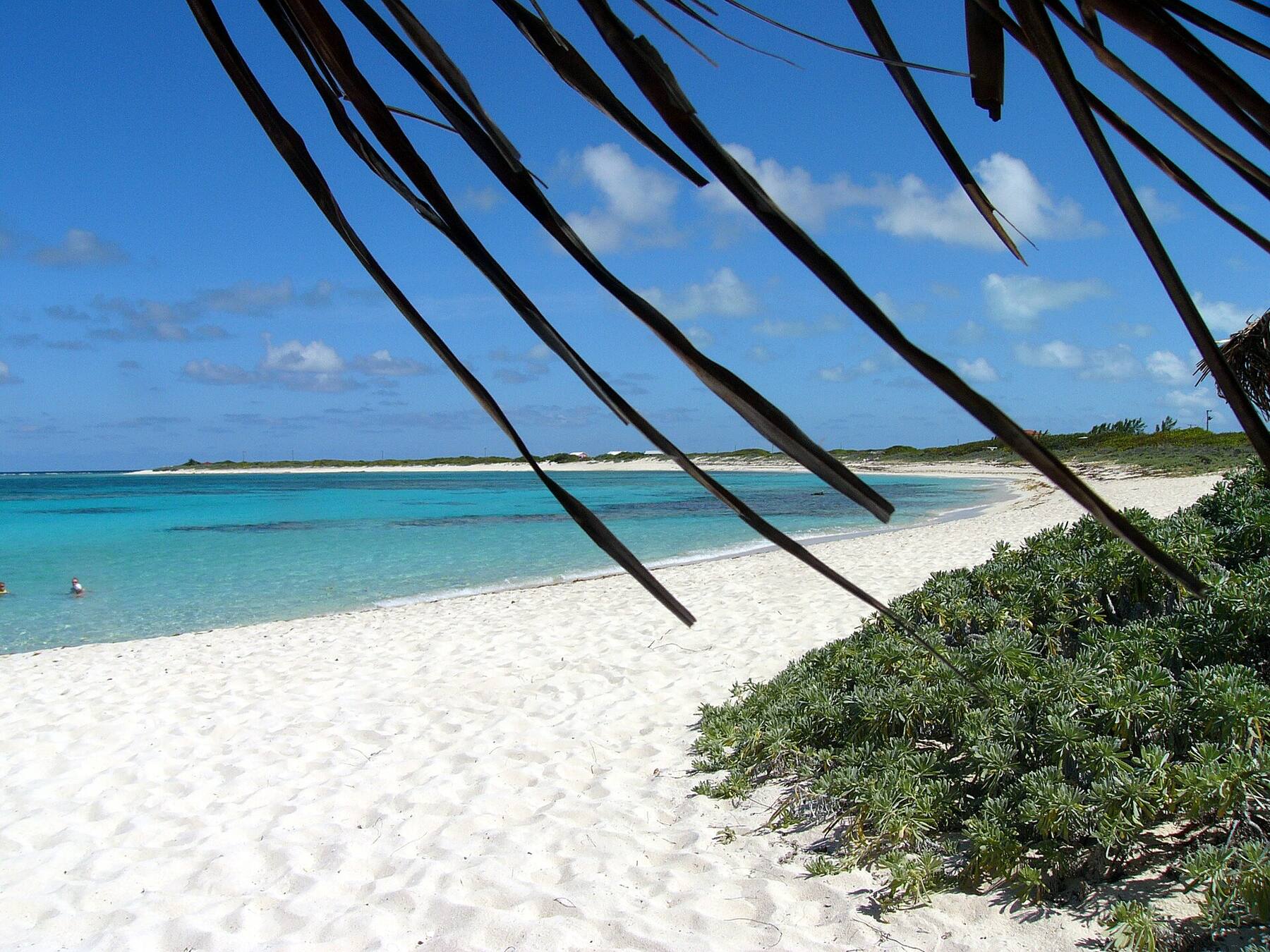
White sand at the south-west corner of Anegada, where the south shore turns north up the island's west end — on the sheltered side of the island, facing west across the water for the sunset. Sid's Pomato Point Restaurant is on the point. It is a short ride west of the Setting Point dock, where the ferries land.
The south-west corner of Anegada, British Virgin Islands — west of the Setting Point ferry dock along the south shore
The beach
White sand round the point, running east along the south shore and north up the west end
Faces
South-west and west: the sunset side, away from the Atlantic swell that reaches the north-shore beaches
The island
Anegada is coral and limestone, not volcanic like the other Virgin Islands, and its highest ground is about 28 ft above the sea
Entry
No gate and no entry fee
On the sand
Sid's Pomato Point Restaurant, on the point — lunch and dinner, dinner booked by 4 pm
Getting here
Smith's Ferry from Road Town on published dates, Inter Island's day trip from Red Hook and Cruz Bay, or a charter flight — then a taxi or a rental from Setting Point
Papers
A passport and the BVI's online ED card for everyone arriving from the U.S. Virgin Islands; from Tortola the trip is domestic
On the old chart
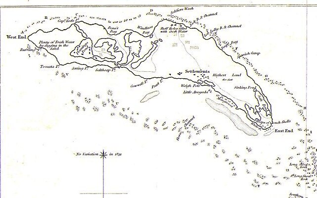
R. H. Schomburgk's 1832 survey marks the point “Tomata Pt.”
Webcam
None — there is no public live camera on Anegada; the nearest is Saba Rock in North Sound, Virgin Gorda
Today
Is Pomato Point good today?
Good Thunderstorms in the forecast. The best stretch left today is 9 am–12 pm.
Day
The call
Why
Best time
Cruise guests here
Sea at the beach
Rain
Today
Good
Thunderstorms in the forecast
9 am–12 pm
—
Some chop · 2.1 ft
Thunder
Tomorrow
Skip today
Rough — 4.7 ft NW swell, shore break · Thunderstorms in the forecast
11 am–2 pm
—
Rough · 3.7 ft
Thunder
Sun, Nov 8
Good
Choppy — N swell into the bay
3 pm–6 pm
—
Gentle · 1.7 ft
57%
Mon, Nov 9
Go
Calm, glassy water
11 am–2 pm
—
Calm · 0.3 ft
31%
Tue, Nov 10
Go
Calm, glassy water
12 pm–3 pm
—
Calm · 0.3 ft
33%
The call is the same one our beach report makes, refreshed every half hour: the swell reaching the island (Open-Meteo's marine forecast off Anegada), NOAA's sargassum satellite and the rain forecast. No cruise ship calls at Anegada, so there is no crowd model here. It is a model, not a report from the beach — the water in front of you has the last word. The bars under each call are the hours from 8 am to 5 pm. Today's beach report
The boats from Tortola and the USVI, what the BVI charges at the border, the island's taxi fares, today's beach and weather reads and the island around it — each one opens the full page.
Pomato Point from OpenStreetMap: the sand round the island's south-west corner, the short track from Anegada Road down to the south shore, and the road itself, east to the Setting Point dock and north up the west end. OpenStreetMap does not map Sid's; it is on the point. Tap a pin for its section.
Getting there
How to get to Pomato Point
Anegada sits on its own about 15 miles north of Virgin Gorda, and there is no daily boat. From Tortola, Smith's Ferry sails from Road Town to Setting Point, on the south shore, on the dates its schedule lists. From St. Thomas and St. John, Inter Island Boat Services runs a day trip from Red Hook and Cruz Bay on the dates it sells. Fly BVI flies on-demand charters from Beef Island and around the region.
Pomato Point is a short ride from the dock, much nearer than the north-shore beaches: west from Setting Point along Anegada Road, then down a short track to the shore. Taxis meet the boats at Setting Point, but the official BVI fare table has no row for Pomato Point, so agree the fare with the driver before you set off. Many visitors rent a car, jeep or scooter instead — the island is flat and the roads quiet. Drive on the left.
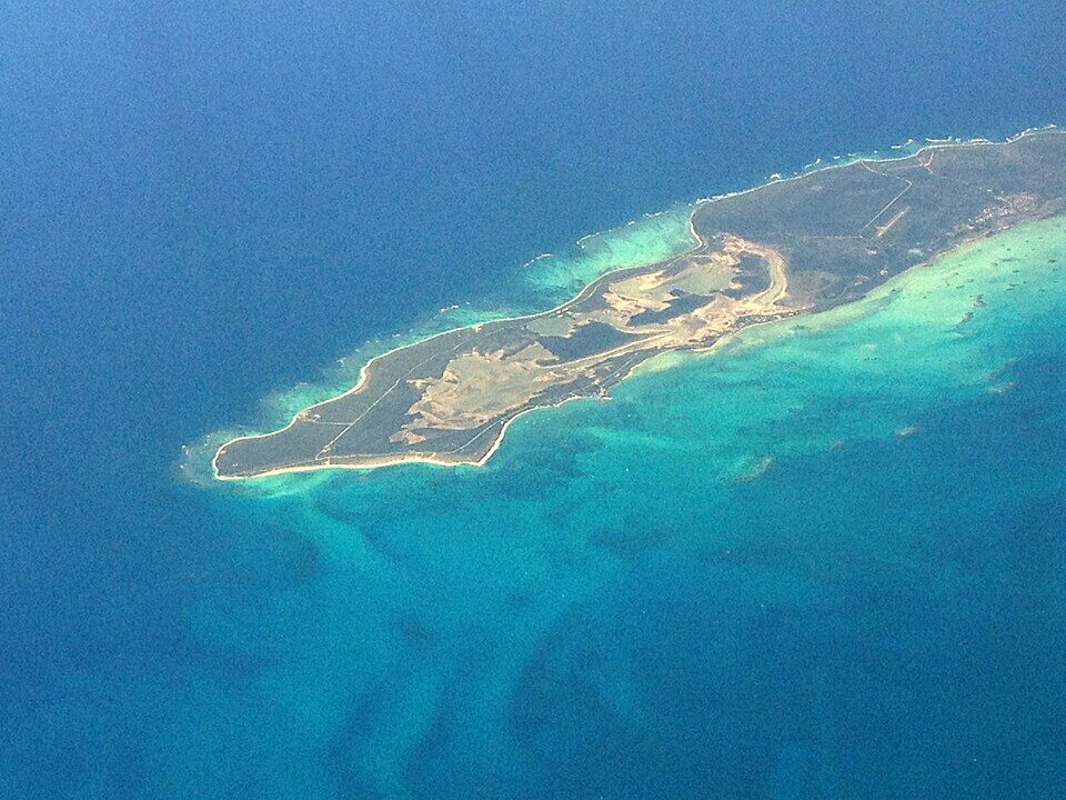
Anegada from the air: the long, low island with the pale salt ponds of the west end on the left, ringed by sand and the turquoise water over the reef Photo: David Broad, CC BY 3.0
Check the date, not the weekday: Smith's Ferry sails to Anegada only on the dates on its schedule, and weather can cancel a crossing.
Agree the taxi fare first — there is no posted official fare to Pomato Point — and take your driver's number for the ride back.
Coming from St. Thomas or St. John, everyone needs a passport — U.S. citizens and children included.
Staying for sunset means staying the night, or a boat of your own: the ferries leave in the afternoon.
Sailing up? Come in through the marked channel to Setting Point in good light; the reef around Anegada has wrecked many ships.
Pomato Point: the restaurant, the boats and the charges
The beach is free — there is no gate. What a day at Pomato Point costs is getting to Anegada: the ferry or the plane, the ride from the dock, and, from St. Thomas or St. John, the British Virgin Islands' charges at the border. Sid's, the restaurant on the point, wants dinner orders in by 4 pm.
What getting here costs
Pomato Point beach
Free
BVI environmental and tourism levy, arriving from the USVI
$10
BVI departure tax, leaving by ferry
$20
The levy and departure tax are the UK government's figures, and apply only when you cross from the U.S. Virgin Islands. The ferry fares are on our route pages, from the operators. There is no posted official taxi fare to Pomato Point: agree it with the driver.
The restaurant and the boats
Sid's Pomato Point Restaurant
Lunch and dinner
Sid's dinner reservations
By 4:00 pm
Inter Island, from Red Hook
7:00 am
Inter Island, from Cruz Bay
7:30 am
Inter Island, from Anegada
4:00 pm
Sid's hours are the BVI Tourist Board's listing: lunch and dinner, dinner reservations by 4 pm; online listings give 11 am to 11 pm. Our seasonal-closures list has Sid's closing from late July to about November 1 — dates Sid's has not confirmed — so call or check its Facebook page before you go. Smith's Ferry sails from Road Town on the dates in its schedule (our route page has them); Inter Island runs on the dates in its booking calendar, with check-in 45 minutes before.
Papers
✓A passport, arriving from the USVI — for everyone, U.S. citizens and children included — Inter Island requires one
✓The BVI's online ED card — required of every traveller entering the BVI since January 1, 2025; fill it in up to 72 hours ahead
✓U.S. customs on the way back — when the boat lands in Cruz Bay or Red Hook
Pomato Point is a quiet beach with one place to eat on it: Sid's, on the point itself. There is nothing else to rent or buy — bring what you need for the day. Hours are the restaurant's own, as listed in October 2026.
Restaurant & bar
Sid's Pomato Point Restaurant
Sidney Wheatley's restaurant, on the point. The BVI Tourist Board lists it for West Indian food — known, it says, for fresh-caught seafood dinners — with lunch and dinner, dinner reservations by 4 pm and a deck for the sunset. Its lobster corn dog won Best Sampler at the 2024 Anegada Lobster Festival, and it served lobster mac-and-cheese bites at the 2025 festival. The number listed for it is (284) 441-5565. OpenStreetMap does not map it; it is on the point.
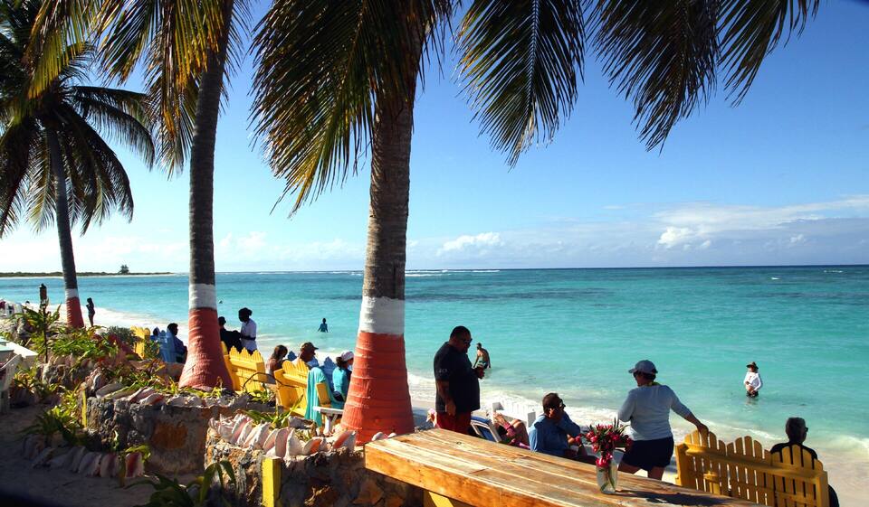
White sand runs round the point: east along the south shore toward Setting Point, and north up the west end of the island. The beach faces south-west and west, on the side of the island away from the north-shore reef and the Atlantic swell that breaks on it, so the water in front is usually calmer than at Loblolly or Cow Wreck. It is a beach for swimming and sitting, not a reef snorkel.
We know of no lifeguard service at Pomato Point or anywhere on Anegada: swim with someone, and stay out when a south or west wind is pushing waves onto the beach — the call at the top of the page reads the sea every half hour. Shade is the scrub at the back of the sand and the restaurant; bring a hat and water.
Getting back
Taxis, cars and the track
There is no taxi stand at Pomato Point. OpenStreetMap maps a short track from Anegada Road down to the south shore just east of the point, and Anegada Road runs on east to the Setting Point dock and north up the west end. Agree a taxi fare before you set off — there is no posted official one — and book the ride back, especially to make a ferry.
Pomato Point faces west across open water, so the sun goes down in front of you. Sid's deck is built for it, and the BVI Tourist Board's listing says as much. Book dinner by 4 pm and watch it from the table. The ferries leave in the afternoon, so a sunset here means a night on the island or a boat of your own.
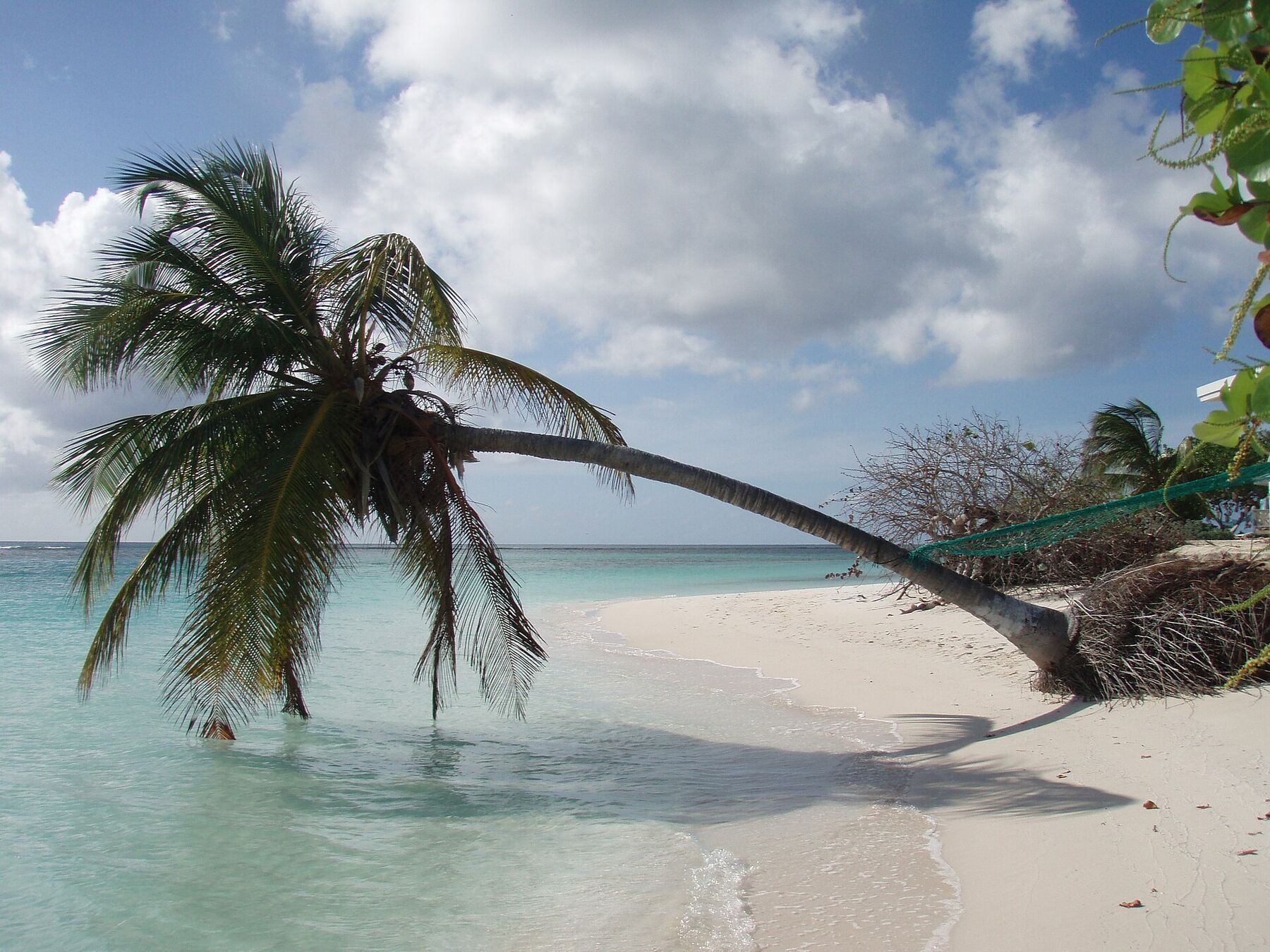
From the point the sand runs north up the west shore of the island to its westernmost tip, about a mile away, where a palm leans out over the water. Walk it at the water's edge and back; there is no shade on the way.
Inland from the point lie the salt ponds of the west end, a protected Ramsar wetland since 1999. Schomburgk's 1832 chart marks a Flamingo Pond here; the birds later vanished from the island, and in 1992 The Conservation Agency, the Bermuda Aquarium, Museum & Zoo and the Guana Island Wildlife Sanctuary released 22 Bermuda-bred flamingos, whose flock now numbers in the hundreds. Look on the road from Setting Point, keep your distance and bring binoculars.
Anegada means lobster. Besides Sid's, the restaurants round the Setting Point anchorage, a short ride east, grill it on the beach at night. The island's Lobster Festival is 27 to 29 November in 2026, the BVI Tourist Board's event page says, with extra boats from Tortola and the USVI.
Eating at Pomato Point means Sid's: West Indian food and fresh-caught seafood, lobster above all, for lunch and dinner. Kitchens on Anegada cook what has been ordered, so call ahead — dinner orders by 4 pm. Bring cash as well as a card.
Every year in late November the island's restaurants hold the Anegada Lobster Festival — 27 to 29 November in 2026, the BVI Tourist Board's event page says. Sid's won the 2024 Best Sampler with a lobster corn dog.
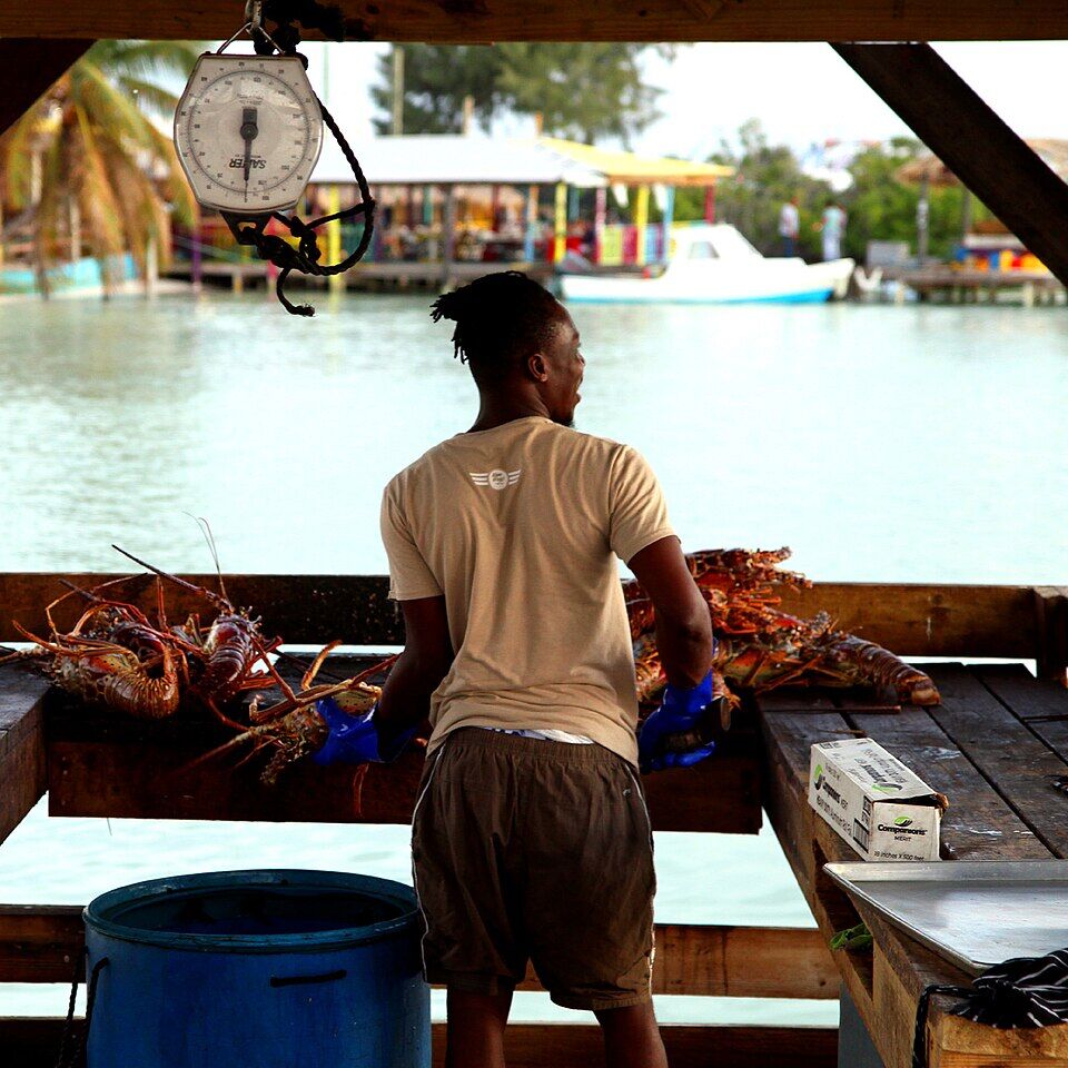
Sorting spiny lobsters at a waterfront stand on Anegada during the Lobster Festival (November 2019) Photo: anoldent, CC BY-SA 2.0
At Pomato Point
Sid's Pomato Point RestaurantSeafood and lobster on the point, with a deck for the sunset; lunch and dinner, dinner booked by 4 pm. Closed for part of the late-summer off-season.
Elsewhere on Anegada
Setting PointThe restaurants by the ferry dock and the anchorage, a short ride east, where lobster is grilled on the beach at night.
The north shoreBeach bars at Cow Wreck and Loblolly Bay for lunch, across the island.
Weather & sea
Pomato Point weather and the best time to go
Warm all year, with a steady easterly trade wind blowing across the flat island and short tropical showers rather than all-day rain; the forecast below has this week's numbers. December to April is the dry, busy sailing season. June to November is hurricane season, and in late summer some of the island's restaurants, Sid's among them, close for a while.
Pomato Point faces south-west and west, with the whole island between it and the easterly trade wind, and the Atlantic swells that break on the north-shore reef in winter do not reach it head-on. Most days the water here is calm. What does reach it is a wind or a swell from the south or west — a passing storm, or a hurricane-season system. The call at the top of this page reads the sea every half hour.
The next 7 days on Anegada
Day
Sky
High / low
Rain
Wind
Seas offshore
Today
Thunderstorms
85° / 80°F
87%
SW 18 mph, gusts 30
3.7 ft
Tomorrow
Thunderstorms
83° / 79°F
90%
WSW 20 mph, gusts 28
4.1 ft
Sun, Nov 8
Thunderstorms
84° / 80°F
66%
W 15 mph
3.7 ft
Mon, Nov 9
Partly cloudy
84° / 82°F
18%
NNW 8 mph
3.3 ft
Tue, Nov 10
Overcast
83° / 82°F
24%
NE 13 mph
3 ft
Wed, Nov 11
Overcast
83° / 82°F
21%
E 13 mph
2.9 ft
Thu, Nov 12
Drizzle
84° / 82°F
24%
ESE 11 mph
2.6 ft
Open-Meteo forecast for Anegada, refreshed every half hour. The seas are offshore; how much of it reaches the sand is the call above. BVI weather & sailing week · North swell season
Sea temperature by month
80°Jan
79°Feb
80°Mar
81°Apr
84°May
85°Jun
85°Jul
85°Aug
87°Sep
86°Oct
84°Nov
81°Dec
Daily-mean sea-surface temperature off Anegada, averaged 2021–2024 (Open-Meteo marine reanalysis): warmest in Sep (86.5°F), coolest in Feb (79.4°F).
Live cameras
Is there a Pomato Point webcam?
No. There is no public live camera at Pomato Point or anywhere on Anegada that we can embed, and we would rather say so than show a still photo dressed up as live. The nearest live camera is at Saba Rock, in North Sound at the east end of Virgin Gorda — about 15 miles south.
R. H. Schomburgk's survey, “Anegada, with its Reefs”, is published by the Royal Geographical Society. It marks the island's south-west corner “Tomata Pt.”, west of Setting Point, with a Flamingo Pond inland and a note that fresh water could be had by digging in the sand.
1992
Flamingos come back
Twenty-two flamingos bred in Bermuda are released in Anegada's salt ponds, decades after the island's own flock had gone. The flock now numbers in the hundreds.
May 11, 1999
A protected wetland
The Western Salt Ponds of Anegada, 1,071 hectares of lagoons, mudflats and mangrove, are designated a wetland of international importance under the Ramsar Convention.
November 2024
Best Sampler
Sid's Pomato Point wins Best Sampler, and the new Alffy trophy, at the 12th Anegada Lobster Festival with a lobster corn dog.
November 2025
The thirteenth festival
Sid's serves three-cheese lobster mac-and-cheese bites at the 2025 Anegada Lobster Festival.
“Anegada, with its Reefs” (cropped to the island): R. H. Schomburgk's survey, published by the Royal Geographical Society in July 1832 — “Tomata Pt.” is marked at the island's south-west corner, west of Setting Point, with Flamingo Pond inland Photo: R. H. Schomburgk, Public domain
At the island's south-west corner, where the south shore turns north up the west end — west of the Setting Point ferry dock along Anegada Road, then down a short track to the shore — a short ride from the dock, much nearer than the north-shore beaches.
How do you get to Pomato Point?
By ferry or plane to Anegada, then a taxi or a rental from Setting Point. Smith's Ferry sails from Road Town, Tortola, to Setting Point on the dates its schedule lists; Inter Island Boat Services runs a day trip from Red Hook (St. Thomas) and Cruz Bay (St. John) on the dates it sells; Fly BVI flies on-demand charters. The official BVI taxi fare table has no row for Pomato Point, so agree the fare with the driver before you set off.
How much is a taxi to Pomato Point?
There is no posted official fare to Pomato Point: the BVI fare table for Anegada lists Setting Point to Loblolly Bay, Cow Wreck Beach, the Anegada Beach Club and The Settlement, but not Pomato Point. Agree the fare with the driver at Setting Point before you set off, and book the ride back.
Is Sid's Pomato Point open?
The BVI Tourist Board lists Sid's for lunch and dinner, with dinner reservations by 4 pm; online listings give 11 am to 11 pm. It closes for part of the late-summer off-season — our seasonal-closures list has late July to about November 1, dates Sid's has not confirmed — so call (284) 441-5565 or check its Facebook page before you go.
Is Pomato Point good for sunset?
Yes — it faces west across open water, so the sun sets in front of the beach, and Sid's has a deck for watching it. The ferries leave Anegada in the afternoon, so staying for sunset means a night on the island or a boat of your own.
Is the water calm at Pomato Point?
Usually. The beach faces south-west and west, on the side of the island away from the easterly trade wind and the Atlantic swell that breaks on the north-shore reef. A wind or swell from the south or west can still push waves onto it; the call at the top of this page reads the sea every half hour.
Can you snorkel at Pomato Point?
It is a swimming and sunset beach rather than a snorkelling one. For reef straight off the sand, Loblolly Bay on the north shore is the island's beach snorkel, on a calm day.
Are there lifeguards at Pomato Point?
We know of no lifeguard service at Pomato Point or anywhere on Anegada. Swim with someone, and stay out of the water when wind or swell is pushing waves onto the beach.
Do you need a passport to visit Pomato Point?
From the U.S. Virgin Islands, yes: Anegada is in the British Virgin Islands, so everyone arriving from St. Thomas or St. John — U.S. citizens included — needs a passport and the BVI's online ED card, and pays the BVI's $10 arrival levy and $20 ferry departure tax. From Tortola or Virgin Gorda it is a domestic trip.
Why is it called Pomato Point?
We have found no source for the name. The oldest chart we know, R. H. Schomburgk's survey of 1832, already marks the island's south-west corner — spelled “Tomata Pt.” on that map.
Is there a webcam at Pomato Point?
No. There is no public live camera at Pomato Point or anywhere on Anegada. The nearest live camera is at Saba Rock in North Sound, Virgin Gorda, about 15 miles south.
Photo & map credits
A coconut palm leaning out over clear, shallow water on white sand at Anegada's westernmost tip — the same shore as Pomato Point, about 1.5 km north of it (May 2008) — ScubaBear68, CC BY 2.0, via Wikimedia Commons (resized).
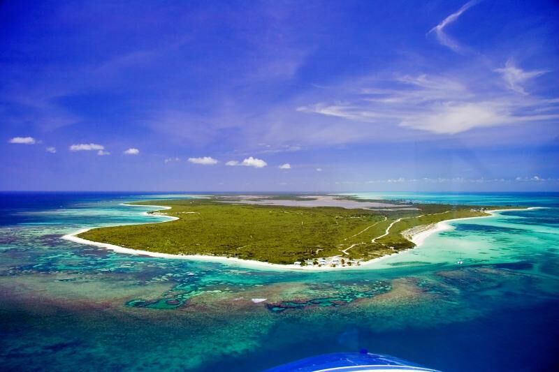
Anegada's west end from the air: a low green island ringed by white sand, with the reef and turquoise shallows around it and the pale salt ponds inland — Walker Mangum, Public domain, via Wikimedia Commons (resized).
Anegada from the air: the long, low island with the pale salt ponds of the west end on the left, ringed by sand and the turquoise water over the reef — David Broad, CC BY 3.0, via Wikimedia Commons (resized).
Sorting spiny lobsters at a waterfront stand on Anegada during the Lobster Festival (November 2019) — anoldent, CC BY-SA 2.0, via Wikimedia Commons (resized).
“Anegada, with its Reefs” (cropped to the island): R. H. Schomburgk's survey, published by the Royal Geographical Society in July 1832 — “Tomata Pt.” is marked at the island's south-west corner, west of Setting Point, with Flamingo Pond inland — R. H. Schomburgk, Public domain, via Wikimedia Commons (resized).
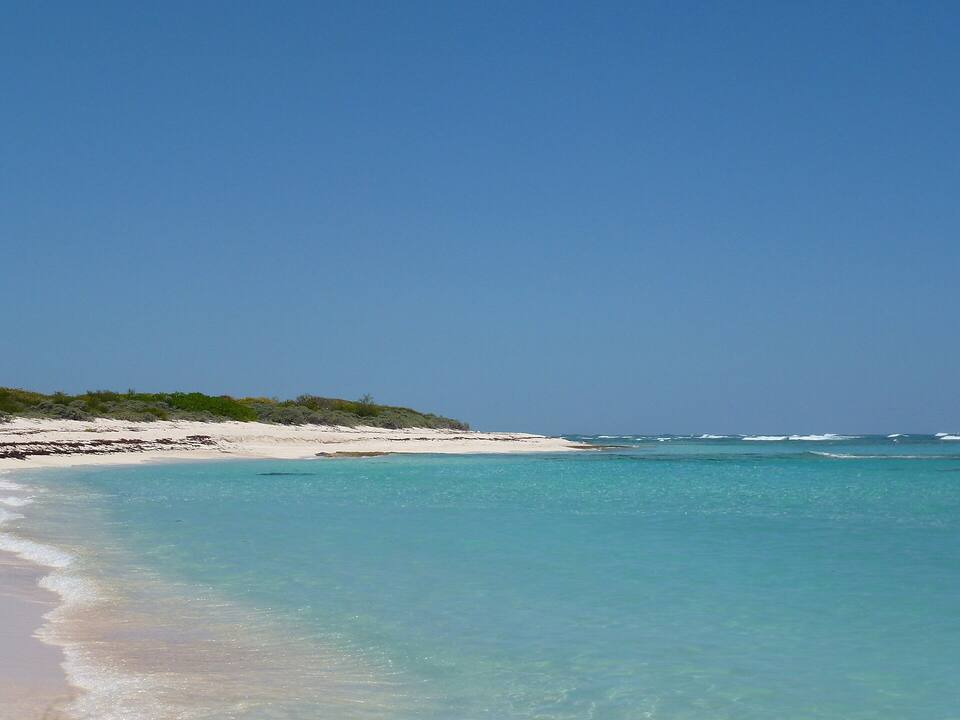
The beach at Loblolly Bay: pale sand, clear shallow water and low green scrub along the shore — Cayeldo, CC BY-SA 3.0, via Wikimedia Commons (resized).
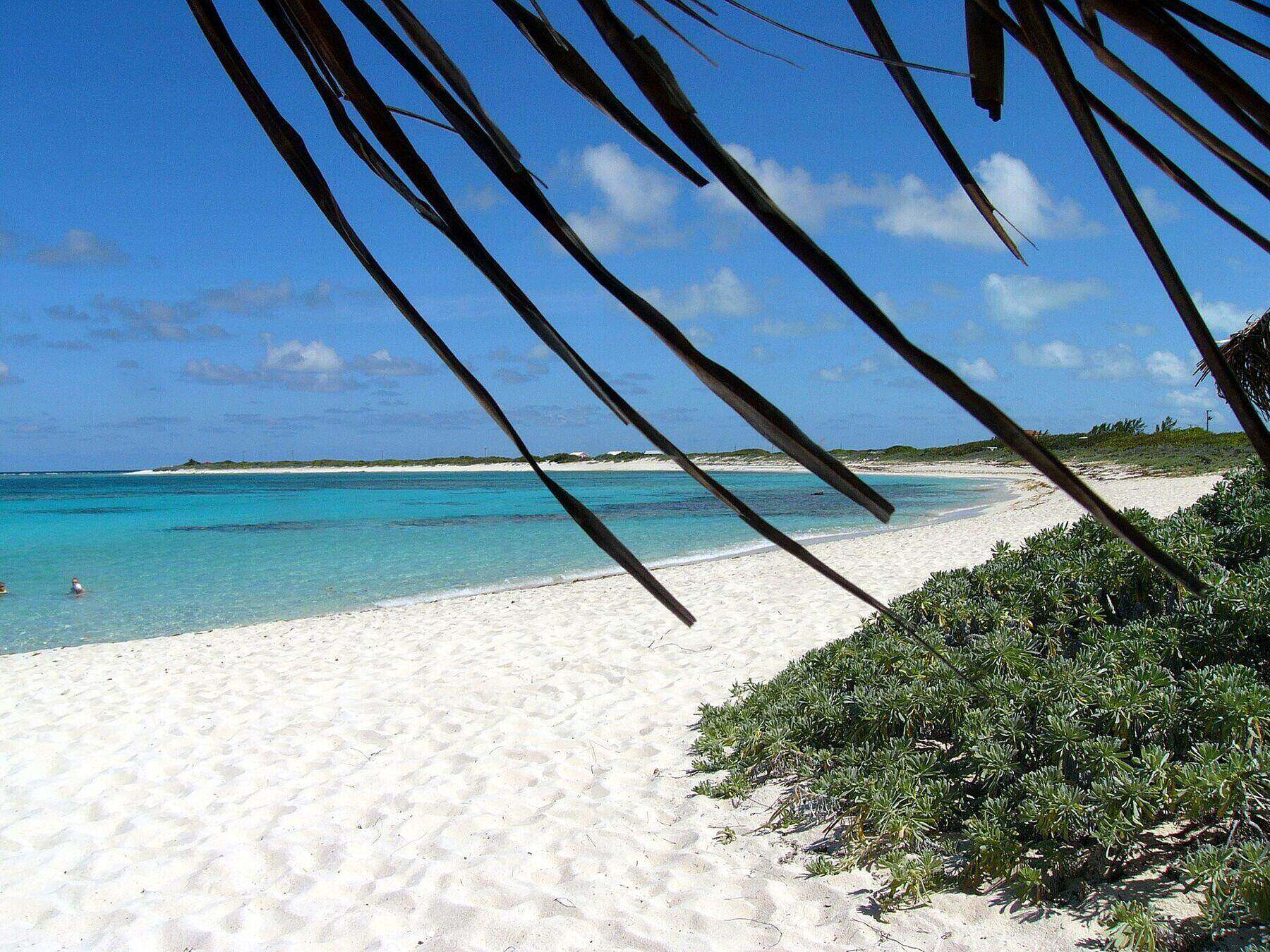
Loblolly Bay looking east along Anegada's north shore from under a thatched shade: white sand, two swimmers in the turquoise shallows, the reef dark under the water, and the far end of the bay — Flash of Beauty's end — on the horizon — Kathleen Tyler Conklin, CC BY 2.0, via Wikimedia Commons (resized).
Cow Wreck Beach from the bar: palms, picnic tables and swimmers in shallow turquoise water — anoldent, CC BY-SA 2.0, via Wikimedia Commons (resized).
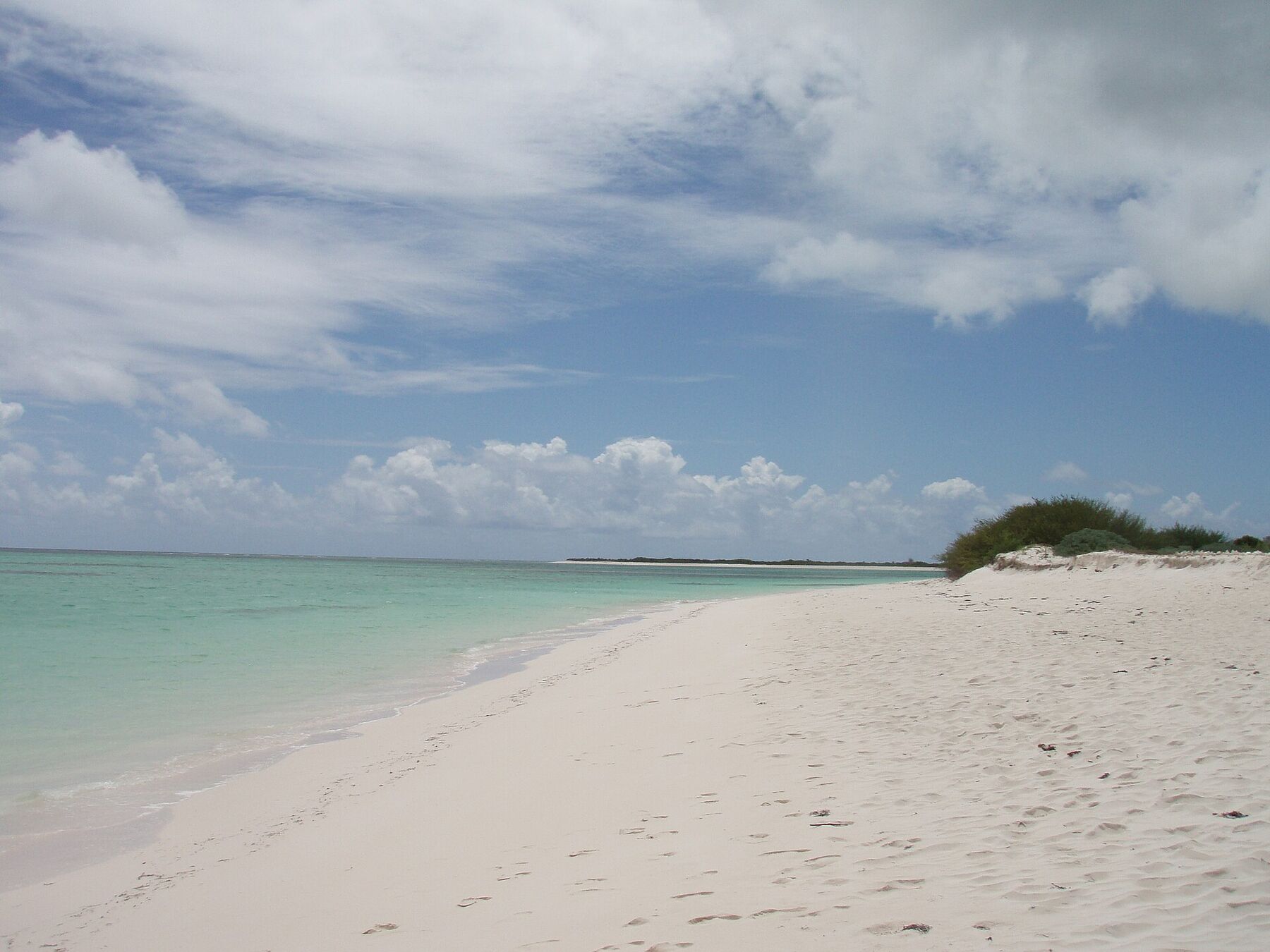
White sand and a low dune of scrub on Anegada, photographed on the drive to Cow Wreck Beach: shallow green water inside the reef and the flat shore running away into the distance (May 2008) — ScubaBear68, CC BY 2.0, via Wikimedia Commons (resized).
 Skip today today
 Skip today today
 Skip today today
 Skip today today