A curve of sand at the far West End of Tortola, at the end of an unpaved road from Long Bay: a cove that opens west under Belmont Point, with reef along its edges and two small beach bars on the sand. Little else is there — no gate, no fee, no public restroom — and it is the nearest beach to the West End ferry from St. Thomas.
The call is the same one our beach report makes, refreshed every half hour: the swell reaching the cove (Open-Meteo's marine forecast off the West End), the cruise passengers our crowd model puts on the sand, NOAA's sargassum satellite and the rain forecast. It is a model, not a lifeguard's report — we found no published lifeguard service at Smuggler's Cove, so look at the water before you swim. The bars under each call are the hours from 8 am to 5 pm. Today's beach report
Taxi fares from the West End ferry, the cruise pier and the airport, the ferry over from St. Thomas, the ships that send a crowd, today's beach and weather reads and the island around it — each one opens the full page.
Smuggler's Cove from OpenStreetMap: the sand, the roads in (Palm Road from Long Bay is unpaved for its last stretch), the houses of Belmont on the hill, and each facility where OpenStreetMap's mappers put it. The West End ferry dock is at the bottom edge. Tap a pin for its section.
Getting there
How to get to Smuggler's Cove
Smuggler's Cove is at the very end of Tortola's West End, round Belmont Point from Long Bay. The usual way in is from the west end of Long Bay: Palm Road runs west behind Belmont Pond for about 1.3 km and comes out on the sand by Nigel's. Its last stretch is dirt and sand, not paving, and visitors describe it as rutted and potholed. There is no bus: visitors come by taxi, in a rental car, on foot from Long Bay or the West End, or by boat.
Taxis charge the official BVI fares in the table, per person and cheaper each as the party grows. From the West End ferry dock at Soper's Hole the cove is a short ride over the hill — the nearest beach to the boat from St. Thomas. From Road Town or the cruise pier it is the length of the island's south coast, then over to Long Bay. Driving, you keep left.
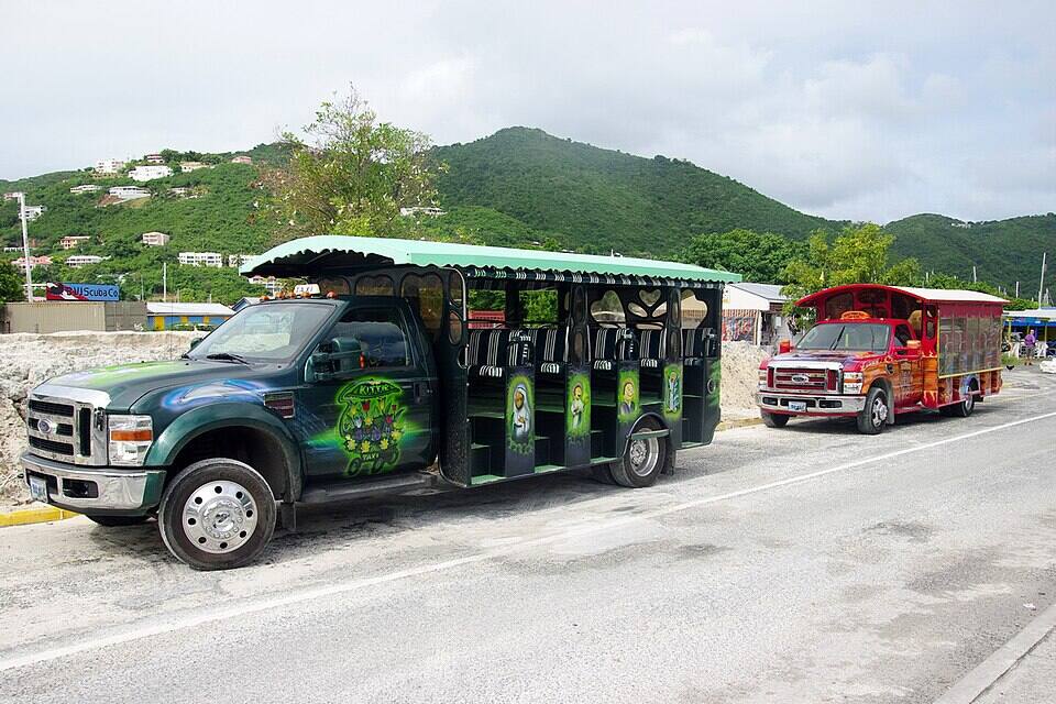
Open-air safari taxis waiting in Road Town Photo: Bgabel, CC BY-SA 3.0
One way, per person by the size of the party: fares set by the BVI Road Traffic (Passenger Fares) Regulations (rates revised December 2022). Drive times are Google's for an ordinary day. Fare calculator for any two stops
Agree the fare for your whole party before you set off, and agree a pick-up time: there is no taxi stand at the cove.
In a rental car, take the dirt road slowly; after rain, the visitors who know it say a four-wheel drive is the one to have. Park in the sandy lot behind the beach, not on the sand.
From a ship, keep the all-aboard time in mind: Road Town's cruise pier is the far end of the island from the cove.
Crossing from St. Thomas? The BVI is a different country: bring a passport, fill in the online ED card before you arrive and clear immigration at the West End dock.
Smuggler's Cove: entry, the land it is on, and papers from St. Thomas
Smuggler's Cove has no gate, no posted hours and no entry fee that we could find. The beach is on Crown land — the BVI Government's — which the Planning Authority calls Belmont Estate Park. What a visitor coming over from St. Thomas or St. John does pay is the BVI's charges at the border, on the West End ferry dock.
Charges
The beach
Free
BVI environmental and tourism levy, arriving from the USVI
$10
BVI departure tax, leaving by ferry
$20
The same, for BVI residents
$15
The levy and the departure tax are the UK government's figures for the BVI; from anywhere else in the BVI none of them apply. Chairs and umbrellas are rented by the bars on the sand, which do not publish their prices: ask before you sit down.
Papers and the land
✓A passport, for everyone arriving from the USVI — U.S. citizens and children included
✓The BVI's online ED card — required of every traveller entering the BVI since January 1, 2025; it can be filled in up to 72 hours ahead
✓U.S. customs on the way back — when the ferry lands in Red Hook or Charlotte Amalie
✕Building on the beach without planning permission — the Planning Authority served a compliance notice over a wooden structure here in May 2026, after complaints that it restricted access to the beach
Not much, which is the point: two small bars, the sand, the reef and a sandy lot to park in. Neither bar publishes its hours or prices; what follows is what we could check, and where we lean on visitors' reports we say so.
Food & drink
Nigel's Boom Boom Beach Bar & Grill
A beach bar and grill on the sand where Palm Road comes out at the cove, mapped on OpenStreetMap as Nigel's Beach Bar: drinks, grilled food and snacks. BVI Traveller reported it back in business in a new, rebuilt bar in March 2018, and visitors' reviews from the 2025–26 season still name it. It publishes no hours or prices; its Facebook page is the place to ask.
The cove's second bar. Visitors' reviews from 2025 and 2026 credit it with grilled fish, jerk chicken and rum punch, and with loungers and umbrellas to rent — gone by late morning on a busy day, they add. OpenStreetMap does not map it and we found no website for it, so it has no pin and no hours here; the Yacht Warriors guide says it takes cash only.
Parking & facilities
Parking — and what isn't there
OpenStreetMap maps a sandy parking area just behind the beach, at the end of Palm Road; we found no attendant and no fee. That is all the infrastructure there is: the guides agree there is no public restroom, and there is no shop and no fresh-water shower. Shade is the bars' umbrellas, which they rent at prices they do not publish, or the trees at the back of the sand. Bring water, and leave nothing in the car.
Safety
No lifeguards
We found no published lifeguard service at the cove. Swim where you can stand, snorkel with someone, watch for dinghies coming in to the sand, and on a day when a winter swell is wrapping into the cove, look before you go in.
Things to do
Things to do at and around Smuggler's Cove
Snorkel
Snorkel the reef
The reason most people make the trip: reef runs along both sides of the cove, with sea fans, brain coral and sponges, BVI Voyager's guide says, close enough to swim to from the sand. Bring your own mask and fins — the guides say nobody rents them at the cove — and reef shoes, since visitors report broken coral underfoot in the shallows in places. On most days the water by the sand is calm and shallow.
The cove opens west, across the water toward Great Thatch and St. John, so the sun goes down over the sea, not behind a hill. The card at the top of the page has tonight's sunset time. Leave before dark if you drove in: the dirt road is harder to read at night.
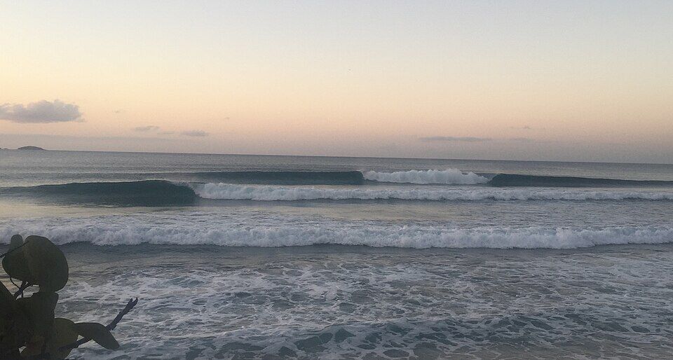
Palm Road comes out at Long Bay, a long, open north-shore beach with Long Bay Beach Resort on it. Further east along the north shore is Apple Bay, where Tortola's winter surf breaks when a north swell runs, with Bomba's Surfside Shack beside it.
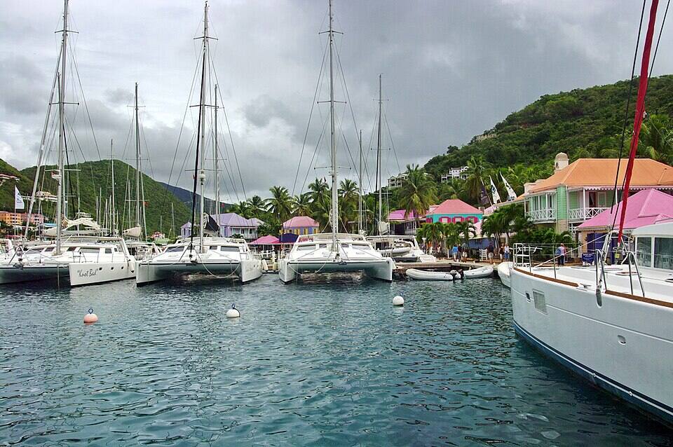
The West End's harbour, over the hill to the south: the ferry dock and customs for the boats to St. Thomas and Jost Van Dyke, a marina, and painted waterfront buildings with shops and restaurants. It is where most people arriving from St. Thomas start their day at the cove.
Jost Van Dyke is the island to the north-west. Without a boat, take a taxi from the cove to the West End dock and the ferry to Great Harbour, then White Bay and the Soggy Dollar.
The two bars on the sand are all there is at the cove: grilled food, cold beer and rum drinks, at hours they do not publish and that move with the season and the day's crowd. Bring cash, and bring your own water and snacks in case neither is open.
Over the hill, Long Bay Beach Resort's website lists Johnny's Beach Bar and the 1748 sushi bar, and Soper's Hole at the West End has waterfront restaurants by the ferry dock. Several West End places close for part of the August–October off-season.
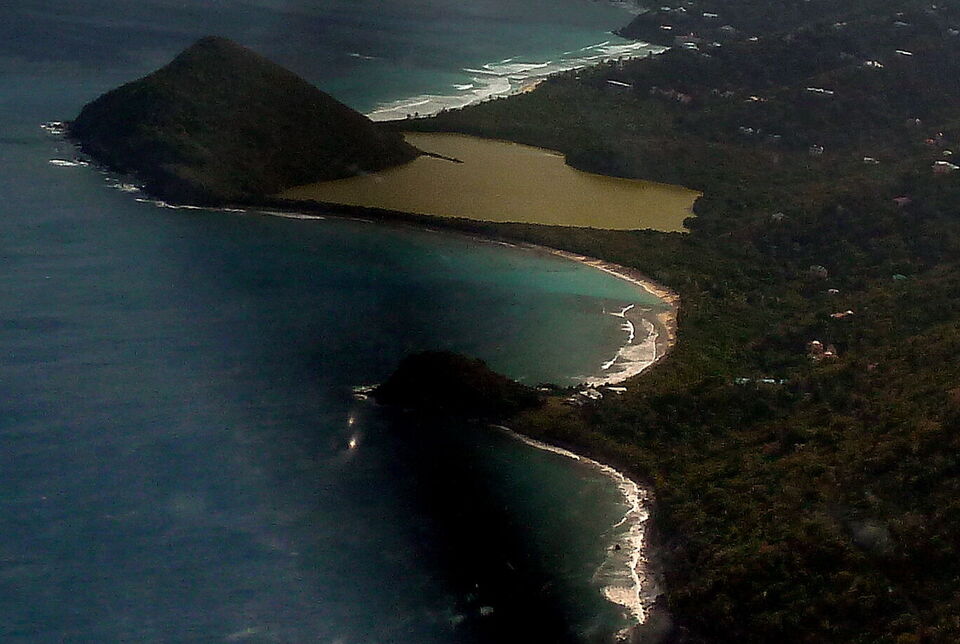
The same photograph, closer: the sand of Smuggler's Cove in front of Belmont Pond, the pale water over the sand and the steep hill of Belmont Point (cropped) Photo: giggel, CC BY 3.0
On the sand
Nigel's Boom Boom Beach Bar & GrillDrinks and grilled food where the road meets the beach; chairs to rent. No published hours.
Patricia's Beach BarGrilled fish, jerk chicken and rum punch by visitors' accounts; loungers and umbrellas to rent; cash only, a travel guide says.
Over the hill
Long Bay Beach ResortJohnny's Beach Bar and the 1748 sushi bar, on the resort's own website; back along Palm Road to Long Bay.
Soper's HoleRestaurants and bars on the West End waterfront by the ferry dock — our closures tracker lists who is open off-season.
Weather & sea
Smuggler's Cove weather and the best time to go
Warm all year: highs in the mid-80s °F, a steady easterly trade wind and short showers rather than all-day rain. December to April is the dry season and the heart of the cruise season; June to November is hurricane season, when some West End bars and restaurants close for part of August to October.
The cove opens west, with the island behind it to the east and Belmont Point to the north, so the trade wind blows from behind the beach and most days the water is calm. Winter is the exception on Tortola's north and west coasts: swells from storms far out in the North Atlantic can wrap round into the cove for a day or two. The call at the top of this page reads the swell every half hour.
The next 7 days on Tortola
Day
Sky
High / low
Rain
Wind
Seas offshore
Today
Thunderstorms
81° / 76°F
89%
SW 18 mph, gusts 25
3.1 ft
Tomorrow
Thunderstorms
80° / 77°F
90%
WSW 20 mph, gusts 26
3.7 ft
Sun, Nov 8
Drizzle
81° / 79°F
58%
W 12 mph
3.2 ft
Mon, Nov 9
Drizzle
80° / 78°F
18%
NNW 8 mph
2.4 ft
Tue, Nov 10
Drizzle
80° / 78°F
32%
NE 14 mph
1.9 ft
Wed, Nov 11
Overcast
81° / 79°F
25%
E 14 mph
2.1 ft
Thu, Nov 12
Drizzle
81° / 79°F
18%
ESE 12 mph
2.6 ft
Open-Meteo forecast for Tortola, refreshed every half hour. The seas are offshore; how much of it reaches the sand is the call above. BVI weather & sailing week · North swell season
Sea temperature by month
80°Jan
79°Feb
80°Mar
81°Apr
83°May
85°Jun
85°Jul
85°Aug
86°Sep
86°Oct
84°Nov
81°Dec
Daily-mean sea-surface temperature off Tortola, averaged 2021–2024 (Open-Meteo marine reanalysis): warmest in Sep (86.3°F), coolest in Feb (79.3°F).
Cruise crowds
Cruise ships and the crowd at Smuggler's Cove
Smuggler's Cove is a long way from Road Town's cruise pier — the length of the island — so only some of a big ship's excursions come this far. The small ships that call at Soper's Hole are a different matter: the cove is the nearest beach to them, over the hill. On a day with ships in, come early or expect company.
28 of the next 31 days have a ship in Road Town or Soper's Hole. The busiest at Smuggler's Cove, by our model:
Thu, Nov 12 — 2 ships, 6,341 guests in port. Packed: ~650 expected here, 8 am–4 pm
Sun, Nov 15 — 3 ships, 7,785 guests in port. Packed: ~800 expected here, 8 am–4 pm
Thu, Nov 19 — 3 ships, 8,841 guests in port. Packed: ~900 expected here, 8 am–4 pm
Sun, Nov 29 — 3 ships, 8,223 guests in port. Packed: ~850 expected here, 9 am–4 pm
Tue, Dec 1 — 2 ships, 7,036 guests in port. Packed: ~700 expected here, 8 am–4 pm
Sun, Dec 6 — 4 ships, 7,865 guests in port. Packed: ~850 expected here, 9 am–4 pm
Our crowd model, not a head count: it puts about 30% of the passengers of a ship at Soper's Hole, and about 10% of a ship in Road Town, on the sand at Smuggler's Cove, starting about 75 minutes after the ship is in and gone 90 minutes before it sails; past 400 on the sand we call it packed. The same model makes the call at the top of the page and on our beach report.
No. There is no public live camera on Tortola that we can show — not at Smuggler's Cove, not at Long Bay, not at Soper's Hole — and we would rather say so than pass off a photo as live. The nearest live views in the BVI are at Scrub Island, off Tortola's north-east tip, and Cooper Island across the channel.
NBC airs a film of Hemingway's novel starring Anthony Quinn, produced on Tortola. The film's records name only the island; local accounts and travel guides put its beach scenes, and the bar building that stood behind the sand, at Smuggler's Cove.
January 2011
The honour bar remembered
A visitor returning to the cove recalls the old self-service honour bar in the shell of the film-set building — help yourself from the fridge and leave the money in a cigar box — and finds it gone, the shell decaying and an old white Lincoln Continental rusting in the bushes. Local lore says the car carried Queen Elizabeth II on a royal visit; we found no record that says so.
September 6, 2017
Hurricane Irma
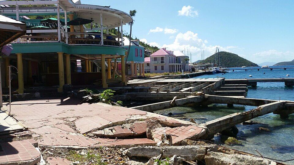
The category 5 hurricane crosses the British Virgin Islands. Four days later, Soper's Hole over the hill is a wreck of broken waterfront and docks.
March 2018
Nigel's back
BVI Traveller reports Nigel's Boom Boom Beach Bar & Grill reopened at the cove in a new, rebuilt bar.
May 6, 2026
A notice over the beach
The Planning Authority serves a compliance notice on a man it says built a wooden structure on Crown land at Smuggler's Cove Beach, in Belmont Estate Park, without development permission; BVI News reports complaints that it restricted access to the beach.
Soper's Hole at the West End on September 10, 2017, four days after Hurricane Irma: the waterfront broken up and the docks wrecked Photo: Legis, CC BY-SA 4.0
The money is the U.S. dollar, and the two bars are small: a travel guide says Patricia's takes cash only. Bring enough for drinks, food, chairs and the taxi back.
Bring water and shade
There is no shop, no fresh-water shower and no public restroom at the cove. Bring water, sunscreen and a hat, and plan your day round that.
Bring your own snorkel gear
The reef along both sides of the cove is the draw, and you cannot count on renting a mask there. Reef shoes help with the broken coral in the shallows.
Take the road slowly
The last stretch of Palm Road is dirt and sand, and visitors call it rutted. In a rental car go slowly, and after rain think about a taxi instead.
Passport from St. Thomas
The BVI is British, not American: U.S. citizens need a passport too for the ferry from Red Hook, an ED card filled in online, and U.S. customs on the way back.
Come early on a busy day
The bars' loungers can be gone by late morning when a small ship is at Soper's Hole. The call at the top of the page shows today's ships.
By taxi or rental car to the far West End of Tortola, then along Palm Road from Long Bay, unpaved for its last stretch, to the sand. From the West End ferry dock it is about 4 minutes (1 km) by road, and the official taxi fare is $15 for one rider, $10 each for three or more. There is no bus.
How much is a taxi to Smuggler's Cove?
BVI taxi fares are set by regulation and charged per person, cheaper each as the party grows. From the West End ferry it is $15 for one rider, $10 each for three or more; from Road Town $32 for one rider, $16 each for two, $14 each for three or more; from Beef Island airport $60 for one rider, $30 each for two, $25 each for three or more. Confirm the total for your group before you set off, and agree a pick-up time — there is no taxi stand at the cove.
How far is Smuggler's Cove from the cruise port?
It is the far end of the island from Road Town's cruise pier: about 29 minutes (13.8 km) by road along the south coast to the West End and over to the cove. The official taxi fare from the cruise pier is $32 for one rider, $15 each for three or more. Keep the all-aboard time in mind on the way back.
Is the road to Smuggler's Cove paved?
Not all of it. The way in is Palm Road from Long Bay, about 1.3 km, and its last stretch to the beach is dirt and sand — OpenStreetMap marks it compacted and unpaved, and visitors describe ruts and potholes. Local taxi drivers know it, and cars make it in dry weather taken slowly; after rain, visitors say a four-wheel drive is the one to have.
Is there an entry fee at Smuggler's Cove?
No entry fee that we could find, and no gate. The beach is on Crown land. You pay for what you use: food and drinks at the two bars, and the chairs and umbrellas they rent, whose prices are not published.
Are there restrooms at Smuggler's Cove?
We found no public restroom at the cove, and the travel guides agree there is none; there is no shower or shop either. Plan your day round that.
Is Smuggler's Cove good for snorkeling?
Yes — it is why most people go. Reef runs along both sides of the cove, with sea fans, brain coral and sponges, close enough to swim to from the sand. Bring your own gear and reef shoes; you cannot count on renting either at the cove.
Is there food at Smuggler's Cove?
Two small beach bars, Nigel's Boom Boom Beach Bar & Grill and Patricia's Beach Bar, serve drinks and grilled food and rent chairs. Neither publishes its hours, so bring water and snacks in case, and bring cash.
Are there lifeguards at Smuggler's Cove?
We found no published lifeguard service. The cove is usually calm, but swim where you can stand, snorkel with someone, and watch for dinghies coming in to the sand.
Can you visit Smuggler's Cove from St. Thomas?
Yes. The ferry from Red Hook lands at West End, the nearest dock to the cove, and a taxi at the official fare of $15 for one rider, $10 each for three or more takes you over the hill. You need a passport and the BVI's online ED card, pay the BVI's $10 arrival levy and $20 ferry departure tax, and clear U.S. customs on the way back.
Was The Old Man and the Sea filmed at Smuggler's Cove?
The 1990 NBC film with Anthony Quinn was produced on Tortola, its records show. Local accounts and travel guides put its beach scenes and the old bar building behind the sand at Smuggler's Cove; we found no production record that names the cove itself.
Is there a Smuggler's Cove webcam?
No public live camera we can embed. There is no live webcam on Tortola at all; the nearest live views in the BVI are at Scrub Island, off Tortola's north-east tip, and Cooper Island across the channel.
Photo & map credits
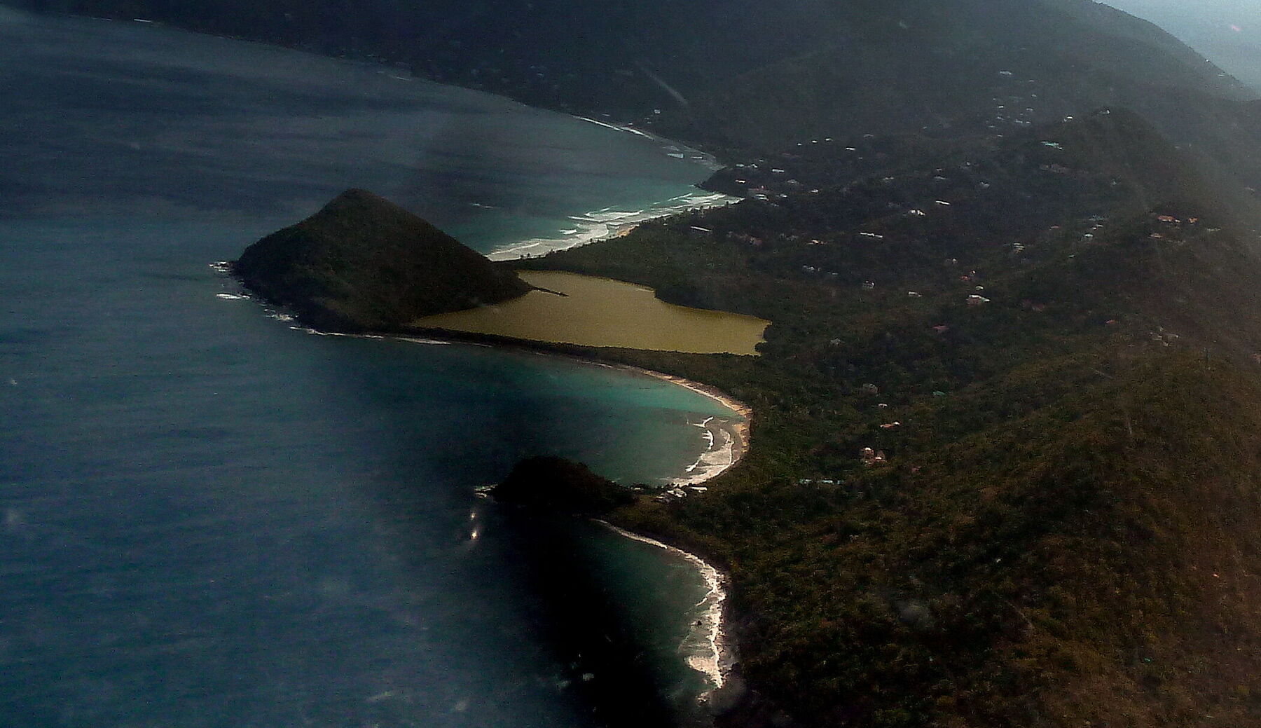
Smuggler's Cove from the air, looking east: the curve of sand below Belmont Pond, Belmont Point on the left with Long Bay's surf beyond it, and rocks and a smaller beach at the cove's south end (cropped from a panorama of the West End) — giggel, CC BY 3.0, via Wikimedia Commons (cropped and resized).
The same photograph, closer: the sand of Smuggler's Cove in front of Belmont Pond, the pale water over the sand and the steep hill of Belmont Point (cropped) — giggel, CC BY 3.0, via Wikimedia Commons (cropped and resized).
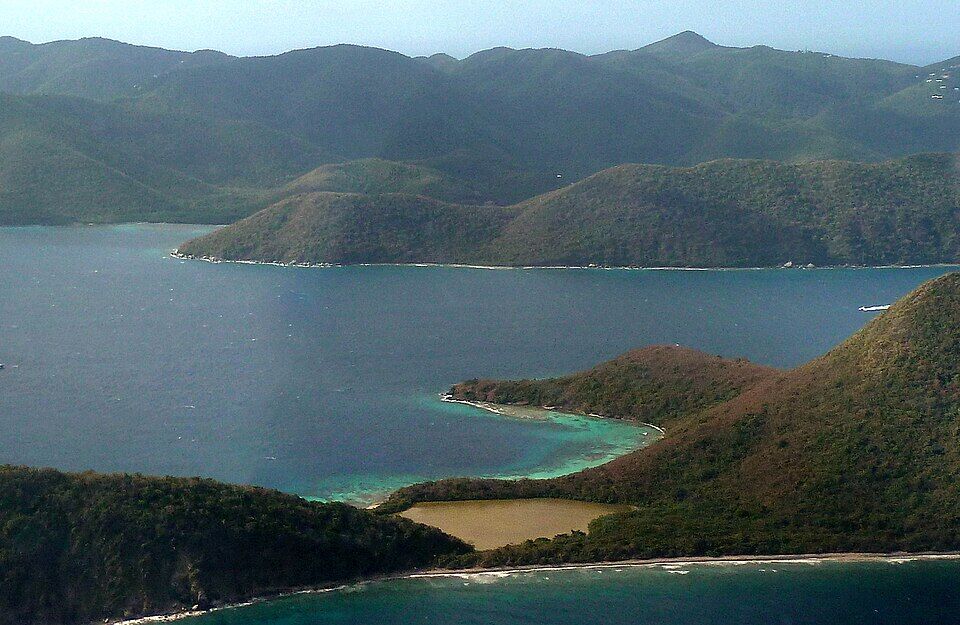
Great Thatch Island from the air, a pond behind the beach on its north shore, with St. John across the channel beyond — giggel, CC BY 3.0, via Wikimedia Commons (resized).
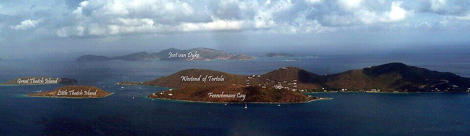
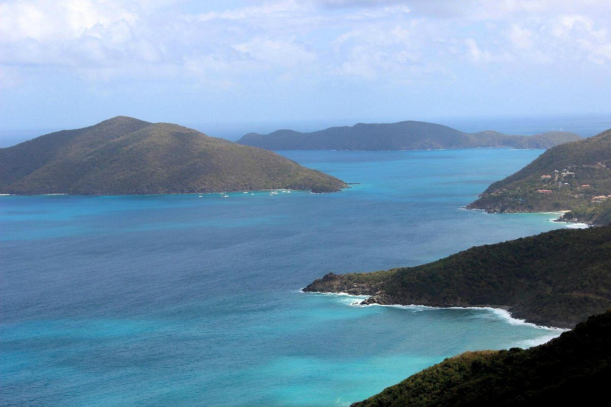
The West End of Tortola from the south-west, as the uploader labelled it: Great Thatch and Little Thatch islands, Frenchman's Cay, the West End and Jost Van Dyke beyond — giggel, CC BY 3.0, via Wikimedia Commons (resized).
Soper's Hole at the West End on September 10, 2017, four days after Hurricane Irma: the waterfront broken up and the docks wrecked — Legis, CC BY-SA 4.0, via Wikimedia Commons (resized).
Swell breaking at Apple Bay, further along Tortola's north shore, at dusk (October 2019) — Gdebsoc, CC BY-SA 4.0, via Wikimedia Commons (resized).
Soper's Hole at the West End: yachts on the moorings and the painted wharf-side buildings — Bgabel, CC BY-SA 3.0, via Wikimedia Commons (resized).
Open-air safari taxis waiting in Road Town — Bgabel, CC BY-SA 3.0, via Wikimedia Commons (resized).
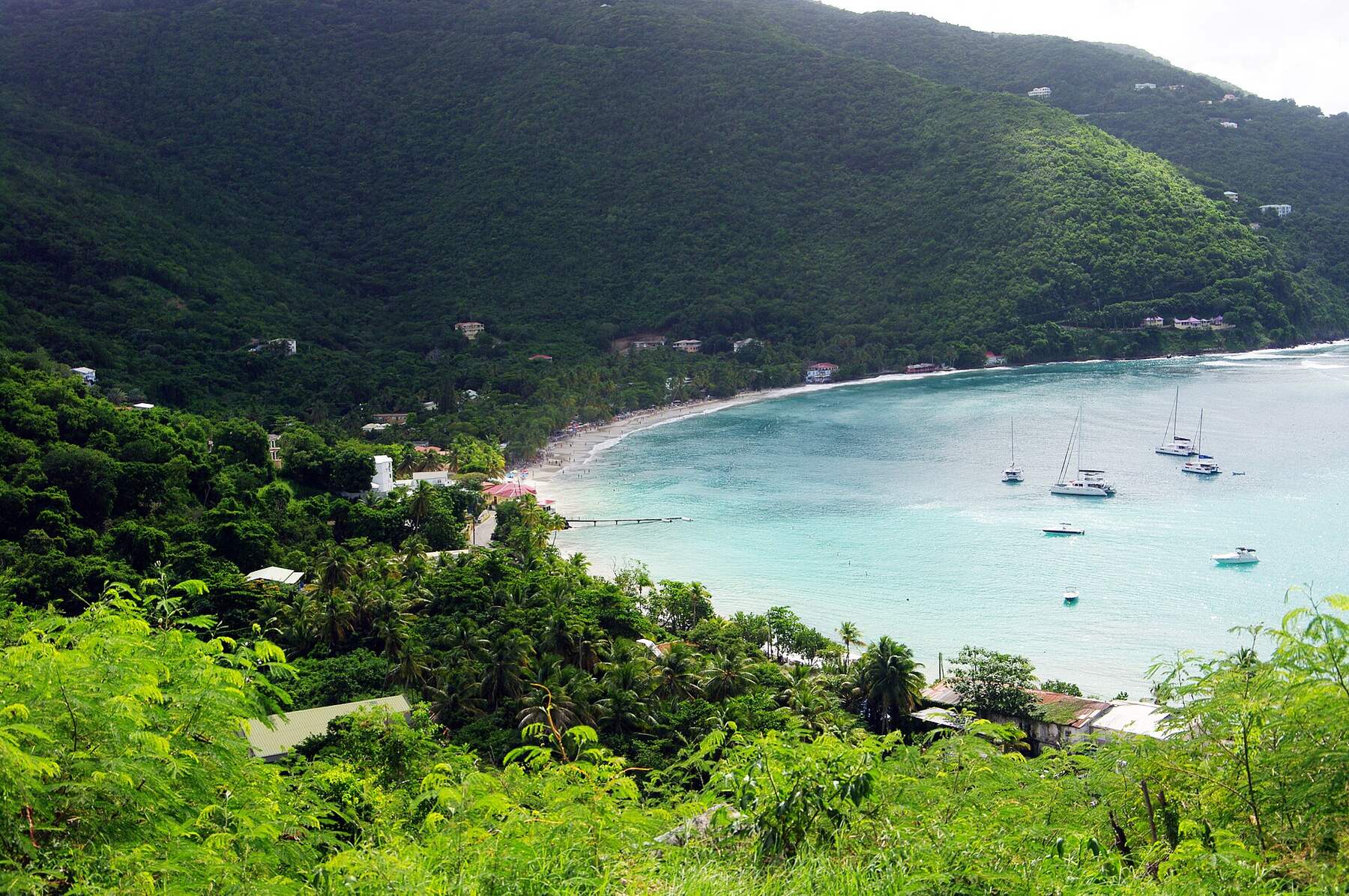
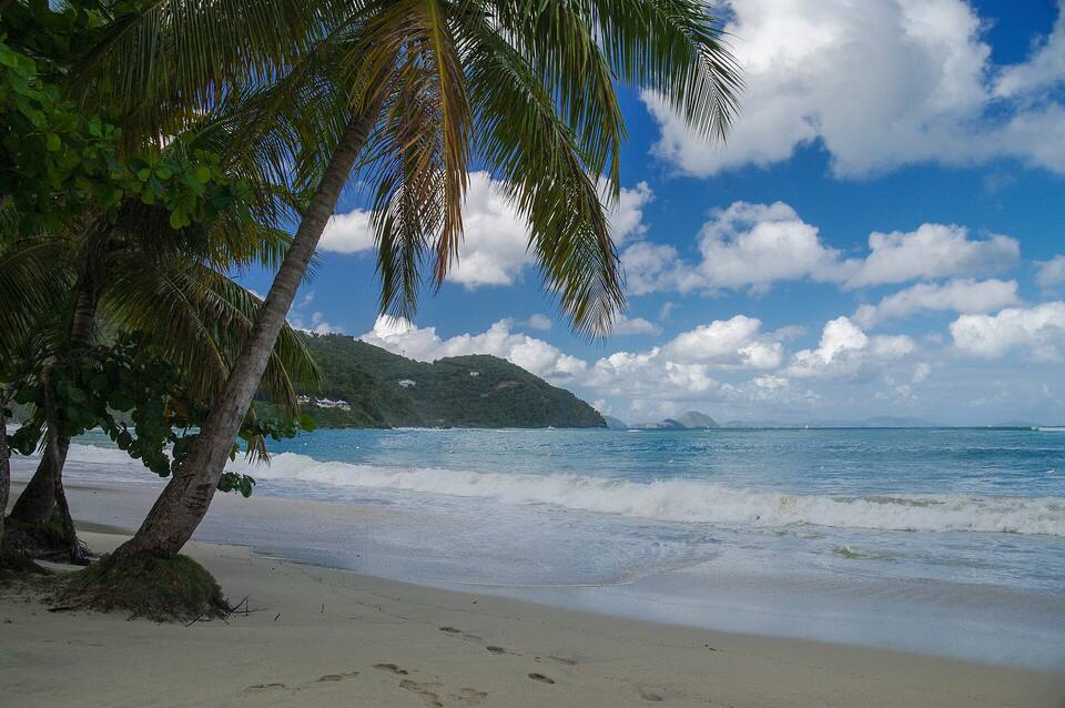
The sand at Cane Garden Bay under the palms, looking out to sea — Jean-Marc Astesana, CC BY-SA 2.0, via Wikimedia Commons (resized).
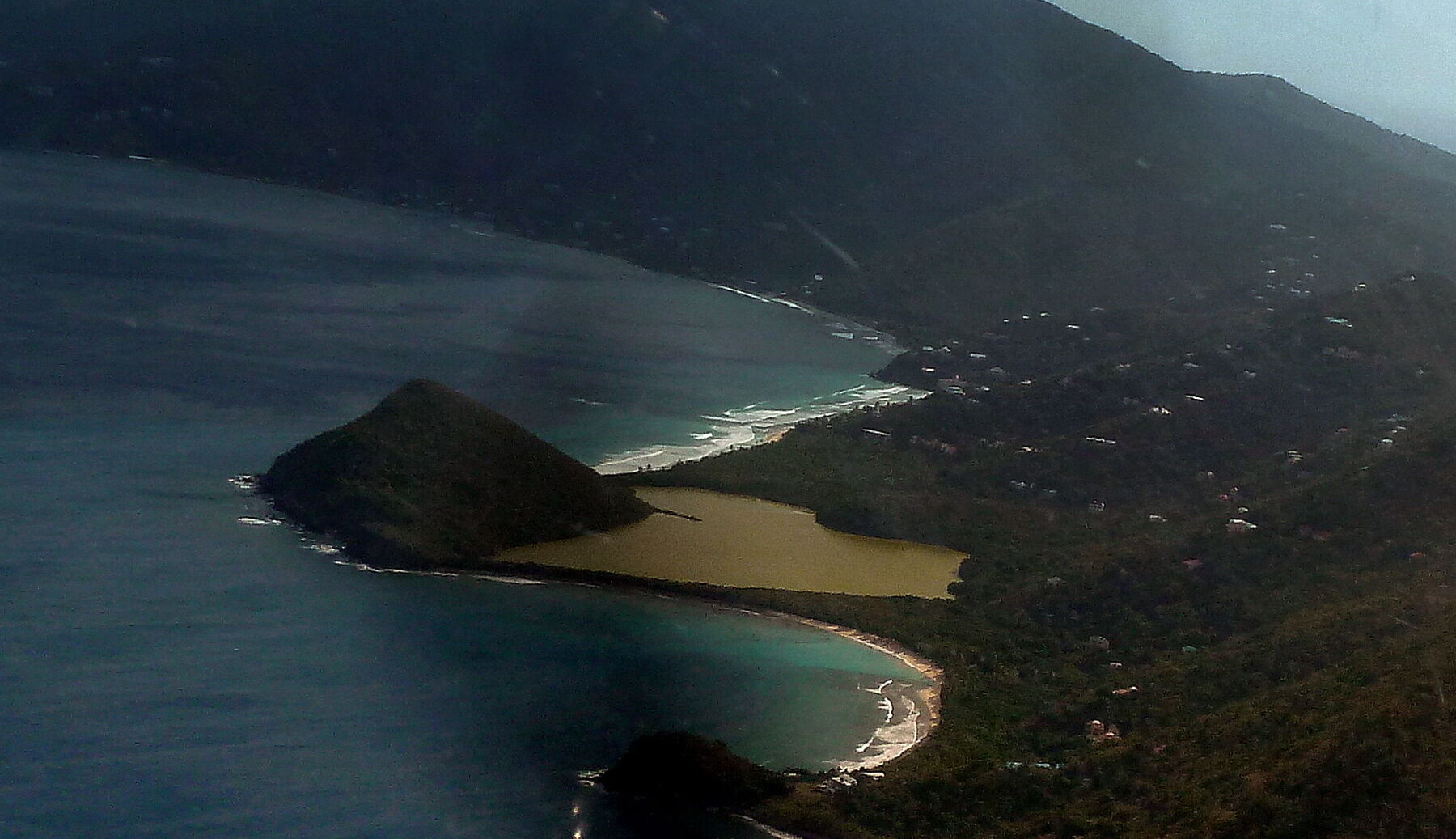
Long Bay from the air, looking north-east along Tortola's north shore: surf breaking along the sand beyond the steep hill of Belmont Point, Belmont Pond behind the beach, and Smuggler's Cove curving round below (cropped from a panorama of the West End) — giggel, CC BY 3.0, via Wikimedia Commons (cropped and resized).
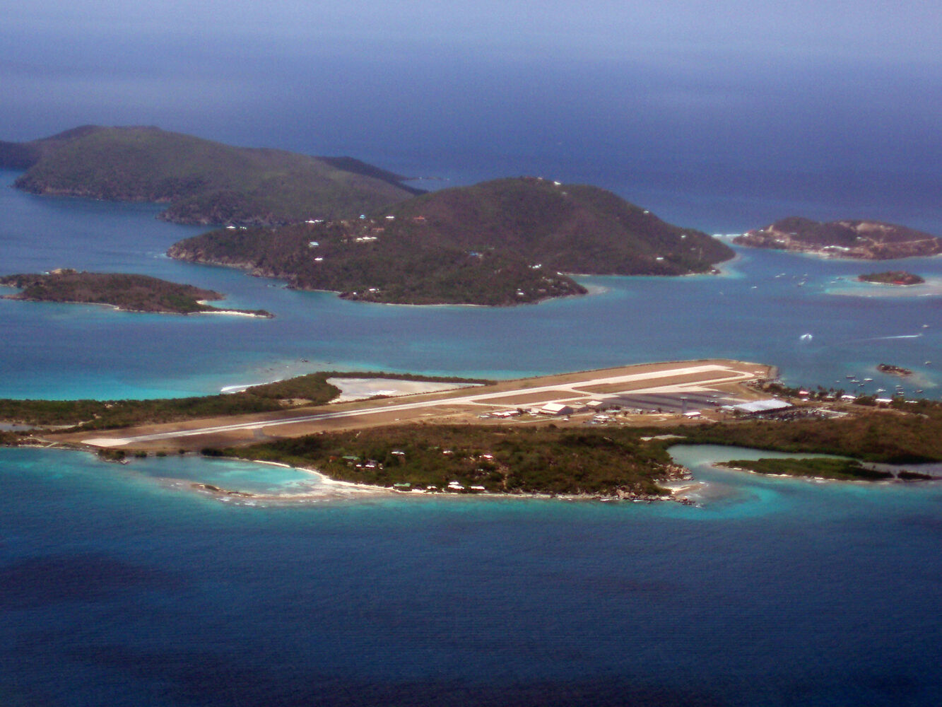
Beef Island from the air, looking north (July 2008): the airport runway across the island, with Long Bay's sand and its salt pond on the far side at the left; Little Camanoe and Great Camanoe beyond, Trellis Bay on the right — Robert Rexach, CC BY-SA 3.0, via Wikimedia Commons (resized).
 Skip today today
 Skip today today
 Think twice today
 Skip today today