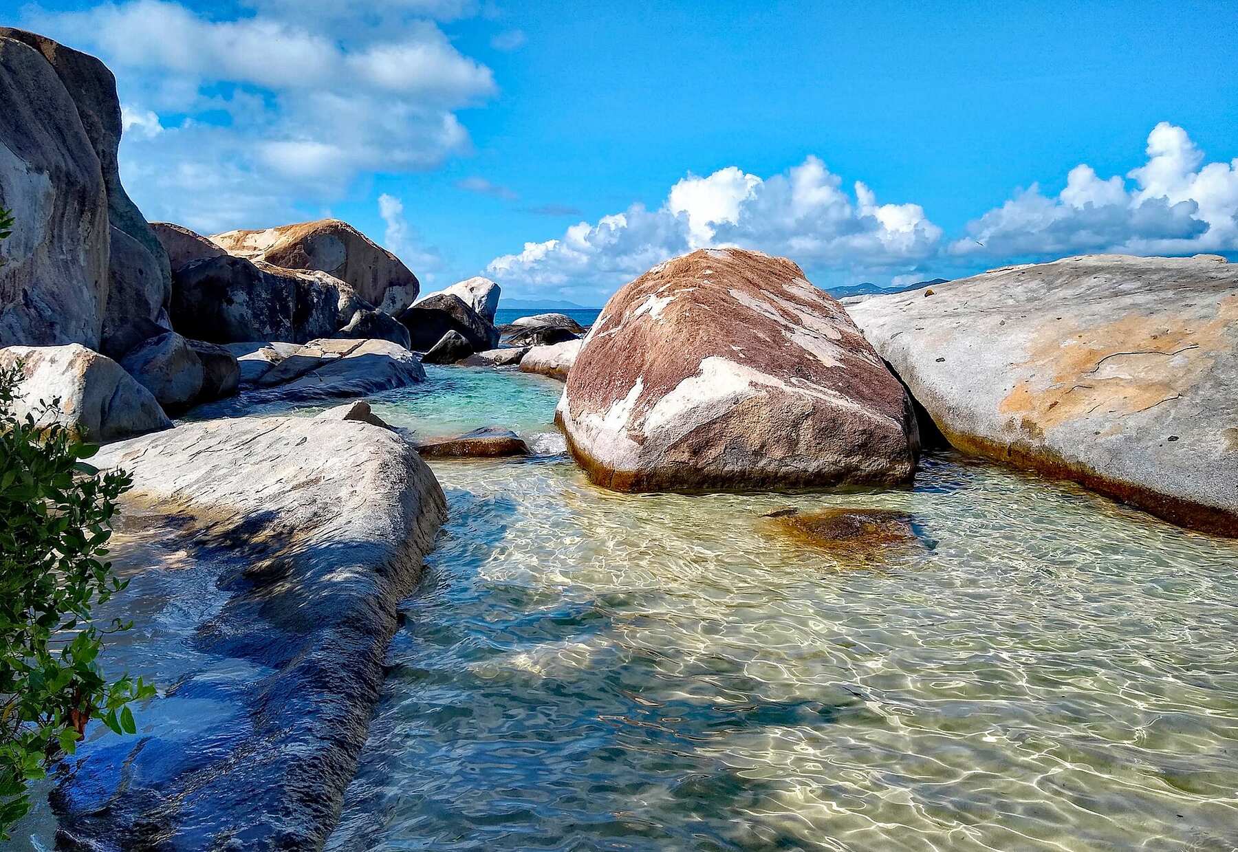
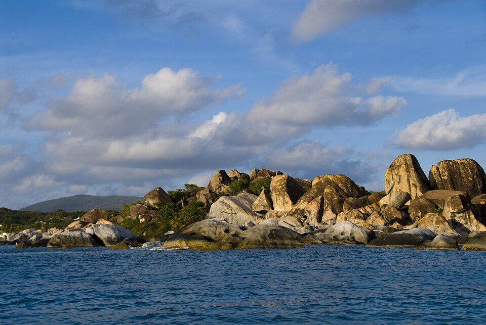
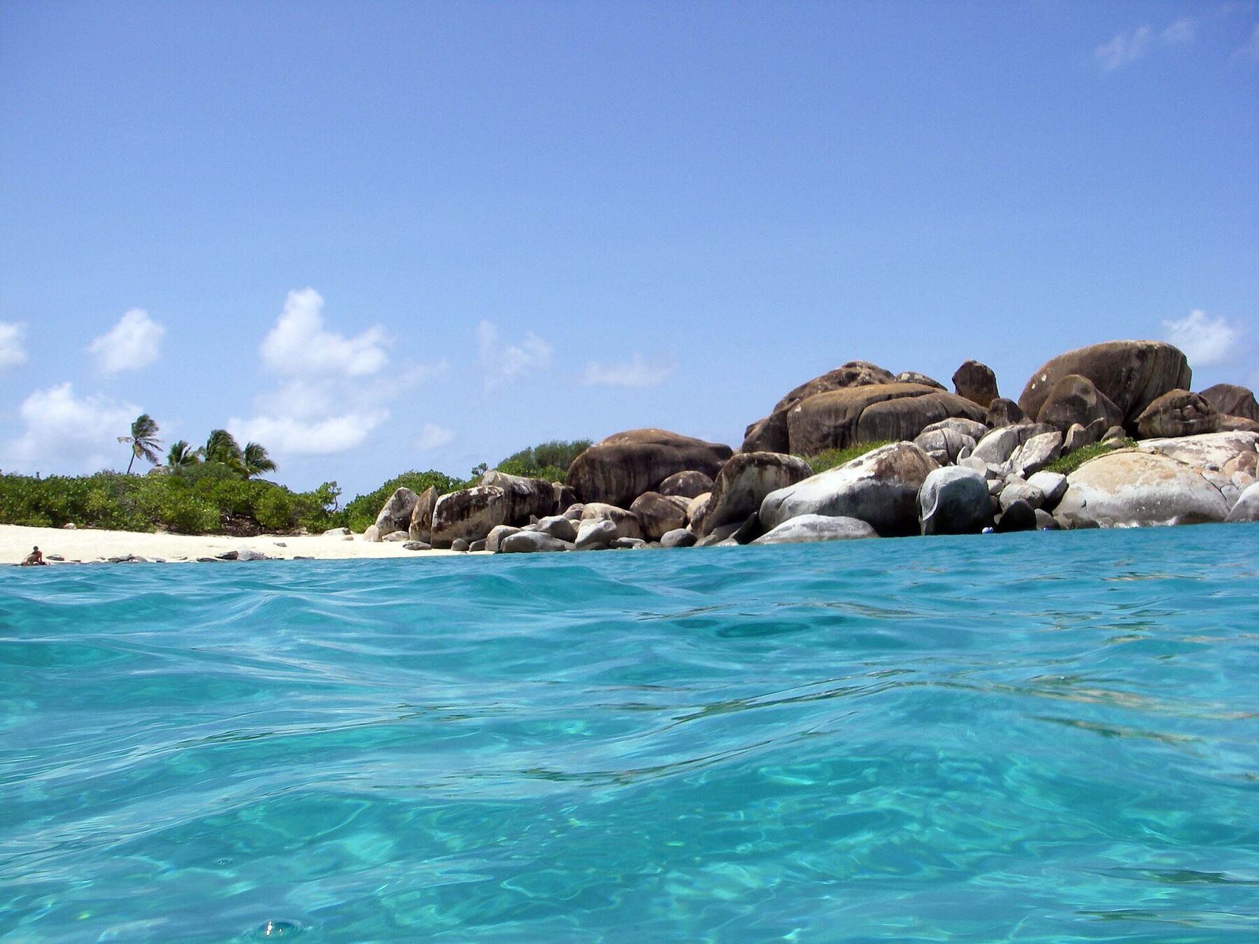
Granite boulders up to 40 feet across, piled on white sand at the south-west tip of Virgin Gorda, with sea pools and grottos between them and a trail through the rocks to Devil's Bay. A national park since 1990, a short taxi ride from the Spanish Town ferry dock, and a stop for day boats, charter yachts and cruise excursions.
The south-west tip of Virgin Gorda, British Virgin Islands, where Tower Road ends above the sea, south of Spanish Town
The beach
A small beach of white sand between granite boulders as big as 40 ft across, with sea pools and grottos among them
Run by
The National Parks Trust of the Virgin Islands: The Baths National Park (6.91 acres), with Devil's Bay National Park next door
Hours
8:30 am to 4:30 pm, every day
Entry
$3 an adult and $2 a child until October 31, 2026; $10 and $5 from November 1. Free for Virgin Islanders, Belongers and residents with ID
Getting down
Two trails from the car park at the top: one to the beach at The Baths, one to Devil's Bay, about 15 minutes
The Caves trail
Through the boulders between The Baths and Devil's Bay: ladders, rope handrails, wading and crawling
The water
Faces west, toward the Sir Francis Drake Channel; winter ground swells can stop swimming and boat landings
By boat
The Trust's day moorings off the beach: 90 minutes, a National Parks permit, and dinghies to the dinghy line
History
Taken by compulsory acquisition in 1987 and made a national park in 1990
Today
Is The Baths good today?
Skip today Rough — 2.8 ft SSW swell, shore break · Thunderstorms in the forecast. If you go, the least bad stretch left is 3 pm–6 pm.
Day
The call
Why
Best time
Cruise guests here
Sea at the beach
Rain
Today
Skip today
Rough — 2.8 ft SSW swell, shore break · Thunderstorms in the forecast
3 pm–6 pm
None
Rough · 3 ft
Thunder
Tomorrow
Skip today
Rough — 3.4 ft SW swell, shore break · Thunderstorms in the forecast
2 pm–5 pm
None
Rough · 3.5 ft
Thunder
Sun, Nov 8
Good
No cruise crowd today · Choppy — SW swell into the bay
3 pm–6 pm
None
Some chop · 2.3 ft
47%
Mon, Nov 9
Go
Glassy, snorkel-clear water · No cruise crowd today
8 am–11 am
None
Calm · 0.2 ft
27%
Tue, Nov 10
Go
Glassy, snorkel-clear water · No cruise crowd today
8 am–11 am
None
Calm · 0.2 ft
22%
The call is the same one our beach report makes, refreshed every half hour: the swell reaching the beach (Open-Meteo's marine forecast off the island), the cruise passengers our crowd model puts on the sand, NOAA's sargassum satellite and the rain forecast. It is a model, not the park's word — the flag flying at the park has the last word. The bars under each call are the hours from 8 am to 5 pm. Today's beach report
The ferry and the taxi fare from the dock, the ships that fill the park, the moorings, today's beach and weather reads and the island around it — each one opens the full page.
The south-west tip of Virgin Gorda from OpenStreetMap: the sand of The Baths, Devil's Bay and Spring Bay, the road's end at the top of the park, and the trails down — each pin where OpenStreetMap's mappers put it. The car park, the ticket booth and the moorings are not on OpenStreetMap, so they have no pin. Tap a pin for its section.
Getting there
How to get to The Baths
The Baths is at the south-west tip of Virgin Gorda, where Tower Road ends in a turning circle above the sea. Almost everyone comes from the ferry dock in Spanish Town, a short ride up the road: open-air taxis meet the ferries and charge the official BVI fare in the table — per person, and less each as the party grows. From the car park at the top, trails go down to the beach and to Devil's Bay.
Ferries cross to Spanish Town from Road Town and from Trellis Bay, by Tortola's airport; from St. Thomas and St. John there are direct international boats on some days of the week, and you clear BVI customs at the dock. By sea, the National Parks Trust's day moorings lie off the beach, and dinghies come in to the dinghy line.
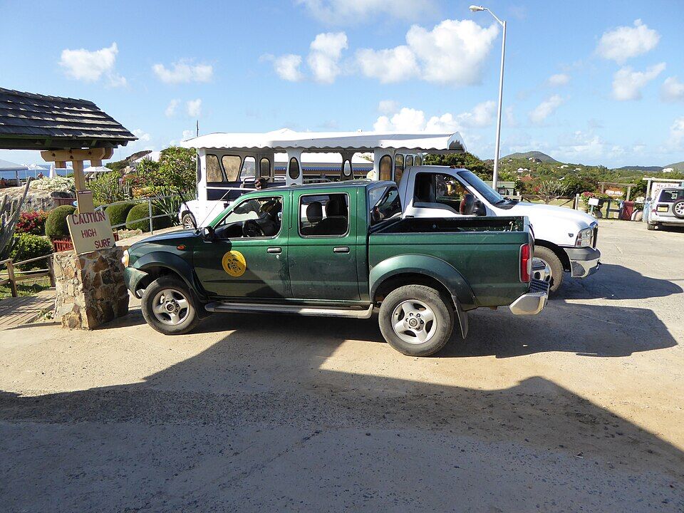
The car park at the top of The Baths, with a National Parks Trust pickup (February 2015) Photo: User:Mattes, CC BY 2.0 de
One way, per person by the size of the party: fares set by the BVI Road Traffic (Passenger Fares) Regulations (rates revised December 2022). Drive times are Google's for an ordinary day. Fare calculator for any two stops
Agree the fare before you set off, and agree a pick-up time at the top — or find a taxi back at the car park.
Pay the park fee at the top before you walk down, or buy the Trust's one-day pass online; it also covers Devil's Bay, Stoney Bay and Spring Bay that day.
From the U.S. Virgin Islands it is an international crossing: bring a passport and expect the BVI entry fees.
On a day trip from Tortola, check the last ferry back to Road Town or Trellis Bay before you go down the trail.
The Baths and Devil's Bay are national parks, run by the National Parks Trust of the Virgin Islands. Visitors pay at the park or buy the Trust's one-day pass online, which covers The Baths, Devil's Bay, Stoney Bay and Spring Bay for the day. Virgin Islanders, Belongers and residents go in free with a valid government ID. The fee for visitors rises on November 1, 2026 — the first rise since 1990.
Entry fees
Adult visitor, to October 31, 2026
$3
Child visitor, to October 31, 2026
$2
Adult visitor, from November 1, 2026
$10
Child visitor (under 18), from November 1, 2026
$5
Virgin Islanders, Belongers and residents, with ID
Free
On October 14, 2026 the Trust's park pages and its online pass (plus a few cents' booking fee) still showed $3 and $2; its October 8 announcement sets $10 and $5 from November 1 and calls them the first phase. An August report of the Trust's request also named a step to $20 on April 1, 2027, which the October announcement does not mention. Accepted ID: a Virgin Islands passport, Belonger card, driver's licence, voter ID card, work permit card or NHI card. Entering without paying is an offence under the Trust's 2008 regulations.
Hours and time limits
The Baths and Devil's Bay
8:30 am – 4:30 pm
The caves (the sign on the beach)
Not after 4:30 pm
The Trust's moorings
Day use · 90 min
Top of the Baths (its website)
8 am – 6 pm
Every day. The park hours are the Trust's; the sign at the start of the Caves trail says not to enter the caves after 4:30 pm. The moorings are first come, first served, and using them overnight is illegal. Top of the Baths' hours are as its own website lists them in October 2026; call it on +1 284 495 5497.
Rules for visitors and boats
✓Swimming and snorkelling — except in a winter ground swell, when the Trust discourages swimming
✕Using the moorings without a permit — a National Parks mooring permit is required by law
✕Overnight on the Trust's moorings — day use only, 90 minutes
✕Anchoring off the beaches — boats use the mooring buoys outside the bays, to spare the coral
✕Over 5 mph near the beaches — come in along the swim-line markers
✕Into the caves after 4:30 pm
✕Filming or photo shoots without a permit — the Trust issues film and photography permits
✕Leaving rubbish — take it with you or use the bins
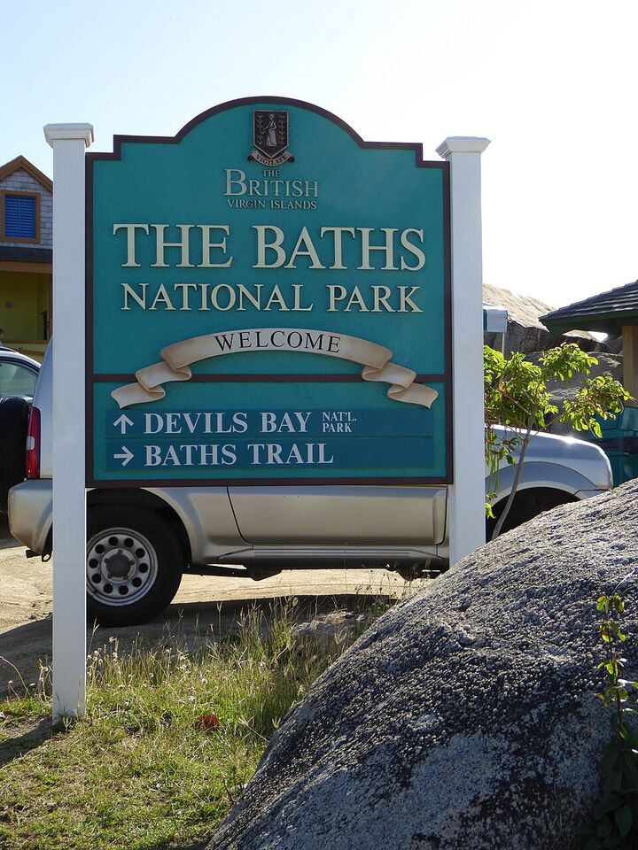
The Baths National Park sign at the car park at the top: Devil's Bay ahead, the Baths trail to the right (February 2015) Photo: User:Mattes, CC BY 2.0 de
The park runs from the car park at the end of Tower Road down to two beaches — The Baths and Devil's Bay — joined through the boulders by the Caves trail. Everything below is from the National Parks Trust or the business itself, as listed in October 2026.
Getting down
The trails from the car park
Tower Road ends in a turning circle at the top of the park, with the car park, the park sign, Top of the Baths and Mad Dog around it. Two trails go down from there through dry scrub and boulders: one to the beach at The Baths, about half a kilometre on OpenStreetMap's map, ending by Poor Man's Bar; and one to Devil's Bay, a 15-minute walk, the Trust says. Wear shoes you can walk on rock in — and keep in mind the walk back up.
A small beach of white sand hemmed in by granite boulders — some as big as 40 ft across, the Trust says — with sea pools and grottos where the boulders lean together and the sea runs in under them. The water off the beach is a daytime anchorage, which the Trust calls ideal for swimming and snorkelling. The sign to the caves and Devil's Bay stands at the south end of the sand.
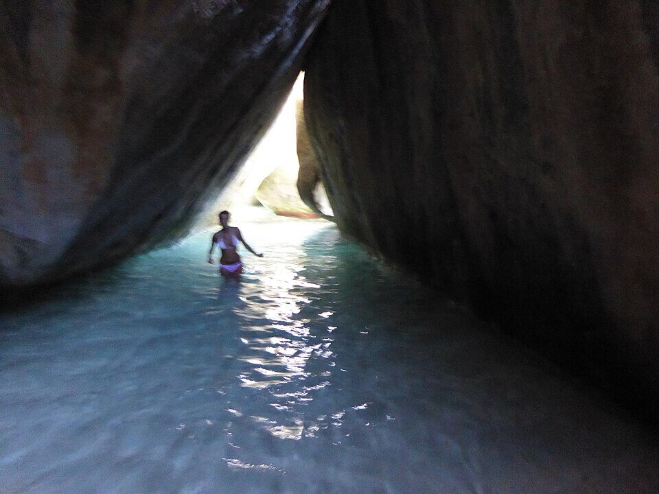
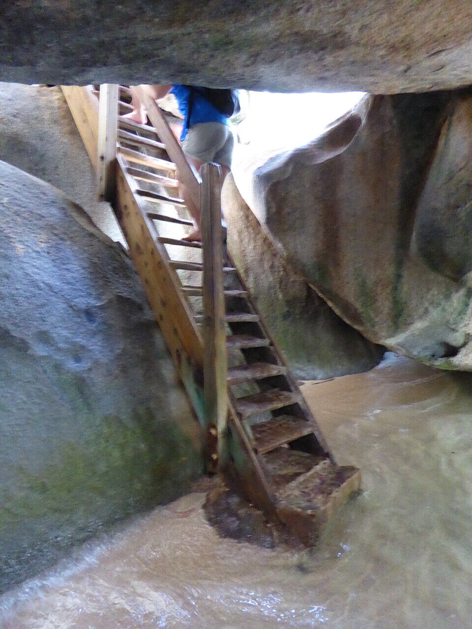
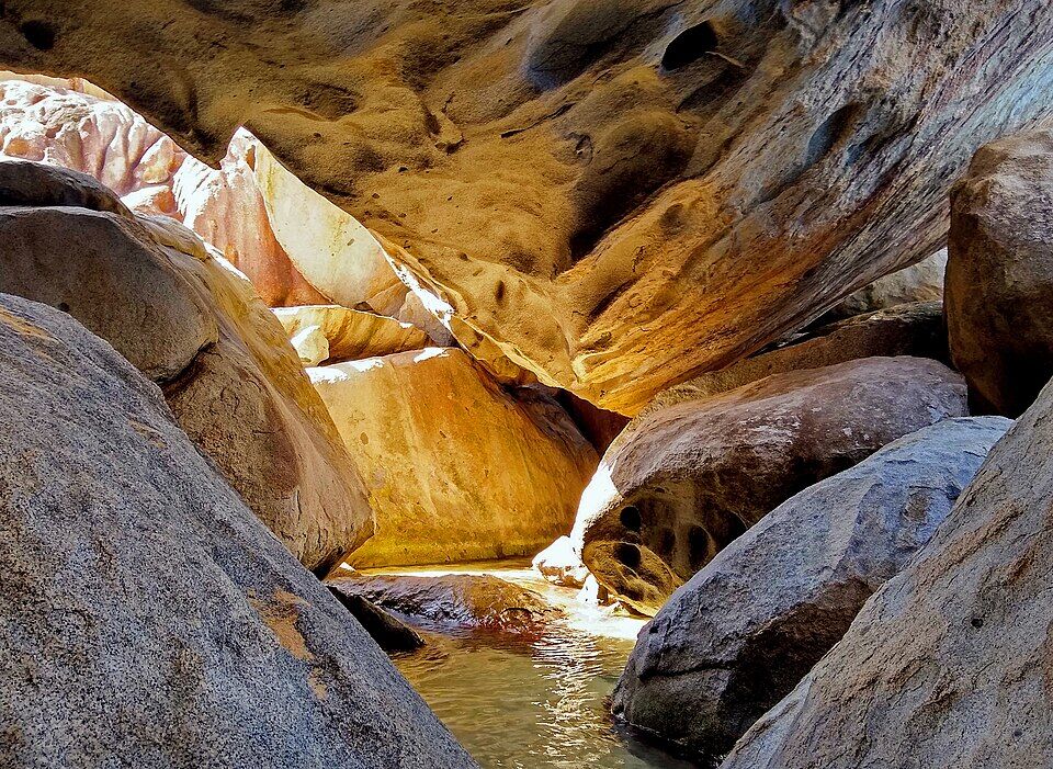
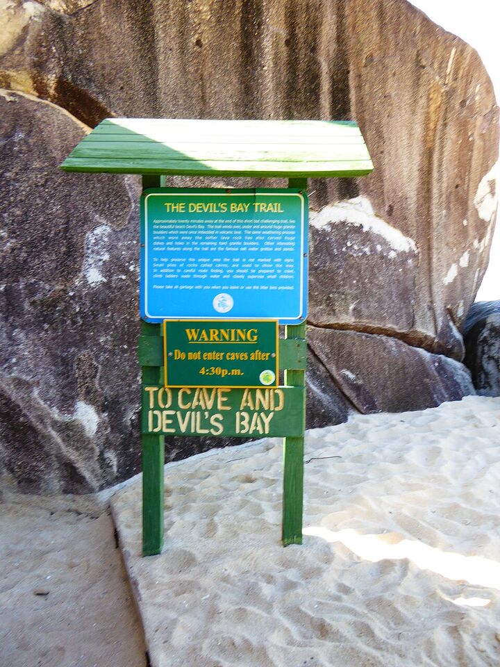
Between The Baths and Devil's Bay the trail goes through the boulders, not round them: steps, wooden ladders and rope handrails, low gaps to crawl through and pools to wade. The Trust's word is caution — the rock is slippery. The sign at its start calls it short but challenging, about twenty minutes, marked with small piles of stones rather than signs, and asks parents to keep a close eye on small children. Do not go into the caves after 4:30 pm.
A horseshoe-shaped bay at the other end of the Caves trail, its own national park since 1963 (58 acres). The Trust calls it a tranquil place to swim and snorkel, with shade umbrellas on the sand. It is also the end of the direct trail from the car park, about 15 minutes down through the scrub, past a viewpoint OpenStreetMap marks on the way. From its southern end a trail goes on to Stoney Bay.
The bar on the sand at the foot of the trail from the car park, by the boulders. USA Today's 10Best list put it fourth among the Caribbean's beach bars for 2026, for its painkillers, frozen margaritas and piña coladas with fresh fruit.
The Trust lists bathrooms and lockers among the park's facilities, by the beach. The bar, the ticket area and the restrooms were renovated under a 2019 rebuilding contract, and new rest stops and gazebos were in place by May 2020. The Trust lists no lifeguards.
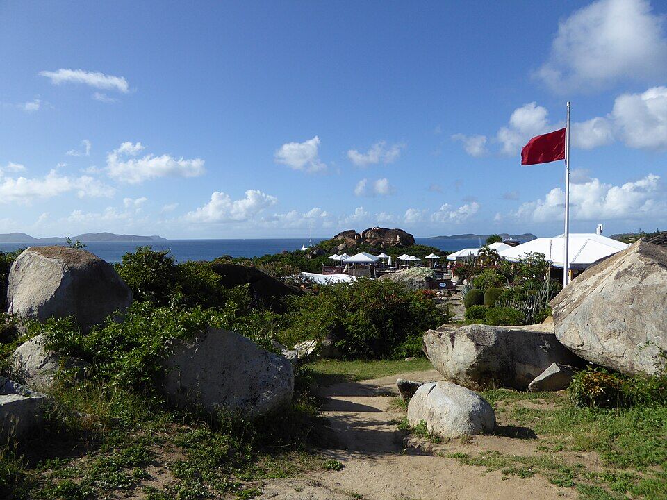
Strong ocean swells can come in the winter months, the Trust says: then the moorings cannot be used, the beach cannot be reached from the sea, and swimming is discouraged because of strong currents. On rough days a red flag flies at the top of the park, as in the photo, and a warning sign at the beach lists of high surf, a dangerous shorebreak, slippery rocks and strong currents. The call at the top of this page reads the swell every half hour.
The Trust keeps mooring buoys off The Baths and outside Devil's Bay so that boats do not anchor on the coral. They are day use only, 90 minutes, first come, first served, and need a National Parks mooring permit — sold by charter companies and dive shops, at the Trust's offices, and at Customs for foreign yachts arriving in the BVI. Dinghies follow the swim-line markers in at no more than 5 mph and tie to the dinghy line off the beach; from there you swim the last stretch, so bring a dry bag.
By the car park, Top of the Baths has a restaurant, a bar, a pool and a row of gift shops, with views across the Sir Francis Drake Channel — every day from 8 am to 6 pm, its website says, with a coffee bar Tuesday to Sunday. Mad Dog, a small bar and café, is across the turning circle.
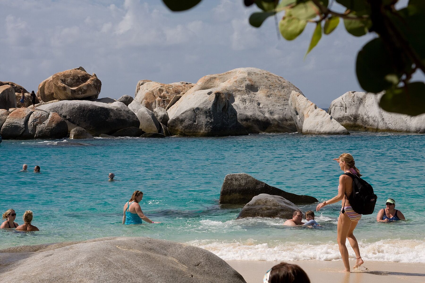
On a calm day the water off the beach is clear and sheltered among the rocks, and the Trust calls it ideal for swimming and snorkelling. Snorkel along the boulders at either end; in a winter ground swell the surge between the rocks is strong, and the Trust discourages swimming.
The walk the boulders are known for: through grottos lit from above, up ladders and along rope handrails, wading pools of sea water between the boulders, to come out at Devil's Bay. Go early, before the day boats; keep the phone in a dry bag and wear shoes that can get wet.
From the southern end of Devil's Bay a trail goes on to Stoney Bay, where — in the Trust's words — the Atlantic swells pummel the coastline and seabirds soar overhead. It is covered by the same day pass. Go for the view rather than a swim, and carry water.
Just north, more boulders and more sand: Spring Bay, a national park since 1964, reached by road along a palm-lined avenue, with a lawn, picnic tables and a grill. Within it is The Crawl, a small bay ringed by boulders that was once used to hold turtles and fish and is now a natural swimming pool. The Baths' day pass covers it.
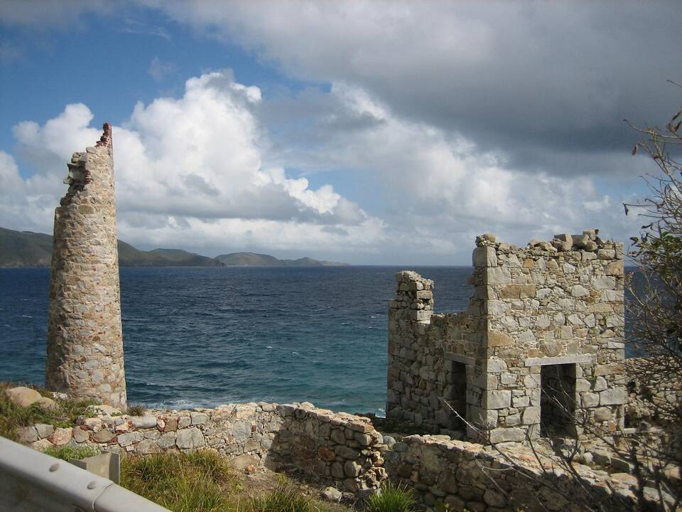
The stone chimney and ruined buildings of the old copper mine on the cliffs at the island's south-east tip, another National Parks Trust site, among granite outcrops. A short taxi ride from Spanish Town; combine it with The Baths in a morning.
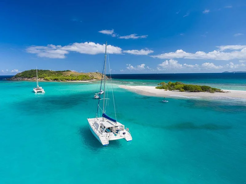
The moorings off The Baths are a day stop on BVI charter routes — our 7-day planner puts it on day three. Come early, take a ball for your 90 minutes, and move on before the day boats fill the field. In a north swell, skip it — the Trust says the moorings cannot be used.
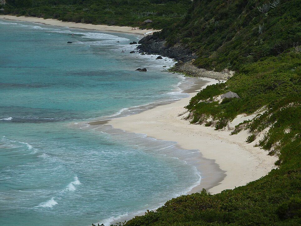
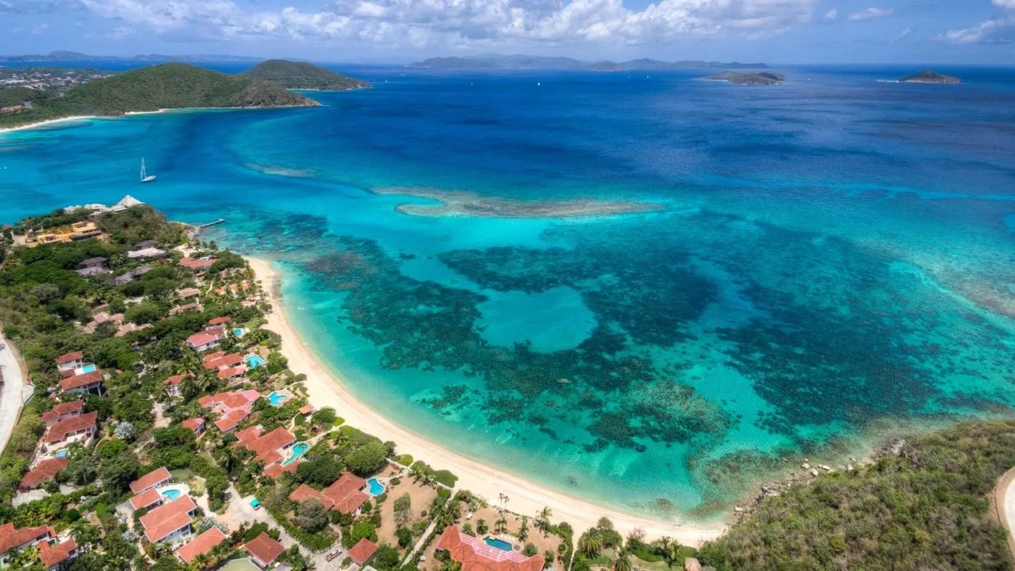
For a long, empty beach after the crowds at The Baths: Savannah Bay, a few minutes north of Spanish Town where the island narrows, a curve of sand with no facilities and a reef to snorkel off its rocky end.
Three places in the park: Poor Man's Bar on the sand at the foot of the trail, and at the top, by the car park, Top of the Baths — a restaurant and bar with a pool and gift shops — and Mad Dog, a small bar and café across the turning circle.
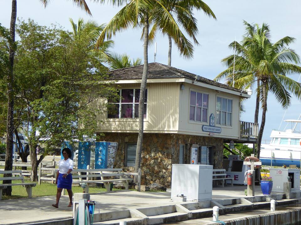
For a proper choice, Spanish Town is a short taxi ride back up the road: the bars and restaurants round the Virgin Gorda Yacht Harbour, by the ferry dock.
A building at the Virgin Gorda Yacht Harbour in Spanish Town, under the palms beside the docks Photo: Mattes, CC BY 2.0 de
In the park
Poor Man's BarOn the beach at The Baths: painkillers, frozen margaritas and piña coladas (USA Today 10Best, 2026).
Top of the BathsRestaurant, bar, pool and gift shops at the top; 8 am–6 pm every day, its website says. +1 284 495 5497.
Mad DogA small bar and café at the road's end, by the car park.
In Spanish Town
The Yacht HarbourRestaurants, bars and shops round the marina by the ferry dock.
The Virgin Gorda guideWhere to eat across the island, North Sound included, and who closes for the autumn.
Weather & sea
The Baths weather and the best time to go
Warm all year: highs in the mid-80s °F, a steady easterly trade wind and short tropical showers rather than all-day rain. December to April is the dry season and the busy one, for charter boats and cruise ships alike. June to November is hurricane season.
The Baths faces west across the Sir Francis Drake Channel, so the island itself shelters it from the easterly trade-wind sea, and on most days the water among the boulders is calm. Its trouble is the winter ground swell: swells from storms far out in the North Atlantic wrap round the island and surge between the rocks, and on those days the Trust says the moorings cannot be used, the beach cannot be reached from the sea, and swimming is discouraged. The call at the top of the page reads the swell every half hour.
The next 7 days on Virgin Gorda
Day
Sky
High / low
Rain
Wind
Seas offshore
Today
Thunderstorms
85° / 81°F
100%
SW 19 mph, gusts 29
2.8 ft
Tomorrow
Thunderstorms
83° / 79°F
87%
WSW 22 mph, gusts 30
3.3 ft
Sun, Nov 8
Drizzle
84° / 81°F
47%
W 14 mph
2.9 ft
Mon, Nov 9
Partly cloudy
83° / 82°F
27%
WNW 5 mph
2.1 ft
Tue, Nov 10
Drizzle
83° / 80°F
24%
NE 11 mph
2 ft
Wed, Nov 11
Overcast
84° / 83°F
25%
E 13 mph
2 ft
Thu, Nov 12
Drizzle
85° / 84°F
20%
ESE 13 mph
2 ft
Open-Meteo forecast for Virgin Gorda, refreshed every half hour. The seas are offshore; how much of it reaches the sand is the call above. BVI weather & sailing week · North swell season
Sea temperature by month
80°Jan
80°Feb
80°Mar
81°Apr
83°May
85°Jun
85°Jul
85°Aug
86°Sep
86°Oct
84°Nov
82°Dec
Daily-mean sea-surface temperature off Virgin Gorda, averaged 2021–2024 (Open-Meteo marine reanalysis): warmest in Sep (86.3°F), coolest in Feb (79.5°F).
Cruise crowds
Cruise ships and the crowd at The Baths
Cruise excursions come to The Baths three ways: across from the big ships in Road Town on Tortola; the small ships that anchor off Spanish Town or in North Sound send their guests by taxi; and a few day charters come from St. Thomas. The territory had 493,397 cruise passengers in the first three months of 2026, the Trust said in August. On a ship day, come when the park opens at 8:30 or late in the afternoon.
30 of the next 31 days have a ship in Road Town or off Virgin Gorda. The busiest at The Baths, by our model:
Sun, Nov 15 — 2 ships, 7,673 guests in port. Packed: ~1,200 expected here, 8 am–4 pm
Thu, Nov 19 — 3 ships, 8,841 guests in port. Packed: ~1,300 expected here, 8 am–4 pm
Sun, Nov 29 — 4 ships, 8,371 guests in port. Packed: ~1,400 expected here, 9 am–4 pm
Tue, Dec 1 — 2 ships, 7,036 guests in port. Packed: ~1,000 expected here, 8 am–4 pm
Thu, Dec 3 — 5 ships, 9,024 guests in port. Packed: ~1,100 expected here, 8 am–4 pm
Sun, Dec 6 — 5 ships, 8,646 guests in port. Packed: ~1,200 expected here, 9 am–4 pm
Our crowd model, not a head count: it puts about 55% of the passengers of the small ships at Virgin Gorda (off Spanish Town and in North Sound) on The Baths, and about 15% of the big ships' in Road Town, whose excursions cross by boat; past 600 on the sand we call it packed. Day charters from St. Thomas are too few to count. The same model makes the call at the top of the page.
No — there is no public live webcam at The Baths. Virgin Gorda's one live camera is at Saba Rock in North Sound, at the other end of the island: it shows the boats in the sound, not the boulders. We would rather say so than show a still photo dressed up as live.
Molten rock rises into the volcanic rock of the island arc but never reaches the surface: it cools slowly, 5 to 10 km down, into the granodiorite of the Virgin Islands batholith. The softer volcanic rock above erodes away, the granite cracks into blocks, and weathering rounds them into the boulders of The Baths.
1963
Devil's Bay National Park
The bay at the other end of the boulders becomes a national park: 58 acres, by the Trust's figures.
1964
Spring Bay National Park
Spring Bay and The Crawl, just to the north, are declared a national park (5.5 acres).
1987
The Baths taken for the public
The Baths is acquired by compulsory acquisition, by order of the House of Assembly.
1990
A national park
The Baths becomes a national park: 6.91 acres of beaches and rocky shore at the island's south-west tip.
1991
The first moorings
The National Parks Trust starts putting mooring buoys at the territory's dive and snorkel sites, pinned into the bedrock, to keep anchors off the coral.
September 2017
Irma and Maria
The two hurricanes severely damage the trail. The Trust closes the beach for repairs; ten weeks later, on November 19, it is still closed.
July 22, 2019
Rebuilding
The Recovery and Development Agency signs a $150,068 contract to renovate the bar and ticket area, upgrade the restrooms and build a new rest area.
November 11, 2019
Toad Hall
Cabinet approves buying Toad Hall, a 5.5-acre estate inside the Greater Baths National Park, for a Trust headquarters and visitor centre.
May 2020
New trails, new rest stops
The Baths and Devil's Bay are the only beaches not reopened on May 10; on May 17 the minister tours the new and wider trails, rest stops and gazebos.
June 3, 2021
ID at the gate
The Trust starts asking residents for a BVI driver's licence or NHI card for free entry, under its 2008 regulations; everyone else pays the $3 fee.
July 1, 2021
A cruise-day closure, withdrawn
A Trust advisory closing the park to residents and other non-cruise visitors from 9 am to 2 pm on ship days is retracted at the ministry's request.
August 2026
Nine mornings for a cruise line
The Trust confirms talks to reserve The Baths and Devil's Bay for a cruise operator on nine peak-season mornings. After a public outcry the Deputy Premier tells the Trust, on August 19, not to sign any such agreement, and the talks are paused.
October 8, 2026
The first fee rise since 1990
The Trust announces new fees from November 1: $10 for adult visitors and $5 for children at The Baths and Devil's Bay, still free for residents with ID.
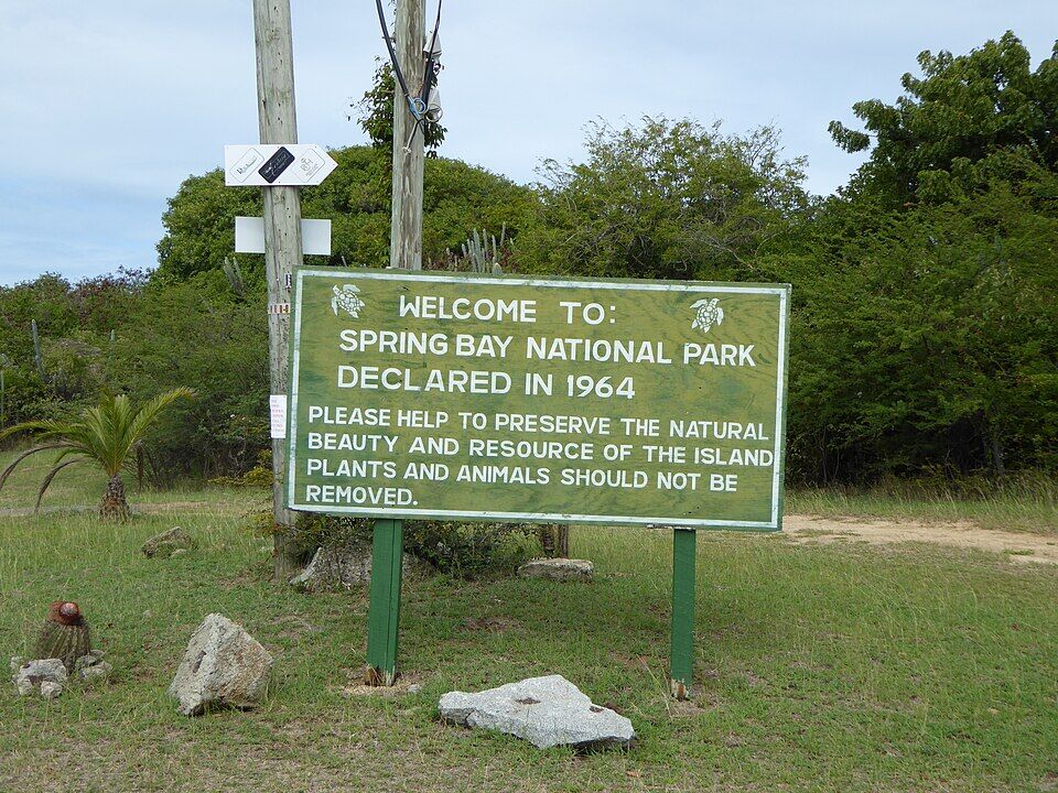
The sign at Spring Bay, next door: 'Welcome to Spring Bay National Park, declared in 1964' (February 2015) Photo: User:Mattes, CC BY 2.0 deThe sign at the start of the Caves trail on the beach: the Devil's Bay trail, about twenty minutes, and 'Do not enter caves after 4:30 p.m.' (February 2015) Photo: User:Mattes, CC BY 2.0 de
The park opens at 8:30. Day boats and ship excursions arrive through the morning; the call at the top of the page shows today's ship crowd hour by hour.
Shoes and a dry bag
The Caves trail means wading, crawling and ladders on wet granite. Wear water shoes or strapped sandals and carry the phone in a dry bag — or leave it in a locker.
Watch the flag in winter
In the winter months a ground swell can put up the red flag: swimming discouraged, no landing from the sea. The walk through the boulders is still worth it from the land side.
Fees change November 1
Visitors pay $3 (children $2) until October 31, 2026 and $10 (children under 18, $5) from November 1. Residents with ID are free either way.
By boat, buy the permit
A National Parks mooring permit is required by law to use the Trust's balls. Charter bases sell it; foreign-flagged yachts buy it at Customs on arrival.
Out of the caves by 4:30
The sign at the start of the Caves trail says not to go into the caves after 4:30 pm, when the park closes.
Until October 31, 2026, visitors pay $3 an adult and $2 a child. From November 1, 2026 the National Parks Trust's new fees are $10 for adult visitors and $5 for children under 18. Virgin Islanders, Belongers and residents go in free with a valid government ID. The Trust's one-day pass also covers Devil's Bay, Stoney Bay and Spring Bay that day.
What are the hours at The Baths?
The National Parks Trust opens The Baths and Devil's Bay from 8:30 am to 4:30 pm every day, and the sign at the start of the Caves trail says not to go into the caves after 4:30 pm. The Trust's moorings off the beach are day use only, with a 90-minute limit.
How do you get to The Baths from the ferry?
Take a taxi from the ferry dock in Spanish Town: about 9 minutes (3 km) by road to the car park at the top of the park. The official fare is $10 for one rider, $5 each for three or more. From the car park, trails go down to the beach and to Devil's Bay. Ferries reach Spanish Town from Road Town and Trellis Bay on Tortola, and direct from St. Thomas and St. John on some days.
How much is a taxi to The Baths?
Virgin Gorda's taxis charge the official BVI fares, per person and less each as the party grows. From the Spanish Town ferry dock to The Baths it is $10 for one rider, $5 each for three or more. Agree the fare and a pick-up time before you set off.
How long does it take to see The Baths?
Allow two to three hours: the walk down from the car park, time on the beach and in the grottos, the Caves trail through the boulders to Devil's Bay — about twenty minutes, the sign says — and the trail between Devil's Bay and the car park, about 15 minutes, the Trust says.
Is the Caves trail at The Baths hard?
It is short but challenging. The trail between The Baths and Devil's Bay goes through the boulders, with steps, wooden ladders and rope handrails; you crawl through low gaps and wade through pools, and the rock is slippery. Wear shoes that can get wet, keep small children close, and do not go into the caves after 4:30 pm.
Can you swim at The Baths?
Yes, most of the year: the Trust calls the water ideal for swimming and snorkelling. In winter, strong ground swells can surge between the boulders; then a red flag flies, the Trust discourages swimming because of strong currents, and boats cannot use the moorings or land on the beach. The Trust lists no lifeguards.
Can you go to The Baths by boat?
Yes. The National Parks Trust has day-use mooring buoys off The Baths and outside Devil's Bay: 90 minutes, first come, first served, no overnight use, and a National Parks mooring permit is required by law. Boats must use the buoys rather than anchor, to spare the coral. Dinghies follow the swim-line markers at no more than 5 mph and tie to the dinghy line, and you swim the last stretch.
Is there food at The Baths?
Yes. Poor Man's Bar is on the beach at the foot of the trail; at the top, by the car park, are Top of the Baths, a restaurant and bar with a pool and gift shops, and Mad Dog, a small bar and café. Spanish Town's restaurants are a short taxi ride away.
When is the best time to visit The Baths?
Early: the park opens at 8:30, before most day boats and cruise excursions arrive, or late in the afternoon. December to April is the dry season but also the busy one; in winter a ground swell can close the water. The call at the top of this page reads the swell and the ship crowd every day.
Are there bathrooms and lockers at The Baths?
Yes. The National Parks Trust lists bathrooms and lockers among the park's facilities, by the beach; the restrooms were upgraded after the 2017 hurricanes. The Trust lists no lifeguards.
How were the boulders at The Baths formed?
They are granite — granodiorite — that formed from molten rock cooling slowly 5 to 10 km underground in the Eocene. When the softer volcanic rock above wore away, the granite cracked into blocks, and weathering rounded them into the boulders, some as big as 40 ft across, that lie on the beach today.
Is there a webcam at The Baths?
No public live camera. Virgin Gorda's only live webcam is at Saba Rock in North Sound, at the other end of the island, and it shows the boats in the sound, not The Baths.
Photo & map credits
Swimmers in the clear water off the beach at The Baths, with granite boulders piled across the cove (November 2007) — Calyponte, CC BY 3.0, via Wikimedia Commons (resized).
The Baths from the water: the white sand on the left, the granite boulders stacked along the shore to the right (2007) — Daniel Lobo, CC BY 2.0, via Wikimedia Commons (resized).
A swimmer wading through a sea pool under the leaning boulders at The Baths (February 2015) — User:Mattes, CC BY 2.0 de, via Wikimedia Commons (resized).
Inside the boulders at The Baths: sunlight on the granite over a shallow pool (November 2019) — P. Hughes, CC BY-SA 4.0, via Wikimedia Commons (resized).
A wooden ladder up through the boulders on the Caves trail, over a pool of sea water (February 2015) — User:Mattes, CC BY 2.0 de, via Wikimedia Commons (resized).
The sign at the start of the Caves trail on the beach: the Devil's Bay trail, about twenty minutes, and 'Do not enter caves after 4:30 p.m.' (February 2015) — User:Mattes, CC BY 2.0 de, via Wikimedia Commons (resized).
The Baths National Park sign at the car park at the top: Devil's Bay ahead, the Baths trail to the right (February 2015) — User:Mattes, CC BY 2.0 de, via Wikimedia Commons (resized).
The car park at the top of The Baths, with a National Parks Trust pickup (February 2015) — User:Mattes, CC BY 2.0 de, via Wikimedia Commons (resized).
A red flag flying at the top of The Baths on a February afternoon, the buildings and umbrellas of the top of the park beyond (2015) — User:Mattes, CC BY 2.0 de, via Wikimedia Commons (resized).
The boulders of The Baths from the water late in the afternoon, as boats see them coming in (April 2012) — Jim Sorbie, CC BY 2.0, via Wikimedia Commons (resized).
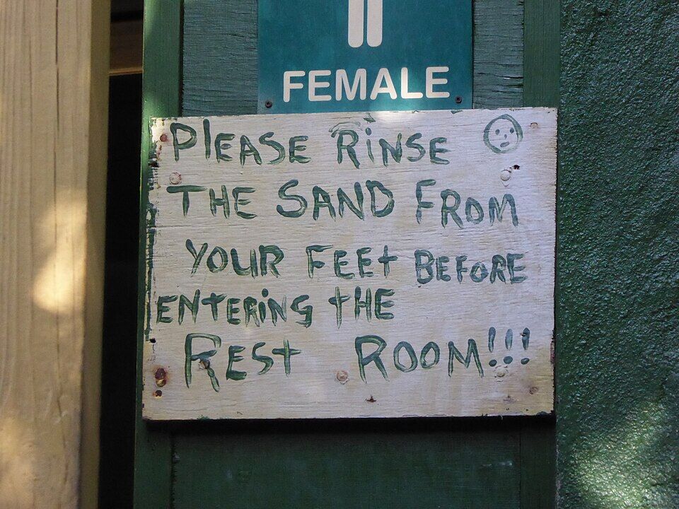
A hand-painted sign on the women's restroom at The Baths: 'Please rinse the sand from your feet before entering the rest room!!!' (2015) — User:Mattes, CC BY 2.0 de, via Wikimedia Commons (resized).
The sign at Spring Bay, next door: 'Welcome to Spring Bay National Park, declared in 1964' (February 2015) — User:Mattes, CC BY 2.0 de, via Wikimedia Commons (resized).
Savannah Bay from the hill above: a long, empty curve of sand on Virgin Gorda's north-west coast (2010) — Gruepig, CC BY-SA 4.0, via Wikimedia Commons (resized).
The stone chimney and ruined mine buildings at Copper Mine, above the sea on Virgin Gorda — Legis, Public domain, via Wikimedia Commons (resized).
A building at the Virgin Gorda Yacht Harbour in Spanish Town, under the palms beside the docks — Mattes, CC BY 2.0 de, via Wikimedia Commons (resized).
 Skip today today