A long, straight run of sand on the north shore of Tortola's West End, from Belmont Point and Belmont Pond in the west to Long Bay Beach Resort at the east end, with a road along the back of much of it. It faces north into the open sea, Jost Van Dyke off to the north-west: calm on most trade-wind days, surf when a winter swell runs. Ten minutes by taxi from the West End ferry, the resort says. Looking for the Long Bay by the airport? That is Long Bay on Beef Island, at the other end of Tortola.
The north shore of Tortola's West End, British Virgin Islands — between Belmont Point and Little Apple Bay, over the hill from Soper's Hole
Not to be confused with
Long Bay on Beef Island, by the airport at the far east end of Tortola — a different beach with its own guide
The beach
About 1 km of sand on OpenStreetMap's outline; the resort calls it a mile
Behind the sand
Long Bay Road along the eastern half, Belmont Pond under Belmont Point at the west end, Long Bay Beach Resort at the east end
Entry
No gate and no fee to the sand; all BVI beaches are public, the Minister for Natural Resources told the House of Assembly in 2023
The resort
Long Bay Beach Resort: the 1748 Restaurant, Johnny's Beach Bar, a coffee shop and a swim-up pool bar, on its own website
Day pass
$100 a person at the resort, $75 of it food and drink credit — and not sold to cruise ship guests
The water
Open to the north: often calm in the trade wind, with surf on winter north swells
Not there
No public restroom, lifeguard or car park that we could find
Nearest ferry
West End (Soper's Hole), for the boats from St. Thomas and Jost Van Dyke
Today
Is Long Bay good today?
Think twice Rough — 3.1 ft SW swell, shore break · Thunderstorms in the forecast. The best stretch left today is 9 am–12 pm.
Day
The call
Why
Best time
Cruise guests here
Sea at the beach
Rain
Today
Think twice
Rough — 3.1 ft SW swell, shore break · Thunderstorms in the forecast
9 am–12 pm
None
Rough · 3.2 ft
Thunder
Tomorrow
Skip today
Rough — 3.5 ft SW swell, shore break · Thunderstorms in the forecast
10 am–1 pm
None
Rough · 3.7 ft
Thunder
Sun, Nov 8
Think twice
Rough — 3.1 ft SW swell, shore break · No cruise crowd today
3 pm–6 pm
None
Rough · 3 ft
59%
Mon, Nov 9
Go
Calm, glassy water · No cruise crowd today
8 am–11 am
None
Calm · 0.2 ft
36%
Tue, Nov 10
Go
Calm, glassy water · No cruise crowd today
11 am–2 pm
None
Calm · 0.2 ft
43%
The call is the same one our beach report makes, refreshed every half hour: the swell reaching the bay (Open-Meteo's marine forecast off the West End), the cruise passengers our crowd model puts on the sand, NOAA's sargassum satellite and the rain forecast. It is a model, not a lifeguard's report — we found no published lifeguard service at Long Bay, so look at the water before you swim, above all on a winter swell day. The bars under each call are the hours from 8 am to 5 pm. Today's beach report
Taxi fares from the West End ferry, Road Town, the cruise pier and the airport, the ferry over from St. Thomas, today's beach and weather reads, the swell, and the island around it — each one opens the full page.
Long Bay from OpenStreetMap: the sand, Long Bay Road along the back of it, the houses of Belmont and Long Bay on the hill, and each place where OpenStreetMap's mappers put it. Palm Road leaves the west end for Smuggler's Cove; Zion Hill Road at the east end climbs over to the south coast and the West End ferry. Tap a pin for its section.
Getting there
How to get to Long Bay
Long Bay is on the north side of Tortola's West End. From the West End ferry dock at Soper's Hole the road climbs over the hill — up Zion Hill Road from the Sir Francis Drake Highway — and comes down to the north shore at Little Apple Bay; Long Bay Road then runs west behind the sand to Belmont, where Palm Road carries on to Smuggler's Cove. The resort's fact sheet puts the West End ferry ten minutes away by taxi. There is no bus: visitors come by taxi, in a rental car, or on foot from the villas of Belmont and Long Bay.
Taxis charge the official BVI fares in the table, per person and cheaper each as the party grows. From Road Town or the cruise pier it is the length of the island's south coast to the West End, then over the hill. Driving, you keep left.
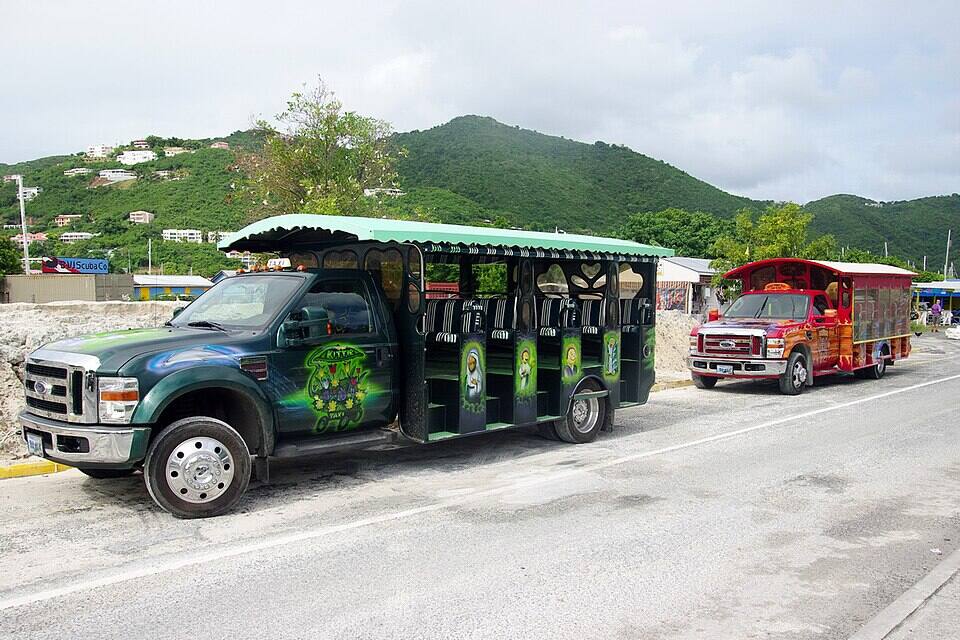
Open-air safari taxis waiting in Road Town Photo: Bgabel, CC BY-SA 3.0
One way, per person by the size of the party: fares set by the BVI Road Traffic (Passenger Fares) Regulations (rates revised December 2022). Drive times are Google's for an ordinary day. Fare calculator for any two stops
Agree the fare for your whole party before you set off, and agree a pick-up time: there is no taxi stand at Long Bay.
We found no public car park on OpenStreetMap or any official page; in a rental car, park off the road and never block a driveway or the resort's entrance.
Tell the driver which Long Bay: the fare table lists Long Bay (West End) and Long Bay (Beef Island) separately, and they are at opposite ends of Tortola.
Crossing from St. Thomas? The BVI is a different country: bring a passport, fill in the online ED card before you arrive and clear immigration at the West End dock.
Long Bay: the sand, the resort's day pass, and papers from St. Thomas
The sand at Long Bay has no gate and no entry fee. Long Bay Beach Resort, at the east end, describes the beach as its own on its fact sheet; the BVI Minister for Natural Resources told the House of Assembly in March 2023 that all BVI beaches are public. What the resort sells is its facilities — pool, loungers, towels, its bars — through a day pass. A visitor coming over from St. Thomas or St. John also pays the BVI's charges at the border, on the West End ferry dock.
Charges
The beach
Free
Resort day pass (includes $75 food & drink credit)
$100 a person
Towel deposit with the day pass, refundable
$25 a towel
BVI environmental and tourism levy, arriving from the USVI
$10
BVI departure tax, leaving by ferry
$20
The same, for BVI residents
$15
The day pass is the resort's own price on its website: $75 of food and drink credit plus a $25 access fee, limited daily, best booked ahead, and not available to cruise ship guests. The levy and the departure tax are the UK government's figures for the BVI; from anywhere else in the BVI they do not apply.
The law and the papers
✓Using the beach — "All BVI beaches are public," the Minister for Natural Resources told the House of Assembly on March 9, 2023, adding that access must be provided even where a beach is linked to private property
✕The resort's pool and facilities without a day pass — they come with a room or the day pass; cruise ship guests cannot buy one
✓A passport, for everyone arriving from the USVI — U.S. citizens and children included
✓The BVI's online ED card — required of every traveller entering the BVI since January 1, 2025
A long beach with one resort on it and a road behind it. Everything for sale — food, drinks, the pool, loungers — is the resort's; beyond it we found no public facilities, so come with water and shade.
Getting on the sand
The road behind the beach
Long Bay Road runs along the back of the beach from the resort west to the corner where it meets Palm Road and Belmont Drive; OpenStreetMap maps that stretch of road a few metres from the sand. West of the corner the beach runs on for about 400 m under Belmont Point, with Belmont Pond behind it and no road — the stretch furthest from the resort. OpenStreetMap maps no public car park, and we found none on any official page.
Food & drink
Long Bay Beach Resort
The resort at the east end of the beach runs the food and drink on it. Its website lists the 1748 Restaurant, in stone and coral walls it says were once a rum distillery on the beach (breakfast 8–10, lunch 12–3, dinner 6–9, Sunday brunch 10–2; reservations by phone); Johnny's Beach Bar on the sand, with live music and an upstairs rum lounge, hours not listed; the 1748 Coffee Shop; a swim-up pool bar; and a 1748 Sushi Bar. Non-guests use the pool and loungers with the day pass ($100, $75 of it food and drink credit), which the resort does not sell to cruise ship guests.
Long Bay looks north into the open sea, with Jost Van Dyke off to the north-west and nothing but ocean to the north. On a trade-wind day the water off the sand is often calm; when a winter north swell runs, it breaks along the beach as surf, and the resort's fact sheet lists surfboards and paddleboards among its amenities. Our /beach model scores the bay as open sand with no snorkelling reef — for reef, Smuggler's Cove round Belmont Point is the nearer bet.
Safety
No lifeguards, no public restroom
We found no published lifeguard service and no public restroom at Long Bay. On a day of north swell, watch the waves for a while before you go in, swim where you can stand, and keep away from the rocks under Belmont Point. Bring water, sunscreen and shade; the resort's facilities are for its guests and day-pass holders.
The length of the sand, from the rocks under Belmont Point to the resort and back, is the thing to do here — most of it with no buildings on the sand. The beach faces north across open water, Jost Van Dyke off to the north-west; the card at the top of the page has tonight's sunset time.
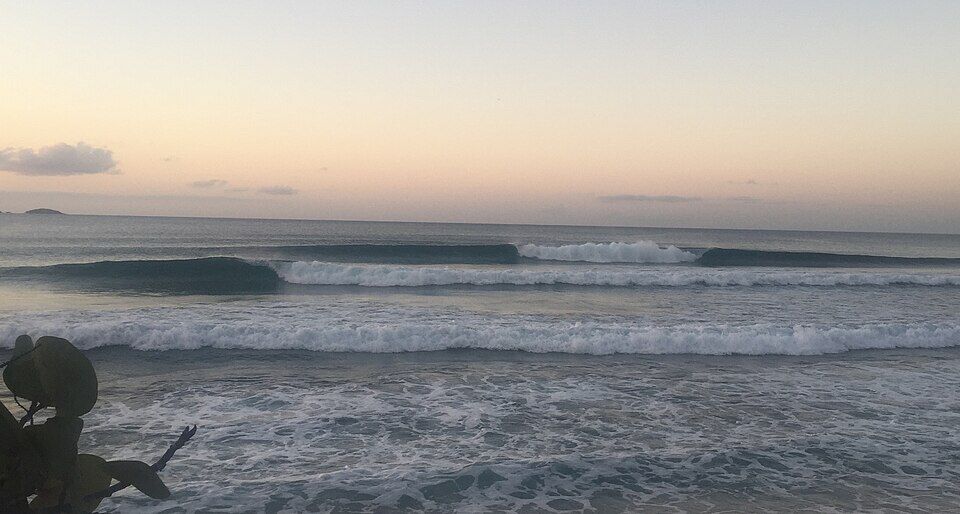
Tortola's north shore is where its winter surf breaks — Apple Bay, a few bays east, is the best known — when swells from storms far out in the North Atlantic arrive. Long Bay takes the same swells. Our north-swell film shows where they come from and this week's forecast; the call at the top of this page reads the swell every half hour.
Round Belmont Point to the south-west, along the last, unpaved stretch of Palm Road from Long Bay's west end: a sheltered cove with reef along its edges for snorkelling and two small beach bars. On a swell day at Long Bay it is usually the calmer water.
The West End's harbour, over the hill to the south: the ferry dock and customs for the boats to St. Thomas and Jost Van Dyke, a marina, and painted waterfront buildings with shops and restaurants.
Tortola has two Long Bays at opposite ends of the island. The other is on Beef Island, by the airport at the east end: a long crescent with salt ponds behind it. The resort here puts the airport 45 minutes away by taxi. Its guide has its own fares, map and rules.
On the beach it is Long Bay Beach Resort or nothing: the 1748 Restaurant (its website gives breakfast 8–10, lunch 12–3, dinner 6–9 and Sunday brunch 10–2), Johnny's Beach Bar on the sand, the 1748 Coffee Shop, a swim-up pool bar and a sushi bar. Book the restaurant ahead; hours move with the season.
Further along the north shore, Little Apple Bay and Apple Bay have beach bars and hotel restaurants on the sand, and Soper's Hole at the West End has waterfront restaurants by the ferry dock. Several West End places close for part of the August–October off-season.
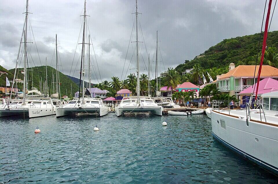
Soper's Hole at the West End: yachts on the moorings and the painted wharf-side buildings Photo: Bgabel, CC BY-SA 3.0
On the beach
1748 RestaurantThe resort's restaurant by the sand; breakfast, lunch, dinner and Sunday brunch at the hours on its website; reservations by phone.
Johnny's Beach BarCocktails on the sand, live music and an upstairs rum lounge, the resort says; no hours published.
1748 Coffee Shop & pool barCoffee, pastries, sandwiches and smoothies by the beach, and a swim-up bar at the pool (pool with a room or day pass).
Along the coast
Apple BayBeach bars and hotel restaurants on the next bays east — see our beach bars guide for who is open.
Soper's HoleRestaurants and bars on the West End waterfront by the ferry dock — our closures tracker lists who is open off-season.
Weather & sea
Long Bay weather and the best time to go
Warm all year: highs in the mid-80s °F, a steady easterly trade wind and short showers rather than all-day rain. December to April is the dry season; June to November is hurricane season, when some West End restaurants and the resort's outlets may keep shorter hours or close for part of August to October.
Long Bay faces north, so the easterly trade wind blows along the shore and many days the water by the sand is calm. Winter is the exception: swells from storms far out in the North Atlantic reach Tortola's north shore for a day or two at a time and break along the beach. The call at the top of this page reads the swell every half hour.
The next 7 days on Tortola
Day
Sky
High / low
Rain
Wind
Seas offshore
Today
Thunderstorms
81° / 76°F
89%
SW 18 mph, gusts 25
3.1 ft
Tomorrow
Thunderstorms
80° / 77°F
90%
WSW 20 mph, gusts 26
3.5 ft
Sun, Nov 8
Drizzle
81° / 79°F
58%
W 12 mph
3.1 ft
Mon, Nov 9
Drizzle
80° / 78°F
18%
NNW 8 mph
2.4 ft
Tue, Nov 10
Drizzle
80° / 78°F
32%
NE 14 mph
2 ft
Wed, Nov 11
Overcast
81° / 79°F
25%
E 14 mph
2.2 ft
Thu, Nov 12
Drizzle
81° / 79°F
18%
ESE 12 mph
2.1 ft
Open-Meteo forecast for Tortola, refreshed every half hour. The seas are offshore; how much of it reaches the sand is the call above. BVI weather & sailing week · North swell season
Sea temperature by month
80°Jan
79°Feb
80°Mar
81°Apr
83°May
85°Jun
85°Jul
85°Aug
86°Sep
86°Oct
84°Nov
81°Dec
Daily-mean sea-surface temperature off Tortola, averaged 2021–2024 (Open-Meteo marine reanalysis): warmest in Sep (86.3°F), coolest in Feb (79.3°F).
Cruise crowds
Cruise ships and the crowd at Long Bay
Long Bay is far from Road Town's cruise pier — the length of the island — and the resort does not sell its day pass to cruise ship guests. The small ships that call at Soper's Hole are nearer: the beach is over the hill from them. Even then, a beach this long spreads a crowd out.
1 of the next 31 days have a ship in Soper's Hole.
Our crowd model, not a head count: it puts about 20% of the passengers of a ship at Soper's Hole on the sand at Long Bay, starting about 75 minutes after the ship is in and gone 90 minutes before it sails; past 500 on the sand we call it packed. Ships in Road Town are not counted here. The same model makes the call at the top of the page and on our beach report.
No. There is no public live camera on Tortola that we can show — not at Long Bay, not at the resort, not at Soper's Hole — and we would rather say so than pass off a photo as live. The nearest live views in the BVI are at Scrub Island, off Tortola's north-east tip, and Cooper Island across the channel.
Long Bay Beach Resort dates itself to the 1960s on its own website — "since the late 1960s" in its story, "established in 1960" in a post on the same page — round a building it says reuses the stone, coral and limestone walls of an old rum distillery on the beach, now the 1748 Restaurant.
September 6, 2017
Hurricane Irma
The category 5 hurricane crosses the British Virgin Islands. The resort's own account says the storm "flattened the entire coast into ruins"; afterwards the Strange family bought the property and began a multi-year rebuild.
September 2023
A month closed
The 42-room resort, rebranded and reopened during the pandemic, closes for September 1–30 for renovations, the Caribbean Journal reports.
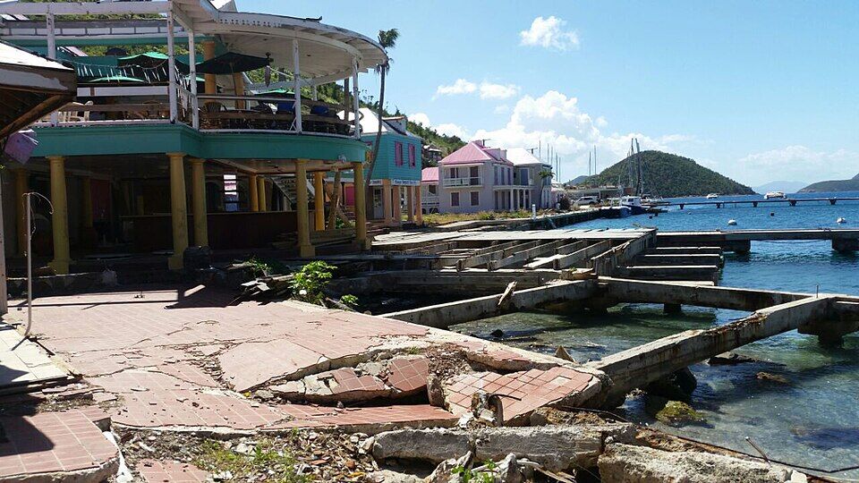
Soper's Hole at the West End on September 10, 2017, four days after Hurricane Irma: the waterfront broken up and the docks wrecked Photo: Legis, CC BY-SA 4.0
Tortola has two. To a taxi driver this one is Long Bay, West End; the other is Long Bay on Beef Island by the airport, and the fares are different.
Bring water and shade
We found no public restroom, shower or shop on the beach. Bring water, sunscreen and a hat, or buy a day pass and use the resort's.
Look before you swim in winter
The beach is open to the north. On a north-swell day the waves break along the sand; swim where you can stand, or go round to Smuggler's Cove.
Day pass, not from a ship
The resort's $100 day pass ($75 of it food and drink credit) is limited daily and not sold to cruise ship guests. Book ahead.
Book dinner
The 1748 Restaurant takes reservations by phone; the hours on its website are breakfast 8–10, lunch 12–3, dinner 6–9.
Passport from St. Thomas
The BVI is British, not American: U.S. citizens need a passport for the ferry from Red Hook, an ED card filled in online, and U.S. customs on the way back.
On the north shore of the West End, between Belmont Point and Little Apple Bay, over the hill from the West End ferry at Soper's Hole. Long Bay Beach Resort is at its east end and Belmont Pond behind its west end. It is not Long Bay on Beef Island, by the airport at the other end of Tortola.
How do you get to Long Bay, Tortola?
By taxi or rental car: from the West End ferry dock over the hill by Zion Hill Road, then west along Long Bay Road behind the sand. From the West End ferry it is about 10 minutes (2.3 km) by road, and the official taxi fare is $12 for one rider, $8 each for three or more. There is no bus.
How much is a taxi to Long Bay, Tortola?
BVI taxi fares are set by regulation and charged per person, cheaper each as the party grows. From the West End ferry it is $12 for one rider, $8 each for three or more; from Road Town $20 for one rider, $12 each for three or more; from the cruise pier $27 for one rider, $12 each for three or more; from Beef Island airport $50 for one rider, $25 each for two, $20 each for three or more. Ask for Long Bay, West End, confirm the total for your group before you set off, and agree a pick-up time.
Is Long Bay, Tortola a public beach?
Yes. There is no gate and no fee to the sand, and the BVI Minister for Natural Resources told the House of Assembly in March 2023 that all BVI beaches are public, with access to be provided even where a beach is linked to private property. Long Bay Beach Resort's pool, loungers and other facilities are for its guests and day-pass holders.
Does Long Bay Beach Resort sell a day pass?
Yes, on its website: $100 a person, made up of $75 of food and drink credit and a $25 access fee, for the beachfront, pool and resort spaces, with a $25 refundable deposit per towel. Numbers are limited daily, the resort recommends booking ahead, and the day pass is not available to cruise ship guests.
Is Long Bay, Tortola good for swimming?
Often, on a trade-wind day, when the water off the sand is calm. It is open to the north, so on a winter north swell the waves break along the beach. We found no lifeguard service: look first, swim where you can stand, and on a rough day go round to Smuggler's Cove.
Is there snorkeling at Long Bay, Tortola?
It is a sand beach, not a reef beach: our beach model does not score it for snorkelling. For reef close to the sand, Smuggler's Cove is round Belmont Point to the south-west, along Palm Road.
Are there restaurants at Long Bay, Tortola?
Long Bay Beach Resort's: the 1748 Restaurant (its website gives breakfast 8–10, lunch 12–3, dinner 6–9 and Sunday brunch 10–2), Johnny's Beach Bar on the sand, the 1748 Coffee Shop, a swim-up pool bar and a sushi bar. We found nothing else on the beach.
Are there restrooms or lifeguards at Long Bay, Tortola?
We found no public restroom and no published lifeguard service on the beach. The resort's facilities are for its guests and day-pass holders. Bring water and shade.
Is Long Bay on Tortola the same as Long Bay on Beef Island?
No. Tortola has two Long Bays at opposite ends of the island: this one on the north shore of the West End, by Long Bay Beach Resort and Smuggler's Cove; the other on Beef Island at the east end, by the airport. Taxi fares list them separately as Long Bay (West End) and Long Bay (Beef Island), and each has its own guide on this site.
Can you visit Long Bay, Tortola from St. Thomas?
Yes. The ferry from Red Hook lands at West End, the nearest dock, and a taxi at the official fare of $12 for one rider, $8 each for three or more takes you over the hill. You need a passport and the BVI's online ED card, pay the BVI's $10 arrival levy and $20 ferry departure tax, and clear U.S. customs on the way back.
Is there a Long Bay, Tortola webcam?
No public live camera we can embed. There is no live webcam on Tortola at all; the nearest live views in the BVI are at Scrub Island, off Tortola's north-east tip, and Cooper Island across the channel.
Photo & map credits
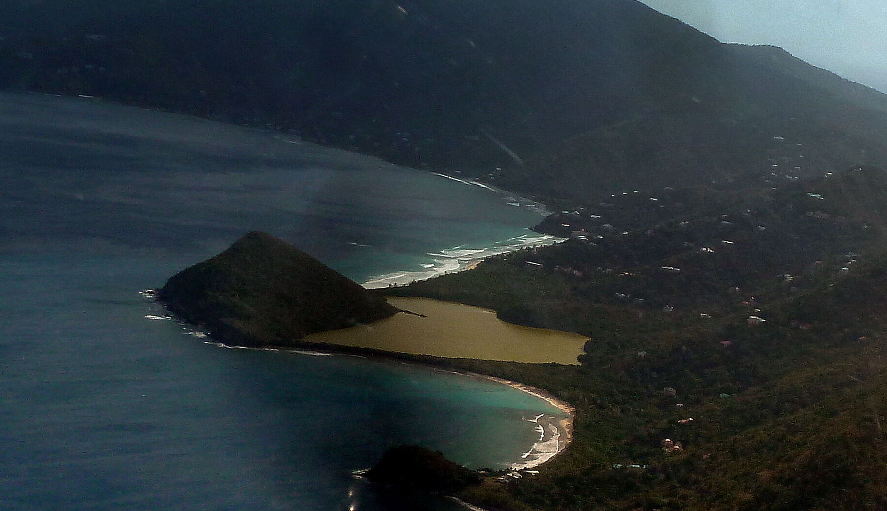
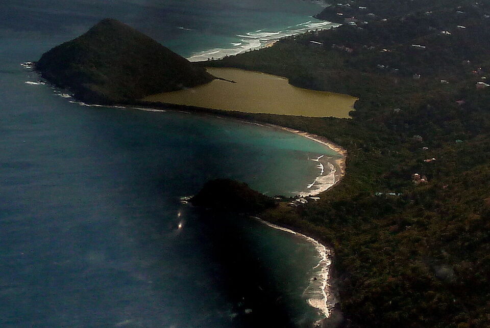
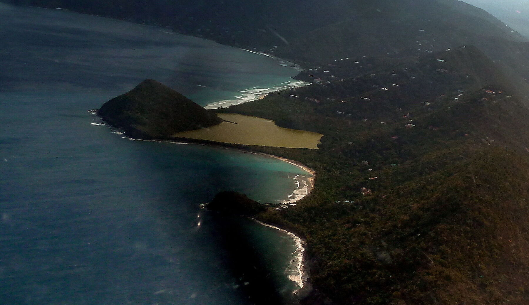
Long Bay from the air, looking north-east along Tortola's north shore: surf breaking along the sand beyond the steep hill of Belmont Point, Belmont Pond behind the beach, and Smuggler's Cove curving round below (cropped from a panorama of the West End) — giggel, CC BY 3.0, via Wikimedia Commons (cropped and resized).
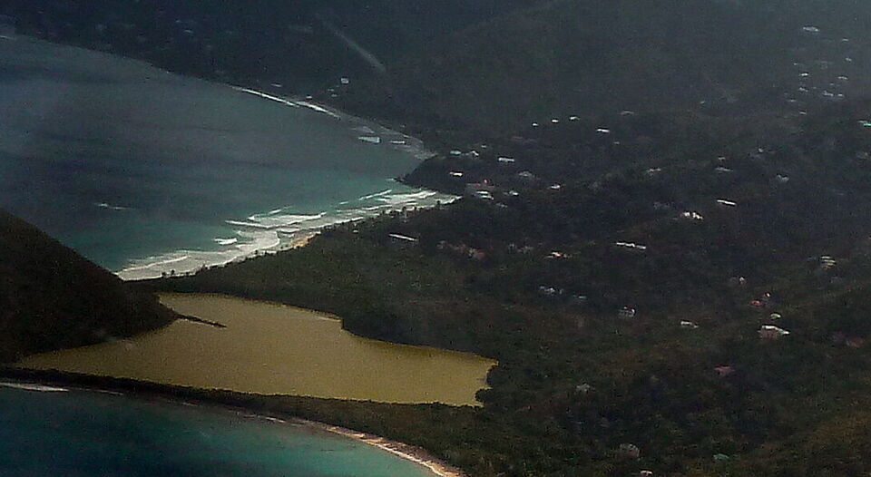
The same photograph, closer: white water along Long Bay's sand at its Belmont end, the green flat behind it and Belmont Pond in front (cropped) — giggel, CC BY 3.0, via Wikimedia Commons (cropped and resized).
Smuggler's Cove from the air, the next beach west: the sand in front of Belmont Pond and the hill of Belmont Point (cropped) — giggel, CC BY 3.0, via Wikimedia Commons (cropped and resized).
Swell breaking at Apple Bay, the next bays east along Tortola's north shore, at dusk (October 2019) — Gdebsoc, CC BY-SA 4.0, via Wikimedia Commons (resized).
Soper's Hole at the West End on September 10, 2017, four days after Hurricane Irma: the waterfront broken up and the docks wrecked — Legis, CC BY-SA 4.0, via Wikimedia Commons (resized).
Soper's Hole at the West End: yachts on the moorings and the painted wharf-side buildings — Bgabel, CC BY-SA 3.0, via Wikimedia Commons (resized).
Open-air safari taxis waiting in Road Town — Bgabel, CC BY-SA 3.0, via Wikimedia Commons (resized).
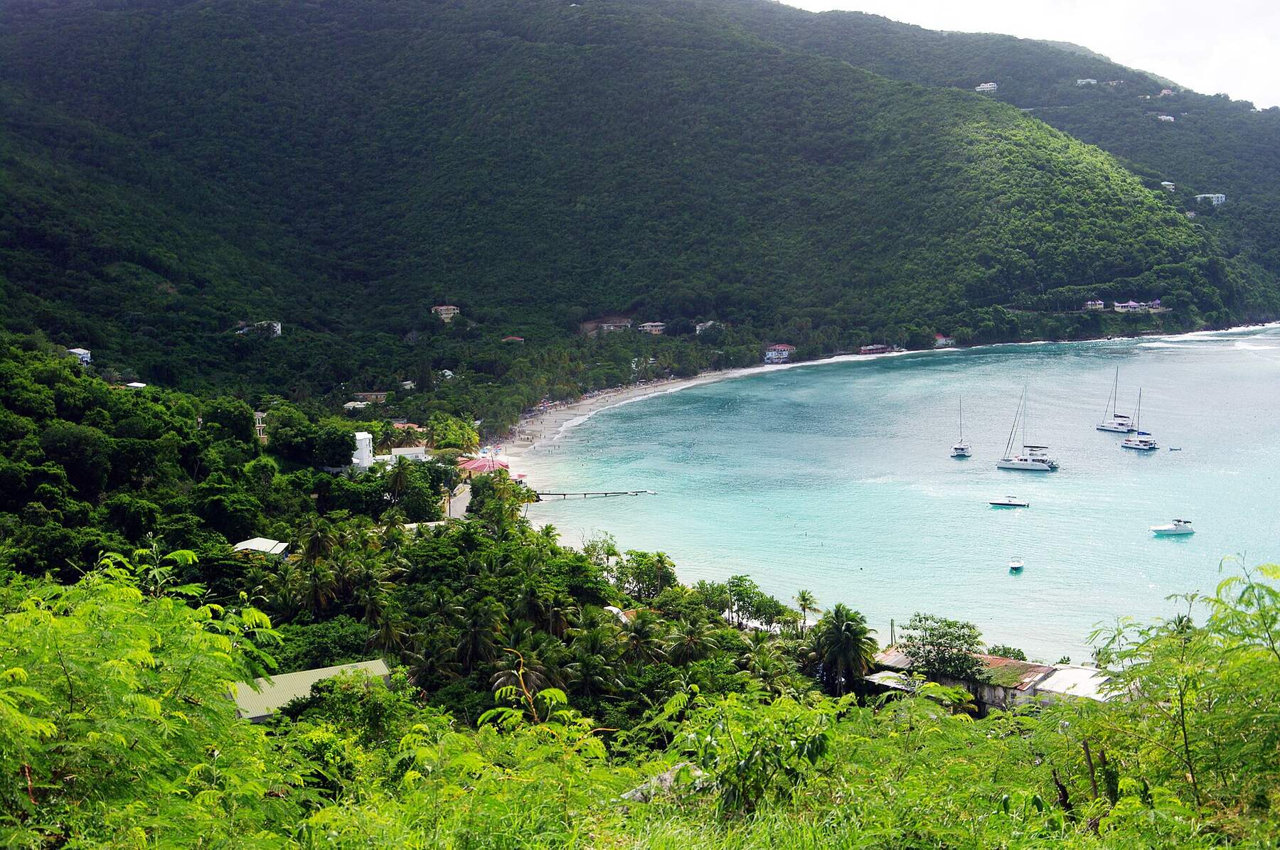
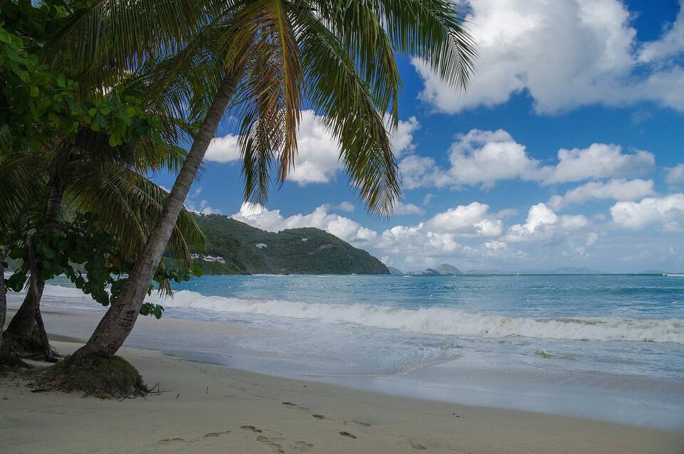
The sand at Cane Garden Bay under the palms, looking out to sea — Jean-Marc Astesana, CC BY-SA 2.0, via Wikimedia Commons (resized).
Smuggler's Cove from the air, looking east: the curve of sand below Belmont Pond, Belmont Point on the left with Long Bay's surf beyond it, and rocks and a smaller beach at the cove's south end (cropped from a panorama of the West End) — giggel, CC BY 3.0, via Wikimedia Commons (cropped and resized).
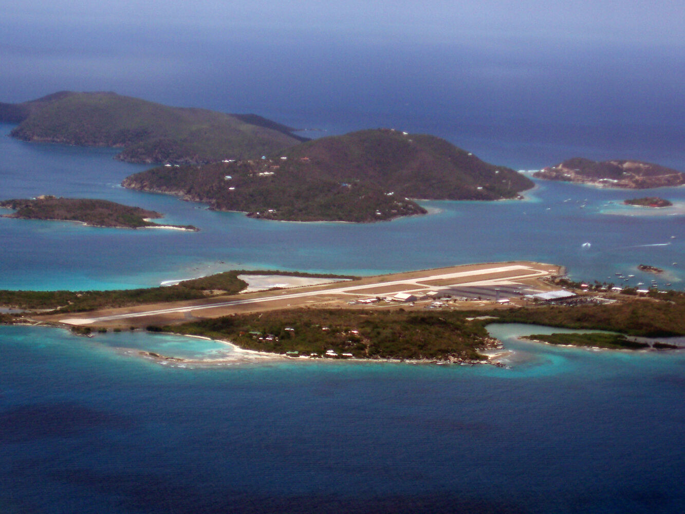
Beef Island from the air, looking north (July 2008): the airport runway across the island, with Long Bay's sand and its salt pond on the far side at the left; Little Camanoe and Great Camanoe beyond, Trellis Bay on the right — Robert Rexach, CC BY-SA 3.0, via Wikimedia Commons (resized).
 Skip today today
 Skip today today
 Skip today today
 Skip today today